
U.S. Route 75 is a north–south U.S. Highway that runs 1,239 miles (1,994 km) in the central United States. The highway's northern terminus is located at the Canadian border near Noyes, Minnesota, at a now-closed border crossing. From this point, the highway once continued farther north as Manitoba Highway 75. Its southern terminus is located at Interstate 30 (I-30) and I-45 in Dallas, Texas, where US 75 is known as North Central Expressway.

Interstate 244 (I-244), also known as the Martin Luther King Jr. Memorial Expressway since 1984, the Crosstown Expressway, and the Red Fork Expressway, is a 15.8-mile-long (25.4 km) east–west Interstate Highway bypass route of I-44 in Tulsa, Oklahoma.

U.S. Route 266 is a 43.09-mile (69.35 km), east–west U.S. Numbered Highway in Okmulgee, McIntosh, and Muskogee counties in Oklahoma, United States, that connects U.S. Route 62 U.S. Route 75 in Henryetta with U.S. Route 64 in Warner. The highway no longer meets the former route of its parent, U.S. Route 66, and is closely paralleled by Interstate 40 (I-40), which replaced US 266 as the major east–west highway east of Oklahoma City during the 1960s.

The John Kilpatrick Turnpike pending Interstate 344 (I-344) signage as of June of 2024, is a controlled-access toll road in Oklahoma City, Oklahoma. The turnpike forms a partial beltway that runs from State Highway 152 (SH-152) and Interstate 240 (I-240) to an interchange with Interstate 35 (I-35) and Interstate 44 (I-44). At the eastern terminus, traffic continuing east merges with I-44 traffic, forming the Turner Turnpike. The Kilpatrick Turnpike is 31.0 miles (49.9 km) long.

The Cimarron Turnpike is a controlled-access toll road in north-central Oklahoma. The route travels 67 miles (108 km), from an interchange with Interstate 35 (I-35) north of Perry, to Westport, just west of Tulsa. The route also consists of a 7.2-mile (11.6 km) spur which runs from the mainline southwest to an interchange with U.S. Route 177 north of Stillwater.

Interstate 283 (I-283) is an auxiliary route of the Interstate Highway System located just east of Harrisburg, Pennsylvania. It travels from the Harrisburg East interchange of I-76 north to I-83/U.S. Route 322 at the Eisenhower Interchange. Pennsylvania Route 283 continues southeast from near the southern terminus of I-283 to Lancaster as a freeway, functioning as an extension of the Interstate, though they are two separate roads.

State Highway 66 is a 192.7-mile (310.1 km) state highway in the U.S. state of Oklahoma, beginning at U.S. Highway 81 in El Reno and ending at U.S. Highway 60 near White Oak. The highway was designated in 1985 as a replacement for the decommissioned U.S. Highway 66. Although most of the highway follows Historic Route 66, the highway follows US 66's final alignment, joining Interstate 44 through Tulsa and Oklahoma City, while older versions of the route follow various city streets through both cities.

State Highway 74, usually abbreviated as SH-74 or OK-74 is the numbering of two different highways maintained by the U.S. state of Oklahoma. These highways were once a single major north–south route, connecting Oklahoma City to more rural parts of the state. The original road stretched from SH-7 near Tatums to SH-11 west of Deer Creek.
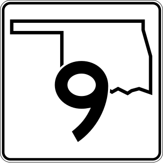
State Highway 9, abbreviated as SH-9, OK-9, or simply Highway 9, is a major east–west highway in the U.S. state of Oklahoma. Spanning across the central part of the state, SH-9 begins at the Texas state line west of Vinson, Oklahoma, and ends at the Arkansas state line near Fort Smith, Arkansas. State Highway 9 is a major highway around the Norman area. At 348.1 miles (560.2 km), SH-9 is Oklahoma's second-longest state highway.

State Highway 7 is a 150.5-mile (242.2 km) highway in southern Oklahoma. This lengthy highway connects many towns in Oklahoma's "Little Dixie" area. It runs from Interstate 44 in Lawton to U.S. 69/US-75 in Atoka.

State Highway 99 (SH-99) is a north–south state highway through central Oklahoma. It runs from the Texas state line at Lake Texoma to the Kansas state line near Lake Hulah. It is 241.5 miles (388.7 km) long. The highway overlaps U.S. Highway 377 (US-377) for over half its length.

State Highway 51, abbreviated to SH-51 or OK-51, is a major state highway in Oklahoma, United States. It runs for 332.8 miles (535.6 km) east–west across the state, running from the Texas state line to Arkansas. It is the third-longest state highway in the system.

The H. E. Bailey Turnpike is an 86.4-mile (139.0 km) controlled-access toll road in the southwestern region of the U.S. state of Oklahoma. The route, opened on April 23, 1964, is a four-lane freeway that connects Oklahoma City to Lawton in its northern section and Lawton to Wichita Falls, Texas along its southern section, roughly paralleling U.S. Route 277. The turnpike also includes an 8.2-mile (13.2 km) spur route that leads toward Norman, Oklahoma. Since 1982, it has been signed as a part of Interstate 44, and as such uses its mileposts. Travel along the full length of the toll road costs $5.50 for a two-axle vehicle.

State Highway 36 is a state highway in Oklahoma. It runs for 44.4 miles (71.5 km), forming a western loop route from Interstate 44, which it connects to at both ends. It passes through Cotton Co., Tillman Co., and Comanche Co. It currently has no lettered spur routes. State Highway 36 was first added to the highway system around 1926.

U.S. Highway 77 (US-77) in Oklahoma is a 267.21-mile-long (430.03 km) U.S. Highway in the U.S. state of Oklahoma. It travels from south to north, paralleling Interstate 35 (I-35), connecting Texas to Kansas through the central part of the state. It travels through many major cities, including Ardmore, Oklahoma City and its suburbs, Guthrie, and Ponca City. It has four lettered spur routes.

U.S. Route 69 is a major north-south U.S. Highway in the U.S. state of Oklahoma. It extends the corridor formed by U.S. Route 75 in Texas, from Dallas northeast via McAlester and Muskogee to the Will Rogers Turnpike near Vinita. From Vinita to the Kansas state line, US-69 generally parallels the turnpike along old U.S. Highway 66.

In Oklahoma, U.S. Highway 62 (US 62) runs diagonally across the state, from the Texas state line in far southwestern Oklahoma to the Arkansas state line near Fayetteville. US-62 spends a total of 402.48 miles (647.73 km) in the Sooner State. The highway passes through fifteen of Oklahoma's counties. Along the way the route serves two of Oklahoma's largest cities, Lawton and Oklahoma City, as well as many regionally important cities, like Altus, Chickasha, Muskogee, and Tahlequah. Despite this, US-62 has no lettered spur routes like many other U.S. routes in Oklahoma do.

U.S. Route 70 is a transcontinental U.S. highway extending from Globe, Arizona to Atlantic, North Carolina. Along the way, 289.81 miles (466.40 km) of its route passes through the state of Oklahoma. Entering the state south of Davidson, the highway serves Oklahoma's southern tier before exiting the state east of Broken Bow. It serves the cities of Ardmore, Durant, Hugo, and Idabel, as well as Tillman, Cotton, Jefferson, Carter, Marshall, Bryan, Choctaw, and McCurtain counties.

U.S. Route 412 is a U.S. highway in the south-central portion of the United States, connecting Springer, New Mexico to Columbia, Tennessee. A 504.11-mile (811.29 km) section of the highway crosses the state of Oklahoma, traversing the state from west to east. Entering the state southwest of Boise City, US-412 runs the length of the Oklahoma Panhandle and serves the northern portion of the state's main body, before leaving the state at West Siloam Springs. Along the way, the route serves many notable cities and towns, including Boise City, Guymon, Woodward, Enid, and the state's second-largest city, Tulsa.

U.S. Route 64 (US-64) is a U.S. highway running from the Four Corners area to the Outer Banks of North Carolina. Between these two points, the highway passes through the entire width of Oklahoma; a total of 591.17 miles (951.40 km) of US-64 lies in the state of Oklahoma. US-64 enters the state from New Mexico, crossing the line between the two states between Clayton, New Mexico, and Boise City in Cimarron County. The route runs the full length of the Oklahoma Panhandle, then serves the northernmost tier of counties in the main body of the state before dipping southeastward to Tulsa, the state's second-largest city. From Tulsa, the highway continues southeast, leaving Oklahoma just west of Fort Smith, Arkansas. In addition to Tulsa, US-64 serves fifteen Oklahoma counties and the cities of Guymon, Woodward, Enid, and Muskogee.

