1998 Oklahoma tornado outbreak

Last updated
1998 Oklahoma tornado outbreak
19981004map.png
Tornadoes that touched down in the NWS Norman area. Seven more touched down in the NWS Tulsa area.
Type Tornado outbreak
DurationOctober 4, 1998
Highest winds
Tornadoes
confirmed
26
Max. rating1 F3 tornado
Largest hail2.75 in (7.0 cm) in diameter in 3 different locations [2] [3] [4]
Fatalities11 injuries
Areas affected Oklahoma

1Most severe tornado damage; see Fujita scale

The 1998 Oklahoma tornado outbreak was a tornado outbreak that affected the state of Oklahoma on October 4, 1998. 26 tornadoes touched down, making this event the largest autumnal tornado outbreak in state history.

Contents

Confirmed tornadoes

Confirmed tornadoes by Fujita rating
FUF0F1F2F3F4F5Total
0107810026
List of confirmed tornadoes – Sunday, October 4, 1998 [note 1]
F# LocationCounty / ParishStateStart Coord.Time (UTC)Path lengthMax widthSummary
F2SSW of Dacoma to NW of Carmen Woods, Alfalfa OK 36°31′N98°39′W / 36.52°N 98.65°W / 36.52; -98.65 (Dacoma (Oct. 4, F2)) 19:25–19:4310 mi (16 km)440 yd (400 m)An abandoned home was damaged, and a barn and garage were destroyed south of Dacoma. The tornado then moved into Alfalfa County where it destroyed an office building and a gas plant. A mobile home adjacent to the gas plant lost most of its roof. [5] [6]
F0SE of Cherokee Alfalfa OK 36°42′N98°17′W / 36.70°N 98.28°W / 36.70; -98.28 (Cherokee (Oct. 4, F0)) 20:050.1 mi (0.16 km)25 yd (23 m)An Alfalfa County Sheriff's Deputy saw this brief tornado as it tracked over a small part of the salt flats of Salt Plains National Wildlife Refuge. No damage occurred. [7]
F0W of Medford Grant OK 36°49′N97°49′W / 36.82°N 97.82°W / 36.82; -97.82 (Medford (Oct. 4, F0)) 21:040.1 mi (0.16 km)25 yd (23 m)A state trooper saw this brief tornado touch down very close to OK 11. No damage occurred. [8]
F0SW of Watonga Blaine OK 35°46′N98°31′W / 35.77°N 98.52°W / 35.77; -98.52 (Watonga (Oct. 4, F0)) 21:38-21:411.5 mi (2.4 km)25 yd (23 m)A storm chaser caught this brief tornado on video. No damage occurred. [9]
F2SW of Watonga to SE of Hitchcock Blaine OK 35°49′N98°27′W / 35.82°N 98.45°W / 35.82; -98.45 (Watonga (Oct. 4, F2)) 21:50-22:1212 mi (19 km)200 yd (180 m)Three homes were significantly damaged, with one having its roof removed. [10]
F0N of Medicine Park Comanche OK 34°48′N98°30′W / 34.80°N 98.50°W / 34.80; -98.50 (Medicine Park (Oct. 4, F0)) 22:140.3 mi (0.48 km)50 yd (46 m)An Oklahoma Highway Patrol officer saw a brief tornado. No damage occurred. [11]
F1S of Dover Kingfisher OK 35°55′N98°00′W / 35.92°N 98.00°W / 35.92; -98.00 (Dover (Oct. 4, F1)) 22:28-22:427 mi (11 km)100 yd (91 m)A haybarn was destroyed, five barns were damaged, and one home was also damaged. Powerlines and trees were downed along the path. [12]
F0NE of Cyril Caddo OK 34°54′N98°11′W / 34.90°N 98.18°W / 34.90; -98.18 (Cyril (Oct. 4, F0)) 22:450.5 mi (0.80 km)25 yd (23 m)Some minor roof damage occurred on the far northeastern side of Cyril. Powerlines and trees were knocked down. [13]
F1WNW of Stillwater Payne, Noble OK 36°07′N97°15′W / 36.12°N 97.25°W / 36.12; -97.25 (Stillwater (Oct. 4, F1)) 22:47-22:566 mi (9.7 km)100 yd (91 m)This tornado tracked over parts of Lake Carl Blackwell in Payne County, and Lake McMurtry in Noble County. A mobile home was severely damaged after the tornado moved off of Lake McMurtry. [14] [15]
F1 Pawnee Pawnee OK 36°20′N96°48′W / 36.33°N 96.80°W / 36.33; -96.80 (Pawnee (Oct. 4, F1)) 23:38-23:390.4 mi (0.64 km)125 yd (114 m)On the southwest side of Pawnee, a brief tornado destroyed a mobile home, and minorly damaged at least 50 homes. This minor damage included roofing, windows, and porches. [16]
F2NW of Blanchard to SSW of Newcastle Grady, McClain OK 35°10′N97°35′W / 35.17°N 97.58°W / 35.17; -97.58 (Blanchard (Oct. 4, F2)) 00:15-00:183 mi (4.8 km)100 yd (91 m)Several mobile homes and outbuildings were damaged north of Middleberg. A mobile home was completely destroyed, and two others were blown over in the Bridge Creek area. [17] [18]
F0N of Newcastle to WSW of Moore McClain, Cleveland OK 35°18′N97°36′W / 35.30°N 97.60°W / 35.30; -97.60 (Newcastle (Oct. 4, F0)) 00:26-00:271.5 mi (2.4 km)33 yd (30 m)Damage was primarily limited to trees. [19] [20]
F2 Moore Cleveland OK 35°20′N97°30′W / 35.33°N 97.50°W / 35.33; -97.50 (Moore (Oct. 4, F2)) 00:34-00:413 mi (4.8 km)580 yd (530 m)Many homes lost portions if not all of their roofs, and one home lost a portion of an exterior wall. Some warehouses also lost sections of roofing. [21]
F0S of Barnsdall Osage OK 36°33′N96°10′W / 36.55°N 96.17°W / 36.55; -96.17 (Barnsdall (Oct. 4, F0)) 00:56-00:571 mi (1.6 km)75 yd (69 m)Three barns and two outbuildings were destroyed. Four homes had minor damage. Numerous large tree branches were snapped. [22]
F2ESE of Meeker Lincoln OK 35°28′N96°51′W / 35.47°N 96.85°W / 35.47; -96.85 (Meeker (Oct. 4, F2)) 01:37-01:403 mi (4.8 km)580 yd (530 m)Three homes just south of US 62 had significant roof damage, and an RV was pushed over. Along the highway, trees and a home had light damage. Another home along the path had roof and porch damage. [23]
F2WNW of Prague Lincoln OK 35°29′N96°48′W / 35.48°N 96.80°W / 35.48; -96.80 (Prague (Oct. 4, F2)) 01:45-01:526 mi (9.7 km)580 yd (530 m)A mobile home had light damage at the start of the path. A mobile home along US 62 was destroyed. Debris from the mobile home was scattered to the northwest about 150 yd (140 m). Slight tree and outbuilding damage occurred as the tornado moved northeast before it dissipated. [24]
F1WNW Shawnee Pottawatomie OK 35°22′N96°57′W / 35.37°N 96.95°W / 35.37; -96.95 (Shawnee 1 (Oct. 4, F1)) 01:50-01:553 mi (4.8 km)100 yd (91 m)Extensive tree damage occurred at a private golf course. The clubhouse at the golf course sustained minor damage to its roof and the air-conditioning unit. A mobile home was destroyed. [25]
F1N of Prague Lincoln OK 35°33′N96°46′W / 35.55°N 96.77°W / 35.55; -96.77 (Prague (Oct. 4, F1)) 01:52-02:088 mi (13 km)440 yd (400 m)A mobile home was lifted and thrown about 100 yd (91 m), uprooting a power pole while it was airborne. The mobile home was destroyed, with the six people who took shelter inside sustaining injuries. As the tornado crossed OK 99, a mobile home sustained minor damage, three outbuildings were destroyed, some logs at a sawmill were tossed, and trees were knocked down. [26]
F1 Shawnee Pottawatomie OK 35°20′N96°55′W / 35.33°N 96.92°W / 35.33; -96.92 (Shawnee 2 (Oct. 4, F1)) 01:58-02:002 mi (3.2 km)100 yd (91 m)This tornado developed very close to if not in the downtown area of Shawnee. Many homes had minor roof and structural damage, and trees and powerlines were knocked down. [27]
F0SSE of Nowata to NNE of New Alluwe Nowata OK 36°38′N95°37′W / 36.63°N 95.62°W / 36.63; -95.62 (Nowata (Oct. 4, F0)) 02:05-02:168 mi (13 km)50 yd (46 m)A barn was destroyed, an old school building was destroyed, and a mobile home lost most of its roof. Debris from the mobile home's roof was wrapped around trees as far as over 100 yd (91 m) away. Afterwards, the tornado then crossed Lake Oologah. After coming off the lake, a shed was destroyed, a home and barn were damaged, and several trees were knocked down. This tornado was observed by a trained spotter as it was north of New Alluwe. It dissipated shortly after. [28]
F3WNW of Little to SE of Prague Seminole, Pottawatomie OK 35°23′N96°46′W / 35.38°N 96.77°W / 35.38; -96.77 (Little (Oct. 4, F3)) 02:08-02:176 mi (9.7 km)880 yd (800 m)This was the strongest tornado of the outbreak. It touched down west-northwest of Little, where only minor tree damage occurred. As the tornado moved northeast, it increased in size to its peak width of a 0.5 mi (0.80 km) wide. Numerous outbuildings were heavily damaged, and trees were snapped. On the north side of the tornado's path, three mobile homes were slightly damaged, and three other homes had minor roof single damage. As the tornado crossed I-40 it blew over a truck carrying hazardous materials. Further to the northeast, a mobile home lost its roof, multiple outbuildings were destroyed, and trees were damaged before the tornado crossed the North Canadian River into Pottawatomie County. After crossing the river, a barn was partially unroofed. The small community of Center View was hit, mainly on its south and east side. As the tornado crossed OK 99, a home lost its roof and most of its exterior walls. Five other homes nearby suffered major to significant damage. Further northeast, another home suffered significant roof damage, the south-facing brick wall was buckled, and the garage was destroyed. Steel and cinder-block debris from the garage impaled a tree. Additional tree and outbuilding damage occurred along the path before the tornado lifted. In all, about 60 homes or businesses were damaged or destroyed. [29] [30]
F0NW of Collinsville Tulsa OK 36°24′N95°52′W / 36.40°N 95.87°W / 36.40; -95.87 (Collinsville (Oct. 4, F0)) 02:190.5 mi (0.80 km)50 yd (46 m)Several trained spotters reported this tornado. No damage occurred. [31]
F2SE of Boley to SW of Nuyaka Okfuskee, Okmulgee OK 35°29′N96°27′W / 35.48°N 96.45°W / 35.48; -96.45 (Boley (Oct. 4, F2)) 02:37-03:0427 mi (43 km)1,408 yd (1,287 m)This was the widest and longest-tracked tornado of the outbreak. In IXL, nearly every structure in the small community was damaged in some form. A home and two mobile homes were destroyed, with debris from one of the mobile homes being found a 0.5 mi (0.80 km) away. Four businesses and a public building at the local park were also destroyed. Six homes and two mobile homes were destroyed, and 21 homes and a mobile home sustained minor damage. In the Haydenville area, north of Okemah on OK 56, two homes and a mobile home were destroyed. Three homes, three mobile homes, and the Haydenville fire station suffered major damage. Five homes and a store sustained minor damage. Just southwest of the Haydenville area, a mobile home was completely destroyed. Four people inside the mobile home suffered injuries. In Okmulgee County, only minor tree damage occurred before the tornado lifted. Surveys done by the National Weather Service Tulsa, Oklahoma found evidence that smaller satellite tornadoes circulated around the larger tornado. The tornado itself was around 0.8 mi (1.3 km) wide at its widest point, with the damage width reaching around 3 mi (4.8 km) wide at times due to the smaller satellite tornadoes rotating around the larger one. [32] [33]
F1E of Nuyaka Okmulgee OK 35°39′N96°06′W / 35.65°N 96.10°W / 35.65; -96.10 (Nuyaka (Oct. 4, F1)) 03:17-03:181 mi (1.6 km)100 yd (91 m)A storm chaser doing an aerial survey found damage path through the Okmulgee Wildlife Management Area just east of Nuyaka. Damage was limited to trees being blown over. [34]
F0SE of Tullahassee Wagoner OK 35°49′N95°25′W / 35.82°N 95.42°W / 35.82; -95.42 (Tullahassee (Oct. 4, F0)) 04:270.8 mi (1.3 km)50 yd (46 m)One home had roof damage, and many trees were damaged in a forested area. This was produced by the same thunderstorm that produced the F2 tornado in Okfuskee and Okmulgee Counties. [35]

See also

Notes

  1. All dates are based on the local time zone where the tornado touched down; however, all times are in Coordinated Universal Time for consistency.

Related Research Articles

<span class="mw-page-title-main">Anticyclonic tornado</span> Tornadoes that spin in the opposite direction of normal tornadoes

An anticyclonic tornado is a tornado which rotates in a clockwise direction in the Northern Hemisphere and a counterclockwise direction in the Southern Hemisphere. The term is a naming convention denoting the anomaly from normal rotation which is cyclonic in upwards of 98 percent of tornadoes. Many anticyclonic tornadoes are smaller and weaker than cyclonic tornadoes, forming from a different process, as either companion/satellite tornadoes or nonmesocyclonic tornadoes.

<span class="mw-page-title-main">Tornadoes of 2007</span> List of notable worldwide tornadoes that occurred in 2007

This page documents the tornadoes and tornado outbreaks that occurred in 2007, primarily in the United States. Most tornadoes form in the U.S., although some events may take place internationally, particularly in parts of neighboring southern Canada during the summer season. Some tornadoes also take place in Europe, e. g. in the United Kingdom or in Germany.

<span class="mw-page-title-main">Tornadoes of 2001</span>

This page documents notable tornadoes and tornado outbreaks worldwide in 2001. Strong and destructive tornadoes form most frequently in the United States, Bangladesh, and Eastern India, but they can occur almost anywhere under the right conditions. Tornadoes also develop occasionally in southern Canada during the Northern Hemisphere's summer and somewhat regularly at other times of the year across Europe, Asia, and Australia. Tornadic events are often accompanied with other forms of severe weather, including strong thunderstorms, strong winds, and hail.

On May 24–25, 1957, a tornado outbreak primarily affected the Western High Plains, Central Great Plains, and Central Oklahoma/Texas Plains of the United States. 45 tornadoes touched down over the area, most of which took place across northern and western Texas, in addition to southern Oklahoma. Overall activity initiated over eastern New Mexico and spread northeastward as far as southwestern Wisconsin. The strongest tornado, which occurred in southern Oklahoma on May 24, was assigned a rating of F4 near Lawton. Anomalously, some tornadoes touched down during the early morning hours, rather than late afternoon or early evening, when daytime heating typically peaks.

<span class="mw-page-title-main">Tornadoes of 1999</span>

This page documents the tornadoes and tornado outbreaks of 1999, primarily in the United States. Most tornadoes form in the U.S., although some events may take place internationally, particularly in parts of neighboring southern Canada during the Northern Hemisphere's summer season, as well as Europe. One particular event, the Bridge Creek-Moore, Oklahoma F5 tornado, produced the highest wind speed ever recorded on Earth, which was 301 ± 20 mph (484 ± 32 km/h).

From May 3 to May 11, 2003, a prolonged and destructive series of tornado outbreaks affected much of the Great Plains and Eastern United States. Most of the severe activity was concentrated between May 4 and May 10, which saw more tornadoes than any other week-long span in recorded history; 335 tornadoes occurred during this period, concentrated in the Ozarks and central Mississippi River Valley. Additional tornadoes were produced by the same storm systems from May 3 to May 11, producing 363 tornadoes overall, of which 62 were significant. Six of the tornadoes were rated F4, and of these four occurred on May 4, the most prolific day of the tornado outbreak sequence; these were the outbreak's strongest tornadoes. Damage caused by the severe weather and associated flooding amounted to US$4.1 billion, making it the costliest U.S. tornado outbreak of the 2000s. A total of 50 deaths and 713 injuries were caused by the severe weather, with a majority caused by tornadoes; the deadliest tornado was an F4 that struck Madison and Henderson counties in Tennessee, killing 11. In 2023, tornado expert Thomas P. Grazulis created the outbreak intensity score (OIS) as a way to rank various tornado outbreaks. The tornado outbreak sequence of May 2003 received an OIS of 232, making it the fourth worst tornado outbreak in recorded history.

<span class="mw-page-title-main">Tornadoes of 1987</span>

This page documents the tornadoes and tornado outbreaks of 1987, primarily in the United States. Most tornadoes form in the U.S., although some events may take place internationally. Tornado statistics for older years like this often appear significantly lower than modern years due to fewer reports or confirmed tornadoes.

<span class="mw-page-title-main">Tornadoes of 1998</span>

This page documents the tornadoes and tornado outbreaks of 1998, primarily in the United States. Most tornadoes form in the U.S., although some events may take place internationally. Tornado statistics for older years like this often appear significantly lower than modern years due to fewer reports or confirmed tornadoes, however by the 1990s tornado statistics were coming closer to the numbers we see today.

<span class="mw-page-title-main">Tornadoes of 1984</span>

This page documents the tornadoes and tornado outbreaks of 1984, primarily in the United States. Most tornadoes form in the U.S., although some events may take place internationally. Tornado statistics for older years like this often appear significantly lower than modern years due to fewer reports or confirmed tornadoes.
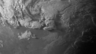
<span class="mw-page-title-main">Tornado outbreak of May 15–17, 2013</span> Tornado outbreak in the United States

A small but damaging tornado outbreak impacted northern Texas, south-central Oklahoma, northern Louisiana, and northern Alabama in mid-May 2013. The outbreak was the result of an upper-level shortwave trough that tracked across the Southern Plains of the United States. An associated low-pressure area and atmospheric instability resulted in the formation of tornadoes across northern Texas and Oklahoma on May 15. Afterwards the storm system weakened as it tracked eastward, though six additional tornadoes were reported in Texas, Louisiana, and Alabama in the two days following May 15. Over a period of nearly two days, the storm system produced 26 tornadoes in four states. The strongest of these was an EF4 tornado which struck Hood County, Texas on May 15. However, on May 16 and May 17 no tornadoes were confirmed to have been stronger than EF1 intensity. In addition to tornadoes, large hail was reported, peaking at 4 in (10 cm) in diameter near Mineral Wells, Texas on May 15.

<span class="mw-page-title-main">Tornadoes of 1962</span>

This page documents the tornadoes and tornado outbreaks of 1962, primarily in the United States. Most tornadoes form in the U.S., although tornadoes events can take place internationally. Tornado statistics for older years like this often appear significantly lower than modern years due to fewer reports or confirmed tornadoes.
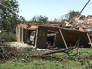
<span class="mw-page-title-main">Tornado outbreak of June 13, 1998</span> Weather event in the United States

On June 13, 1998, a tornado outbreak occurred across much of the United States. The day saw 45 tornadoes touchdown primarily across Kansas, Nebraska, and Oklahoma. The outbreak saw the Storm Prediction Center outline two Moderate Risk areas in parts of Virginia, North Carolina, and South Carolina, and in parts of Kansas and Nebraska. Additionally, two far more expansive Slight Risk areas were delineated across much of the Central and Eastern United States. By 06:00 UTC June 14, tornadoes had struck parts of six states, including downtown Sabetha, Kansas and parts of North Oklahoma City and the vicinity.

<span class="mw-page-title-main">Tornadoes of 2018</span>

This page documents notable tornadoes and tornado outbreaks worldwide in 2018. Strong and destructive tornadoes form most frequently in the United States, Brazil, Bangladesh and Eastern India, but they can occur almost anywhere under the right conditions. Tornadoes also develop occasionally in southern Canada during the Northern Hemisphere's summer and somewhat regularly at other times of the year across Europe, Asia, Argentina and Australia. Tornadic events are often accompanied with other forms of severe weather, including strong thunderstorms, strong winds, and hail. There were 1,169 preliminary filtered reported tornadoes and 1,121 confirmed tornadoes in the United States in 2018. Worldwide, 17 tornado-related deaths were confirmed; 10 in the United States, four in Brazil, two in Indonesia, and one in Canada.

<span class="mw-page-title-main">Tornadoes of 1958</span>

This page documents the tornadoes and tornado outbreaks of 1958, primarily in the United States. Most tornadoes form in the U.S., although some events may take place internationally. Tornado statistics for older years like this often appear significantly lower than modern years due to fewer reports or confirmed tornadoes.

<span class="mw-page-title-main">Tornadoes of 1954</span>

This page documents the tornadoes and tornado outbreaks of 1954, primarily in the United States. Most tornadoes form in the U.S., although some events may take place internationally. Tornado statistics for older years like this often appear significantly lower than modern years due to fewer reports or confirmed tornadoes.

<span class="mw-page-title-main">Tornadoes of 1953</span>

This page documents the tornadoes and tornado outbreaks of 1953, primarily in the United States. Most tornadoes form in the U.S., although some events may take place internationally. Tornado statistics for older years like this often appear significantly lower than modern years due to fewer reports or confirmed tornadoes. This was the first year to record an F5 tornado as well as one of the deadliest tornado seasons in official U.S. records, which go back to 1950.

This page documents the tornadoes and tornado outbreaks of 1951, primarily in the United States. Most tornadoes form in the U.S., although some events may take place internationally. Tornado statistics for older years like this often appear significantly lower than modern years due to fewer reports or confirmed tornadoes.

This page documents the tornadoes and tornado outbreaks of 1950, primarily in the United States. Most tornadoes form in the U.S., although some events may take place internationally.

An outbreak of seven tornadoes struck the Central Plains and Mississippi in Late-April 1950. Five of the seven tornadoes were significant (F2+), including two violent F4 tornadoes in Texas and Oklahoma, both of which killed five. Overall, the outbreak killed 11, injured 38, and caused $1.575 million in damage. A lightning strike at Lake Texoma in Oklahoma caused an additional fatality and injury as well.

References

  1. "Storm Events Database October 4, 1998". National Centers for Environmental Information. National Centers for Environmental Information. Retrieved December 6, 2020.
  2. "Storm Events Database October 4, 1998". National Centers for Environmental Information. National Centers for Environmental Information. Retrieved December 6, 2020.
  3. "Storm Events Database October 4, 1998". National Centers for Environmental Information. National Centers for Environmental Information. Retrieved December 6, 2020.
  4. "Storm Events Database October 4, 1998". National Centers for Environmental Information. National Centers for Environmental Information. Retrieved December 6, 2020.
  5. "Storm Events Database October 4, 1998". National Centers for Environmental Information. National Centers for Environmental Information. Retrieved December 6, 2020.
  6. "Storm Events Database October 4, 1998". National Centers for Environmental Information. National Centers for Environmental Information. Retrieved December 6, 2020.
  7. "Storm Events Database October 4, 1998". National Centers for Environmental Information. National Centers for Environmental Information. Retrieved December 6, 2020.
  8. "Storm Events Database October 4, 1998". National Centers for Environmental Information. National Centers for Environmental Information. Retrieved December 6, 2020.
  9. "Storm Events Database October 4, 1998". National Centers for Environmental Information. National Centers for Environmental Information. Retrieved December 6, 2020.
  10. "Storm Events Database October 4, 1998". National Centers for Environmental Information. National Centers for Environmental Information. Retrieved December 6, 2020.
  11. "Storm Events Database October 4, 1998". National Centers for Environmental Information. National Centers for Environmental Information. Retrieved December 6, 2020.
  12. "Storm Events Database October 4, 1998". National Centers for Environmental Information. National Centers for Environmental Information. Retrieved December 6, 2020.
  13. "Storm Events Database October 4, 1998". National Centers for Environmental Information. National Centers for Environmental Information. Retrieved December 6, 2020.
  14. "Storm Events Database October 4, 1998". National Centers for Environmental Information. National Centers for Environmental Information. Retrieved December 6, 2020.
  15. "Storm Events Database October 4, 1998". National Centers for Environmental Information. National Centers for Environmental Information. Retrieved December 6, 2020.
  16. "Storm Events Database October 4, 1998". National Centers for Environmental Information. National Centers for Environmental Information. Retrieved December 6, 2020.
  17. "Storm Events Database October 4, 1998". National Centers for Environmental Information. National Centers for Environmental Information. Retrieved December 6, 2020.
  18. "Storm Events Database October 4, 1998". National Centers for Environmental Information. National Centers for Environmental Information. Retrieved December 6, 2020.
  19. "Storm Events Database October 4, 1998". National Centers for Environmental Information. National Centers for Environmental Information. Retrieved December 6, 2020.
  20. "Storm Events Database October 4, 1998". National Centers for Environmental Information. National Centers for Environmental Information. Retrieved December 6, 2020.
  21. "Storm Events Database October 4, 1998". National Centers for Environmental Information. National Centers for Environmental Information. Retrieved December 6, 2020.
  22. "Storm Events Database October 4, 1998". National Centers for Environmental Information. National Centers for Environmental Information. Retrieved December 6, 2020.
  23. "Storm Events Database October 4, 1998". National Centers for Environmental Information. National Centers for Environmental Information. Retrieved December 6, 2020.
  24. "Storm Events Database October 4, 1998". National Centers for Environmental Information. National Centers for Environmental Information. Retrieved December 6, 2020.
  25. "Storm Events Database October 4, 1998". National Centers for Environmental Information. National Centers for Environmental Information. Retrieved December 6, 2020.
  26. "Storm Events Database October 4, 1998". National Centers for Environmental Information. National Centers for Environmental Information. Retrieved December 6, 2020.
  27. "Storm Events Database October 4, 1998". National Centers for Environmental Information. National Centers for Environmental Information. Retrieved December 6, 2020.
  28. "Storm Events Database October 4, 1998". National Centers for Environmental Information. National Centers for Environmental Information. Retrieved December 6, 2020.
  29. "Storm Events Database October 4, 1998". National Centers for Environmental Information. National Centers for Environmental Information. Retrieved December 6, 2020.
  30. "Storm Events Database October 4, 1998". National Centers for Environmental Information. National Centers for Environmental Information. Retrieved December 6, 2020.
  31. "Storm Events Database October 4, 1998". National Centers for Environmental Information. National Centers for Environmental Information. Retrieved December 6, 2020.
  32. "Storm Events Database October 4, 1998". National Centers for Environmental Information. National Centers for Environmental Information. Retrieved December 6, 2020.
  33. "Storm Events Database October 4, 1998". National Centers for Environmental Information. National Centers for Environmental Information. Retrieved December 6, 2020.
  34. "Storm Events Database October 4, 1998". National Centers for Environmental Information. National Centers for Environmental Information. Retrieved December 6, 2020.
  35. "Storm Events Database October 4, 1998". National Centers for Environmental Information. National Centers for Environmental Information. Retrieved December 6, 2020.