Hardeman County, Texas

Last updated • 3 min readFrom Wikipedia, The Free Encyclopedia

Hardeman County
Hardeman County Courthouse (Quanah, Texas).jpg
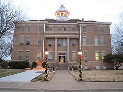
The Hardeman County Courthouse in Quanah
Map of Texas highlighting Hardeman County.svg
Location within the U.S. state of Texas
Texas in United States.svg
Texas's location within the U.S.
Coordinates: 34°17′N99°45′W / 34.29°N 99.75°W / 34.29; -99.75
CountryFlag of the United States.svg United States
StateFlag of Texas.svg  Texas
Founded1884
Seat Quanah
Largest cityQuanah
Area
  Total697 sq mi (1,810 km2)
  Land695 sq mi (1,800 km2)
  Water1.8 sq mi (5 km2)  0.3%
Population
 (2020)
  Total3,549
  Density5.1/sq mi (2.0/km2)
Time zone UTC−6 (Central)
  Summer (DST) UTC−5 (CDT)
Congressional district 13th

Hardeman County ( /ˈhɑːrdɪmən/ HAR-di-mən) is a county located in the U.S. state of Texas. As of the 2020 census, its population was 3,549. [1] The county seat and largest city is Quanah. [2] The county was created in 1858 and later organized in 1884. [3] It is named for two brothers, Bailey Hardeman and Thomas Jones Hardeman, [4] early Texas politicians and legislators. Hardeman County was one of 46 prohibition or entirely dry counties in the state of Texas until November 2006, when voters approved referendums to permit the legal sale of alcoholic beverages for on- and off-premises consumption.

Contents

Geography

According to the U.S. Census Bureau, the county has a total area of 697 sq mi (1,810 km2), of which 695 sq mi (1,800 km2) are land and 1.8 sq mi (4.7 km2) (0.3%) are covered by water. [5]

The Prairie Dog Town Fork Red River joins with Buck Creek in the northwestern corner of the county to form the Red River, which flows east to form the northern border of the county, separating it from Oklahoma. [6]

Hardeman County is the northernmost county in Texas that is not part of the Texas Panhandle.

Major highways

Adjacent counties

Demographics

Historical population
CensusPop.Note
1880 50
1890 3,9047,708.0%
1900 3,634−6.9%
1910 11,213208.6%
1920 12,48711.4%
1930 14,53216.4%
1940 11,073−23.8%
1950 10,212−7.8%
1960 8,275−19.0%
1970 6,795−17.9%
1980 6,368−6.3%
1990 5,283−17.0%
2000 4,724−10.6%
2010 4,139−12.4%
2020 3,549−14.3%
U.S. Decennial Census [7]
1850–2010 [8] 2010 [9] 2020 [10]
Hardeman County, Texas – Racial and ethnic composition
Note: the US Census treats Hispanic/Latino as an ethnic category. This table excludes Latinos from the racial categories and assigns them to a separate category. Hispanics/Latinos may be of any race.
Race / Ethnicity (NH = Non-Hispanic)Pop 2000 [11] Pop 2010 [9] Pop 2020 [10] % 2000% 2010% 2020
White alone (NH)3,7312,9382,44178.98%70.98%68.78%
Black or African American alone (NH)2272171304.81%5.24%3.66%
Native American or Alaska Native alone (NH)2715140.57%0.36%0.39%
Asian alone (NH)1212180.25%0.29%0.51%
Pacific Islander alone (NH)0010.00%0.00%0.03%
Other race alone (NH)2170.04%0.02%0.20%
Mixed race or Multiracial (NH)40671200.85%1.62%3.38%
Hispanic or Latino (any race)68588981814.50%21.48%23.05%
Total4,7244,1393,549100.00%100.00%100.00%

As of the census [12] of 2000, 4,724 people, 1,943 households, and 1,319 families were residing in the county. The population density was 7 people/sq mi (2.7 people/km2). The 2,358 housing units averaged 3 units per square mile (1.2/km2). The racial makeup of the county was 85.4% White, 4.8% African American, 0.8% Native American, 0.3% Asian, 7.1% from other races, and 1.6% from two or more races. About 14.5% of the population were Hispanic or Latino of any race.

Of the 1,943 households, 29.9% had children under the age of 18 living with them, 54.7% were married couples living together, 10.4% had a female householder with no husband present, and 32.1% were not families. About 29.5% of all households were made up of individuals, and 18.0% had someone living alone who was 65 years of age or older. The average household size was 2.40, and the average family size was 2.97.

In the county, the population distribution was 25.40% under the age of 18, 7.50% from 18 to 24, 22.60% from 25 to 44, 24.30% from 45 to 64, and 20.20% who were 65 years of age or older. The median age was 41 years. For every 100 females, there were 89.40 males. For every 100 females age 18 and over, there were 85.2 males.

The median income for a household in the county was $28,312, and for a family was $33,325. Males had a median income of $26,683 versus $18,566 for females. The per capita income for the county was $16,824. About 14.6% of families and 17.8% of the population were below the poverty line, including 26.0% of those under age 18 and 13.4% of those age 65 or over.

Economy

Georgia-Pacific operates a gypsum plant in the small community of Acme, located 6 miles (9.7 km) west of Quanah on U.S. Highway 287.

Attractions

Communities

Cities

Unincorporated communities

Ghost towns

Politics

Republican Drew Springer, Jr., a businessman from Muenster in Cooke County, has represented Hardeman County in the Texas Senate since 2021, and previously in the Texas House of Representatives from 2013 to 2021. Hardeman County formerly leaned Democratic, however in recent years it has swung to become solidly Republican.

United States presidential election results for Hardeman County, Texas [13]
Year Republican Democratic Third party(ies)
No.%No.%No.%
2020 1,33084.18%24115.25%90.57%
2016 1,20779.78%24916.46%573.77%
2012 1,17678.66%30220.20%171.14%
2008 1,19975.17%37323.39%231.44%
2004 1,21471.33%48028.20%80.47%
2000 97662.68%56636.35%150.96%
1996 61039.84%75048.99%17111.17%
1992 61431.71%95449.28%36819.01%
1988 85542.73%1,14357.12%30.15%
1984 1,23856.97%92742.66%80.37%
1980 1,05646.46%1,17451.65%431.89%
1976 80536.18%1,40363.06%170.76%
1972 1,35768.29%61430.90%160.81%
1968 87334.25%1,14544.92%53120.83%
1964 69727.53%1,83572.47%00.00%
1960 1,47255.44%1,18244.52%10.04%
1956 1,11946.45%1,28153.18%90.37%
1952 1,57155.69%1,24244.03%80.28%
1948 22611.44%1,65483.70%964.86%
1944 22310.26%1,75680.81%1948.93%
1940 36212.86%2,45387.14%00.00%
1936 2079.38%1,99190.17%100.45%
1932 1456.79%1,98592.97%50.23%
1928 1,33359.43%91040.57%00.00%
1924 25618.18%1,09978.05%533.76%
1920 25219.03%96773.04%1057.93%
1916 948.14%93280.69%12911.17%
1912 363.38%84379.15%18617.46%

Education

School districts serving sections of the county include: [14]

The county is in the service area of Vernon College. [15]

See also

Related Research Articles

<span class="mw-page-title-main">Wilbarger County, Texas</span> County in Texas, United States

Wilbarger County is a county located in the North Texas region of the U.S. state of Texas. As of the 2020 census, the population was 12,887. The county seat is Vernon. The county was created in 1858 and later organized in 1881. Wilbarger is named for Josiah Pugh Wilbarger and Mathias Wilbarger, two early settlers.

<span class="mw-page-title-main">Tyler County, Texas</span> County in Texas, United States

Tyler County is a county located in the U.S. state of Texas. It is in East Texas and its seat is Woodville.

<span class="mw-page-title-main">Trinity County, Texas</span> County in Texas, United States

Trinity County is a county located in the U.S. state of Texas. As of the 2020 census, the population was 13,602. Its county seat is Groveton. The county is named for the Trinity River.

<span class="mw-page-title-main">Robertson County, Texas</span> County in Texas, United States

Robertson County is a county in the U.S. state of Texas. As of the 2020 census, its population was 16,757. Its county seat is Franklin. The county was created in 1837 and organized the following year. It is named for Sterling C. Robertson, an early settler who signed the Texas Declaration of Independence.

<span class="mw-page-title-main">Motley County, Texas</span> County in Texas, United States

Motley County is a county located in the U.S. state of Texas. As of the 2020 census, its population was 1,063, making it the 10th-least populous county in Texas. Its county seat is Matador. The county was created in 1876 and organized in 1891. It is named for Junius William Mottley, a signer of the Texas Declaration of Independence. Mottley's name is spelled incorrectly because the bill establishing the county misspelled his name. Motley County was one of 30 prohibition, or entirely dry, counties in Texas, but is now a wet county.

<span class="mw-page-title-main">Montague County, Texas</span> County in Texas, US

Montague County is a county located in the U.S. state of Texas, established in 1857. As of the 2020 census, its population was 19,965. The county seat is Montague. The county was created in 1857 and organized the next year. It is named for Daniel Montague, a surveyor and soldier in the Mexican–American War.

<span class="mw-page-title-main">Mitchell County, Texas</span> County in Texas, United States

Mitchell County is a county in the U.S. state of Texas. As of the 2020 census, its population was 8,990. Its county seat is Colorado City. The county was created in 1876 and organized in 1881. It is named for Asa and Eli Mitchell, two early settlers and soldiers in the Texas Revolution.

<span class="mw-page-title-main">Milam County, Texas</span> County in Texas, United States

Milam County is a county located in the U.S. state of Texas. As of the 2020 census, its population was 24,754. The county seat is Cameron. The county was created in 1834 as a municipality in Mexico and organized as a county in 1837. Milam County is named for Benjamin Rush Milam, an early settler and a soldier in the Texas Revolution.

<span class="mw-page-title-main">Hall County, Texas</span> County in Texas, United States

Hall County is a county located in the U.S. state of Texas. As of the 2020 census, the population is 2,825. Its county seat is Memphis. The county was created in 1876 and later organized in 1890. It is named for Warren D. C. Hall, a secretary of war for the Republic of Texas.

<span class="mw-page-title-main">Garza County, Texas</span> County in Texas, United States

Garza County is a county located in the U.S. state of Texas. As of the 2020 census, its population was 5,816, of which most of the population were residing in its county seat, and only incorporated municipality, Post. The county was created in 1876 and later organized in 1907. Garza is named for a pioneer Bexar County family, as it was once a part of that county.

<span class="mw-page-title-main">Frio County, Texas</span> County in Texas, United States

Frio County is a county located in the U.S. state of Texas. As of the 2020 census, its population was 18,385. The county seat is Pearsall. The county was created in 1858 and later organized in 1871. Frio is named for the Frio River, whose name is Spanish for "cold".

<span class="mw-page-title-main">Foard County, Texas</span> County in Texas, United States

Foard County is a county located in the U.S. state of Texas. As of the 2020 census, its population was 1,095. Its county seat is Crowell, which is also the county's only incorporated community. The county is named for Robert Levi Foard, an attorney who served as a major with the Confederate Army, in the American Civil War.

<span class="mw-page-title-main">Donley County, Texas</span> County in Texas, United States

Donley County is a county located in the U.S. state of Texas. As of the 2020 census, its population was 3,258. Its county seat is Clarendon. The county was created in 1876 and later organized in 1882.

<span class="mw-page-title-main">Crosby County, Texas</span> County in Texas, United States

Crosby County is a county located in the U.S. state of Texas. As of the 2020 census, its population was 5,133. The county seat is Crosbyton. The county was founded in 1876 and later organized in 1886. Both the county and its seat are named for Stephen Crosby, a land commissioner in Texas.

<span class="mw-page-title-main">Cottle County, Texas</span> County in Texas, United States

Cottle County is a county in the U.S. state of Texas. As of the 2020 census, its population was 1,380. Its county seat is Paducah. The county was founded in 1876 and later organized in 1892. It is named for George Washington Cottle, who died defending the Alamo. Cottle County was formerly one of 46 prohibition, or entirely dry counties in the state of Texas. It now allows beer and wine sales.
<span class="mw-page-title-main">Childress County, Texas</span> County in Texas, United States

Childress County is a county located in the U.S. state of Texas. As of the 2020 census, its population was 6,664. The county seat is Childress. The county was created in 1876 and later organized in 1887. It is named for George Campbell Childress, the author of the Texas Declaration of Independence.

<span class="mw-page-title-main">Bailey County, Texas</span> County in Texas, United States

Bailey County is a county located in the U.S. state of Texas. It is in West Texas and its county seat is Muleshoe. As of the 2020 census, its population was 6,904.

<span class="mw-page-title-main">Chillicothe, Texas</span> City in Hardeman County, Texas, United States

Chillicothe is a city in Hardeman County, Texas, United States. The population was 549 at the 2020 census.

<span class="mw-page-title-main">Quanah, Texas</span> City in Texas, United States

Quanah is a city in and the county seat of Hardeman County, Texas, United States. As of the 2020 census the population was 2,279, down from 2,641 at the 2010 census.

<span class="mw-page-title-main">Moore County, Texas</span> County in Texas, United States

Moore County is a county located in the U.S. state of Texas. As of the 2020 census, its population was 21,358. The county seat is Dumas. The county was created in 1876 and organized in 1892. It is named for Edwin Ward Moore, the commander of the Texas Navy. The Dumas micropolitan statistical area includes all of Moore County.
References

  1. "Hardeman County, Texas". United States Census Bureau . Retrieved February 23, 2021.
  2. "Find a County". National Association of Counties. Retrieved June 7, 2011.
  3. "Texas: Individual County Chronologies". Texas Atlas of Historical County Boundaries. The Newberry Library. 2008. Archived from the original on April 12, 2017. Retrieved May 24, 2015.
  4. Gannett, Henry (1905). The Origin of Certain Place Names in the United States. Govt. Print. Off. pp.  149.
  5. "2010 Census Gazetteer Files". United States Census Bureau. August 22, 2012. Retrieved April 28, 2015.
  6. "Secondary Streams of Texas". Texas Almanac. Texas State Historical Association. Retrieved May 5, 2015. Red River, Prairie Dog Town Fork
  7. "Decennial Census of Population and Housing by Decades". US Census Bureau.
  8. "Texas Almanac: Population History of Counties from 1850–2010" (PDF). Texas Almanac. Archived (PDF) from the original on October 9, 2022. Retrieved April 28, 2015.
  9. 1 2 "P2 Hispanic or Latino, and Not Hispanic or Latino by Race – 2010: DEC Redistricting Data (PL 94-171) – Hardeman County, Texas". United States Census Bureau .
  10. 1 2 "P2 Hispanic or Latino, and Not Hispanic or Latino by Race – 2020: DEC Redistricting Data (PL 94-171) – Hardeman County, Texas". United States Census Bureau .
  11. "P004: Hispanic or Latino, and Not Hispanic or Latino by Race – 2000: DEC Summary File 1 – Hardeman County, Texas". United States Census Bureau.
  12. "U.S. Census website". United States Census Bureau . Retrieved May 14, 2011.
  13. Leip, David. "Dave Leip's Atlas of U.S. Presidential Elections". uselectionatlas.org. Retrieved July 25, 2018.
  14. "2020 census - school district reference map: Hardeman County, TX" (PDF). U.S. Census Bureau. Archived (PDF) from the original on October 9, 2022. Retrieved June 29, 2022. - Text list
  15. Texas Education Code, Sec. 130.207. Vernon Regional Junior College District Service Area.

34°17′N99°45′W / 34.29°N 99.75°W / 34.29; -99.75