Borden County | |
---|---|
Coordinates: 32°44′N101°26′W / 32.74°N 101.43°W | |
Country | United States |
State | Texas |
Founded | 1876 |
Named for | Gail Borden Jr. |
Seat | Gail |
Largest community | Gail |
Area | |
• Total | 906 sq mi (2,350 km2) |
• Land | 897 sq mi (2,320 km2) |
• Water | 8.6 sq mi (22 km2) 1.0% |
Population (2020) | |
• Total | 631 |
• Estimate (2022) | 585 |
• Density | 0.70/sq mi (0.27/km2) |
Time zone | UTC−6 (Central) |
• Summer (DST) | UTC−5 (CDT) |
Congressional district | 19th |
Website | www |
Borden County is a rural county located in the U.S. state of Texas. It is in West Texas and its county seat is Gail. [1]
As of the 2020 census, its population was 631, [2] making it the fifth-least populous county in Texas. Borden is one of four remaining prohibition or entirely dry counties in the state of Texas. [3]
The county was created in 1876 and later organized in 1891. [4] Gail and Borden County are named for Gail Borden Jr., businessman, publisher, surveyor, and pioneer of condensed milk.
Shoshone and the Penateka band of Comanches were early tribes in the area. [5]
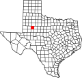
Borden County was created in 1876 from Bosque County and named for Gail Borden Jr., the inventor of condensed milk. Borden was publisher and editor of the Telegraph and Texas Register , as well as a political leader in the Republic of Texas. The county was organized in 1891, and Gail was made the county seat. [6]
Farmers and ranchers settled the county, but the population remained relatively small. In 1902, Texas placed lands in the public domain and spurred a land rush in Borden County. Many of the newcomers grew cotton. [5]
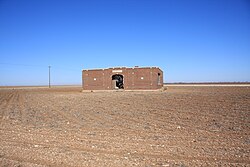
Borden County has had two courthouses, one built in 1890. The current courthouse is of brick and concrete construction and was erected in 1939. The architect was David S. Castle Co. [7]
Oil was discovered in the county in 1949. By 1991, more than 340,000,000 barrels (54,000,000 m3) of petroleum had been taken out of Borden County since its discovery. [8]
According to the United States Census Bureau, the county has a total area of 906 square miles (2,350 km2), of which 897 square miles (2,320 km2) are land and 8.6 square miles (22 km2) (1.0%) are covered by water. [9]
Census | Pop. | Note | %± |
---|---|---|---|
1880 | 35 | — | |
1890 | 222 | 534.3% | |
1900 | 776 | 249.5% | |
1910 | 1,386 | 78.6% | |
1920 | 965 | −30.4% | |
1930 | 1,505 | 56.0% | |
1940 | 1,396 | −7.2% | |
1950 | 1,106 | −20.8% | |
1960 | 1,076 | −2.7% | |
1970 | 888 | −17.5% | |
1980 | 859 | −3.3% | |
1990 | 799 | −7.0% | |
2000 | 729 | −8.8% | |
2010 | 641 | −12.1% | |
2020 | 631 | −1.6% | |
2022 (est.) | 585 | [10] | −7.3% |
U.S. Decennial Census [11] 1850–2010 [12] 2010-2020 [2] |
Race / Ethnicity | Pop 2010 [13] | Pop 2020 [14] | % 2010 | % 2020 |
---|---|---|---|---|
White alone (NH) | 539 | 528 | 84.09% | 83.68% |
Black or African American alone (NH) | 0 | 1 | 0.00% | 0.16% |
Native American or Alaska Native alone (NH) | 2 | 0 | 0.31% | 0.00% |
Asian alone (NH) | 1 | 0 | 0.16% | 0.00% |
Pacific Islander alone (NH) | 0 | 0 | 0.00% | 0.00% |
Some Other Race alone (NH) | 0 | 1 | 0.00% | 0.16% |
Mixed Race/Multi-Racial (NH) | 4 | 15 | 0.62% | 2.38% |
Hispanic or Latino (any race) | 95 | 86 | 14.82% | 13.63% |
Total | 641 | 631 | 100.00% | 100.00% |
Note: the US Census treats Hispanic/Latino as an ethnic category. This table excludes Latinos from the racial categories and assigns them to a separate category. Hispanics/Latinos can be of any race.
As of the census [15] of 2000, 729 people, 292 households, and 216 families resided in the county. The population density was 0.80 people per square mile (0.31 people/km2). The 435 housing units averaged 0.48 units per square mile (0.19/km2). The racial makeup of the county was 90.53% White, 0.14% African American, 0.27% Native American, 6.31% from other races, and 2.74% from two or more races. About 11.93% of the population was Hispanic or Latino of any race.
Of the 292 households, 30.10% had children under the age of 18 living with them, 65.10% were married couples living together, 6.20% had a female householder with no husband present, and 25.70% were not families. Around 22.60% of all households consisted of individuals, and 9.20% had someone living alone who was 65 years of age or older. The average household size was 2.50 and the average family size was 2.93.
In the county, the population was distributed as 24.60% under the age of 18, 6.70% from 18 to 24, 27.40% from 25 to 44, 25.00% from 45 to 64, and 16.30% who were 65 years of age or older. The median age was 40 years. For every 100 females, there were 103.10 males. For every 100 females age 18 and over, there were 108.30 males.
The median income for a household in the county was $29,205, and for a family was $36,458. Males had a median income of $25,556 versus $21,607 for females. The per capita income for the county was $18,364. About 14.00% of the population and 11.80% of families were below the poverty line. Of the total people living in poverty, 14.30% were under the age of 18 and 11.60% were 65 or older.
The county is served by nearby radio stations KBXJ (FM) and KPET (AM), and the various Midland and Odessa radio and TV stations.
The largest self-reported ancestry groups in Borden County are: [16] · English – 17% · Irish – 15% · German – 12% · Mexican – 9% · French (except Basque) – 3% · Scotch-Irish – 3% · Other Hispanic or Latino – 3% · Scottish – 2% · Spanish – 1% · American Indian tribes, specified – 1%
The county is served mostly by Borden County Independent School District.
The weekly newspaper, the Borden Star, covers events for the school and county.
Borden County was Donald Trump's second strongest county in 2020, only slightly edged out by Roberts County in the same state. [17]
Year | Republican | Democratic | Third party | |||
---|---|---|---|---|---|---|
No. | % | No. | % | No. | % | |
2020 | 397 | 95.43% | 16 | 3.85% | 3 | 0.72% |
2016 | 330 | 90.41% | 31 | 8.49% | 4 | 1.10% |
2012 | 324 | 89.26% | 32 | 8.82% | 7 | 1.93% |
2008 | 316 | 87.53% | 40 | 11.08% | 5 | 1.39% |
2004 | 303 | 84.40% | 55 | 15.32% | 1 | 0.28% |
2000 | 283 | 80.17% | 62 | 17.56% | 8 | 2.27% |
1996 | 194 | 58.08% | 93 | 27.84% | 47 | 14.07% |
1992 | 184 | 48.68% | 106 | 28.04% | 88 | 23.28% |
1988 | 283 | 62.33% | 169 | 37.22% | 2 | 0.44% |
1984 | 325 | 69.44% | 140 | 29.91% | 3 | 0.64% |
1980 | 279 | 67.23% | 131 | 31.57% | 5 | 1.20% |
1976 | 150 | 38.46% | 234 | 60.00% | 6 | 1.54% |
1972 | 330 | 76.21% | 96 | 22.17% | 7 | 1.62% |
1968 | 117 | 30.31% | 157 | 40.67% | 112 | 29.02% |
1964 | 152 | 36.28% | 266 | 63.48% | 1 | 0.24% |
1960 | 166 | 40.39% | 230 | 55.96% | 15 | 3.65% |
1956 | 127 | 34.51% | 240 | 65.22% | 1 | 0.27% |
1952 | 182 | 46.43% | 210 | 53.57% | 0 | 0.00% |
1948 | 18 | 7.73% | 203 | 87.12% | 12 | 5.15% |
1944 | 34 | 11.04% | 237 | 76.95% | 37 | 12.01% |
1940 | 44 | 10.50% | 375 | 89.50% | 0 | 0.00% |
1936 | 26 | 10.48% | 220 | 88.71% | 2 | 0.81% |
1932 | 7 | 2.81% | 242 | 97.19% | 0 | 0.00% |
1928 | 98 | 57.31% | 73 | 42.69% | 0 | 0.00% |
1924 | 10 | 10.42% | 86 | 89.58% | 0 | 0.00% |
1920 | 4 | 3.81% | 89 | 84.76% | 12 | 11.43% |
1916 | 1 | 1.10% | 84 | 92.31% | 6 | 6.59% |
1912 | 1 | 0.76% | 128 | 97.71% | 2 | 1.53% |
Scurry County is a county located in the U.S. state of Texas. As of the 2020 census, its population was 16,932. Its county seat is Snyder, which is the home for Western Texas College. Scurry County is named for Confederate General William Scurry. The county was created in 1876 and organized in 1884. Scurry County was one of 46 prohibition, or entirely dry, counties in the state of Texas, until a 2006 election approved the sale of beer and wine in Snyder, and a 2008 election approved the sale of liquor by the drink throughout the county.
Rains County is a county located in the U.S. state of Texas. As of the 2020 census, its population was 12,164. Its seat is Emory. The county are named for Emory Rains, a Texas state legislator.
Morris County is a county located near the eastern border of the U.S. state of Texas. As of the 2020 census, its population was 11,973. Its county seat is Daingerfield. Morris County is probably named for William Wright Morris, an early judge and planter from Henderson, also in northeast Texas. As of 2016, Morris County is no longer one of six entirely dry, prohibition counties in the state of Texas. Morris County is "partially wet."
Mitchell County is a county in the U.S. state of Texas. As of the 2020 census, its population was 8,990. Its county seat is Colorado City. The county was created in 1876 and organized in 1881. It is named for Asa and Eli Mitchell, two early settlers and soldiers in the Texas Revolution.
Medina County is a county located in the U.S. state of Texas. As of the 2020 census, its population was 50,748. Its county seat is Hondo. The county is named for the Medina River. The extreme northern part of the county lies within the Edwards Plateau, which elevates into the Texas Hill Country. The Medina Dam, the fourth largest in the nation when completed in 1913, is listed on the National Register of Historic Places. The irrigation project, creating Medina Lake, was built by 1500 skilled workers who worked in shifts operating 24 hours a day to complete the dam in two years. Medina County is part of the San Antonio, TX Metropolitan Statistical Area.
McMullen County is a county located in the U.S. state of Texas. As of the 2020 census, its population was 600, making it the fourth-least populous county in Texas. Its county seat is Tilden. The county was established from parts of Bexar County, Atascosa County, and Live Oak County in 1858 and later organized in 1877. It is named for John McMullen, founder of a colony in Texas. The McMullen County Courthouse was designed by the architect W.C. Stephenson, originally from Buffalo, New York. Stephenson also designed some 50 buildings in Beeville, including the Bee County Courthouse.
Madison County is a county located in the U.S. state of Texas. As of the 2020 census, its population was 13,455. Its seat is Madisonville. The county was created in 1853 and organized the next year. It is named for James Madison, the fourth President of the United States. Hillary Mercer Crabb. In 1852 he was elected to serve the unexpired term of State Representative F. L. Hatch. Among Crabb's accomplishments as a legislator was the introduction of a bill to create Madison County.
Live Oak County is a county in the U.S. state of Texas. It was named for its native groves of live oak. George West is its county seat. Its population was 11,335 in the 2020 census.
Leon County is a county in the U.S. state of Texas. As of the 2020 census, its population was 15,719. Its county seat is Centerville.
Howard County is a county located in the U.S. state of Texas. At the 2020 census, its population was 34,860. Its county seat is Big Spring. The county was created in 1876 and organized in 1882. It is named for Volney E. Howard, a U.S. Congressman from Texas.
Hardin County is a county located in the U.S. state of Texas, United States. As of the 2020 census, its population was 56,231. The county seat is Kountze. The county is named for the family of William Hardin from Liberty County, Texas.
Glasscock County is a county located in the U.S. state of Texas. As of the 2020 census, its population was 1,169. Its county seat is Garden City. The county was created in 1827 and later organized in 1869. It is named for George Washington Glasscock, an early settler of the Austin, Texas area and the namesake of Georgetown, Texas.
Ector County is a county located in the U.S. state of Texas. In the 2020 census, its population was 165,171. Its county seat is Odessa. The county was founded in 1887 and organized in 1891. It is named for Matthew Ector, a Confederate general in the American Civil War.
Dawson County is a county in the U.S. state of Texas. As of the 2020 census, its population was 12,456. The county seat is Lamesa. The county was created in 1876 and later organized in 1905. It is named for Nicholas Mosby Dawson, a soldier of the Texas Revolution. Dawson County comprises the Lamesa, TX Micropolitan Statistical Area (μSA), and it is, by population, the smallest Micropolitan Statistical Area in the United States.
Burleson County is a county located in the U.S. state of Texas. As of the 2020 census, the population was 17,642. Its county seat is Caldwell. The county is named for Edward Burleson, a general and statesman of the Texas Revolution.
Atascosa County is a county located in the U.S. state of Texas. It is in South Texas and its county seat is Jourdanton.
Blanco is a city in rural Blanco County, Texas, United States. The population was 1,739 at the 2010 census. Blanco is a cattle and ranching community.
Gail is an unincorporated community in Borden County, Texas, United States. Located at the junction of U.S. Highway 180 and Farm to Market Road 669, it is the county seat of Borden County. As of the 2010 Census, the population was 231.
Moore County is a county located in the U.S. state of Texas. As of the 2020 census, its population was 21,358. The county seat is Dumas. The county was created in 1876 and organized in 1892. It is named for Edwin Ward Moore, the commander of the Texas Navy. The Dumas micropolitan statistical area includes all of Moore County.
Runnels County is a county located in the U.S. state of Texas. As of the 2020 census, its population was 9,900. Its county seat is Ballinger. The county was created in 1858 and later organized in 1880. It is named for Hiram G. Runnels, a Texas state legislator.