Foard County | |
|---|---|
 The Foard County Courthouse in Crowell, Texas | |
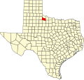
 Location within the U.S. state of Texas | |
 Texas's location within the U.S. | |
| Coordinates: 33°59′N99°47′W / 33.98°N 99.78°W | |
| Country | |
| State | |
| Founded | 1891 |
| Named after | Robert Levi Foard |
| Seat | Crowell |
| Largest city | Crowell |
| Area | |
• Total | 708 sq mi (1,830 km2) |
| • Land | 704 sq mi (1,824 km2) |
| • Water | 3.3 sq mi (9 km2) 0.5% |
| Population (2020) | |
• Total | 1,095 |
• Estimate (2024) | 1,053 |
| • Density | 1.532/sq mi (0.5914/km2) |
| Time zone | UTC−6 (Central) |
| • Summer (DST) | UTC−5 (CDT) |
| Congressional district | 13th |
| Website | https://www.foardcounty.texas.gov/ |
Foard County is a county located in the U.S. state of Texas. As of the 2020 census, its population was 1,095. [1] Its county seat is Crowell, [2] which is also the county's only incorporated community. The county is named for Robert Levi Foard, an attorney who served as a major with the Confederate Army, [3] [4] in the American Civil War.
Contents
- Geography
- Major highways
- Adjacent counties
- Demographics
- 2020 census
- 2000 census
- Politics
- Attractions
- Communities
- Education
- See also
- References
- External links
Foard County was one of 46 prohibitions, or entirely dry, counties in the state of Texas until voters approved a referendum to permit the legal sale of alcoholic beverages in May 2006.