Reeves County | |
---|---|
![]() Reeves County Courthouse in Pecos | |
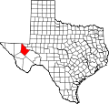
![]() Location within the U.S. state of Texas | |
![]() Texas's location within the U.S. | |
Coordinates: 31°19′N103°41′W / 31.32°N 103.68°W | |
Country | ![]() |
State | ![]() |
Founded | 1884 |
Named for | George R. Reeves |
Seat | Pecos |
Largest city | Pecos |
Area | |
• Total | 2,642 sq mi (6,840 km2) |
• Land | 2,635 sq mi (6,820 km2) |
• Water | 6.7 sq mi (17 km2) 0.3% |
Population (2020) | |
• Total | 14,748 |
• Density | 5.2/sq mi (2.0/km2) |
Time zone | UTC−6 (Central) |
• Summer (DST) | UTC−5 (CDT) |
Congressional district | 23rd |
Website | www |
Reeves County is a county located in the U.S. state of Texas. As of the 2020 census, its population was 14,748. [1] Its county seat and most populous city is Pecos. [2] The county was created in 1883 and organized the next year. [3] It is named for George R. Reeves, a Texas state legislator and colonel in the Confederate Army. It is one of the nine counties that comprise the Trans-Pecos region of West Texas. Reeves County comprises the Pecos micropolitan statistical area.
Prehistoric Clovis culture peoples [4] in Reeves County lived in the rock shelters and caves nestled near water supplies. These people left behind artifacts and pictographs as evidence of their presence. [5] Jumano Indians led the Antonio de Espejo [6] 1582–1583 expedition near Toyah Lake on a better route to the farming and trade area of La Junta de los Ríos. Espejo's diary places the Jumano along the Pecos River and its tributaries. [7] The Mescalero Apache [8] [9] frequented San Solomon Springs to irrigate their crops. In 1849, John Salmon "RIP" Ford [10] explored the area between San Antonio and El Paso, noting in his mapped report the productive land upon which the Mescalero Indians farmed.
The state legislature formed Reeves from Pecos County in 1883, and named it after Texas legislator and soldier George Robertson Reeves. [11] [12] The county was organized in 1884. The town of Pecos [13] was named as county seat.
Toyah Valley farmers George B. and Robert E. Lyle were the first Anglo settlers 1871. White settlers started arriving in the area four years later, lured by open-range ranching. [14] For the remainder of the century, the county economy was dependent upon farming and ranching as it moved into the manufacturing and oil industries of the 20th century.
The Texas and Pacific Railway built through Reeves County in 1881, with stations at Pecos [15] and Toyah. [16] By 1890, the Pecos River Railway [17] had built from Pecos to New Mexico. Toyahvale, [18] which means "flowing water", became the western terminus of the railroad.
Balmorhea State Park was built at Toyahvale by the Civilian Conservation Corps. [19] The park was deeded to the State of Texas in 1934 and opened to the public in 1968.
Pecos Army Air Field was one of the 120 airbases that trained the pioneer Women Airforce Service Pilots [20] to fly military aircraft. At the Pecos installation, WASP flew AT-6, UC-78, and AT-17 aircraft in engineering tests, administrative duties, and transporting freight. The base was activated in 1942 as a World War II pilot school. [21] The base was deactivated in 1945. At its peak, the base population of 4,034 rivaled the town of Pecos in size. Portions of the base were sold off over the years, with Pecos Municipal Airport retaining the remainder.
Pecos is the site of the largest private prison in the world, the Reeves County Detention Complex, operated by the GEO Group. [22]
According to the U.S. Census Bureau, the county has a total area of 2,642 square miles (6,840 km2), of which 6.7 sq mi (17 km2) (0.3%) are covered by water. [23]
Census | Pop. | Note | %± |
---|---|---|---|
1890 | 1,247 | — | |
1900 | 1,847 | 48.1% | |
1910 | 4,392 | 137.8% | |
1920 | 4,457 | 1.5% | |
1930 | 6,407 | 43.8% | |
1940 | 8,006 | 25.0% | |
1950 | 11,745 | 46.7% | |
1960 | 17,644 | 50.2% | |
1970 | 16,526 | −6.3% | |
1980 | 15,801 | −4.4% | |
1990 | 15,852 | 0.3% | |
2000 | 13,137 | −17.1% | |
2010 | 13,783 | 4.9% | |
2020 | 14,748 | 7.0% | |
U.S. Decennial Census [24] 1850–2010 [25] 2010–2020 [26] 2020 [1] |
Race / Ethnicity (NH = Non-Hispanic) | Pop 2000 [27] | Pop 2010 [28] | Pop 2020 [29] | % 2000 | % 2010 | % 2020 |
---|---|---|---|---|---|---|
White alone (NH) | 3,131 | 2,690 | 1,697 | 23.83% | 19.52% | 11.51% |
Black or African American alone (NH) | 238 | 672 | 224 | 1.81% | 4.88% | 1.52% |
Native American or Alaska Native alone (NH) | 34 | 21 | 27 | 0.26% | 0.15% | 0.18% |
Asian alone (NH) | 46 | 118 | 165 | 0.35% | 0.86% | 1.12% |
Pacific Islander alone (NH) | 0 | 2 | 3 | 0.00% | 0.01% | 0.02% |
Other race alone (NH) | 3 | 20 | 39 | 0.02% | 0.15% | 0.26% |
Mixed race or Multiracial (NH) | 45 | 27 | 83 | 0.34% | 0.20% | 0.56% |
Hispanic or Latino (any race) | 9,640 | 10,233 | 12,510 | 73.38% | 74.24% | 84.83% |
Total | 13,137 | 13,783 | 14,748 | 100.00% | 100.00% | 100.00% |
As of the 2020 United States census, there were 14,748 people, 3,772 households, and 2,388 families residing in the county. According to the 2010 United States census, 13,783 people were living in the county; 77.2% White, 5.0% African American, 0.9% Asian, 0.5% Native American, 14.9% of some other race, and 1.5% of two or more races. About 74.2% were Hispanics or Latinos (of any race).
In 2020, Donald Trump not only flipped Reeves County, but won the greatest margin of victory for a Republican presidential candidate since President Nixon's 1972 re-election at 61.1%.
Year | Republican | Democratic | Third party(ies) | |||
---|---|---|---|---|---|---|
No. | % | No. | % | No. | % | |
2024 | 2,340 | 68.04% | 1,070 | 31.11% | 29 | 0.84% |
2020 | 2,254 | 61.10% | 1,395 | 37.82% | 40 | 1.08% |
2016 | 1,417 | 44.50% | 1,659 | 52.10% | 108 | 3.39% |
2012 | 1,188 | 41.29% | 1,655 | 57.53% | 34 | 1.18% |
2008 | 1,445 | 46.96% | 1,606 | 52.19% | 26 | 0.84% |
2004 | 1,777 | 52.34% | 1,600 | 47.13% | 18 | 0.53% |
2000 | 1,273 | 40.08% | 1,872 | 58.94% | 31 | 0.98% |
1996 | 1,007 | 28.40% | 2,279 | 64.27% | 260 | 7.33% |
1992 | 1,244 | 27.30% | 2,569 | 56.37% | 744 | 16.33% |
1988 | 1,724 | 37.86% | 2,812 | 61.75% | 18 | 0.40% |
1984 | 2,461 | 50.51% | 2,396 | 49.18% | 15 | 0.31% |
1980 | 2,315 | 50.95% | 2,138 | 47.05% | 91 | 2.00% |
1976 | 1,711 | 39.41% | 2,613 | 60.18% | 18 | 0.41% |
1972 | 2,427 | 61.57% | 1,510 | 38.31% | 5 | 0.13% |
1968 | 1,310 | 37.33% | 1,456 | 41.49% | 743 | 21.17% |
1964 | 1,251 | 34.80% | 2,340 | 65.09% | 4 | 0.11% |
1960 | 1,549 | 40.53% | 2,235 | 58.48% | 38 | 0.99% |
1956 | 1,492 | 52.24% | 1,356 | 47.48% | 8 | 0.28% |
1952 | 1,727 | 55.39% | 1,385 | 44.42% | 6 | 0.19% |
1948 | 309 | 17.27% | 1,383 | 77.31% | 97 | 5.42% |
1944 | 201 | 13.31% | 1,157 | 76.62% | 152 | 10.07% |
1940 | 247 | 15.89% | 1,305 | 83.98% | 2 | 0.13% |
1936 | 100 | 8.13% | 1,127 | 91.63% | 3 | 0.24% |
1932 | 122 | 10.07% | 1,085 | 89.60% | 4 | 0.33% |
1928 | 344 | 46.61% | 394 | 53.39% | 0 | 0.00% |
1924 | 96 | 18.75% | 387 | 75.59% | 29 | 5.66% |
1920 | 91 | 16.55% | 457 | 83.09% | 2 | 0.36% |
1916 | 43 | 10.89% | 346 | 87.59% | 6 | 1.52% |
1912 | 8 | 2.37% | 278 | 82.49% | 51 | 15.13% |
Two school districts serve sections of the county: [31]
All of the county is in the service area of Odessa College. [32]
Yoakum County is a county located in the far western portion of the U.S. state of Texas. As of the 2020 census, the population was 7,694. Its county seat is Plains. The county was created in 1876 and later organized in 1907. It is named for Henderson King Yoakum, a Texas historian.
Ward County is a county located in the U.S. state of Texas. As of the 2020 census, its population was 11,644. The county seat is Monahans. The county was created in 1887 and organized in 1892. It is named for Thomas W. Ward, a soldier in the Texas Revolution.
Val Verde County is a county located on the southern Edwards Plateau in the U.S. state of Texas. The 2020 population is 47,586. Its county seat is Del Rio. The Del Rio micropolitan statistical area includes all of Val Verde County.
Somervell County is a county on the Edwards Plateau in the U.S. state of Texas. As of the 2020 census, its population was 9,205. Its county seat is Glen Rose. The county is named for Alexander Somervell, secretary of war for the Republic of Texas.
Schleicher County is a county located on the Edwards Plateau in the U.S. state of Texas. As of the 2020 census, its population was 2,451. Its county seat is Eldorado. The county was created in 1887 and organized in 1901. It is named for Gustav Schleicher, a German immigrant who became a surveyor and politician.
Reagan County is a county on the Edwards Plateau in the U.S. state of Texas. As of the 2020 census, its population was 3,385. The county seat is Big Lake. The county is named after John Henninger Reagan (1818–1905), who was the postmaster general of the Confederate States and also a U.S. senator, U.S. representative, and first chairman of the Railroad Commission of Texas.
Presidio County is a county located in the U.S. state of Texas. As of the 2020 census, its population was 6,131. Its county seat is Marfa. The county was created in 1850 and later organized in 1875. Presidio County is in the Trans-Pecos region of West Texas and is named for the border settlement of Presidio del Norte. It is on the Rio Grande, which forms the Mexican border.
Pecos County is a county located in the U.S. state of Texas. As of the 2020 census, its population was 15,193. The county seat is Fort Stockton. The county was created in 1871 and organized in 1875. It is named for the Pecos River. It is one of the nine counties that comprise the Trans-Pecos region of West Texas.
Loving County is a county in the U.S. state of Texas. With a population of 64 according to the 2020 census, it is the least populous county in the United States with a permanent population. Its county seat and only community is Mentone.
Limestone County is a county in the U.S. state of Texas. As of the 2020 census, its population was 22,146. Its county seat is Groesbeck. The county was created in 1846.
Kinney County is a county located in the U.S. state of Texas. As of the 2020 census, its population was 3,129. Its county seat is Brackettville. The county was created in 1850 and later organized in 1874. It is named for Henry Lawrence Kinney, an early settler.
Hudspeth County is a county located in the U.S. state of Texas. As of the 2020 census, the population was 3,432. Its county seat is Sierra Blanca, and the largest community is Fort Hancock. The county is named for Claude Benton Hudspeth, a state senator and United States Representative from El Paso. It is northeast of the Mexico–U.S. border.
Falls County is a county in the U.S. state of Texas. As of the 2020 census, its population was 16,968. The county seat is Marlin. It is named for the original 10-foot-tall waterfall on the Brazos River, which existed until the river changed course during a storm in 1866. The present falls is two miles northeast of the original falls, at the Falls on the Brazos Park, a camping site only a few miles out of Marlin on Farm to Market Road 712.
Culberson County is a county located in the U.S. state of Texas. As of the 2020 census, its population was 2,188. The county seat is Van Horn. Culberson County was founded in 1911 and organized the next year. It is named for David B. Culberson, a Confederate soldier and U.S. representative.
Crockett County is a county located on the Edwards Plateau in the U.S. state of Texas. As of the 2020 census, its population was 3,098. The county seat is Ozona. The county was founded in 1875 and later organized in 1891. It is named in honor of Davy Crockett, the legendary frontiersman who died at the Battle of the Alamo.
Concho County is a county located on the Edwards Plateau in the U.S. state of Texas. At the 2020 census, the population was 3,303. Its county seat is Paint Rock. The county was founded in 1858 and later organized in 1879. It is named for the Concho River.
Brewster County is a county located in the U.S. state of Texas. It is in West Texas and its county seat is Alpine. It is one of the nine counties that comprise the Trans-Pecos region, and borders Mexico. Brewster County is the largest county by area in the state - at 6,192 square miles (16,040 km2) it is over three times the size of the state of Delaware, and more than 500 square miles (1,300 km2) bigger than Connecticut.
Balmorhea is a city in Reeves County, in the U.S. state of Texas. The population was 408 as of the 2020 census.
Pecos is the largest city in and the county seat of Reeves County, Texas, United States. It is in the valley on the west bank of the Pecos River at the eastern edge of the Chihuahuan Desert, in the Trans-Pecos region of West Texas and just south of New Mexico's border. Its population was 12,916 at the 2020 census. On January 24, 2012, Pecos City appeared on the Forbes 400 as the second-fastest growing small town in the United States. The city is a regional commercial center for ranching, oil and gas production, and agriculture. The city is most recognized for its association with the local cultivation of cantaloupes. Pecos claims to be the site of the world's first rodeo on July 4, 1883.
Toyahvale is an unincorporated community in southern Reeves County, Texas, United States. It lies along State Highway 17 and FM 3078, south of the city of Pecos, the county seat of Reeves County.