Toyahvale, Texas

Last updated

Toyahvale
USA Texas location map.svg
Red pog.svg
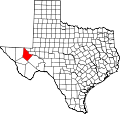
Toyahvale
Location within the state of Texas
Usa edcp location map.svg
Red pog.svg
Toyahvale
Location within the United States
Coordinates: 30°56′40″N103°47′22″W / 30.94444°N 103.78944°W / 30.94444; -103.78944
CountryUnited States
State Texas
County Reeves
Elevation
3,323 ft (1,013 m)
Population
 (2000)
  Totalapprox. 60
Time zone UTC-6 (Central (CST))
  Summer (DST) UTC-5 (CDT)
ZIP codes
79786
GNIS feature ID1370067

Toyahvale is an unincorporated community in southern Reeves County, Texas, United States. It lies along State Highway 17 and FM 3078, south of the city of Pecos, the county seat of Reeves County.

Contents

Description

Mission Mary Calera Chapel (c. 1902), just outside Toyahvale, August 2015 Mission Mary Calera Chapel.JPG
Mission Mary Calera Chapel (c. 1902), just outside Toyahvale, August 2015

Despite its similar name, Toyahvale is distinct from the town of Toyah, which lies 25 miles (40 km) to the north. [1] Its elevation is 3,323 feet (1,013 m). [2] Although Toyahvale is unincorporated, it has a post office, with the ZIP code of 79786. [3]

Toyahvale reported a population of 25 in 1925 and 150 in 1926. In 1933, the population was back down to 25. Between 1950 and 1990, the population was reported as between 50-60 people and the latest numbers recorded a population of 60 in 2000. [4]

Toyahvale's name is a portmanteau: its first half is of a local Indian word for "flowing water", combined with "vale". The community was established after 1884, but its first post office was not opened until 1894. It closed in 1931, but reopened in 1933. Toyahvale used to be the western terminus of the Pecos Valley Southern Railway until the line was trimmed back to Saragosa in 1971. It is also the location of Balmorhea State Park. [5]

Climate

According to the Köppen Climate Classification system, Toyahvale has a semi-arid climate, abbreviated "BSk" on climate maps. [6]

See also

Flag of Texas.svg Texasportal

Related Research Articles

Montalba is an unincorporated community in central Anderson County, Texas, United States. According to the Handbook of Texas, the community had a population of 809 in 2019. It is located within the Palestine, Texas micropolitan area.

Knott is an unincorporated community in northwestern Howard County, Texas, United States. It lies along FM 846 northwest of the city of Big Spring, the county seat of Howard County. Its elevation is 2,612 feet (796 m). Although Knott is unincorporated, it has a post office, with the ZIP code of 79748.

Maryneal is an unincorporated community in southern Nolan County, Texas, United States. It lies along FM 608 south of the city of Sweetwater, the county seat of Nolan County. Its elevation is 2,566 feet (782 m). Although Maryneal is unincorporated, it has a post office, with the ZIP code of 79535; the ZCTA for ZIP Code 79535 had a population of 181 at the 2000 census.

Nolan is an unincorporated community in southeastern Nolan County, Texas, United States. It lies along FM 126 southeast of the city of Sweetwater, the county seat of Nolan County. Its elevation is 2,493 feet (760 m), which happens to be the average elevation of the United States. Although Nolan is unincorporated, it has a post office, with the ZIP code of 79537; the ZCTA for ZIP Code 79537 had a population of 94 at the 2000 census.

<span class="mw-page-title-main">Knickerbocker, Texas</span> Unincorporated community in Tom Green County, Texas, United States

Knickerbocker is an unincorporated community in southwestern Tom Green County, Texas, United States. It lies along Farm to Market Road 2335, southwest of the city of San Angelo, the county seat of Tom Green County. Its elevation is 2,051 feet (625 m). Although Knickerbocker is unincorporated, it has a post office, with the ZIP code of 76939.

<span class="mw-page-title-main">Cat Spring, Texas</span> Unincorporated community in Texas, United States

Cat Spring is an unincorporated community in southern Austin County, Texas, United States. According to the Handbook of Texas, it had a population of 76 in 2000. Cat Spring was one of the first German/American settlements in Texas, and the location of Texas' first agricultural society.

Weesatche is an unincorporated community in northern Goliad County, Texas, United States. It lies along State Highway 119 north of the city of Goliad, the county seat of Goliad County. Its elevation is 233 feet (71 m). Although Weesatche is unincorporated, it has a post office, with the ZIP code of 77993. The community is part of the Victoria, Texas Metropolitan Statistical Area.

Summerfield is an unincorporated community in northwestern Castro County, Texas, United States. It lies along U.S. Route 60 northwest of the city of Dimmitt, the county seat of Castro County. Its elevation is 3,937 feet (1,200 m). Although Summerfield is unincorporated, it has a post office, with the ZIP code of 79085.

Lowake is an unincorporated community in northwestern Concho County, Texas, United States, along the Concho River. It lies along FM 381, north of the town of Paint Rock, the county seat of Concho County. Its elevation is 1,752 feet (534 m). Although Lowake is unincorporated, it has a post office, with the ZIP code of 76855; the post office was established in 1909.

Aiken is an unincorporated community in western Floyd County, Texas, United States. It lies along U.S. Route 70 north of the city of Floydada, the county seat of Floyd County. Its elevation is 3,300 feet (1,006 m). Although Aiken is unincorporated, it has a post office, with the ZIP code of 79221.

Midkiff is a T-shaped unincorporated desert village in northeastern Midland County, Texas, United States. It lies along RM 2401 and FM 3095, north of the city of Rankin, the county seat of Upton County. Its elevation is 2,736 feet (834 m). It has a post office, serving the ZIP code of 79755; the ZCTA for ZIP Code 79755 had a population of 245 at the 2000 census.

Vancourt is an unincorporated community in eastern Tom Green County, Texas, United States. It lies along U.S. Route 87 east of the city of San Angelo, the county seat of Tom Green County. Its elevation is 1,867 feet (569 m). Although Vancourt is unincorporated, it has a post office, with the ZIP code of 76955; the ZCTA for ZIP Code 76955 had a population of 108 at the 2000 census.

Carlsbad is a census-designated place and unincorporated community in northwestern Tom Green County, Texas, United States. It lies along U.S. Route 87, northwest of the city of San Angelo, the county seat of Tom Green County. Its elevation is 2,024 feet (617 m). Although Carlsbad is unincorporated, it has a post office, with the ZIP code of 76934; the ZCTA for ZIP Code 76934 had a population of 1,332 at the 2000 census.

Mereta is an unincorporated community in eastern Tom Green County, Texas, United States. It lies along local roads east of the city of San Angelo, the county seat of Tom Green County. Its elevation is 1,755 feet (535 m). Although Mereta is unincorporated, it has a post office, with the ZIP code of 76940; the ZCTA for ZIP Code 76940 had a population of 138 at the 2000 census.

Dodge is an unincorporated community in eastern Walker County, Texas, United States, on the northern edge of the Sam Houston National Forest. It lies along FM 405 east of the city of Huntsville, the county seat of Walker County. Its elevation is 400 feet (122 m). Although Dodge is unincorporated, it has a post office, with the ZIP code of 77334; the ZCTA for ZIP Code 77334 had a population of 184 at the 2000 census.

<span class="mw-page-title-main">Waring, Texas</span> Unincorporated community in Texas, United States

Waring is an unincorporated community in northwestern Kendall County, Texas, United States. It lies along local roads and the Guadalupe River, northwest of the city of Boerne, the county seat of Kendall County. Its elevation is 1,345 feet (410 m). Although Waring is unincorporated, it has a post office, with the ZIP code of 78074; the ZCTA for ZIP Code 78074 had a population of 59 at the 2000 census. The community is part of the San Antonio Metropolitan Statistical Area.

<span class="mw-page-title-main">Bergheim, Texas</span> Unincorporated community in Texas, United States

Bergheim is an unincorporated community in eastern Kendall County, Texas, United States known for its German-Texan culture and heritage. It lies along State Highway 46 east of the city of Boerne, the county seat of Kendall County. Its elevation is 1,437 feet (438 m). Although Bergheim is unincorporated, it has a post office, with the ZIP code of 78004; the ZCTA for ZIP Code 78004, consisting mostly of rural land, had a population of 1,183 at the 2010 census. The community is part of the San Antonio metropolitan statistical area. Bergheim is still a predominantly a ranching and agricultural community.

Farnsworth is a census designated place in western Ochiltree County, Texas, United States. It lies at the intersection of State Highway 15 with FM376, southwest of the city of Perryton, the county seat of Ochiltree County. Its elevation is 2,995 feet (913 m). Although Farnsworth is unincorporated, it has a post office, with the ZIP code of 79033; the ZCTA for ZIP code 79033 had a population of 106 at the 2000 census.

Waka is an unincorporated community in western Ochiltree County, Texas, United States. It lies along State Highway 15 southwest of the city of Perryton, the county seat of Ochiltree County. Its elevation is 3,045 feet (928 m). Although Waka is unincorporated, it has a post office, with the ZIP code of 79093; the ZCTA for ZIP code 79093 had a population of 76 at the 2000 census.

Lelia Lake is an unincorporated community in central Donley County, Texas, United States. It lies along U.S. Route 287, southeast of the city of Clarendon, the county seat of Donley County. Although Lelia Lake is unincorporated, it has a post office, with the ZIP code of 79240; the ZCTA for ZIP code 79240 had a population of 101 at the 2000 census.

References

  1. Rand McNally. The Road Atlas '08. Chicago: Rand McNally, 2008, p. 99.
  2. U.S. Geological Survey Geographic Names Information System: Toyahvale, Texas
  3. Zip Code Lookup
  4. SMITH, JULIA CAUBLE (June 15, 2010). "TOYAHVALE, TX". tshaonline.org. Retrieved December 5, 2019.
  5. Toyahvale, Texas, Handbook of Texas Online, 2008-01-18. Accessed 2008-08-11.
  6. Climate Summary for Toyahvale, Texas