Arno | |
|---|---|
 Arno Location in Texas | |
| Coordinates: 31°39′47″N103°38′10″W / 31.6631852°N 103.6360152°W | |
| Country | United States |
| State | Texas |
| County | Reeves |
| Elevation | 2,671 ft (814 m) |
Arno is a ghost town in Reeves County, Texas, United States. [1]
Arno | |
|---|---|
| Arno Location in Texas | |
| Coordinates: 31°39′47″N103°38′10″W / 31.6631852°N 103.6360152°W | |
| Country | United States |
| State | Texas |
| County | Reeves |
| Elevation | 2,671 ft (814 m) |
Arno is a ghost town in Reeves County, Texas, United States. [1]
Situated near the Pecos River and on Texas State Highway 302 and the Atchison, Topeka and Santa Fe Railway, Arno was settled in the early 20th century. A post office operated from 1907 to 1915, with Ola Solman serving as postmistress. At its peak in the 1930s, the population was 10 and it had one business. The town was abandoned by the 1950. [2] [3]

Terrell County is a county in the U.S. state of Texas. As of the 2020 census, its population was 760, making it the seventh-least populous county in Texas, and the 37th-least populous county in the nation. Its county seat is the census-designated place of Sanderson; no incorporated municipalities are in the county. The county was named for Alexander W. Terrell, a Texas state senator. Terrell County is one of the nine counties in the Trans-Pecos region of West Texas. It is the setting for Cormac McCarthy's novel No Country for Old Men, and the Academy Award-winning film adaptation of the same name.
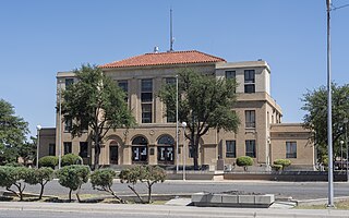
Reeves County is a county located in the U.S. state of Texas. As of the 2020 census, its population was 14,748. Its county seat and most populous city is Pecos. The county was created in 1883 and organized the next year. It is named for George R. Reeves, a Texas state legislator and colonel in the Confederate Army. It is one of the nine counties that comprise the Trans-Pecos region of West Texas. Reeves County comprises the Pecos micropolitan statistical area.

Pecos County is a county located in the U.S. state of Texas. As of the 2020 census, its population was 15,193. The county seat is Fort Stockton. The county was created in 1871 and organized in 1875. It is named for the Pecos River. It is one of the nine counties that comprise the Trans-Pecos region of West Texas.

Loving County is a county in the U.S. state of Texas. With a population at 64 during the 2020 census, it is the least populous county in the United States with a permanent population. Its county seat and only community is Mentone. The county was originally created in 1887, and after being disorganized in 1897, was reorganized in 1931.

Crockett County is a county located on the Edwards Plateau in the U.S. state of Texas. As of the 2020 census, its population was 3,098. The county seat is Ozona. The county was founded in 1875 and later organized in 1891. It is named in honor of Davy Crockett, the legendary frontiersman who died at the Battle of the Alamo.

Eddy County is a county located in the U.S. state of New Mexico. As of the 2020 census, the population was 62,314. Its county seat and largest city is Carlsbad. The county was created in 1891 and later organized in 1892. It is north of the Texas state line.

Fort Stockton is a city in and the county seat of Pecos County, Texas, United States. It is located on Interstate 10, future Interstate 14, U.S. Highways 67, 285, and 385, and the Santa Fe Railroad, 329 mi (529 km) northwest of San Antonio and 240 mi (390 km) southeast of El Paso. Its population was 8,466 at the 2020 census.

Iraan is a city in Pecos County, Texas, United States. Its population was 1,055 at the 2020 census. The city's name is an amalgamation of the first names of Ira and Ann Yates, owners of the ranch land upon which the town was built.

Pecos is the largest city in and the county seat of Reeves County, Texas, United States. It is in the valley on the west bank of the Pecos River at the eastern edge of the Chihuahuan Desert, in the Trans-Pecos region of West Texas and just south of New Mexico's border. Its population was 12,916 at the 2020 census. On January 24, 2012, Pecos City appeared on the Forbes 400 as the second-fastest growing small town in the United States. The city is a regional commercial center for ranching, oil and gas production, and agriculture. The city is most recognized for its association with the local cultivation of cantaloupes. Pecos claims to be the site of the world's first rodeo on July 4, 1883.

The Pecos River originates in north-central New Mexico and flows into Texas, emptying into the Rio Grande. Its headwaters are on the eastern slope of the Sangre de Cristo mountain range in Mora County north of Pecos, New Mexico, at an elevation of over 12,000 feet (3,700 m). The river flows for 926 miles (1,490 km) before reaching the Rio Grande near Del Rio. Its drainage basin encompasses about 44,300 square miles (115,000 km2).

Langtry is an unincorporated community in Val Verde County, Texas, United States. The community is notable as the place where Judge Roy Bean, the "Law West of the Pecos", had his saloon and practiced law.

The geography of Texas is diverse and large. Occupying about 7% of the total water and land area of the U.S., it is the second largest state after Alaska, and is the southernmost part of the Great Plains, which end in the south against the folded Sierra Madre Oriental of Mexico. Texas is in the South Central United States of America, and is considered to form part of the U.S. South and also part of the U.S. Southwest.

Odessa College is a public junior college in Odessa, Texas. The college serves the people of Ector County and the Permian Basin. It was established in 1946 and enrolled 8,024 students in Fall 2021 and 7,679 students in Spring 2022 in its university-parallel and occupational/technical courses, and 11,000 students annually in its Basic Education, Continuing Education, and Community Recreation courses.
Sheffield is a census-designated place in Pecos County, Texas, United States. According to the 2020 Census, the community had an estimated population of 174 in 2020. Named for pioneer rancher Will Sheffield, it has a post office with ZIP code of 79781.

Pandale is a remote desert hamlet in Val Verde County, Texas, United States. Its current population is smaller than in some previous years. It has been used as a starting point for canoeing and kayaking expeditions on the Pecos River. There are no businesses or services in Pandale.
The Pecos Wilderness is a protected wilderness area within the Santa Fe National Forest and Carson National Forest. The Pecos Wilderness lies within the Camino Real Ranger District of the Carson National Forest, and the Pecos Ranger District and Espanola Ranger District of the Santa Fe National Forest. The Pecos Wilderness includes the southernmost extension of the Rocky Mountains in the sub-range of the Sangre de Cristo Mountains of north central New Mexico. One trail head for the wilderness is only 15 miles by road from Santa Fe, the state capital. Covering an area of 223,667 acres (90,515 ha)(350 sq mi) it is the second largest wilderness in the state after the Gila Wilderness. An area of fewer than 200,000 acres (81,000 ha) was given wilderness protection by Congress in 1964. Congress protected an additional 55,000 acres (22,000 ha) in 1980. The Wilderness boasts one of the highest concentrations of peaks exceeding 12,000 feet (3,700 m) in elevation in New Mexico, including Santa Fe Baldy, 12,622 feet (3,847 m), the highest point in Santa Fe County, and South Truchas Peak, 13,102 feet (3,993 m), the second highest peak in the state.

Lobo is a ghost town in Culberson County, Texas, United States, that was abandoned in 1991.
The Pecos League of Professional Baseball Clubs is an independent professional baseball league headquartered in Houston, which operates in cities in desert mountain regions throughout California, New Mexico, Arizona, Colorado, Kansas, Oklahoma, and Texas. The league plays in cities that do not have Major League Baseball or Minor League Baseball teams and is not affiliated with either.
Comanche Springs was an aquifer of six artesian springs geographically located between the Edwards Plateau and the Trans-Pecos regions of West Texas. The military fortification Camp Stockton was built around the springs, eventually growing become the city of Fort Stockton.
Municipalities and communities of Reeves County, Texas, United States | ||
|---|---|---|
| Cities | 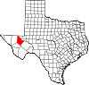 | |
| Town | ||
| CDP | ||
| Other communities | ||
| Ghost town | ||