Jackson County, Texas

Last updated

Jackson County
Jackson County, TX Courthouse IMG 1019.JPG
The Jackson County Courthouse in Edna
Flag of Jackson County, Texas.png
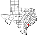
Map of Texas highlighting Jackson County.svg
Location within the U.S. state of Texas
Texas in United States.svg
Texas's location within the U.S.
Coordinates: 28°56′N96°35′W / 28.94°N 96.58°W / 28.94; -96.58
CountryFlag of the United States.svg United States
StateFlag of Texas.svg  Texas
Founded1836
Named for Andrew Jackson
Seat Edna
Largest cityEdna
Area
  Total
857 sq mi (2,220 km2)
  Land829 sq mi (2,150 km2)
  Water27 sq mi (70 km2)  3.2%
Population
 (2020)
  Total
14,988 Increase2.svg
Time zone UTC−6 (Central)
  Summer (DST) UTC−5 (CDT)
Congressional district 27th
Website www.co.jackson.tx.us
Historical carriage inside the Jackson County, Texas, Courthouse Historical carriage in Jackson County, TX, Courthouse IMG 1018.JPG
Historical carriage inside the Jackson County, Texas, Courthouse
Edna Theatre -- Edna, TX Edna Theatre -- Edna, TX.jpg
Edna Theatre -- Edna, TX

Jackson County is a county in the U.S. state of Texas. As of the 2020 census its population was 14,988. [1] Its county seat is Edna. [2] The county was created in 1835 as a municipality in Mexico and in 1836 was organized as a county (of the Republic of Texas). [3] [4] It is named for Andrew Jackson, President of the United States from 1829 to 1837. [5]

Contents

Geography

According to the U.S. Census Bureau, the county has a total area of 857 square miles (2,220 km2), of which 829 square miles (2,150 km2) is land and 27 square miles (70 km2) (3.2%) is water. [6]

Major highways

Adjacent counties

Demographics

Historical population
CensusPop.Note
1850 996
1860 2,612162.2%
1870 2,278−12.8%
1880 2,72319.5%
1890 3,28120.5%
1900 6,09485.7%
1910 6,4716.2%
1920 11,24473.8%
1930 10,980−2.3%
1940 11,7206.7%
1950 12,91610.2%
1960 14,0408.7%
1970 12,975−7.6%
1980 13,3522.9%
1990 13,039−2.3%
2000 14,39110.4%
2010 14,075−2.2%
2020 14,9886.5%
U.S. Decennial Census [7]
1850–2010 [8] 2020 [9]
Jackson County, Texas – Racial and ethnic composition
Note: the US Census treats Hispanic/Latino as an ethnic category. This table excludes Latinos from the racial categories and assigns them to a separate category. Hispanics/Latinos may be of any race.
Race / Ethnicity (NH = Non-Hispanic)Pop 2000 [10] Pop 2010 [11] Pop 2020 [9] % 2000% 2010% 2020
White alone (NH)9,5468,8558,51066.33%62.91%56.78%
Black or African American alone (NH)1,0819429377.51%6.69%6.25%
Native American or Alaska Native alone (NH)4235360.29%0.25%0.24%
Asian alone (NH)55501580.38%0.36%1.05%
Pacific Islander alone (NH)6150.04%0.01%0.03%
Other race alone (NH)081020.04%0.06%0.68%
Mixed race or Multiracial (NH)1041054110.72%0.75%2.74%
Hispanic or Latino (any race)3,5514,0794,82924.68%28.98%32.22%
Total14,39114,07514,988100.00%100.00%100.00%

As of the census [12] of 2000, there were 14,391 people, 5,336 households, and 3,889 families residing in the county. The population density was 17 people per square mile (6.6 people/km2). There were 6,545 housing units at an average density of 8 units per square mile (3.1/km2). The racial makeup of the county was 76.49% White, 7.64% Black or African American, 0.39% Native American, 0.39% Asian, 0.06% Pacific Islander, 12.65% from other races, and 2.39% from two or more races. 24.68% of the population were Hispanic or Latino of any race. 17.9% were of German, 10.8% American, 9.3% Czech, 6.0% Irish and 5.6% English ancestry according to Census 2000. 81.6% spoke English and 17.4% Spanish as their first language.

There were 5,336 households, out of which 34.70% had children under the age of 18 living with them, 58.20% were married couples living together, 10.50% had a female householder with no husband present, and 27.10% were non-families. 24.20% of all households were made up of individuals, and 12.50% had someone living alone who was 65 years of age or older. The average household size was 2.65 and the average family size was 3.15.

In the county, the population was spread out, with 27.40% under the age of 18, 8.20% from 18 to 24, 26.10% from 25 to 44, 22.30% from 45 to 64, and 15.90% who were 65 years of age or older. The median age was 37 years. For every 100 females there were 96.70 males. For every 100 females age 18 and over, there were 93.40 males.

The median income for a household in the county was $35,254, and the median income for a family was $42,066. Males had a median income of $32,639 versus $19,661 for females. The per capita income for the county was $16,693. About 12.20% of families and 14.70% of the population were below the poverty line, including 19.10% of those under age 18 and 15.60% of those age 65 or over.

Communities

Cities

Census-designated places

Unincorporated communities

Ghost town

Politics

Jackson County has voted Republican in every presidential election since 1980, often by landslide margins.

United States presidential election results for Jackson County, Texas [13]
Year Republican Democratic Third party(ies)
No.%No.%No.%
2020 5,23182.34%1,03316.26%891.40%
2016 4,26680.46%90417.05%1322.49%
2012 3,90677.73%1,07021.29%490.98%
2008 3,72373.46%1,30125.67%440.87%
2004 3,76674.18%1,29625.53%150.30%
2000 3,36569.30%1,44629.78%450.93%
1996 2,53354.59%1,78538.47%3226.94%
1992 2,45147.57%1,72233.42%97919.00%
1988 2,95457.75%2,14141.86%200.39%
1984 3,66166.83%1,80432.93%130.24%
1980 2,54056.91%1,82640.91%972.17%
1976 1,88442.50%2,52456.94%250.56%
1972 2,74369.81%1,16329.60%230.59%
1968 1,43833.55%1,69839.62%1,15026.83%
1964 1,16829.55%2,77570.22%90.23%
1960 1,67042.04%2,26857.10%340.86%
1956 2,25958.64%1,57140.78%220.57%
1952 2,11357.14%1,58442.83%10.03%
1948 48824.75%1,34368.10%1417.15%
1944 34414.98%1,70874.39%24410.63%
1940 29616.41%1,50683.48%20.11%
1936 17115.16%95284.40%50.44%
1932 18214.99%1,03084.84%20.16%
1928 57254.68%47345.22%10.10%
1924 35430.28%75864.84%574.88%
1920 35533.65%56253.27%13813.08%
1916 12320.71%40367.85%6811.45%
1912 356.59%32360.83%17332.58%

Education

School districts include: [14]

Residents of the county not in Ganado ISD are in the service area of Victoria College. Residents of the Ganado ISD part are in the service area of Wharton County Junior College. [15]

See also

Related Research Articles

<span class="mw-page-title-main">Wharton County, Texas</span> County in Texas, United States

Wharton County is a county located in the U.S. state of Texas. As of the 2020 census, its population was 41,570. Its county seat is Wharton. The county was named for brothers William Harris Wharton and John Austin Wharton.

<span class="mw-page-title-main">Tyler County, Texas</span> County in Texas, United States

Tyler County is a county located in the U.S. state of Texas. It is in East Texas and its seat is Woodville. As of the 2020 census, its population was 19,798. Tyler County is named for John Tyler, the 10th President of the United States. Despite its name, Tyler County does not contain the city of Tyler, Texas; the latter is located about 140 miles to the north in Smith County.

<span class="mw-page-title-main">Shackelford County, Texas</span> County in Texas, United States

Shackelford County is a county located in the U.S. state of Texas. As of the 2020 census, its population was 3,105. Its county seat is Albany. The county was created in 1858 and later organized in 1874. Shackelford is named for Dr. Jack Shackelford, a Virginia physician who equipped soldiers at his own expense to fight in the Texas Revolution.

<span class="mw-page-title-main">San Jacinto County, Texas</span> County in Texas, United States

San Jacinto County is a county in the U.S. state of Texas. As of the 2020 census, its population was 27,402. Its county seat is Coldspring. The county's name comes from the Battle of San Jacinto which secured Texas' independence from Mexico and established a republic in 1836.

<span class="mw-page-title-main">McMullen County, Texas</span> County in Texas, United States

McMullen County is a county located in the U.S. state of Texas. As of the 2020 census, its population was 600, making it the fourth-least populous county in Texas. Its county seat is Tilden. The county was established from parts of Bexar County, Atascosa County, and Live Oak County in 1858 and later organized in 1877. It is named for John McMullen, founder of a colony in Texas. The McMullen County Courthouse was designed by the architect W.C. Stephenson, originally from Buffalo, New York. Stephenson also designed some 50 buildings in Beeville, including the Bee County Courthouse.

<span class="mw-page-title-main">Matagorda County, Texas</span> County in Texas, United States

Matagorda County is a county located in the U.S. state of Texas. As of the 2020 census, its population was 36,255. Its county seat is Bay City, not to be confused with the larger Baytown in Harris and Chambers Counties. Matagorda County is named for the canebrakes that once grew along the coast.

<span class="mw-page-title-main">Lavaca County, Texas</span> County in Texas, United States

Lavaca County is a county located in the U.S. state of Texas. As of the 2020 census, its population was 20,337. Its county seat is Hallettsville. The county was created in 1846. It is named for the Lavaca River, which curves its way southeast through Moulton and Hallettsville before reaching the coast at Matagorda Bay.

<span class="mw-page-title-main">Karnes County, Texas</span> County in Texas, United States

Karnes County is a county in the U.S. state of Texas. As of the 2020 census, the population was 14,710. Its county seat is Karnes City. The county is named for Henry Karnes, a soldier in the Texas Revolution. The former San Antonio and Aransas Pass Railway passed through Karnes County in its connection linking San Antonio with Corpus Christi.

<span class="mw-page-title-main">Hockley County, Texas</span> County in Texas, United States

Hockley County is a county located in the U.S. state of Texas. As of the 2020 census, its population was 21,537. Its county seat is Levelland. The county was created in 1876, but not organized until 1921. It is named for George Washington Hockley, a secretary of war of the Republic of Texas.

<span class="mw-page-title-main">Collingsworth County, Texas</span> County in Texas, United States

Collingsworth County is a county in the U.S. state of Texas. As of the 2020 census, its population was 2,652. Its county seat is Wellington. The county was created in 1876 and later organized in 1890. It is named for James Collinsworth, a signer of the Texas Declaration of Independence and first chief justice of the Republic of Texas. Collingsworth County was one of 30 prohibition, or entirely dry, counties in Texas, but a vote in 2017 changed this law.

<span class="mw-page-title-main">Cochran County, Texas</span> County in Texas, United States

Cochran County is a county located in the U.S. state of Texas. As of the 2020 census, its population was 2,547. The county seat is Morton. The county was created in 1876 and later organized in 1924. It is named for Robert E. Cochran, a defender of the Alamo.

<span class="mw-page-title-main">Burleson County, Texas</span> County in Texas, United States

Burleson County is a county located in the U.S. state of Texas. As of the 2020 census, the population was 17,642. Its county seat is Caldwell. The county is named for Edward Burleson, a general and statesman of the Texas Revolution.

<span class="mw-page-title-main">Briscoe County, Texas</span> County in Texas, United States

Briscoe County is a county located in the U.S. state of Texas. As of the 2020 census, the population was 1,435. Its county seat is Silverton. The county was created in 1876 and later organized in 1892. It is named for Andrew Briscoe, a soldier during the Texas Revolution.

<span class="mw-page-title-main">Austin County, Texas</span> County in Texas, United States

Austin County is a rural, agricultural dominated county in the U.S. state of Texas. As of the 2020 census, the population was 30,167. Its seat is Bellville. The county and region was settled primarily by German emigrants in the 1800s.

<span class="mw-page-title-main">Cumings, Texas</span> Census-designated place in Texas, United States

Cumings is an unincorporated community and census-designated place (CDP) in Fort Bend County, Texas, United States. The population was 2,207 at the 2020 census, significantly up from 981 at the 2010 census.

<span class="mw-page-title-main">Edna, Texas</span> City in Jackson County, Texas, United States

Edna is a city and the county seat of Jackson County, Texas, United States. The population was 5,499 at the 2010 census and 5,987 at the 2020 census.

<span class="mw-page-title-main">Ganado, Texas</span> City in Texas

Ganado is a city in Jackson County, Texas, United States. The population was 1,975 at the 2020 census.

<span class="mw-page-title-main">La Ward, Texas</span> City in Texas

La Ward is a city in Jackson County, Texas, United States. The population was 176 at the 2020 census.

<span class="mw-page-title-main">Hungerford, Texas</span> CDP in Texas, United States

Hungerford is a census-designated place (CDP) in northeastern Wharton County, Texas, United States. U.S. Route 59, Texas State Highway 60, and Farm to Market Road 1161 intersect in the community. The Kansas City Southern Railway Co. passes through Hungerford. The population was 390 at the 2020 census. It is located on what in the 1820s was part of colonist Alexander Jackson's land grant north of George E. Quinan's home. By the 1870s, the Quinan settlement grew up a short distance away, but its residents moved to the new town when the railroad came through Hungerford.

<span class="mw-page-title-main">Moore County, Texas</span> County in Texas, United States

Moore County is a county located in the U.S. state of Texas. As of the 2020 census, its population was 21,358. The county seat is Dumas. The county was created in 1876 and organized in 1892. It is named for Edwin Ward Moore, the commander of the Texas Navy. The Dumas micropolitan statistical area includes all of Moore County.

References

  1. "Jackson County, Texas". United States Census Bureau . Retrieved January 30, 2022.
  2. "Find a County". National Association of Counties. Archived from the original on May 31, 2011. Retrieved June 7, 2011.
  3. "Texas: Individual County Chronologies". Texas Atlas of Historical County Boundaries. The Newberry Library. 2008. Archived from the original on April 12, 2017. Retrieved June 20, 2015.
  4. "Jackson County". Texas Almanac. Texas State Historical Association. Retrieved June 20, 2015.
  5. Gannett, Henry (1905). The Origin of Certain Place Names in the United States. Govt. Print. Off. pp.  167.
  6. "2010 Census Gazetteer Files". United States Census Bureau. August 22, 2012. Retrieved May 2, 2015.
  7. "Decennial Census of Population and Housing by Decades". US Census Bureau.
  8. "Texas Almanac: Population History of Counties from 1850–2010" (PDF). Texas Almanac. Archived (PDF) from the original on October 9, 2022. Retrieved May 2, 2015.
  9. 1 2 "P2 Hispanic or Latino, and Not Hispanic or Latino by Race – 2020: DEC Redistricting Data (PL 94-171) – Jackson County, Texas". United States Census Bureau .
  10. "P004: Hispanic or Latino, and Not Hispanic or Latino by Race – 2000: DEC Summary File 1 – Jackson County, Texas". United States Census Bureau .
  11. "P2 Hispanic or Latino, and Not Hispanic or Latino by Race – 2010: DEC Redistricting Data (PL 94-171) – Jackson County, Texas". United States Census Bureau .
  12. "U.S. Census website". United States Census Bureau . Retrieved May 14, 2011.
  13. Leip, David. "Dave Leip's Atlas of U.S. Presidential Elections". uselectionatlas.org. Retrieved July 25, 2018.
  14. "2020 CENSUS - SCHOOL DISTRICT REFERENCE MAP: Jackson County, TX" (PDF). U.S. Census Bureau . Retrieved November 29, 2024. - Text list
  15. Texas Education Code Sec. 130.208. THE VICTORIA COLLEGE DISTRICT SERVICE AREA. Sec. 130.211. WHARTON COUNTY JUNIOR COLLEGE DISTRICT SERVICE AREA.

28°56′N96°35′W / 28.94°N 96.58°W / 28.94; -96.58