Lolita, Texas | |
---|---|
Coordinates: 28°50′15″N96°32′35″W / 28.83750°N 96.54306°W | |
Country | United States of America |
State | Texas |
County | Jackson |
Area | |
• Total | 2.6 sq mi (6.7 km2) |
• Land | 2.6 sq mi (6.7 km2) |
• Water | 0.0 sq mi (0.0 km2) |
Elevation | 39 ft (12 m) |
Population (2020) | |
• Total | 519 |
• Density | 200/sq mi (77/km2) |
Time zone | UTC-6 (Central (CST)) |
• Summer (DST) | UTC-5 (CDT) |
ZIP code | 77971 |
Area code | 361 |
FIPS code | 48-43432 [1] |
GNIS feature ID | 1361622 [2] |
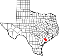
Lolita is a census-designated place (CDP) in Jackson County, Texas, United States. The population was 519 at the 2020 census.
The area around Lolita was first settled in the 1840s by Isaac N. Mitchell, who ran a plantation there. Lolita was established in 1909 and named for Lolita Reese, the granddaughter of a veteran of the Texas Revolution. [3] The following year, a post office opened in Lolita, and the St. Louis, Brownsville and Mexico Railway built a switch there. After World War II, five businesses operated in Lolita, and by 1969 the community had seven businesses. [4]
Lolita is located at 28°50′15″N96°32′35″W / 28.83750°N 96.54306°W (28.837530, -96.542929). [5]
According to the United States Census Bureau, the CDP has a total area of 2.6 square miles (6.7 km2), all land.
Census | Pop. | Note | %± |
---|---|---|---|
2000 | 548 | — | |
2010 | 555 | 1.3% | |
2020 | 519 | −6.5% | |
U.S. Decennial Census [6] 1850–1900 [7] 1910 [8] 1920 [9] 1930 [10] 1940 [11] 1950 [12] 1960 [13] 1970 [14] 1980 [15] 1990 [16] 2000 [17] 2010 [18] 2020 [19] |
As of the census [1] of 2000, there were 548 people, 201 households, and 142 families residing in the CDP. The population density was 210.9 inhabitants per square mile (81.4/km2). There were 234 housing units at an average density of 90.0 per square mile (34.7/km2). The racial makeup of the CDP was 85.22% White, 0.18% African American, 0.18% Native American, 0.18% Asian, 0.36% Pacific Islander, 12.04% from other races, and 1.82% from two or more races. Hispanic or Latino of any race were 21.90% of the population.
There were 201 households, out of which 34.8% had children under the age of 18 living with them, 59.7% were married couples living together, 8.5% had a female householder with no husband present, and 28.9% were non-families. 24.4% of all households were made up of individuals, and 11.9% had someone living alone who was 65 years of age or older. The average household size was 2.73 and the average family size was 3.27.
In the CDP, the population was spread out, with 30.5% under the age of 18, 7.7% from 18 to 24, 26.6% from 25 to 44, 21.9% from 45 to 64, and 13.3% who were 65 years of age or older. The median age was 34 years. For every 100 females, there were 99.3 males. For every 100 females age 18 and over, there were 87.7 males.
The median income for a household in the CDP was $42,065, and the median income for a family was $50,536. Males had a median income of $36,607 versus $26,000 for females. The per capita income for the CDP was $16,148. About 3.4% of families and 4.2% of the population were below the poverty line, including 8.4% of those under age 18 and none of those age 65 or over.
Public education in the community of Lolita is provided by the Industrial Independent School District.
In the Vladimir Nabokov novel Ada, or Ardor , in a letter to Marina after his duel with Baron D'Onsky, Demon Veen tells her that he had gone to his aunt's ranch near Lolita, Texas. The notes on the text, written by Vivian Darkbloom (Nabokov's alter ego), state that "this town exists, or, rather, existed, for it has been renamed, I believe, after the appearance of the notorious novel," referring, of course, to Nabokov's own novel Lolita .
The climate in this area is characterized by hot, humid summers and generally mild to cool winters. According to the Köppen Climate Classification system, Lolita has a humid subtropical climate, abbreviated "Cfa" on climate maps. [20]
Marathon is a census-designated place (CDP) in Brewster County, Texas, United States. The population was 470 in 2007, after growing from 455 in 2000, but had decreased to 430 by 2010. The population further decreased to 410 by 2020.
Arroyo Colorado Estates is a census-designated place (CDP) in Cameron County, in the U.S. state of Texas. The population was 997 at the 2010 census. It is part of the Brownsville–Harlingen Metropolitan Statistical Area.
Olmito is a census-designated place (CDP) in Cameron County, Texas, United States. Olmito is Spanish for "little elm". The population was 1,021 at the 2020 census. It is part of the Brownsville–Harlingen Metropolitan Statistical Area. Olmito is the self-described "mesquite capital of the world."
Harper is an unincorporated community and census-designated place (CDP), located 23 miles (37 km) west of Fredericksburg on U.S. Highway 290, in Gillespie County, in the U.S. state of Texas. The population was 1,332 at the 2020 census.
Hartley is a census-designated place (CDP) in Hartley County, Texas, United States. The population was 540 at the 2010 census.
Heidelberg is a census-designated place (CDP) in Hidalgo County, Texas, United States. The population was 1,507 at the 2020 United States Census. It is part of the McAllen–Edinburg–Mission Metropolitan Statistical Area.
Relampago is a census-designated place (CDP) in Hidalgo County, Texas, United States. The population was 129 at the 2020 United States Census. It is part of the McAllen–Edinburg–Mission Metropolitan Statistical Area.
Evadale is an unincorporated community and census-designated place (CDP) in Jasper County, Texas, United States. The population was 1,246 at the 2020 census.
Central Gardens is an unincorporated community and census-designated place (CDP) in Jefferson County, Texas, United States. The population was 4,373 at the 2020 census. It is part of the Beaumont–Port Arthur metropolitan area.
Lipscomb is an unincorporated community and census-designated place (CDP) in Lipscomb County, Texas, United States. It is the Lipscomb county seat. The population was 66 at the 2020 census.
Markham is a census-designated place (CDP) in Matagorda County, Texas, United States. Named in 1903 for Charles H. Markham, a railroad engineer for Southern Pacific, the town was founded in 1901 as Cortes. In 1914, it was a designated stop on the Texas and New Orleans Railroad. As of the 2020 census, the population was 908.
Quemado is a census-designated place (CDP) in Maverick County, Texas, United States. Its population was 230 at the 2010 census.
Mauriceville is a census-designated place (CDP) in Orange County, Texas, United States. The population was 2,983 at the 2020 census. It is part of the Beaumont–Port Arthur Metropolitan Statistical Area.
Redford is a census-designated place (CDP) in Presidio County, Texas, United States. The population was 43 at the 2020 census.
Milam is a census-designated place (CDP) in Sabine County, Texas, United States. It is located along the Sabine River at the junction of Highway 87 and Highway 21. The population was 1,355 at the 2020 census. Milam is the largest city in Sabine County.
Elbert is a census-designated place (CDP) in Throckmorton County, Texas, United States. The population was 29 at the 2020 census.
Garfield is a census-designated place (CDP) in Travis County, Texas, United States. As of the 2020 census, the CDP population was 1,825.
Knippa is a census-designated place (CDP) in Uvalde County, Texas, United States. The population was 606 at the 2020 census.
Inez is a census-designated place (CDP), on Interstate 69/U.S. Highway 59, fifteen miles northeast of Victoria, near the Jackson County, Texas line in Victoria County, Texas, United States. The population was 2,098 at the 2010 census. It is included in the Victoria, Texas, Metropolitan Statistical Area. The name is that of a daughter of a railroad developer.
Port Mansfield is a census-designated place (CDP) in Willacy County, Texas, United States. The population was 226 at the 2010 census.