Texana, Texas

Last updated
Texana, Texas
Ghost Town
USA Texas location map.svg
Red pog.svg
Texana, Texas
Location of Texana, Texas
Usa edcp location map.svg
Red pog.svg
Texana, Texas
Texana, Texas (the United States)
Coordinates: 28°55′N96°34′W / 28.91°N 96.56°W / 28.91; -96.56 (Texana, Texas)
Country United States
State Texas
County Jackson County
Santa Anna1832
Founded by
  • Francis F. Wells
  • Pamelia McNutt Porter
Time zone UTC−06:00 (CST)
  Summer (DST) UTC−05:00 (CDT)

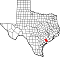
Texana is a ghost town which was located in Jackson County, Texas, United States, near Edna. [1] The community was one of the earliest Anglo-American settlements in the state. The town flourished as late as 1880, but when the railroad bypassed the town, it rapidly declined. The site now lies under the Lake Texana reservoir.

Contents

History

In 1832 Dr. Francis F. Wells and his sister-in-law, Pamelia McNutt Porter, founded a community in south central Jackson County that later developed into Texana. The village was originally named Santa Anna after Antonio López de Santa Anna, at the time a popular Mexican liberal, soldier, and politician. In 1835, however, after Santa Anna had proven himself an enemy of republican government, the residents of the settlement changed the name to Texana. During the Texas Revolution of 1835-1836, Texana served as a port of entry and training camp for many volunteers from the United States. Dr. Jack Shackelford's company of Alabama Red Rovers camped around Texana for about two weeks before joining James Fannin's command at Goliad. In the spring of 1836 the citizens of Texana joined the Runaway Scrape. "Uncle" Jeff Parson, a slave during the Runaway Scrape, told how the "old town of Texana was abandoned, not an individual was left on Jackson County soil, all were in flight, where they were going no one knew."[ citation needed ]

After the Battle of San Jacinto, when republic officials organized the surrounding area into Jackson County, Texana - one of the oldest Anglo-American settlements - served as county seat. In the summer of 1836 the Army of the Republic of Texas established Camp Independence on acreage belonging to Captain Sylvanus Hatch about four or five miles from Texana. Hatch was a Freemason and member of Solomon's Lodge No. 1, F. & A. M. at Savannah, Georgia,[ citation needed ] which was founded by the renowned soldier, statesman, philanthropist and freemason James Edward Oglethorpe in 1734. The next year Camp Independence was the site of the famous duel between Felix Huston and Albert Sidney Johnston. That year also saw a public sale of town lots that encouraged settlement. In 1840 Texana incorporated as a municipality. By 1880 the town had acquired regular steamboat service, mail and stage routes, a booming business section, and its own newspaper, the Clarion. As late as 1882 Texana was a thriving port with as many as twenty ships docking each week. In 1883, however, the New York, Texas and Mexican Railway bypassed the settlement, precipitating a sharp decline. Shortly thereafter county voters elected to make Edna the county seat, and by 1884 Texana was a virtual ghost town.

Lake Texana

Lake Texana, a reservoir on the Navidad River, currently covers the ghost town, as a result of the construction of the Palmetto Bend Dam, which was finished in 1979. The lake currently serves as a recreational destination for visitors. The dam and the lake are managed by the Lavaca-Navidad River Authority.

Texas Historical Commission Site

Texana, Texas received a Texas historical maker in 1936 at the threshold of the Texas Gulf Coast. The Texas Historical Commission acknowledged the 1832 settlement in Mexican Texas with a 1936 Texas Centennial Marker made of gray granite with a bronze inscription. [2]

The geographic coordinates place the in situ of the Texas Centennial marker at the access entrance to the Lavaca-Navidad River Authority.

See also

Brackenridge Recreation Complex

Related Research Articles

<span class="mw-page-title-main">Edna, Texas</span> City in Jackson County, Texas, United States

Edna is a city and the county seat of Jackson County, Texas, United States. The population was 5,499 at the 2010 census and 5,987 at the 2020 census.

<span class="mw-page-title-main">Battle of San Jacinto</span> Decisive battle of the Texas Revolution

The Battle of San Jacinto, fought on April 21, 1836, in present-day La Porte and Deer Park, Texas, was the final and decisive battle of the Texas Revolution. Led by General Samuel Houston, the Texan Army engaged and defeated General Antonio López de Santa Anna's Mexican army in a fight that lasted just 18 minutes. A detailed, first-hand account of the battle was written by General Houston from the headquarters of the Texan Army in San Jacinto on April 25, 1836. Numerous secondary analyses and interpretations have followed.

This is a timeline of the Texas Revolution, spanning the time from the earliest independence movements of the area of Texas, over the declaration of independence from Spain, up to the secession of the Republic of Texas from Mexico.

<span class="mw-page-title-main">Lorenzo de Zavala</span> Mexican and Texan politician (1788–1836)

Manuel Lorenzo Justiniano de Zavala y Sánchez, known simply as Lorenzo de Zavala, was a Mexican and later Tejano physician, politician, diplomat and author. Born in Yucatán under Spanish rule, he was closely involved in drafting the constitution for the First Federal Republic of Mexico in 1824 after Mexico won independence from Spain. Years later, he also helped in drafting a constitution for Mexico's rebellious enemy at the time, the Republic of Texas, to secure independence from Mexico in 1836. Zavala was said to have had a keen intellect and was fluent in multiple languages.

<span class="mw-page-title-main">Runaway Scrape</span> Evacuations of Texian civilians during the Texas Revolution

The Runaway Scrape events took place mainly between September 1835 and April 1836 and were the evacuations by Texas residents fleeing the Mexican Army of Operations during the Texas Revolution, from the Battle of the Alamo through the decisive Battle of San Jacinto. The ad interim government of the new Republic of Texas and much of the civilian population fled eastward ahead of the Mexican forces. The conflict arose after Antonio López de Santa Anna abrogated the 1824 Constitution of Mexico and established martial law in Coahuila y Tejas. The Texians resisted and declared their independence. It was Sam Houston's responsibility, as the appointed commander-in-chief of the Provisional Army of Texas, to recruit and train a military force to defend the population against troops led by Santa Anna.

Fort Bend was a blockhouse built in a large bend of the Brazos River in what is now Fort Bend County, Texas, to provide protection against Indian raids. It was erected in November 1822 by several members of Stephen F. Austin's Old Three Hundred, including William W. Little, Joseph Polley, William Smithers [Smeathers], Charles Beard, Henry Holster and is described as a "little log shanty". The location was reportedly selected by Austin, and a settlement soon grew up around the post. As the site provided one of the more favorable fords of the Brazos River, it became important during the Texas Revolution. The Fort Bend crossing was briefly defended in April 1836 by a rear guard detachment led by Wiley Martin. Where Mexican pickets forced the company of 46 men to retreat across the Ford after a short skirmish. After Martin was maneuvered out of the position, Gen. Antonio López de Santa Anna transported a portion of his Mexican army across the Brazos at the crossing. After Santa Anna's defeat at the battle of San Jacinto the site was used briefly by the Texas army. Troops under Thomas Jefferson Green, who were in pursuit of retreating Mexican forces led by Gen. Vicente Filisola, halted for a short time in mid-May 1836 at Fort Bend. Because Fort Bend had been the center of activity in the area its name was given to the county when it was established in 1837. The next year nearby Richmond, Texas was selected as the county seat and soon absorbed the smaller Fort Bend settlement. In 1936 the Texas Centennial Commission erected a monument to commemorate Fort Bend's role in the Texas Revolution.

<span class="mw-page-title-main">Navidad River</span> River in the Texas Gulf Coastal Plain

The Navidad River is a 90-mile (140 km)-long coastal river in the U.S. state of Texas that runs roughly parallel to its sister river, the Lavaca River. It is not spring fed, and all of its volume is runoff, which eventually provides for much of the water in Lake Texana.

Lake Texana is a reservoir on the Navidad River, 8 miles (13 km) east of Edna, in Jackson County, Texas. The reservoir is formed by the construction of Palmetto Bend Dam. The dam and lake are managed by the Lavaca-Navidad River Authority, and supply water to surrounding communities and industries. Lake Texana is the only reservoir managed by the Authority.

<span class="mw-page-title-main">Lavaca-Navidad River Authority</span>

The Lavaca-Navidad River Authority or LNRA was formed in August, 1941 by the Texas legislature. Its regulatory authority is authorized by Article 16, Section 59, of the Texas Constitution, codified in Vernon's Annotated Texas Civil Statutes as Article 8280-131. Its main concerns are water conservation in the Lavaca River and Navidad River basins within the boundaries of Jackson County, Texas. The authority maintains its headquarters at 4631 Farm to Market Road 3131 in unincorporated Jackson County, near the City of Edna.

<span class="mw-page-title-main">Immortal 32</span>

The Immortal 32 was a relief force of thirty-two Texian Militia from the Gonzales Ranger Company who reinforced the Texians under siege at the Alamo. They are "immortalized" as the only unit to answer the To the People of Texas & All Americans in the World letter. Along with the other Alamo defenders, they were all killed and burned after the Battle of the Alamo.

Brackenridge Recreation Complex is a park operated by the Lavaca-Navidad River Authority. The park is a former state park in Texas then known as Lake Texana State Park and is located near Edna in Jackson County, halfway between Houston and Corpus Christi on Lake Texana.

Elizabeth Powell was a Texas colonist who received a land grant for a league of land from the Mexican government in present day Powell Point, Fort Bend County, Texas, on the waters of the San Bernard River and Turkey Creek. Powell operated a boarding house and bar that was a popular stop considering there were not many establishments in early Texas.

<span class="mw-page-title-main">Egypt, Wharton County, Texas</span> Unincorporated community in Texas, United States

Egypt is an unincorporated community in northern Wharton County in the U.S. state of Texas. According to the Handbook of Texas, the community had a population of 26 in 2000. It is located within the Greater Houston metropolitan area.

The Wild Man of the Navidad is believed to be one of the first sightings of Bigfoot in Texas.

<span class="mw-page-title-main">Texana Presbyterian Church</span> Historic church in Texas, United States

Texana Presbyterian Church is a historic church in Brackenridge Recreation Complex outside of Edna, Texas.

Copano is a ghost town on the northwestern shore of Copano Bay in Refugio County, Texas. It is located 5 mi (8.0 km) north of present-day Bayside, on Copano Point. The port, which holds the distinction as the first in South Texas, was founded in the early 18th century by the Spanish, and named for the Copane Indians who resided in the area. Initially, it was used as a port by smugglers and pirates, until 1785, when it was officially opened for use by the Spanish empire. The port was abandoned in the 1880s, following the settlement of the area after the Texas Revolution. Ruins of the town site can still be found, but are currently in danger of falling into Copano Bay.

Sarahville de Viesca or Fort Milam or Bucksnort is a ghost town in Falls County, Texas, United States. The settlement was established in 1834 by Sterling C. Robertson and named for his mother Mrs. Sarah Robertson and Agustín Viesca, the Mexican governor of Coahuila y Tejas. The site was located at the falls of the Brazos River, where the river formerly dropped 10 feet (3 m) and where a well-used ford was located. The town was temporarily deserted in 1836 during the Runaway Scrape and permanently abandoned soon afterward because of native American raids. Fort Milam was built on the west-bank site but abandoned a few years later in favor of the town of Bucksnort, which occupied the east bank. Bucksnort vanished when the nearby town of Marlin was founded. There is a county park and historical marker located where Farm to Market Road 712 crosses the Brazos, south of Marlin.

Spanish Camp is an unincorporated community in north central Wharton County, in the U.S. state of Texas. The community is located between Egypt and Hungerford along Farm to Market Road 1161, (FM 1161) near its intersection with Farm to Market Road 640 (FM 640). After the Mexican army of Antonio López de Santa Anna camped at the site in 1836, the community took the name Spanish Camp. In 1870, a church in the community was founded by former slaves and the congregation still existed as of 2013.

<span class="mw-page-title-main">Lake Creek Settlement</span>

The Lake Creek Settlement was a settlement in Stephen F. Austin's Second Colony, located in Mexican Texas, and later the Republic of Texas after it gained independence in 1836. The Lake Creek Settlement was located between the West Fork of the San Jacinto River (Texas) and the stream known as Lake Creek. It was the first Anglo-American settlement in what is today western Montgomery County, Texas.

<span class="mw-page-title-main">Dillard Cooper</span> Survivor of the Goliad Massacre

Dillard Cooper (1814-1896) was an American farmer and Texas Revolutionary soldier who survived the Goliad massacre. Born in South Carolina, Cooper married his first wife, Lucinda, and moved first to Tennessee and then to Courtland, Alabama.

References

  1. "Jackson County, Texas Map ~ 1840". The Portal to Texas History. Texas General Land Office.
  2. "Site of the Old Town of Texana ~ Marker Number: 5237". Texas Historic Sites Atlas. Texas Historical Commission. 1936.