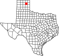
Roberts County | |
---|---|
Coordinates: 35°50′N100°49′W / 35.83°N 100.81°W | |
Country | United States |
State | Texas |
Founded | 1889 |
Named for | John S. Roberts and Oran Milo Roberts |
Seat | Miami |
Largest city | Miami |
Area | |
• Total | 924 sq mi (2,390 km2) |
• Land | 924 sq mi (2,390 km2) |
• Water | 0.1 sq mi (0.3 km2) 0.01% |
Population (2020) | |
• Total | 827 |
• Density | 1/sq mi (0.4/km2) |
Time zone | UTC−6 (Central) |
• Summer (DST) | UTC−5 (CDT) |
Congressional district | 13th |
Website | www |
Roberts County is a county located in the U.S. state of Texas. As of the 2020 census, its population was 827, [1] making it the eighth-least populous county in Texas. Its county seat is Miami, which is also the county's only incorporated community. [2] The county was created in 1876 and organized in 1889. [3] It is named for Oran Milo Roberts, a governor of Texas. Roberts County is one of four prohibition (entirely dry) counties in the state of Texas. [4]
The Plains Apache inhabited the Texas Panhandle until they were displaced by the Comanche who dominated the area until the 1870s. The Comanche hunted the large herds of buffalo, which grazed on the prairie. In the Red River War of 1874–75, United States Army troops led by Ranald S. Mackenzie drove out the Comanches. Simultaneously, buffalo hunters killed the large herds in the area, destroying the food supply and livelihood of the Plains tribes, making way for permanent settlement by Anglo-Americans.
In 1876, Roberts County was carved from the Bexar Territory and the Clay Land District. [5] In 1887, the Southern Kansas Railway was built through Roberts County, and settlers followed.
Roberts County is the scene of a recent battle for water rights, where the City of Amarillo, Texas, the Canadian River Municipal Water Authority, and T. Boone Pickens have sought to purchase the water rights within the county. Between the three, they own 80% of the water rights. [6]
According to the U.S. Census Bureau, the county has a total area of 924 sq mi (2,390 km2), of which 0.1 sq mi (0.26 km2) (0.01%) is covered by water. [7]
The county is relatively flat except for the Canadian River valley. Most of the land is used for cattle ranching. The county contains the 68,000-acre (280 km2) Mesa Vista Ranch, which seeks to protect quail, dove, and pheasant habitat along the creek beds south of the Canadian River. [8]
Census | Pop. | Note | %± |
---|---|---|---|
1880 | 32 | — | |
1890 | 326 | 918.8% | |
1900 | 620 | 90.2% | |
1910 | 950 | 53.2% | |
1920 | 1,469 | 54.6% | |
1930 | 1,457 | −0.8% | |
1940 | 1,289 | −11.5% | |
1950 | 1,031 | −20.0% | |
1960 | 1,075 | 4.3% | |
1970 | 967 | −10.0% | |
1980 | 1,187 | 22.8% | |
1990 | 1,025 | −13.6% | |
2000 | 887 | −13.5% | |
2010 | 929 | 4.7% | |
2020 | 827 | −11.0% | |
U.S. Decennial Census [9] 1850–2010 [10] 2010 [11] 2020 [12] |
Race / Ethnicity (NH = Non-Hispanic) | Pop 2000 [13] | Pop 2010 [11] | Pop 2020 [12] | % 2000 | % 2010 | % 2020 |
---|---|---|---|---|---|---|
White alone (NH) | 850 | 929 | 717 | 95.83% | 90.53% | 86.70% |
Black or African American alone (NH) | 3 | 0 | 2 | 0.34% | 0.00% | 0.24% |
Native American or Alaska Native alone (NH) | 0 | 3 | 2 | 0.00% | 0.32% | 0.24% |
Asian alone (NH) | 1 | 2 | 0 | 0.11% | 0.22% | 0.00% |
Pacific Islander alone (NH) | 0 | 0 | 0 | 0.00% | 0.00% | 0.00% |
Other race alone (NH) | 0 | 0 | 1 | 0.00% | 0.00% | 0.12% |
Mixed race or Multiracial (NH) | 5 | 9 | 55 | 0.56% | 0.97% | 6.65% |
Hispanic or Latino (any race) | 28 | 74 | 50 | 3.16% | 7.97% | 6.05% |
Total | 887 | 929 | 827 | 100.00% | 100.00% | 100.00% |
As of the census [14] of 2000, 887 people, 362 households, and 275 families were residing in the county. The population density was less than 1/km2 (2.6/sq mi). The 449 housing units averaged less than 1 per square mile (0.39/km2). The racial makeup of the county was 96.51% White, 0.34% African American, 0.56% Native American, 0.11% Asian, 1.35% from other races, and 1.13% from two or more races. About 3.16% of the population was Hispanic or Latino of any race.
Of the 362 households, 31.8% had children under 18 living with them, 70.7% were married couples living together, 3.9% had a female householder with no husband present, and 24.0% were not families. About 23.8% of all households were made up of individuals, and 10.8% had someone living alone who was 65 or older. The average household size was 2.45, and the average family size was 2.88.
In the county, the age distribution was 25.0% under 18, 4.8% from 18 to 24, 24.8% from 25 to 44, 30.9% from 45 to 64, and 14.4% who were 65 or older. The median age was 42 years. For every 100 females, there were 100.20 males. For every 100 females age 18 and over, there were 97.30 males.
The median income for a household in the county was $44,792, and for a family was $50,400. Males had a median income of $33,125 versus $23,611 for females. The per capita income for the county was $20,923. About 5.00% of families and 7.20% of the population were below the poverty line, including 7.50% of those under age 18 and 5.50% of those age 65 or over.
The largest self-reported ancestry groups in Roberts County, Texas are: [15]
Year | Republican | Democratic | Third party(ies) | |||
---|---|---|---|---|---|---|
No. | % | No. | % | No. | % | |
2024 | 547 | 95.63% | 20 | 3.50% | 5 | 0.87% |
2020 | 529 | 96.18% | 17 | 3.09% | 4 | 0.73% |
2016 | 524 | 94.58% | 20 | 3.61% | 10 | 1.81% |
2012 | 468 | 92.13% | 33 | 6.50% | 7 | 1.38% |
2008 | 477 | 92.08% | 41 | 7.92% | 0 | 0.00% |
2004 | 461 | 90.93% | 46 | 9.07% | 0 | 0.00% |
2000 | 472 | 85.97% | 72 | 13.11% | 5 | 0.91% |
1996 | 421 | 72.09% | 122 | 20.89% | 41 | 7.02% |
1992 | 391 | 63.37% | 126 | 20.42% | 100 | 16.21% |
1988 | 441 | 75.90% | 135 | 23.24% | 5 | 0.86% |
1984 | 539 | 83.57% | 106 | 16.43% | 0 | 0.00% |
1980 | 482 | 75.08% | 150 | 23.36% | 10 | 1.56% |
1976 | 350 | 62.28% | 202 | 35.94% | 10 | 1.78% |
1972 | 467 | 84.91% | 71 | 12.91% | 12 | 2.18% |
1968 | 311 | 60.51% | 90 | 17.51% | 113 | 21.98% |
1964 | 297 | 60.00% | 198 | 40.00% | 0 | 0.00% |
1960 | 339 | 76.18% | 104 | 23.37% | 2 | 0.45% |
1956 | 279 | 69.92% | 118 | 29.57% | 2 | 0.50% |
1952 | 379 | 80.64% | 91 | 19.36% | 0 | 0.00% |
1948 | 76 | 18.18% | 317 | 75.84% | 25 | 5.98% |
1944 | 89 | 21.29% | 289 | 69.14% | 40 | 9.57% |
1940 | 55 | 11.80% | 408 | 87.55% | 3 | 0.64% |
1936 | 27 | 5.96% | 426 | 94.04% | 0 | 0.00% |
1932 | 36 | 7.33% | 451 | 91.85% | 4 | 0.81% |
1928 | 243 | 70.03% | 104 | 29.97% | 0 | 0.00% |
1924 | 104 | 29.97% | 241 | 69.45% | 2 | 0.58% |
1920 | 60 | 25.10% | 173 | 72.38% | 6 | 2.51% |
1916 | 27 | 10.76% | 220 | 87.65% | 4 | 1.59% |
1912 | 16 | 6.75% | 183 | 77.22% | 38 | 16.03% |
Roberts County was one of the earliest counties in Texas to turn Republican. The last Democrat to win the county in a presidential election was Harry S. Truman in 1948, when he carried nearly 76% of its ballots. No Democrat has since exceeded the 40% of the vote that Texas native Lyndon B. Johnson won in the county in his 1964 national landslide. Jimmy Carter in 1976 was the last Democrat to win even 30% of the county's vote, Bill Clinton in 1996 to win 20%, and Al Gore in 2000 to win just 10%.
In recent years, Roberts County has become almost unanimously Republican. In 2008, 92% of voters voted for Republican John McCain versus only 7.92% for Democrat Barack Obama, making it one of the most Republican counties in the United States. [17] In the 2016 presidential election, Republican Donald Trump received 94.58% of the vote, [18] the largest margin in a county for a Republican in the U.S. that election. [19] [20] [21] Roberts was again Trump's strongest county in 2020, and he won it by an even stronger margin: 96.2%.
The county is governed by an elected county judge and four commissioners (each elected by a precinct within the county). [22]
Montgomery County is a county in the U.S. state of Texas. As of the 2020 U.S. census, the county had a population of 620,443. The county seat is Conroe. The county was created by an act of the Congress of the Republic of Texas on December 14, 1837, and is named for the town of Montgomery. Between 2000 and 2010, its population grew by 55%, the 24th-fastest rate of growth of any county in the United States. Between 2010 and 2020, its population grew by 36%. According to the U.S. Census Bureau, the estimated population is 711,354 as of July 1, 2023.
Zapata County is a county located in the U.S. state of Texas. As of the 2020 census, its population was 13,889. Its county seat is Zapata. The county is east of the Mexico–United States border and is named for Colonel José Antonio de Zapata, a rancher in the area who rebelled against Mexico.
Sutton County is a county located on the Edwards Plateau in the U.S. state of Texas. As of the 2020 census, the population was 3,372. Its county seat is Sonora. The county was created in 1887 and organized in 1890. Sutton County is named for John S. Sutton, an officer in the Confederate Army.
Starr County is located in the U.S. state of Texas. As of the 2020 census, its population was 65,920. Its county seat is Rio Grande City. The county was created in 1848. It is named for James Harper Starr, who served as secretary of the treasury of the Republic of Texas.
Parker County is a county located in the U.S. state of Texas. As of the 2020 census, its population was 148,222. The county seat is Weatherford. The county was created in 1855 and organized the following year. It is named for Isaac Parker, a state legislator who introduced the bill that established the county in 1855. Parker later fought in the Texas Brigade.
Nueces County is located in the U.S. state of Texas. As of the 2020 census, the population was 353,178, making it the 16th-most populous county in the state. The county seat is Corpus Christi. The county was formed in 1846 from portions of San Patricio County and organized the following year. It is named for the Nueces River, which marks the county's northwestern boundary with San Patricio County before emptying into its mouth at Nueces Bay north of the port of Corpus Christi. Nueces County is part of the Corpus Christi metropolitan statistical area.
Newton County is the easternmost county in the U.S. state of Texas. As of the 2020 census, its population was 12,217. Its county seat is Newton. The county is named for John Newton, a veteran of the American Revolutionary War.
Lee County is a county located in the U.S. state of Texas. As of the 2020 census, its population was 17,478. Its county seat is Giddings. The county was founded in 1874 and is named for Confederate General Robert E. Lee. The county has many Confederate memorials and monuments to the Confederate States of America.
King County is a county located in the U.S. state of Texas. The population was 265 at the 2020 census, making it the second-least populated county in Texas and the third-least populated county in the United States. King County has no incorporated communities. Its county seat is the census-designated place (CDP) of Guthrie. The county was created in 1876 and organized in 1891. It is named for William Philip King, who died at the Battle of the Alamo.
Kent County is a county located in the U.S. state of Texas. As of the 2020 census, its population was 753, making it the sixth-least populous county in Texas. Its county seat is Jayton. The county was created in 1876 and later organized in 1892. It is named for Andrew Kent, who died at the Battle of the Alamo. Kent County is a prohibition or entirely dry county, one of four remaining in the state.
Kenedy County is a county located in the U.S. state of Texas. As of the 2020 census, its population was 350. It is the third-least populous county in Texas and fourth-least populous in the United States. Its county seat is Sarita. The county was created in 1921 from parts of Hidalgo and Willacy counties and is named for Mifflin Kenedy, an early area rancher and steamboat operator.
Jim Wells County is a county in the U.S. state of Texas. As of the 2020 census, its population was 38,891. The county was founded in 1911 and is named for James B. Wells Jr. (1850–1923), for three decades a judge and Democratic Party political boss in South Texas.
Jack County is a county located in the north central part of the U.S. state of Texas. As of the 2020 census, its population was 8,472. Its county seat is Jacksboro. The county was created in 1856 and organized the next year. It is named for Patrick Churchill Jack and his brother William Houston Jack, both soldiers of the Texas Revolution.
Hamilton County is a county located on the Edwards Plateau in the U.S. state of Texas. As of the 2020 census, its population was 8,222. The county seat is Hamilton. The county was created in 1858. It is named for James Hamilton Jr., a former governor of South Carolina who gave financial aid to the Republic of Texas.
Gray County is a county located in the U.S. state of Texas. As of the 2020 census, its population was 21,227. The county seat is Pampa. The county was created in 1876 and later organized in 1902. is named for Peter W. Gray, a Confederate lawyer and soldier in the American Civil War.
Glasscock County is a county located in the U.S. state of Texas. As of the 2020 census, its population was 1,169. Its county seat is Garden City. The county was created in 1827 and later organized in 1869. It is named for George Washington Glasscock, an early settler of the Austin, Texas area and the namesake of Georgetown, Texas.
Foard County is a county located in the U.S. state of Texas. As of the 2020 census, its population was 1,095. Its county seat is Crowell, which is also the county's only incorporated community. The county is named for Robert Levi Foard, an attorney who served as a major with the Confederate Army, in the American Civil War.
Duval County is a county located in the U.S. state of Texas. As of the 2020 census, its population was 9,831. The county seat is San Diego. The county was founded in 1858 and later organized in 1876. It is named for Burr H. Duval, a soldier in the Texas Revolution who died in the Goliad Massacre.
Cottle County is a county in the U.S. state of Texas. As of the 2020 census, its population was 1,380. Its county seat is Paducah. The county was founded in 1876 and later organized in 1892. It is named for George Washington Cottle, who died defending the Alamo. Cottle County was formerly one of 46 prohibition, or entirely dry counties in the state of Texas. It now allows beer and wine sales.
Madison County is a county located in the U.S. state of Idaho. As of the 2020 census, the population was 52,913. The county seat and largest city is Rexburg. Madison County is part of the Rexburg, Idaho micropolitan area, which is also included in the Idaho Falls metropolitan area.