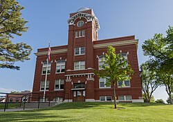
Military monument at Hemphill County CourthouseThe former Woman's Christian Temperance Union building in Canadian is being converted into a new Hemphill County Library.Canadian Record newspaper office serves Hemphill County.
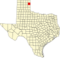
Hemphill County is a county located in the U.S. state of Texas. As of the 2020 census, its population was 3,382.[1] The county seat and only incorporated community in the county is the city of Canadian.[2] The county was created in 1876 and organized in 1887.[3] It is named for John Hemphill, a judge and Confederate congressman.[4] Hemphill County is the most recent Texas county to permit alcohol sales.[5][6]
For the 200 years leading up to 1875, nomadic Indian tribes representing the Apache, Comanche, Kiowa, and others roamed the Panhandle following the huge bison (buffalo) herds. In search for an alternate route to California through Santa Fe, New Mexico, Josiah Gregg (1840), and Captain Randolph B. Marcy (1845) surveyed trails that crossed Hemphill County, following the south bank of the Canadian River.
The 1874–75 Red River War was an effort by the United States Army to force the Indians of the Southern Plains to move to Indian Territory in present-day Oklahoma. Two major battles took place in what would become Hemphill County - the Battle of Lyman's Wagon Train and the Battle of Buffalo Wallow.
On April 12, 1879, Wheeler County became the first organized county in the Panhandle, with 14 other unorganized counties attached to it, one of which was Hemphill County. Hemphill County was organized in July 1887.
Influence of Santa Fe Railroad
In 1886, the Southern Kansas Railway Company, a Santa Fe subsidiary, began to build a rail line into the Panhandle of Texas. The tracks entered Hemphill County during 1887 and further encouraged settlement in the area, creating three town sites: Mendota, Canadian, and Glazier.
In 1907, Canadian was designated a division point by the Santa Fe, a factor that brought diversification to the previously ranching economy of the area. The Santa Fe influence remained very strong until the mid-1950s, when the railway moved its employees to Amarillo.
During the 1970s, the county grew due to a rapid expansion of oil production. Though oil was discovered in the county in 1955, production remained relatively small because the technology had not yet progressed to efficiently capture the very deep reserves known to exist. By 1974, oil production had reached 999,000 barrels (158,800m3) and more than 1,891,000bbl (300,600m3) in 1978. In 2000, about 505,000bbl (80,300m3) of oil and more than 8 billion cubic feet of natural gas were produced in the county, but the future looked very bright.
The Abraham Companies are based in the Moody Building, a former hotel in Canadian.
Geography
According to the U.S. Census Bureau, the county has a total area of 912sqmi (2,360km2), of which 5.9sqmi (15km2) (0.6%) are covered by water.[8]
Hemphill County, Texas – Racial and ethnic composition Note: the US Census treats Hispanic/Latino as an ethnic category. This table excludes Latinos from the racial categories and assigns them to a separate category. Hispanics/Latinos may be of any race.
As of the census[26] of 2000, 3,351 people, 1,280 households, and 948 families resided in the county. The population density was four peopleper square mile (1.5 people/km2). The 1,548 housing units averaged two unitsper square mile (0.77 units/km2). The racial makeup of the county was 87.65% White, 1.55% Black or African American, 0.72% Native American, 0.27% Asian, 0.03% Pacific Islander, 8.48% from other races, and 1.31% from two or more races. About 15.6% of the population were Hispanic or Latino of any race.
Of the 1,280 households, 32.7% had children under 18 living with them, 65.2% were married couples living together, 5.9% had a female householder with no husband present, and 25.9% were not families. About 24.4% of all households were made up of individuals, and 12.0% had someone living alone who was 65 or older. The average household size was 2.50 and the average family size was 2.98.
In the county, the population was distributed as 28.0% under 18, 6.5% from 18 to 24, 25.3% from 25 to 44, 25.4% from 45 to 64, and 14.7% who were 65 or older. The median age was 39 years. For every 100 females, there were 101.3 males. For every 100 females 18 and over, there were 92.2 males.
The median income for a household in the county was $35,456, and for a family was $42,036. Males had a median income of $31,154 versus $19,423 for females. The per capita income for the county was $16,929. About 10.90% of families and 12.60% of the population were below the poverty line, including 16.70% of those under age 18 and 12.80% of those age 65 or over.
During the period 1912 through the 1940s, Democratic candidates at the presidential level predominated in Hemphill County, the exception being 1928. From 1952, Republicans have held sway, losing the county only in the 1964 landslide by native son Lyndon Johnson.
United States presidential election results for Hemphill County, Texas[27]
This page is based on this Wikipedia article Text is available under the CC BY-SA 4.0 license; additional terms may apply. Images, videos and audio are available under their respective licenses.