Randall County, Texas

Last updated

Randall County
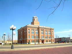
Canyon-Texas1RG.jpg
The Randall County Courthouse in 2011
Randall county seal.jpg
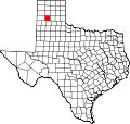
Map of Texas highlighting Randall County.svg
Location within the U.S. state of Texas
Texas in United States.svg
Texas's location within the U.S.
Coordinates: 34°58′N101°54′W / 34.97°N 101.9°W / 34.97; -101.9
CountryFlag of the United States.svg United States
StateFlag of Texas.svg  Texas
Founded1889
Named for Horace Randal
Seat Canyon
Largest city Amarillo
Area
  Total922 sq mi (2,390 km2)
  Land912 sq mi (2,360 km2)
  Water11 sq mi (30 km2)  1.2%
Population
 (2020)
  Total140,753
  Density150/sq mi (59/km2)
Time zone UTC−6 (Central)
  Summer (DST) UTC−5 (CDT)
Congressional district 13th
Website www.randallcounty.com

Randall County is a county located in the U.S. state of Texas. As of the 2020 census, its population was 140,753. [1] Its county seat is Canyon. [2] The county was created in 1876 and later organized in 1889. [3] It is named for Horace Randal, a Confederate brigadier general killed at the Battle of Jenkins Ferry. The reason the county name differs from his is because the bill creating the county misspelled Randal's name.

Contents

Randall County, alongside adjacent Potter County is part of the Amarillo Metropolitan Statistical Area.

At one time, the large JA Ranch, founded by Charles Goodnight and John George Adair, which reached into six counties, held acreage in Randall County.

Geography

According to the U.S. Census Bureau, the county has a total area of 922 square miles (2,390 km2), of which 912 square miles (2,360 km2) is land and 11 square miles (28 km2) (1.2%) is covered by water. [4]

Palo Duro Canyon, the second-largest canyon in the United States, is located in Randall County.

Major highways

Adjacent counties

National protected area

Demographics

Historical population
CensusPop.Note
1880 3
1890 1876,133.3%
1900 963415.0%
1910 3,312243.9%
1920 3,67511.0%
1930 7,07192.4%
1940 7,1851.6%
1950 13,77491.7%
1960 33,913146.2%
1970 53,88558.9%
1980 75,06239.3%
1990 89,67319.5%
2000 104,31216.3%
2010 120,72515.7%
2020 140,75316.6%
U.S. Decennial Census [5]
1850–2010 [6] 2010 [7] 2020 [8]
Randall County, Texas - Demographic Profile
(NH = Non-Hispanic)
Race / EthnicityPop 2010 [7] Pop 2020 [8] % 2010% 2020
White alone (NH)94,36195,45778.16%67.82%
Black or African American alone (NH)2,7014,5672.24%3.24%
Native American or Alaska Native alone (NH)5867940.49%0.56%
Asian alone (NH)1,6252,6041.35%1.85%
Pacific Islander alone (NH)29540.02%0.04%
Some Other Race alone (NH)934120.08%0.29%
Mixed Race/Multi-Racial (NH)1,5555,2821.29%3.75%
Hispanic or Latino (any race)19,77531,58316.38%22.44%
Total120,725140,753100.00%100.00%

Note: the US Census treats Hispanic/Latino as an ethnic category. This table excludes Latinos from the racial categories and assigns them to a separate category. Hispanics/Latinos can be of any race.

As of the census [9] of 2000, 104,312 people, 41,240 households, and 28,785 families resided in the county. The population density was 114 people per square mile (44 people/km2). The 43,261 housing units averaged 47 units per square mile (18/km2). The racial makeup of the county was 90.44% White, 1.50% Black or African American, 0.65% Native American, 1.03% Asian, 0.03% Pacific Islander, 4.71% from other races, and 1.64% from two or more races. About 10.3% of the population were Hispanic or Latino of any race.

Of the 41,240 households, 33.90% had children under the age of 18 living with them, 57.50% were married couples living together, 9.20% had a female householder with no husband present, and 30.20% were not families; 25.40% of all households were made up of individuals, and 8.50% had someone living alone who was 65 years of age or older. The average household size was 2.49, and the average family size was 3.00.

In the county, the population was distributed as 26.10% under the age of 18, 11.20% from 18 to 24, 28.40% from 25 to 44, 22.40% from 45 to 64, and 11.90% who were 65 years of age or older. The median age was 35 years. For every 100 females, there were 94.70 males. For every 100 females age 18 and over, there were 91.20 males.

The median income for a household in the county was $42,712, and for a family was $52,420. Males had a median income of $36,333 versus $25,358 for females. The per capita income for the county was $21,840. About 5.70% of families and 8.10% of the population were below the poverty line, including 8.50% of those under age 18 and 6.60% of those age 65 or over.
Politics

Although once more Democratic-leaning, the county has become solidly Republican. The Republican candidate has carried the county in every presidential election since 1952, usually by overwhelming margins. [10] In the last thirteen elections, no Republican candidate has received less than 61% of the county's vote, [11] and since 2000, Randall has been the nation's most Republican "metropolitan" county outside of predominantly Mormon counties in Utah. [12]

Randall County was one of the more than 200 counties in Texas to cast the majority of its votes for Republican John McCain. McCain received 41,895 votes, which was 81% of the total, while Democrat Barack Obama received 9,461 votes, or 18% of the total, far below his national percentage.

United States presidential election results for Randall County, Texas [13]
Year Republican Democratic Third party
No.%No.%No.%
2020 50,79678.54%12,80219.79%1,0761.66%
2016 43,46280.03%8,36715.41%2,4764.56%
2012 41,44783.40%7,57415.24%6751.36%
2008 41,94880.93%9,46818.27%4160.80%
2004 40,52083.40%7,84916.15%2180.45%
2000 33,92181.17%7,20917.25%6601.58%
1996 28,26671.33%9,17723.16%2,1845.51%
1992 24,97161.60%9,11922.50%6,44715.90%
1988 27,98676.33%8,49223.16%1880.51%
1984 30,24983.08%6,04416.60%1160.32%
1980 23,13673.72%7,32323.34%9232.94%
1976 17,11564.53%9,07434.21%3351.26%
1972 18,55783.13%3,47015.54%2961.33%
1968 11,40061.32%4,06021.84%3,13216.85%
1964 7,84356.50%6,01643.34%220.16%
1960 6,95867.76%3,28231.96%290.28%
1956 4,60962.28%2,77437.49%170.23%
1952 4,30569.28%1,90530.66%40.06%
1948 72226.05%1,93669.84%1144.11%
1944 40919.34%1,43968.04%26712.62%
1940 38217.67%1,77982.28%10.05%
1936 1427.87%1,65691.80%60.33%
1932 23114.10%1,39485.10%130.79%
1928 73352.66%65947.34%00.00%
1924 15418.22%62774.20%647.57%
1920 18333.21%36065.34%81.45%
1916 6314.93%34180.81%184.27%
1912 216.34%26981.27%4112.39%

Communities

Cities

Towns

Villages

Unincorporated communities

Ghost towns

Education

School districts include: [14]

All of the county is in the service area of Amarillo College. [15]

See also

Related Research Articles

<span class="mw-page-title-main">Swisher County, Texas</span> County in Texas, United States

Swisher County is a county in the U.S. state of Texas. As of the 2020 census, its population was 6,971. Its county seat is Tulia. The county was created in 1876 and later organized in 1890. It is named for James G. Swisher, a soldier of the Texas Revolution and signer of the Texas Declaration of Independence.

<span class="mw-page-title-main">San Augustine County, Texas</span> County in Texas, United States

San Augustine County is a county located in the U.S. state of Texas. As of the 2020 census, its population was 7,918. Its county seat is San Augustine.

<span class="mw-page-title-main">Potter County, Texas</span> County in Texas, United States

Potter County is a county located in the U.S. state of Texas. As of the 2020 census, its population was 118,525. Its county seat is Amarillo. The county was created in 1876 and organized in 1887. It is named for Robert Potter, a politician, signer of the Texas Declaration of Independence, and the Texas Secretary of the Navy. Potter County is included in the Amarillo metropolitan area.

<span class="mw-page-title-main">Parmer County, Texas</span> County in Texas, United States

Parmer County is a county located in the southwestern Texas Panhandle on the High Plains of the Llano Estacado in the U.S. state of Texas. As of the 2020 Census, the population was 9,869. The county seat is Farwell. The county was created in 1876 and later organized in 1907. It is named in honor of Martin Parmer, a signer of the Texas Declaration of Independence and early judge. Parmer County was one of 10 prohibition, or entirely dry, counties in the state of Texas, but is now a wet county.

<span class="mw-page-title-main">Oldham County, Texas</span> County in Texas, United States

Oldham County is a county located in the U.S. state of Texas. As of the 2020 census, its population was 1,758. Its county seat is Vega. The county was created in 1876 and organized in 1881. Oldham County is included in the Amarillo, TX Metropolitan Statistical Area.

<span class="mw-page-title-main">Nueces County, Texas</span> County in Texas, United States

Nueces County is located in the U.S. state of Texas. As of the 2020 census, the population was 353,178, making it the 16th-most populous county in the state. The county seat is Corpus Christi. The county was formed in 1846 from portions of San Patricio County and organized the following year. It is named for the Nueces River, which marks the county's northwestern boundary with San Patricio County before emptying into its mouth at Nueces Bay north of the port of Corpus Christi. Nueces County is part of the Corpus Christi metropolitan statistical area.

<span class="mw-page-title-main">Midland County, Texas</span> County in Texas, United States

Midland County is a county located in the U.S. state of Texas. As of 2020, the population was 169,983. The county seat is Midland. The county is so named for being halfway (midway) between Fort Worth and El Paso on the Texas and Pacific Railway. Midland County is included in the Midland, TX Metropolitan Statistical Area as well as the Midland–Odessa Combined Statistical Area.

<span class="mw-page-title-main">Lubbock County, Texas</span> County in Texas, United States

Lubbock County is a county located in the U.S. state of Texas. The 2020 census placed the population at 310,639. Its county seat and largest city is Lubbock. The county was created in 1876 and organized in 1891. It is named for Thomas Saltus Lubbock, a Confederate colonel and Texas Ranger.

<span class="mw-page-title-main">Live Oak County, Texas</span> County in Texas, United States

Live Oak County is a county in the U.S. state of Texas. It was named for its native groves of live oak. George West is its county seat. Its population was 11,335 in the 2020 census.

<span class="mw-page-title-main">Kenedy County, Texas</span> County in Texas, United States

Kenedy County is a county located in the U.S. state of Texas. As of the 2020 census, its population was 350. It is the third-least populous county in Texas and fourth-least populous in the United States. Its county seat is Sarita. The county was created in 1921 from parts of Hidalgo and Willacy counties and is named for Mifflin Kenedy, an early area rancher and steamboat operator.

<span class="mw-page-title-main">Haskell County, Texas</span> County in Texas, United States

Haskell County is a county located in the U.S. state of Texas. As of the 2020 census, its population was 5,416. The county seat is Haskell. The county was created in 1858 and later organized in 1885. It is named for Charles Ready Haskell, who was killed in the Goliad massacre.

<span class="mw-page-title-main">Floyd County, Texas</span> County in Texas, United States

Floyd County is a county in the U.S. state of Texas. As of the 2020 census, its population was 5,402. The seat of the county is Floydada. The county was created in 1876 and later organized in 1890. It is named for Dolphin Ward Floyd, who died on his 32nd birthday, March 6, 1836, defending the Alamo.

<span class="mw-page-title-main">Deaf Smith County, Texas</span> County in Texas, United States

Deaf Smith County is a county located in the U.S. state of Texas. As of the 2020 census, the population was 18,583. The county seat is Hereford, which is known as the "Beef Capital of the World". The county was created in 1876 and later organized in 1890. The Hereford, TX Micropolitan Statistical Area includes all of Deaf Smith County.

<span class="mw-page-title-main">Cooke County, Texas</span> County in Texas, United States

Cooke County is a county in the U.S. state of Texas. At the 2020 census, its population was 41,668. The county seat is Gainesville. The county was founded in 1848 and organized the next year. It is named for William Gordon Cooke, a soldier during the Texas Revolution. It is a part of the Texoma region.

<span class="mw-page-title-main">Castro County, Texas</span> County in Texas, United States

Castro County is a county located in the U.S. state of Texas. As of the 2020 census, its population was 7,371. Its county seat is Dimmitt. The county was named for Henri Castro, who was consul general to France for the Republic of Texas and the founder of a colony in Texas.

<span class="mw-page-title-main">Briscoe County, Texas</span> County in Texas, United States

Briscoe County is a county located in the U.S. state of Texas. As of the 2020 census, the population was 1,435. Its county seat is Silverton. The county was created in 1876 and later organized in 1892. It is named for Andrew Briscoe, a soldier during the Texas Revolution.

<span class="mw-page-title-main">Armstrong County, Texas</span> County in Texas, United States

Armstrong County is a county located in the U.S. state of Texas. As of the 2020 census, the population of Armstrong County was 1,848. It is in the Texas Panhandle and its county seat is Claude.

<span class="mw-page-title-main">Canyon, Texas</span> City in Texas, United States

Canyon is a city in, and the county seat of, Randall County, Texas, United States. The population was 14,836 at the 2020 census. It is part of the Amarillo, Texas, metropolitan statistical area. Canyon is the home of West Texas A&M University and Panhandle–Plains Historical Museum, and the outdoor musical drama Texas.

<span class="mw-page-title-main">Happy, Texas</span> Town in Texas, United States

Happy is a town in Randall and Swisher Counties in the U.S. state of Texas. The population was 678 at the 2010 census. The Randall County portion of Happy is part of the Amarillo, Texas Metropolitan Statistical Area.

<span class="mw-page-title-main">Moore County, Texas</span> County in Texas, United States

Moore County is a county located in the U.S. state of Texas. As of the 2020 census, its population was 21,358. The county seat is Dumas. The county was created in 1876 and organized in 1892. It is named for Edwin Ward Moore, the commander of the Texas Navy. The Dumas micropolitan statistical area includes all of Moore County.

References

  1. "Randall County, Texas". United States Census Bureau . Retrieved January 30, 2022.
  2. "Find a County". National Association of Counties. Retrieved June 7, 2011.
  3. "Texas: Individual County Chronologies". Texas Atlas of Historical County Boundaries. The Newberry Library. 2008. Retrieved May 26, 2015.
  4. "2010 Census Gazetteer Files". United States Census Bureau. August 22, 2012. Retrieved May 9, 2015.
  5. "Decennial Census of Population and Housing by Decades". US Census Bureau.
  6. "Texas Almanac: Population History of Counties from 1850–2010" (PDF). Texas Almanac. Archived (PDF) from the original on October 9, 2022. Retrieved May 9, 2015.
  7. 1 2 "P2 HISPANIC OR LATINO, AND NOT HISPANIC OR LATINO BY RACE - 2010: DEC Redistricting Data (PL 94-171) - Randall County, Texas". United States Census Bureau .
  8. 1 2 "P2 HISPANIC OR LATINO, AND NOT HISPANIC OR LATINO BY RACE - 2020: DEC Redistricting Data (PL 94-171) - Randall County, Texas". United States Census Bureau .
  9. "U.S. Census website". United States Census Bureau . Retrieved May 14, 2011.
  10. "Presidential election of 1952 - Map by counties". geoelections.free.fr. Retrieved July 29, 2018.
  11. "President Map - Election Results 2008 - The New York Times". elections.nytimes.com. Retrieved July 29, 2018.
  12. ‘100 Most Republican Counties in 2000 Presidential Election’; The American Statesman, September 17, 2004
  13. Leip, David. "Dave Leip's Atlas of U.S. Presidential Elections". uselectionatlas.org. Retrieved July 29, 2018.
  14. "2020 CENSUS - SCHOOL DISTRICT REFERENCE MAP: Randall County, TX" (PDF). U.S. Census Bureau. Archived (PDF) from the original on October 9, 2022. Retrieved June 29, 2022. - list
  15. Texas Education Code, Sec. 130.164. AMARILLO COLLEGE DISTRICT SERVICE AREA..

34°58′N101°54′W / 34.97°N 101.90°W / 34.97; -101.90