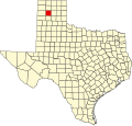
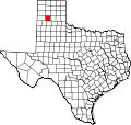
Bushland, Texas

Last updated

Location of Bushland in the state of Texas TXMap-doton-Bushland.png
Location of Bushland in the state of Texas
Bushland Post Office Post Office, Bushland Texas.jpg
Bushland Post Office
Bushland Bushland, TX.jpg
Bushland

Bushland is an unincorporated community and census-designated place (CDP) in southwestern Potter County, Texas, United States. [1] A small portion of the CDP extends south into Randall County. According to the Handbook of Texas, the community had an estimated population of 130 in 2000. [2] [3] The community is part of the Amarillo, Texas Metropolitan Statistical Area.

Contents

Geography

Bushland is located at 35°11′31″N102°03′53″W / 35.19194°N 102.06472°W / 35.19194; -102.06472 (35.1919978, -102.0646392), at an elevation of 3,825 feet. The community is situated along Interstate 40, approximately 14 miles west of Amarillo in southwestern Potter County. [2]

Bushland is the halfway point between Chicago and Los Angeles, 1,062 miles from either city. The two cities were the original endpoints of U.S. Route 66.

History

Established as a station on the Chicago, Rock Island and Gulf Railway, Bushland was named for William Henry Bush, a Chicago native. [3] In 1898, land owner Joseph Glidden (the inventor of barbed wire) transferred the Frying Pan Ranch to Mr. Bush, who was his son-in-law. The total cost was $68,000. [4] [5] Thereafter, Bush donated land for a town site and a railroad right-of-way. On July 3, 1908, the town was formally dedicated by Bush and his associate S.H. Smiser. [2]

Bushland Gas Explosion, 2009 Bushland0025.jpg
Bushland Gas Explosion, 2009

Farmers soon settled in and around Bushland. A public school district was established, followed by the opening of a post office in January 1909. [3] The community's population remained small, hovering near 20 during the 1910s and 1920s. By 1940, that figure had risen to 175, with four businesses operating in the community. Throughout the latter half of the twentieth century and into the twenty-first, Bushland's population has remained steady at around 130. [2]

In 2009, Bushland made National News after a gas pipeline ruptured near Prairie West, a local neighborhood. [6] At 1:00 AM on Wednesday, November 4, 2009, a gas line operated by El Paso Natural Gas Company malfunctioned, shooting flames 700 feet into the air. Three residents of the neighborhood were injured, and transported to Lubbock for health treatment.

Demographics

2020 census

Bushland racial composition [7]
(NH = Non-Hispanic) [lower-alpha 1]
RaceNumberPercentage
White (NH)1,81581.24%
Black or African American (NH)190.85%
Native American or Alaska Native (NH)100.45%
Asian (NH)110.49%
Some Other Race (NH)20.09%
Mixed/Multi-Racial (NH)1054.7%
Hispanic or Latino 27212.18%
Total2,234

As of the 2020 United States census, there were 2,234 people, 709 households, and 672 families residing in the CDP.

Education

Public education in the community of Bushland is provided by the Bushland Independent School District. The district operates three campuses – Bushland Elementary School (grades PK–4), Bushland Middle School (grades 5–8), and Bushland High School (grades 9–12). In 2011, Bushland residents voted in favor of a bond issue to build additions to the High School, build a cafeteria for the Middle School and purchase new buses for the district.

Climate

According to the Köppen Climate Classification system, Bushland has a semi-arid climate, abbreviated "BSk" on climate maps. [9]

Related Research Articles

<span class="mw-page-title-main">Randall County, Texas</span> County in Texas, United States

Randall County is a county located in the U.S. state of Texas. As of the 2020 census, its population was 140,753. Its county seat is Canyon. The county was created in 1876 and later organized in 1889. It is named for Horace Randal, a Confederate brigadier general killed at the Battle of Jenkins Ferry. The reason the county name differs from his is because the bill creating the county misspelled Randal's name.

<span class="mw-page-title-main">Potter County, Texas</span> County in Texas, United States

Potter County is a county located in the U.S. state of Texas. As of the 2020 census, its population was 118,525. Its county seat is Amarillo. The county was created in 1876 and organized in 1887. It is named for Robert Potter, a politician, signer of the Texas Declaration of Independence, and the Texas Secretary of the Navy. Potter County is included in the Amarillo metropolitan area.

<span class="mw-page-title-main">Oldham County, Texas</span> County in Texas, United States

Oldham County is a county located in the U.S. state of Texas. As of the 2020 census, its population was 1,758. Its county seat is Vega. The county was created in 1876 and organized in 1881. Oldham County is included in the Amarillo, TX Metropolitan Statistical Area.

<span class="mw-page-title-main">Carson County, Texas</span> County in Texas, United States

Carson County is a county located in the U.S. state of Texas. As of the 2020 census, its population was 5,807. The county seat is Panhandle. The county was founded in 1876 and later organized in 1888. It is named for Samuel Price Carson, the first secretary of state of the Republic of Texas.

<span class="mw-page-title-main">Claude, Texas</span> City in Texas, United States

Claude is a city in and the county seat of Armstrong County, Texas, United States. The population was 1,196 at the 2010 census. It is located east of Amarillo in the south Texas Panhandle. Claude is part of the Amarillo Metropolitan Statistical Area but is some thirty miles east of Amarillo.

<span class="mw-page-title-main">White Deer, Texas</span> Town in Texas, United States

White Deer is a town in Carson County, Texas, United States. The population was 1,000 at the 2010 census. It is part of the Amarillo metropolitan statistical area.

<span class="mw-page-title-main">Cloverleaf, Texas</span> Census-designated place in Texas, United States

Cloverleaf is a census-designated place (CDP) in east central Harris County, Texas, United States. The population was 24,100 at the 2020 census.

<span class="mw-page-title-main">Channing, Texas</span> City in Texas, United States

Channing is a town in Hartley County, Texas, in the United States. It is the county seat of Hartley County. As of the 2020 United States census, the town's population was 281.

<span class="mw-page-title-main">Lipscomb, Texas</span> Census-designated place in Texas, United States

Lipscomb is an unincorporated community and census-designated place (CDP) in Lipscomb County, Texas, United States. It is the Lipscomb county seat. The population was 37 at the 2010 census.

<span class="mw-page-title-main">Adrian, Texas</span> City in Texas, United States

Adrian is a city on historic route 66 in Oldham County, Texas, United States. The population was 128 at the 2020 census, down from 166 at the 2010 census.

<span class="mw-page-title-main">Vega, Texas</span> City in Texas, United States

Vega is a city and county seat of Oldham County, Texas, United States. The population was 884 at the 2010 census, down from 936 at the 2000 census.

<span class="mw-page-title-main">Tulia, Texas</span> City in Texas, United States

Tulia is a city in, and county seat of, Swisher County, Texas, United States. The population was 4,967 at the 2010 census; in the 2018 census estimate, it had fallen to 4,682. The city is at the junction of U.S. Route 87 and Texas State Highway 86, about 2 miles (3 km) east of Interstate 27. Tulia is a center for farming and agribusiness activities.

<span class="mw-page-title-main">Sanderson, Texas</span> CDP in Texas, United States

Sanderson is a census-designated place (CDP) in and the county seat of Terrell County, Texas, United States. The population was 837 at the 2010 census. Sanderson was created in 1882 as a part of neighboring Pecos County. It became the seat of Terrell County in 1905.

<span class="mw-page-title-main">Sarita, Texas</span> County seat & Unincorporated community in Texas, United States

Sarita is a census-designated place (CDP) in, and the county seat of Kenedy County, Texas, United States. It is the only settlement of note in the county, and as of the 2010 census had a population of 238. Sarita has been ranked the most politically liberal town in Texas.

<span class="mw-page-title-main">Guthrie, Texas</span> Census-designated place in Texas, United States

Guthrie is an unincorporated community and census-designated place (CDP) in, and the county seat of, King County in the U.S. state of Texas. It is in the northern part of the state, 93 miles (150 km) east of Lubbock. It serves as the principal headquarters of the Four Sixes Ranch. As of the 2010 census, its population was 160.

<span class="mw-page-title-main">Montague, Texas</span> Census-designated place & Unincorporated Community in Texas, United States

Montague is a census-designated place and unincorporated community in Montague County, Texas, United States. It is the county seat of Montague County and had an estimated population of 400 in 2000, according to the Handbook of Texas. Its population was 304 as of the 2010 census.

<span class="mw-page-title-main">Palo Pinto, Texas</span> CDP in Texas, United States

Palo Pinto is a census-designated place (CDP) and unincorporated community and county seat in Palo Pinto County, Texas, United States. This was a new CDP for the 2010 census with a population of 333.

Oklaunion is an unincorporated community in Wilbarger County, Texas, United States. According to the Handbook of Texas, the community had an estimated population of 138 in 2000.

<span class="mw-page-title-main">Wildorado, Texas</span> Unincorporated community in Texas, United States

Wildorado is an unincorporated community in Oldham County, Texas, United States. According to the Handbook of Texas, the community had an estimated population of 180 in 2000.

<span class="mw-page-title-main">Washburn, Texas</span> Unincorporated community in Texas, US

Washburn is an unincorporated community in Armstrong County, Texas, United States. According to the Handbook of Texas, the community had an estimated population of 120 in 2000. Washburn is part of the Amarillo Metropolitan Statistical Area.

References

  1. U.S. Geological Survey Geographic Names Information System: Bushland, Texas
  2. 1 2 3 4 "Bushland, Texas". The Handbook of Texas online. Retrieved May 13, 2009.
  3. 1 2 3 "Bushland, Texas". Texas Escapes Online Magazine. Retrieved May 13, 2009.
  4. "Frying Pan Ranch". The Handbook of Texas online. Retrieved May 13, 2009.
  5. "William Henry Bush". The Handbook of Texas online. Retrieved May 13, 2009.
  6. "3 injured, home destroyed in Texas gas line blast". The Seattle Times. November 5, 2009. Retrieved September 10, 2018.
  7. "Explore Census Data". data.census.gov. Retrieved May 20, 2022.
  8. "About the Hispanic Population and its Origin". www.census.gov. Retrieved May 18, 2022.
  9. Climate Summary for Bushland, Texas
  1. Note: the US Census treats Hispanic/Latino as an ethnic category. This table excludes Latinos from the racial categories and assigns them to a separate category. Hispanics/Latinos can be of any race. [8]