| CDP | County | Location
of County | Population
(2020) [15] | Population
(2010) [5] | Population
(2000) [6] | Population
(1990) [7] | Population
(1980) [8] | Notes |
|---|
| Abram-Perezville | Hidalgo |  | x | x | 5,376 | 3,999 | x | Split for the 2010 census into two separate CDPs: Abram CDP and Perezville CDP |
| Alfred-South La Paloma | Travis |  | x | x | 451 | x | x | Split into the Alfred and South La Paloma CDPs prior to the 2010 U.S. census |
| Alton North | Hidalgo | | x | x | 5,051 | x | x | Absorbed by the city of Alton prior to the 2010 U.S. census |
| Anderson Mill | Travis
Williamson | 
 | x | x | 8,953 | 9,468 | x | Absorbed into the city of Austin after the 2010 census |
| Arroyo Gardens-La Tina Ranch | Cameron |  | x | x | 732 | x | x | Split for the 2010 census into two separate CDPs: Arroyo Gardens CDP and La Tina Ranch CDP |
| Bluetown-Iglesia Antigua | Cameron | | x | x | 692 | x | x | Split for the 2010 census into two separate CDPs: Bluetown CDP and Iglesia Antigua CDP |
| Boling-Iago | Wharton |  | x | x | 1,271 | 1,119 | 1,348 | Split for the 2010 census into two separate CDPs: Boling CDP and Iago CDP |
| Box Canyon-Amistad | Val Verde |  | x | x | 76 | x | x | Split for the 2010 census into two separate CDPs: Amistad CDP and Box Canyon CDP |
| Chula Vista-Orason | Cameron | | x | x | 394 | x | x | Split for the 2010 census into two separate CDPs: Chula Vista CDP and Orason CDP |
| Country Acres | San Patricio | 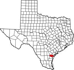 | 163 | 185 | x | x | x | Annexed by the city of Aransas Pass in 2022. |
| Coyote Flats | Johnson |  | x | 312 | x | x | x | Incorporated in 2010. |
| Del Sol-Loma Linda | San Patricio | | x | x | 726 | x | x | Split for the 2010 census into three separate CDPs: Del Sol CDP, Loma Linda CDP, and the La Paloma Addition CDP |
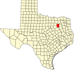
| Dennis | Parker |  | 727 | x | x | x | x | Listed as a CDP in 2020 and then incorporated in 2023. [16] |
| Dominion | Bexar | 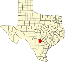 | x | x | x | 1,196 | x | Absorbed into San Antonio prior to the 2000 census |
| Doyle | San Patricio | | x | 254 | 285 | x | x | Annexed by the city of Portland prior to the 2020 U.S. census |
| Eagle Mountain | Tarrant | 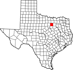 | x | x | 6,599 | 5,847 | x | Absorbed into the city of Saginaw prior to the 2010 census |
| East Bernard | Wharton | | x | x | 1,729 | 1,544 | 1,735 | First appeared as an unincorporated place in the 1970 U.S. census (pop 1,159)
Incorporated prior to the 2010 census |
| Edgewater-Paisano | San Patricio | | x | x | 182 | x | x | Split for the 2010 census into two separate CDPs: Edgewater Estates CDP and Paisano Park CDP |
| Escobares | Starr |  | x | x | x | 1,544 | 1,705 | Although officially incorporated in 2005, Escobares was listed as a city in the 2000 census |
| Escobar I | Starr | | x | 324 | x | x | x | Escobar I was formed prior to the 2010 U.S. census along with JF Villarreal CDP, Loma Vista CDP, Moraida CDP, Pena CDP, and Rivera CDP from parts of North Escobares CDP that was not incorporated into the city of Escobares. [5] It was absorbed by the city of Escobares prior to the 2020 U.S. census and delisted as a CDP. |
| Falman-County Acres | San Patricio | | x | x | 289 | x | x | Split for the 2010 census into two separate CDPs: Falman CDP and Country Acres CDP |
| Faysville | Hidalgo | | x | 439 | 348 | x | x | Absorbed by the city of Edinburg prior to the 2020 U.S. census. |
| First Colony | Fort Bend |  | x | x | x | 18,327 | x | Absorbed into the cities of Sugar Land and Missouri City prior to the 2000 census |
| Grand Acres | Cameron | | x | 49 | 203 | x | x | Part absorbed by the town of Santa Rosa prior to the 2010 U.S. census. Deleted prior to the 2020 U.S. census |
| Homestead Meadows | El Paso |  | x | x | x | 4,978 | x | Split into the Homestead Meadows North CDP and Homestead Meadows South CDP |
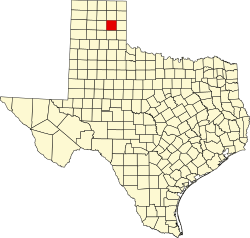
| Horseshoe Bay | Burnet, Llano | 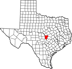
 | x | x | 3,337 | 1,546 | x | Incorporated in 2006 prior to the 2010 U.S. census |
| Ingram | Kerr |  | x | x | x | x | 1,921 | Incorporated prior to the 1990 U.S. census |
| Jollyville | Travis
Williamson |
| x | 16,151 | 15,813 | 15,206 | x | Absorbed into the city of Austin after the 2010 census |
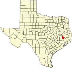
| Kingwood | Harris
Montgomery | 
 | x | x | x | 37,397 | 16,261 | Absorbed into the city of Houston prior to the 2000 census |
| La Casita-Garciasville | Starr | | x | x | 2,177 | 1,186 | x | Broken up prior to the 2010 census to form the CDPs of Amada Acres, Chaparrito, La Casita,
Loma Linda East, Manuel Garcia, Manuel Garcia II, Olivia Lopez de Gutierrez, Ramirez-Perez and Victoria Vera. |
| Las Colonias | Zavala |  | x | x | 283 | x | x | Deleted prior to the 2010 U.S. census with the Amaya and Loma Grande CDPs formed out of parts of its territory |
| Las Milpas-Hidalgo Park | Hidalgo | | x | x | x | x | 3,039 | Annexed by the city of Pharr prior to the 1990 U.S. census. |
| Larga Vista | Webb |  | x | x | 742 | x | x | Absorbed into Laredo prior to the 2010 U.S. census |
| Las Palmas-Juarez | Cameron | | x | x | 1,666 | x | x | Split for the 2010 census into two separate CDPs: Las Palmas II CDP and La Juarez CDP |
| Los Villareales | Starr | | x | x | 930 | x | x | Deleted prior to the 2010 U.S. census after part was annexed to Rio Grande City and the remainder was used to form the CDPs of La Escondida, La Esperanza, and Santel and parts of the CDPs of Mi Ranchito Estate and Ranchitos del Norte. |
| Northcliff | Guadalupe |  | x | x | 1,819 | x | x | Absorbed into the city of Schertz prior to the 2020 census |
| Northridge | Starr | | x | 78 | x | x | x | Absorbed into the city of Roma prior to the 2020 census |
| Old Escobares | Starr | | x | 97 | x | x | x | Old Escobares was formed along with Mesquite CDP from the part of the Escobares CDP that was not incorporated into the city of Escobares. [5] It was absorbed by the city of Escobares prior to the 2020 U.S. census and delisted as a CDP. |
| Onion Creek | Travis | | x | x | 2,116 | 1,544 | | Absorbed into the city of Austin after the 2000 census |
| Owl Ranch-Amargosa | Jim Wells | | x | x | 451 | x | x | Split for the 2010 census into two separate CDPs: Owl Ranch CDP and Amargosa CDP |
| Penitas | Hidalgo | | x | x | x | 1,077 | x | Incorporated prior to the 2000 census |
| Phillips | Hutchinson |  | x | x | x | x | 1,729 | Deleted prior to the 1990 U.S. census after the city was dissolved due to a refinery explosion. Listed as an unincorporated community in the 1950 U.S. census (Pop 4,105), [9] the 1960 U.S. census (pop 3,605), [10] and the 1970 U.S. census (Pop 2,515). [11] |
| Presidio | Presidio |  | x | x | x | x | 1,723 | Incorporated prior to the 1990 census |
| Progreso | Hidalgo | | x | x | x | 1,951 | 1,436 | Incorporated prior to the 2000 census |
| Providence | Denton |  | x | 4,786 | x | x | x | Incorporated as Providence Village prior to the 2020 census |
| Reese AFB | Lubbock |  | x | x | x | 1,263 | 1,934 | Listed as an unincorporated area in the 1970 U.S. census (pop 2,545). The CDP was deleted prior to the 2000 U.S. census after the air base was closed in 1997; and the Reese Center CDP was formed out of part of its area. |
| Reese Center | Lubbock | | x | x | 42 | x | x | Dissolved prior to the 2010 census |
| Rio Grande City | Starr | | x | x | x | 9,891 | 8,930 | Incorporated prior to the 2000 U.S. census. Listed as an unincorporated community in the 1970 U.S. census (Pop 5,676), [9] the 1960 U.S. census (Pop 5,835), [10] and the 1950 U.S. census (Pop 3,992). [11] |
| Rivera | Starr | | x | 162 | x | x | x | Rivera was formed prior to the 2010 U.S. census along with JF Villarreal CDP, Loma Vista CDP, Moraida CDP, Pena CDP, and Escobar I CDP from parts of North Escobares CDP that was not incorporated into the city of Escobares. [5] It was mostly absorbed by the city of Roma prior to the 2020 U.S. census and delisted as a CDP. |
| Roma Creek | Starr | | x | 350 | 610 | x | x | Prior to the 2010 U.S. census, portions of Roma Creek were annexed to the city of Roma and parts were taken to form three new CDPs (Evergreen, Fronton Ranchettes, and Ramos). [5] The remainder was absorbed by the city of Roma prior to the 2020 U.S. census. |
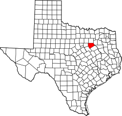
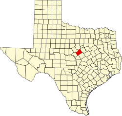
| Salado | Bell |  | x | x | 3,475 | 1,216 | 1,035 | Incorporated prior to the 2010 U.S. census. |
| San Elizario | El Paso | | x | x | x | 4,385 | 1,548 | Incorporated prior to the 2000 census |
| Santa Cruz | Starr | | x | x | 630 | x | x | Split for the 2010 U.S. census into two separate CDPs: El Chaparral and Santa Rosa. A new CDP of the same name (Santa Cruz CDP) was created that does not contain any part of the old CDP. |
| South San Pedro | Nueces |  | x | x | x | x | 1,688 | Appeared as an unincorporated community in the 1970 U.S. census (Pop 3,065). [9] Deleted prior to the 1990 U.S. census [7] |
| Spring Garden-Terra Verde | Nueces | | x | x | 693 | x | x | Split for the 2010 census into two separate CDPs: Spring Gardens CDP and Tierra Verde CDP |
| Study Butte-Terlingua | Brewster |  | x | x | 267 | x | x | Split for the 2010 U.S. census into two separate CDPs: Study Butte and Terlingua |
| Sullivan City | Hidalgo | | x | x | x | 2,371 | x | Incorporated prior to the 2000 census |
| Tanglewood Forest | Travis | | x | x | x | 2,941 | x | Absorbed into the city of Austin before the 2000 census |
| Town West | Fort Bend | | x | x | x | 6,166 | x | Dissolved prior to the 2000 census although remains an active community |
| Wimberley | Hays |  | x | x | | 2,403 | | Incorporated prior to the 2010 census |
| Windemere | Travis | | x | 1,037 | | 3,207 | | Absorbed into the city of Pflugerville before the 2020 census |
|