Blessing, Texas

Last updated

Blessing, Texas
CDP
Signs (22017676358).jpg
Downtown Blessing
TXMap-doton-Blessing.PNG
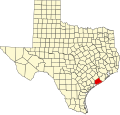
Location of Blessing, Texas
Matagorda County Blessing.svg
Coordinates: 28°52′27″N96°12′55″W / 28.87417°N 96.21528°W / 28.87417; -96.21528
Country United States
State Texas
County Matagorda
Area
  Total2.0 sq mi (5.3 km2)
  Land2.0 sq mi (5.3 km2)
  Water0.0 sq mi (0.0 km2)
Elevation
[1]
36 ft (11 m)
Population
 (2000)
  Total861
  Density423.8/sq mi (163.6/km2)
Time zone UTC-6 (Central (CST))
  Summer (DST) UTC-5 (CDT)
ZIP code
77419
Area code 361
FIPS code 48-08668 [2]
GNIS feature ID2407862 [1]

Blessing is a census-designated place (CDP) in Matagorda County, Texas, United States.

Contents

Blessing got its start when the railroad finally was extended to that point, and first settlers accepted the name "Blessing" after their first choice of "Thank God" was deemed unsuitable by postal officials. [3] A post office called Blessing has been in operation since 1903. [4]

Geography

According to the United States Census Bureau, the CDP has a total area of 2.0 square miles (5.2 km2), all land.

Demographics

As of the census [2] of 2000, there were 861 people, 300 households, and 230 families residing in the CDP. The population density was 423.8 inhabitants per square mile (163.6/km2). There were 334 housing units at an average density of 164.4 per square mile (63.5/km2). The racial makeup of the CDP was 72.01% White, 5.92% Black, 19.98% from other races, and 2.09% from two or more races. Hispanic or Latino of any race were 46.11% of the population.

There were 300 households, out of which 39.7% had children under the age of 18 living with them, 64.3% were married couples living together, 8.7% had a female householder with no husband present, and 23.3% were non-families. 20.7% of all households were made up of individuals, and 10.7% had someone living alone who was 65 years of age or older. The average household size was 2.87 and the average family size was 3.36.

In the CDP, the population was spread out, with 32.2% under the age of 18, 9.2% from 18 to 24, 26.5% from 25 to 44, 18.7% from 45 to 64, and 13.5% who were 65 years of age or older. The median age was 32 years. For every 100 females, there were 111.0 males. For every 100 females age 18 and over, there were 102.8 males.

The median income for a household in the CDP was $22,989, and the median income for a family was $27,431. Males had a median income of $25,833 versus $30,288 for females. The per capita income for the CDP was $10,980. About 26.0% of families and 24.2% of the population were below the poverty line, including 23.4% of those under age 18 and 32.0% of those age 65 or over.

Education

Blessing is served by the Tidehaven Independent School District.

The designated community college for Tidehaven ISD is Wharton County Junior College. [5]

Notable person

Related Research Articles

Selmont-West Selmont is a census-designated place (CDP) in Dallas County, Alabama, United States. At the 2020 census, the population was 2,158.

<span class="mw-page-title-main">Fort Benning South, Georgia</span> CDP in Georgia, United States

Fort Benning South is a former census-designated place (CDP) in Chattahoochee County, Georgia, United States. It is part of the Columbus, Georgia-Alabama Metropolitan Statistical Area. The population was 11,737 at the 2000 census. The area is now part of the consolidated city of Cusseta.

<span class="mw-page-title-main">Swartz, Louisiana</span> Census-designated place in Louisiana, United States

Swartz is a census-designated place (CDP) in Ouachita Parish in northeastern Louisiana, United States. The population was 4,354 at the 2020 United States Census. It is part of the Monroe Metropolitan Statistical Area.

<span class="mw-page-title-main">Chance, Maryland</span> CDP in Maryland, United States

Chance is a census-designated place (CDP) in Somerset County, Maryland, United States. The population was 377 at the 2000 census. It is included in the Salisbury, Maryland-Delaware Metropolitan Statistical Area.

<span class="mw-page-title-main">Toast, North Carolina</span> Census-designated place in North Carolina, United States

Toast is a census-designated place (CDP) in Surry County, North Carolina, United States, just west of Mount Airy. The population was 1,922 at the 2000 census.

<span class="mw-page-title-main">Leach, Oklahoma</span> Census-designated place in Oklahoma, United States

Leach is an unincorporated community and census-designated place (CDP) in southwestern Delaware County, Oklahoma, United States, along U.S. Route 412 and 412 Alternate. The population was 237 at the 2010 census.

Black Lick is a census-designated place (CDP) in Burrell Township, Indiana County, Pennsylvania, United States. The population was 1,462 at the 2010 census.

<span class="mw-page-title-main">Green Valley, South Dakota</span> CDP in South Dakota, United States

Green Valley is a census-designated place (CDP) and unincorporated community in Pennington County, South Dakota, United States. The population was 1,051 at the 2020 census.

<span class="mw-page-title-main">Cross Mountain, Texas</span> Census-designated place in Texas, United States

Cross Mountain is a census-designated place (CDP) in Bexar County, Texas, United States. The population was 3,944 at the 2020 census, an increase over the figure of 3,124 tabulated in 2010. It is part of the San Antonio Metropolitan Statistical Area.

<span class="mw-page-title-main">Liberty City, Texas</span> Census-designated place in Texas, United States

Liberty City is a census-designated place (CDP) in Gregg County, Texas, United States. The population was 2,721 at the 2020 census, an increase over the figure of 2,351 tabulated in 2010.

<span class="mw-page-title-main">Redwood, Texas</span> Unincorporated community in Texas, United States

Redwood is an unincorporated community and census-designated place (CDP) in Guadalupe County, Texas, United States. The population was 4,003 at the 2020 census, a decline from the figure of 4,338 tabulated in 2010. It is part of the San Antonio Metropolitan Statistical Area.

<span class="mw-page-title-main">Oak Trail Shores, Texas</span> Census-designated place in Texas, United States

Oak Trail Shores is an unincorporated community and census-designated place (CDP) in Hood County, Texas, United States. Its population was 2,755 at the 2010 census. It is part of the Granbury micropolitan area as well as the Dallas–Fort Worth metroplex.

<span class="mw-page-title-main">Markham, Texas</span> CDP in Texas, United States

Markham is a census-designated place (CDP) in Matagorda County, Texas, United States. Named in 1903 for Charles H. Markham, a railroad engineer for Southern Pacific, the town was founded in 1901 as Cortes. In 1914, it was a designated stop on the Texas and New Orleans Railroad.

<span class="mw-page-title-main">Radar Base, Texas</span> CDP in Texas, United States

Radar Base is a census-designated place (CDP) in Maverick County, Texas, United States. The population was 762 at the 2010 census.

<span class="mw-page-title-main">Lakeshore Gardens-Hidden Acres, Texas</span> CDP in Texas, United States

Lakeshore Gardens-Hidden Acres is a census-designated place (CDP) in San Patricio County, Texas, United States. The population was 504 at the 2010 census.

<span class="mw-page-title-main">Falcon Village, Texas</span> CDP in Texas, United States

Falcon Village is a census-designated place (CDP) in Starr County, Texas, United States. The population was 3 at the 2020 census.

Eagle Mountain is a former census-designated place (CDP) in Tarrant County, Texas, United States. The population was 6,599 at the 2000 census. It is now a part of the city of Saginaw.

<span class="mw-page-title-main">Lasara, Texas</span> CDP in Texas, United States

Lasara is a census-designated place (CDP) in Willacy County, Texas, United States. The population was 1,039 at the 2010 census.

<span class="mw-page-title-main">Ranchette Estates, Texas</span> CDP in Texas, United States

Ranchette Estates is a census-designated place (CDP) in Willacy County, Texas, United States. The population was 152 at the 2010 census.

<span class="mw-page-title-main">Woods Creek, Washington</span> CDP in Washington, United States

Woods Creek is a census-designated place (CDP) in Snohomish County, Washington, United States. The population was 5,589 at the 2010 census.

References

  1. 1 2 U.S. Geological Survey Geographic Names Information System: Blessing, Texas
  2. 1 2 "U.S. Census website". United States Census Bureau . Retrieved January 31, 2008.
  3. Moyer, Armond; Moyer, Winifred (1958). The origins of unusual place-names. Keystone Pub. Associates. p. 14.
  4. "Post Offices". Jim Forte Postal History. Retrieved January 5, 2017.
  5. Texas Education Code Sec. 130.211. WHARTON COUNTY JUNIOR COLLEGE DISTRICT SERVICE AREA.