Hawkinsville, Texas | |
|---|---|
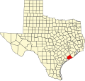
 Location of Hawkinsville in Texas  Hawkinsville, Texas (the United States) | |
| Coordinates: 28°53′16″N95°40′11″W / 28.88778°N 95.66972°W | |
| Country | United States |
| State | Texas |
| County | Matagorda |
| Founded | 1908 |
| Elevation | 16 ft (5 m) |
| Time zone | UTC-6 (Central (CST)) |
| • Summer (DST) | UTC-5 (CDT) |
| Zip code | 77414 |
| Area code | 361 |
| GNIS feature ID | 1379577 [1] |
Hawkinsville is an unincorporated community in Matagorda County, Texas, United States. [1]