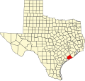
Collegeport, Texas

Last updated

Collegeport, Texas
USA Texas location map.svg
Red pog.svg
Location of Collegeport in Texas
Usa edcp location map.svg
Red pog.svg
Collegeport, Texas (the United States)
Coordinates: 28°43′31″N96°10′30″W / 28.72528°N 96.17500°W / 28.72528; -96.17500
Country United States
State Texas
County Matagorda
Founded1908
Elevation
[1]
10 ft (3 m)
Time zone UTC-6 (Central (CST))
  Summer (DST) UTC-5 (CDT)
Zip code
77428
Area code 361
FIPS code 48-48321
GNIS feature ID1379577 [1]
[2]

Collegeport is an unincorporated community in Matagorda County, Texas, United States. [1]

Contents

Founded on May 25, 1908, Collegeport is located on Tres Palacios Bay, which outlets into Matagorda Bay. Despite the community's name, there is no college in Collegeport, although the Texas State Technical College Marine Education Center is located across Tres Palacios Bay in Palacios, a 25-minute drive away. [3]

History

Early days

Collegeport was acquired through a 9,000-acre (36 km2) land purchase in 1908. Ranchers Jonathan Edward Pierce and Abel Brown Pierce sold their land to developer Burton D. Hurd. In the agreement Hurd would develop a town that would include a college and a port on the Trespalacios Bay.

Families began relocating to Collegeport, also called the "Town of Opportunity", after an advertising venture by Hurd that promoted the area's mild climate and the prospective farming lands. [4]

Growth

A year after the land purchase, Collegeport officially opened Hotel Collegeport and was home to a Federated Church consisting of 14 denominations. As of 1912, the town boasted a population of 496, with a Business Men's League of 90 members, an Episcopal Church, a Woman's Club with a roster of 86 members, and a brick school house that was under construction. Collegeport also claimed the first free public library in the county. Professor Will Travis opened the Gulf Coast University of Industrial Arts and proceeded to make deals with the pioneer orange growers from the north as part of a student labor program. A point of interest in Collegeport was its rail station and Pavilion that was perched over the bay. Collegeport's State Bank was located on what is now Highway 1095 with a capital of $10,000, with Abel B. Pierce as president and J.B. McCain as cashier.

The town also had two newspapers in print: the Collegeport Chronicle and the Collegeport New Era.

Collegeport had, at its peak, consisted of three hotels, a City State Bank, a telephone exchange, two hardware stores, a drugstore, two grocery stores, a barber shop, a planing mill, carpenters, blacksmiths, a boat building shop, doctors, a dentist, a veterinarian, a lawyer, a college, a high school, an ice house, a pavilion with boat services, and the Missouri Pacific Rail Station. [4]

Decline

Despite Hurd's claims of Collegeport's mild and warm climate, freezes began to plague the town and its farmers. In 1914, a heavy freeze passed through, killing most of the crops. The aftermath of the freeze brought a drought and a disease that killed off most of the livestock. Families suffered many losses through the freeze, causing a number of families to move away from Collegeport.

By 1935, the railroad depot was dismantled and rebuilt as the Mopac House. In 1961, Hurricane Carla moved in off the Gulf of Mexico, causing many of the original families to leave permanently. [4]

Present day

As of 2008 Collegeport has two churches, a community center, the Mopac House, a volunteer fire department, and a post office. [5]

Education

The area is within the Palacios Independent School District.

Climate

The climate in this area is characterized by hot, humid summers and generally mild to cool winters. According to the Köppen Climate Classification system, Collegeport has a humid subtropical climate, abbreviated "Cfa" on climate maps. [6]

Related Research Articles

<span class="mw-page-title-main">Matagorda County, Texas</span> County in Texas, United States

Matagorda County is a county located in the U.S. state of Texas. As of the 2020 census, the population was 36,255. Its county seat is Bay City, not to be confused with the larger Baytown in Harris and Chambers Counties. Matagorda County is named for the canebrakes that once grew along the coast.

<span class="mw-page-title-main">Brazoria, Texas</span> City in Texas, United States

Brazoria is a city in the U.S. state of Texas, in the Houston–The Woodlands–Sugar Land metropolitan area and Brazoria County. As of the 2020 census, the city population was 2,866.

<span class="mw-page-title-main">Bay City, Texas</span> City in Texas, United States

Bay City is a city and the county seat of Matagorda County, Texas, United States. The population was 17,614 at the 2010 census and 18,061 at the 2020 census.

<span class="mw-page-title-main">Palacios, Texas</span> City in Texas, United States

Palacios is a city in Matagorda County, Texas, United States. The population was 4,395 at the 2020 census.

<span class="mw-page-title-main">Boling-Iago, Texas</span> CDP in Texas, United States

Boling-Iago is a census-designated place (CDP) in Wharton County, Texas, United States. The population was 1,271 as of the 2000 United States Census. Boling-Iago is located along Farm to Market Road 1301 about 10 miles (16 km) southeast of Wharton, the county seat. Boling is located at the intersection of FM 1301 and Farm to Market Road 442, while the community of Iago is 1.5 miles (2.4 km) to the northeast at the intersection of FM 1301 and Farm to Market Road 1096. The Boling Independent School District received a Recognized ranking in 2010. The numerous pump jacks and oil tanks in the vicinity indicate that Boling and Iago lie atop oil-bearing rock formations.

<span class="mw-page-title-main">Matagorda Bay</span> Bay on the Texas coast, United States of America

Matagorda Bay is a large Gulf of Mexico bay on the Texas coast, lying in Calhoun and Matagorda counties and located approximately 80 miles (130 km) northeast of Corpus Christi, 143 miles (230 km) east-southeast of San Antonio, 108 miles (174 km) south-southwest of Houston, and 167 miles (269 km) south-southeast of Austin. It is one of seven major estuaries along the Gulf Coast of Texas and serves as the mouth of numerous streams, most notably the Lavaca and Colorado Rivers. The Texas seaport of Port Lavaca is located on the system's northwestern extension of Lavaca Bay. The city of Palacios is found on northeastern extension of Tres Palacios Bay, and Port O'Connor is located on the southwestern tip of the main bay's shore. The ghost town of Indianola, which was a major port before it was destroyed by two hurricanes in the late 19th century, is also found on the bay.

<span class="mw-page-title-main">South Texas</span> Region of the U.S. state of Texas

South Texas is a region of the U.S. state of Texas that lies roughly south of—and includes—San Antonio. The southern and western boundary is the Rio Grande, and to the east it is the Gulf of Mexico. The population of this region is about 4.96 million according to the 2017 census estimates. The southern portion of this region is often referred to as the Rio Grande Valley. The eastern portion along the Gulf of Mexico is also referred to as the Coastal Bend.

<span class="mw-page-title-main">Matagorda Island</span>

Matagorda Island, Spanish for "thick bush," is a 38-mile (61 km) long barrier island on the Texas Gulf coast, located approximately seven miles south of Port O'Connor, in the southernmost part of Calhoun County. The traditional homeland of the Karankawa people, the island is oriented generally northeast-southwest, with the Gulf of Mexico on the east and south, and Espiritu Santo Bay on the west and north. It is separated from San José Island to the south by Cedar Bayou, and is separated from the Matagorda Peninsula to the north by Pass Cavallo. It is accessible by boat only. It has a land area of 60.7 square miles.

<span class="mw-page-title-main">Area code 361</span> Area code in Texas, United States

North American area code 361 is a state of Texas telephone area code for numbers in the Corpus Christi area, the Coastal Bend and the Victoria Crossroads. It was created prior to February 13, 1999, in a split from area code 512.

Wadsworth is an unincorporated community in Matagorda County, Texas, United States. According to the Handbook of Texas, the community had an estimated population of 180 in 2000.

Mumford is an unincorporated community in Robertson County, Texas, United States. It is part of the Bryan-College Station metropolitan area. Its elevation is 259 feet (79 m), and it is located at 30°44′4″N96°33′54″W. Mumford is unincorporated and has no post office, with the ZIP code of 77867; the ZCTA for ZIP Code 77867 had a population of 176 at the 2000 census.

Wallisville is an unincorporated town in northern Chambers County, Texas, United States. According to the Handbook of Texas, the community had a population of 460 in 2000. It is located within the Greater Houston metropolitan area.

<span class="mw-page-title-main">Matagorda, Texas</span> Town in Texas, United States

Matagorda is a census-designated place in Matagorda County, Texas, United States. It is located near the mouth of the Colorado River on the upper Texas coast in the United States. In 2020, its population was 313. Matagorda is primarily a tourist town, with commercial and recreational fishing being the top industries. Approximately 23 miles (37 km) of the beach are accessible by vehicle and 35 additional miles are accessible only by boat. Matagorda is at the end of State Highway 60 and the beginning of Farm to Market Road 2031, which runs over the Intracoastal Waterway and south to the Gulf of Mexico.

<span class="mw-page-title-main">Maydelle, Texas</span> Unincorporated community in Texas, United States

Maydelle is a small unincorporated community in Cherokee County, Texas, United States. According to the Handbook of Texas, the community had a population of 250 in 2000. It is located within the Tyler-Jacksonville combined statistical area.

The Matagorda Peninsula is a narrow spit of land on the southeastern coast of Texas in the United States.

Pierce is an unincorporated community in Wharton County, Texas, United States. According to the Handbook of Texas, Pierce had an estimated population of 49 in 2000. It is located within the Greater Houston metropolitan area.

<span class="mw-page-title-main">Tres Palacios Bay</span>

Tres Palacios Bay is a northeastern extension of Matagorda Bay on the Texas coast in Matagorda County. It is fed by the Tres Palacios River. The city of Palacios is located on its shores. A channel that connects Palacios to the Intracoastal Waterway has been dredged through the bay.

Magnet is an unincorporated community in southeastern Wharton County, Texas, United States. The rural community is situated at the intersection of State Highway 60 (SH 60) and County Road 102, a short distance north of the Matagorda County line. Magnet is identified by road signs on SH 60 and by a tall broadcasting tower. According to the Handbook of Texas, the community had a population of 42 in 2000. it is located within the Greater Houston metropolitan area.

<span class="mw-page-title-main">Cane Belt Railroad</span>

The Cane Belt Railroad was chartered in the U.S. state of Texas in 1898. Formed by a group of businessmen from Eagle Lake, the short-line railroad was intended to bring the area's sugarcane to market. In 1902 a disagreement between two of the railroad's chief promoters proved deadly. By 1904 the line was in operation from Sealy to Matagorda on the Gulf of Mexico. That year the company's stock was bought by the Atchison, Topeka and Santa Fe Railway and the line continued operations under lease to the Gulf, Colorado and Santa Fe Railway starting in 1905. By the 1920s, the local sugarcane industry collapsed but the railroad was saved by the discovery of two nearby sulphur mines. In 1948, the Cane Belt was merged into the Gulf, Colorado and Santa Fe Railway. In the 1990s most of the original line was abandoned after the last sulphur mine closed. By 2013, only a small portion of the line south of Bay City was operating as part of the BNSF Railway.

<span class="mw-page-title-main">Estuaries of Texas</span> Estuaries on the Gulf coast of Texas

The U.S. state of Texas has a series of estuaries along its coast on the Gulf of Mexico, most of them bounded by the Texas barrier islands. Estuaries are coastal bodies of water in which freshwater from rivers mixes with saltwater from the sea. Twenty-one drainage basins terminate along the Texas coastline, forming a chain of seven major and five minor estuaries: listed from southwest to northeast, these are the Rio Grande Estuary, Laguna Madre, the Nueces Estuary, the Mission–Aransas Estuary, the Guadalupe Estuary, the Colorado–Lavaca Estuary, East Matagorda Bay, the San Bernard River and Cedar Lakes Estuary, the Brazos River Estuary, Christmas Bay, the Trinity–San Jacinto Estuary, and the Sabine–Neches Estuary. Each estuary is named for its one or two chief contributing rivers, excepting Laguna Madre, East Matagorda Bay, and Christmas Bay, which have no major river sources. The estuaries are also sometimes referred to by the names of their respective primary or central water bodies, though each also includes smaller secondary bays, inlets, or other marginal water bodies.

References

  1. 1 2 3 U.S. Geological Survey Geographic Names Information System: Collegeport, Texas
  2. "Collegeport Texas Zip Codes & Area Code - FIPS48321". postalcodelookup.ca. Retrieved February 25, 2008.[ permanent dead link ]
  3. Google Maps
  4. 1 2 3 Collegeport
  5. Collegeport Texas Gulf Coast
  6. Climate Summary for Collegeport, Texas

28°43′31″N96°10′30″W / 28.725267°N 96.174966°W / 28.725267; -96.174966