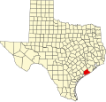
Van Vleck, Texas | |
---|---|
Coordinates: 29°01′44″N95°52′26″W / 29.02889°N 95.87389°W | |
Country | United States |
State | Texas |
County | Matagorda |
Area | |
• Total | 3.2 sq mi (8.2 km2) |
• Land | 3.2 sq mi (8.2 km2) |
• Water | 0.0 sq mi (0.0 km2) |
Elevation | 39 ft (12 m) |
Population | |
• Total | 1,923 |
• Density | 600/sq mi (230/km2) |
Time zone | UTC-6 (Central (CST)) |
• Summer (DST) | UTC-5 (CDT) |
ZIP code | 77482 |
Area code | 979 |
FIPS code | 48-75068 [3] |
GNIS feature ID | 2409500 [1] |
Van Vleck is a census-designated place (CDP) in Matagorda County, Texas, United States. The population total represents one of the few areas with positive growth in Matagorda County. The 2010 census showed a 25% increase with 1,844 people (versus 1,411 at the 2000 census). [4] Although near Bay City, the site of Van Vleck falls outside the ETJ of Bay City and is regulated by county police and county ordinance.
According to the United States Census Bureau, the CDP has a total area of 3.2 square miles (8.3 km2), all land.
Census | Pop. | Note | %± |
---|---|---|---|
2020 | 1,923 | — | |
U.S. Decennial Census [5] 1850–1900 [6] 1910 [7] 1920 [8] 1930 [9] 1940 [10] 1950 [11] 1960 [12] 1970 [13] 1980 [14] 1990 [15] 2000 [16] 2010 [17] |
The 2010 census showed a 25% increase with 1,844 people (versus 1,411 at the 2000 census). [4] Further census details are pending.
As of the census [3] of 2000, there were 1,411 people, 505 households, and 397 families residing in the CDP. The population density was 444.4 inhabitants per square mile (171.6/km2). There were 578 housing units at an average density of 182.1 per square mile (70.3/km2). The racial makeup of the CDP was 70.09% White, 17.51% African American, 0.35% Native American, 0.07% Asian, 8.72% from other races, and 3.26% from two or more races. Hispanic or Latino of any race were 25.66% of the population.
There were 505 households, out of which 36.4% had children under the age of 18 living with them, 61.4% were married couples living together, 13.7% had a female householder with no husband present, and 21.2% were non-families. 18.8% of all households were made up of individuals, and 7.1% had someone living alone who was 65 years of age or older. The average household size was 2.79 and the average family size was 3.18.
In the CDP, the population was spread out, with 29.2% under the age of 18, 8.4% from 18 to 24, 26.9% from 25 to 44, 23.3% from 45 to 64, and 12.1% who were 65 years of age or older. The median age was 37 years. For every 100 females, there were 97.6 males. For every 100 females age 18 and over, there were 94.7 males.
The median income for a household in the CDP was $30,810, and the median income for a family was $40,170. Males had a median income of $31,034 versus $14,438 for females. The per capita income for the CDP was $15,595. About 3.6% of families and 4.8% of the population were below the poverty line, including 2.1% of those under age 18 and 19.3% of those age 65 or over.
The local economy is mostly dependent on industrial work in plants at local Sweeny and Bay City. Many Bay City residents of higher income choose to live in the Van Vleck ISD. The Van Vleck area has benefitted greatly from the commercial development just minutes away on Highway 35 that have included several new restaurants, banks, hotels, and a new Walmart supercenter. [18]
The town site (town center) of Van Vleck has undergone slow but gradual improvements with a new post office, church, and a growingly popular restaurant that seats over 100 and is often full to capacity. [19] Also found in Van Vleck are several authentic Mexican/Hispanic restaurants serving the local Hispanic population and non-Hispanics alike, a doughnut store, a fireworks stand, several gas stations, and equipment rental/sales shops.
Although it is of similar size to other nearby towns such as West Columbia, Van Vleck has benefited from high traffic counts equal to or more than most areas of the larger and nearby Bay City. Traffic counts are three times the average for a comparable small town as reported by TXDOT. [20]
Over 10,000 cars pass through the town using the main arterial Texas Highway 35 that connects Bay City to Texas State Highway 288 and U.S. Route 59. [20] [21] The proximity to the growing potential of Bay City has been to Van Vleck's advantage. [21]
The town also has a small but well recognized ISD. [22]
In popular culture, Van Vleck is often mentioned for its small but well known small town features. [23] This is also the hometown of Charles Austin.
Van Vleck does not have any local hospitals. For regular and urgent care, residents rely on the nearby Sweeny Community Hospital and its multiple growing clinics. The strong demand has allowed Sweeney to add 1-2 new physicians a year despite the distance from other towns like Van Vleck. [24] Also, a closer and more often used center is Matagorda Regional Medical Center in Bay City. This facility was built in July 2009. Multiple physicians and specialties are available in Bay City.
The regional demand for healthcare is very strong as most doctors/hospitals are not currently drawn to the area. The revamped Matagorda Regional Medical Center has made strides in attracting new physicians and fulfilling the medical needs of the county. The hospital is working on developing a regional cancer center, and regularly runs at capacity. [25]
Van Vleck is served by the Van Vleck Independent School District. Van Vleck ISD has Academically State Recognized District and Schools. They have one-to-one digital learning, K-12 STEM Courses, K-12 Fine Arts Programs, 6-12 Pre-Advanced & Advanced Placement Classes, 9-12 Career & Technical Education Courses, and Duel Credit Classes. There is Van Vleck Elementary, E.Rudd Intermediate, O.H. Herman Middle School, and Van Vleck High School. The ISD has several recognitions [26] that include a National Blue Ribbon Elementary School. [27] The VVISD is the proud winner and record setter in numerous areas, including power lifting and jump sports, with first place in multiple years, including those set by Charles Austin. They have a state recognized FFA Chapter & Meat Processing Plant, State Recognized Fine Arts Programs and Outstanding UIL Sports Programs.
The local high school also is a recurring winner, and title holder, of multiple national sports competitions.
The designated community college for Van Vleck ISD is Wharton County Junior College. [28]
1830s Bailey Hardeman moved to this location in Matagorda county in the early part of the decade.
1836 Hardeman dies of fever just 1 mile south of Van Vleck in Caney Creek. Today this area is known as Caney but was called Caney Crossing during the days of the Republic of Texas. It is named for the Caney Creek
1840s The area became known as Hardeman's Post Office, after Bailey Hardeman, one of the signers of the Texas Declaration of Independence [29]
1900s The Texas and New Orleans railroad (T&NO rail road) brings rail lines to Matagorda County with a stop in Van Vleck. The T&NO was a subsidiary of Southern Pacific Railroad
1901 Town officially named for W. G. Van Vleck, a railroad official that served as the companies southern pacific superintendent. Several Hardeman families still live in Matagorda county and Van Vleck has a road named Hardeman road This year, the railroad connected Van Vleck to Wharton Tx.
1930 The town was originally northwest of its present location, but in 1930, when State Highway 35 was built, the town moved to the highway.
1952 First Baptist Church was built
1955 Methodist church built
1996 Charles Austin, of Van Vleck Texas wins olympic gold medal
2010 Population count expands by 25% from prior census of 2000
2010 First Physician clinic to serve the area, a Dermatology clinic opens its doors. [30]
2010 First Baptist Church of Van Vleck builds new church on 4 acre lot on Highway 35 just east of the Van Vleck High School Football Burl McKinney Stadium
2015 Van Vleck Lions Club is established.
Montgomery County is a county in the U.S. state of Texas. As of the 2020 U.S. census, the county had a population of 620,443. The county seat is Conroe. The county was created by an act of the Congress of the Republic of Texas on December 14, 1837, and is named for the town of Montgomery. Between 2000 and 2010, its population grew by 55%, the 24th-fastest rate of growth of any county in the United States. Between 2010 and 2020, its population grew by 36%. According to the U.S. Census Bureau, the estimated population is 711,354 as of July 1, 2023.
Matagorda County is a county located in the U.S. state of Texas. As of the 2020 census, the population was 36,255. Its county seat is Bay City, not to be confused with the larger Baytown in Harris and Chambers Counties. Matagorda County is named for the canebrakes that once grew along the coast.
Porter Heights is a census-designated place (CDP) in Montgomery County, Texas, United States. The population was 1,903 at the 2020 census.
La Rosita is a census-designated place (CDP) in Starr County, Texas, United States. The population was 85 at the 2010 census, a decline from the figure of 1,729 tabulated in 2000 due to the Census Bureau redefining the CDP. By the 2020 census, the population further decreased to 82.
Los Alvarez is a census-designated place (CDP) in Starr County, Texas, United States. The population was 303 at the 2010 census, a decline from the figure of 1,434 tabulated in 2000.
Roma Creek is a former census-designated place (CDP) in Starr County, Texas, United States. The population was 350 at the 2010 census down from 610 at the 2000 census.
Boling-Iago is a census-designated place (CDP) in Wharton County, Texas, United States. The population was 1,271 as of the 2000 United States Census. Boling-Iago is located along Farm to Market Road 1301 about 10 miles (16 km) southeast of Wharton, the county seat. Boling is located at the intersection of FM 1301 and Farm to Market Road 442, while the community of Iago is 1.5 miles (2.4 km) to the northeast at the intersection of FM 1301 and Farm to Market Road 1096. The Boling Independent School District received a Recognized ranking in 2010. The numerous pump jacks and oil tanks in the vicinity indicate that Boling and Iago lie atop oil-bearing rock formations.
Mission Bend is a census-designated place (CDP) around Texas State Highway 6 within the extraterritorial jurisdiction of Houston in Fort Bend and Harris counties in the U.S. state of Texas; Mission Bend is 4 miles (6 km) northwest of the city hall of Sugar Land and 20 miles (32 km) southwest of Downtown Houston. The population was 36,914 at the 2020 census.
Sargent is a small unincorporated community located in the eastern corner of Matagorda County, Texas, United States.
Matagorda is a census-designated place in Matagorda County, Texas, United States. It is located near the mouth of the Colorado River on the upper Texas coast in the United States. In 2020, its population was 313. Matagorda is primarily a tourist town, with commercial and recreational fishing being the top industries. Approximately 23 miles (37 km) of the beach are accessible by vehicle and 35 additional miles are accessible only by boat. Matagorda is at the end of State Highway 60 and the beginning of Farm to Market Road 2031, which runs over the Intracoastal Waterway and south to the Gulf of Mexico.
Caney is an unincorporated community in Matagorda County, Texas, United States.
Hawkinsville was a community in Matagorda County, Texas, United States. In 2018, there were a few homes nearby, several businesses one mile to the south, and the name appeared on maps, but one source refers to the place in the past tense, while a second source states that the town disappeared in the 1950s. The town site is between Cedar Lane and Sargent.
Paloma Creek is a master-planned community in northeastern Denton County, Texas, United States. The community is listed by the U.S. Census Bureau as two separate census-designated places, "Paloma Creek" and "Paloma Creek South", separated by U.S. Highway 380. As of the 2010 census, the Paloma Creek CDP had a population of 2,501, while Paloma Creek South had a population of 2,753. As of 2022, the HOA currently estimates the population to be approximately 20,000.
Barrera is a census-designated place (CDP) in Starr County, Texas, United States. It is a new CDP, formed from part of the Los Alvarez CDP prior to the 2010 census, with a population of 108.
JF Villarreal is a census-designated place (CDP) in Starr County, Texas, United States. It is a new CDP, formed from part of the North Escobares CDP prior to the 2010 census, with a population of 104.
Loma Vista is a census-designated place (CDP) in Starr County, Texas, United States. It is a new CDP, formed from part of the North Escobares CDP prior to the 2010 census, with a population of 160.
Moraida is a census-designated place (CDP) in Starr County, Texas, United States. It is a new CDP, formed from part of the North Escobares CDP prior to the 2010 census, with a population of 212.
Pena is an unincorporated community and census-designated place (CDP) in Starr County, Texas, United States. It was formed from part of the North Escobares CDP prior to the 2010 census, with a population of 118.
Deerwood is an unincorporated community and census-designated place (CDP) in Montgomery County, Texas, United States. It was first listed as a CDP prior to the 2020 census.
Hasima is a ghost town in Brazoria County, Texas, United States. It is located within the Greater Houston metropolitan area.
{{cite web}}
: CS1 maint: archived copy as title (link)Media related to Van Vleck, Texas at Wikimedia Commons