Sargent, Texas | |
|---|---|
 FM 457 swing bridge at the Intracoastal Waterway | |
 Interactive map of Sargent, Texas | |
| Coordinates: 28°50′06″N95°39′53″W / 28.83500°N 95.66472°W | |
| Country | |
| State | |
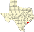
| Counties | Matagorda |
| Settled | 1834 |
| Named after | George Thomas Sargent [1] |
| Elevation | 3 ft (0.91 m) |
| Population (2015 [3] ) | |
• Total | 2,764 |
| Time zone | UTC-6 (CST) |
| • Summer (DST) | UTC-5 (CDT) |
| ZIP code | 77414 |
| Area code | 979 |
| FIPS code | 48321 |
| GNIS feature ID | 2805811 [2] |
| Farm Roads | |
Sargent is a small unincorporated community located in the eastern corner of Matagorda County, Texas, United States.
Contents
- History
- Geography
- Mitchell's Cut
- Preservation and development
- Government
- Demographics
- 2020 Census
- Education
- References
Sargent is a fishing, boating, and water sports community with a variable population, as most of its inhabitants are weekend commuters from larger cities such as Houston, Austin, and San Antonio. Sargent is on Farm to Market Road 457, five miles northwest of the Gulf of Mexico and twenty-four miles southeast of Bay City, in the eastern corner of Matagorda County. Approximately 501 permanent residents live in the Sargent area, while on holiday weekends the population may swell to as high as 5,000. The Sargent area, with its proximity to the Gulf of Mexico, East Matagorda Bay, the Intracoastal Waterway, and Caney Creek, is home base to many commercial and sport fisherman and shrimpers. Red drum (aka Redfish), Spotted Seatrout (aka Speckled Trout), Flounder, Blue Crab and shrimp are among the local favorites.
In addition to the local fishing, one of the unique appeals of Sargent is that many of the homesites are waterfront. Several developments, such as Caney Creek Estates, became established in the late 1950s and early 1960s. Following the widespread damage caused by Hurricane Carla in 1961, other developments such as Downey's Caney Creek, Caney Court, and Caney Creek Haven were established, including new waterfront lots created by the digging of manmade canals off Caney Creek and the Intracoastal Waterway.
Many waterfront lots were originally sold as campsites. Much of Sargent still has a fishing camp influence with many recreational vehicles present, although the majority of developed homesites now have permanent dwellings. Also prevalent are the many private wooden piers and docks, where modern recreational watercraft can be docked. Most piers also have electric fishing lights that allow night fishing, particularly during the colder months where Spotted Seatrout are known to feed as they migrate inland. [4]
Sargent Beach, where multiple rows of beach houses in the 1960s eventually succumbed to continual coastal erosion, has received more attention to preserve what remains of this relatively narrow island bordered by the Gulf of Mexico, the Intracoastal Waterway, Mitchell's Cut into East Matagorda Bay, and the San Bernard River far to the east.