Markham, Texas

Last updated

Markham, Texas
CDP
TXMap-doton-Markham.PNG
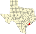
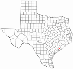
Location of Markham, Texas
Matagorda County Markham.svg
Coordinates: 28°57′46″N96°03′52″W / 28.96278°N 96.06444°W / 28.96278; -96.06444 [1]
Country United States
State Texas
County Matagorda
Area
  Total2.3 sq mi (5.9 km2)
  Land2.3 sq mi (5.9 km2)
  Water0.0 sq mi (0.0 km2)
Elevation
[1]
52 ft (16 m)
Population
 (2000)
  Total1,138
  Density497.5/sq mi (192.1/km2)
Time zone UTC-6 (Central (CST))
  Summer (DST) UTC-5 (CDT)
ZIP code
77456
Area code 979
FIPS code 48-46716 [2]
GNIS feature ID2408182 [1]

Markham is a census-designated place (CDP) in Matagorda County, Texas, United States. [1] Named in 1903 for Charles H. Markham, a railroad engineer for Southern Pacific (and later President of the Illinois Central Railroad), the town was founded in 1901 as Cortes. In 1914, it was a designated stop on the Texas and New Orleans Railroad.

Contents

Geography

According to the United States Census Bureau, the CDP has a total area of 2.3 square miles (6.0 km2), all land. Markham lies southwest, approximately 90 miles or 1+12-hour drive to downtown Houston.

Demographics

As of the census [2] of 2000, there were 1,138 people, 386 households, and 306 families residing in the CDP. The population density was 497.5 inhabitants per square mile (192.1/km2). There were 446 housing units at an average density of 195.0 per square mile (75.3/km2). The racial makeup of the CDP was 79.88% White, 9.93% African American, 0.09% Native American, 0.09% Asian, 7.91% from other races, and 2.11% from two or more races. Hispanic or Latino of any race were 36.03% of the population.

There were 386 households, out of which 39.9% had children under the age of 18 living with them, 61.7% were married couples living together, 11.9% had a female householder with no husband present, and 20.7% were non-families. 17.9% of all households were made up of individuals, and 7.0% had someone living alone who was 65 years of age or older. The average household size was 2.95 and the average family size was 3.35.

In the CDP, the population was spread out, with 31.5% under the age of 18, 8.3% from 18 to 24, 27.4% from 25 to 44, 22.1% from 45 to 64, and 10.7% who were 65 years of age or older. The median age was 33 years. For every 100 females, there were 96.2 males. For every 100 females age 18 and over, there were 90.9 males.

The median income for a household in the CDP was $41,900, and the median income for a family was $49,792. Males had a median income of $32,391 versus $20,938 for females. The per capita income for the CDP was $17,302. About 7.6% of families and 11.4% of the population were below the poverty line, including 15.3% of those under age 18 and 19.7% of those age 65 or over.

Education

Markham is served by the Tidehaven Independent School District.

The designated community college for Tidehaven ISD is Wharton County Junior College. [3]

Related Research Articles

<span class="mw-page-title-main">LeChee, Arizona</span> CDP in Coconino County, Arizona

LeChee is a census-designated place (CDP) in Coconino County, Arizona, United States. The population was 1,443 at the 2010 census.

<span class="mw-page-title-main">Clinton, Montana</span> CDP in Montana, United States

Clinton is a census-designated place (CDP) in Missoula County, Montana, United States. It is part of the 'Missoula, Montana Metropolitan Statistical Area'. The CDP was named for General Sir Henry Clinton. The population was 1,052 at the 2010 census, an increase from its population of 549 in 2000.

<span class="mw-page-title-main">Ramblewood, New Jersey</span> Populated place in Burlington County, New Jersey, US

Ramblewood is an unincorporated community and census-designated place (CDP) located within Mount Laurel in Burlington County, in the U.S. state of New Jersey. As of the 2010 United States Census, the CDP's population was 5,907.

Justice is a census-designated place (CDP) in Rogers County, Oklahoma, United States. The population was 1,311 at the 2000 census.

<span class="mw-page-title-main">Lakehills, Texas</span> CDP in Texas, United States

Lakehills is a census-designated place (CDP) in Bandera County, Texas, United States. The population was 5,150 at the 2010 census, making it the most populous place in Bandera County. It is part of the San Antonio Metropolitan Statistical Area.

<span class="mw-page-title-main">Bixby, Texas</span> CDP in Texas, United States

Bixby is a census-designated place (CDP) in Cameron County, Texas, United States. The population was 504 at the 2010 census. It is part of the Brownsville–Harlingen Metropolitan Statistical Area.

<span class="mw-page-title-main">Laureles, Texas</span> CDP in Texas, United States

Laureles is a census-designated place (CDP) in Cameron County, Texas, United States. The population was 3,692 at the 2010 census. It is part of the Brownsville–Harlingen Metropolitan Statistical Area. Laureles is an area between Los Fresnos and San Benito, Texas.

<span class="mw-page-title-main">Villa Pancho, Texas</span> Census-designated place in Texas, United States

Villa Pancho is a census-designated place (CDP) in Cameron County, Texas, United States. The population was 788 at the 2010 census, up from 386 at the 2000 census. It is part of the Brownsville–Harlingen Metropolitan Statistical Area.

<span class="mw-page-title-main">Yznaga, Texas</span> Census-designated place in Texas, United States

Yznaga is a census-designated place (CDP) in Cameron County, Texas, United States. The population was 91 at the 2010 census. It is part of the Brownsville–Harlingen Metropolitan Statistical Area.

<span class="mw-page-title-main">Stonewall, Texas</span> Census-designated place in Texas, United States

Stonewall is an unincorporated community and census-designated place (CDP) in Gillespie County, Texas, United States. The population was 525 at the 2010 census. It was named for Confederate General Thomas J. (Stonewall) Jackson, by Israel P. Nunez, who established a stage station near the site in 1870.

<span class="mw-page-title-main">McQueeney, Texas</span> Census-designated place in Texas, United States

McQueeney is an unincorporated community and census-designated place (CDP) in Guadalupe County, Texas, United States. The population was 2,545 at the 2010 census. It is part of the San Antonio Metropolitan Statistical Area.

Northcliffe is a former census-designated place (CDP) in Guadalupe County, Texas, United States. The population was 1,819 at the 2000 census. The area is now part of the city of Schertz and did not have its population recorded separately at the 2010 census. It is part of the San Antonio Metropolitan Statistical Area.

<span class="mw-page-title-main">Blessing, Texas</span> CDP in Texas, United States

Blessing is a census-designated place (CDP) in Matagorda County, Texas, United States.

<span class="mw-page-title-main">Lakeshore Gardens-Hidden Acres, Texas</span> CDP in Texas, United States

Lakeshore Gardens-Hidden Acres is a census-designated place (CDP) in San Patricio County, Texas, United States. The population was 504 at the 2010 census.

<span class="mw-page-title-main">Inez, Texas</span> CDP in Texas, United States

Inez is a census-designated place (CDP), on Interstate 69/U.S. Highway 59 fifteen miles northeast of Victoria, Texas, near the Jackson County, Texas line in Victoria County, Texas, United States. The population was 2,098 at the 2010 census. It is included in the Victoria, Texas, Metropolitan Statistical Area. The name is that of a daughter of a railroad developer.

Larga Vista is a former census-designated place (CDP) in Webb County, Texas, United States. The population was 742 at the 2000 census. Larga Vista lost its census-designated place status in 2010 because it became surrounded by Laredo, Texas. A CDP may not be located, either partially or entirely, within an incorporated place or another CDP. Today, Larga Vista is considered a Laredo neighborhood.

<span class="mw-page-title-main">Hungerford, Texas</span> CDP in Texas, United States

Hungerford is a census-designated place (CDP) in northeastern Wharton County, Texas, United States. U.S. Route 59, Texas State Highway 60, and Farm to Market Road 1161 intersect in the community. The Kansas City Southern Railway Co. passes through Hungerford. The population was 347 at the 2010 census. It is located on what in the 1820s was part of colonist Alexander Jackson's land grant north of George E. Quinan's home. By the 1870s, the Quinan settlement grew up a short distance away, but its residents moved to the new town when the railroad came through Hungerford.

<span class="mw-page-title-main">Lake Cavanaugh, Washington</span> CDP in Washington, United States

Lake Cavanaugh is a census-designated place (CDP) in Skagit County, Washington, United States. The population was 167 at the 2010 census. It is included in the Mount Vernon–Anacortes, Washington Metropolitan Statistical Area.

<span class="mw-page-title-main">Rowley (CDP), Massachusetts</span> Census-designated place in Massachusetts, United States

Rowley is a census-designated place (CDP) in the town of Rowley in Essex County, Massachusetts, United States. The population was 1,416 at the 2010 census.

<span class="mw-page-title-main">Suffield Depot, Connecticut</span> Census-designated place in Connecticut, United States

Suffield Depot is the name of a census-designated place (CDP) corresponding to the village of Suffield, the primary settlement of the town of Suffield, Connecticut, in Hartford County. The population of the CDP was 1,325 as of the 2010 census.

References

  1. 1 2 3 4 U.S. Geological Survey Geographic Names Information System: Markham, Texas
  2. 1 2 "U.S. Census website". United States Census Bureau . Retrieved January 31, 2008.
  3. Texas Education Code Sec. 130.211. WHARTON COUNTY JUNIOR COLLEGE DISTRICT SERVICE AREA.