Bledsoe, Texas

Last updated

Bledsoe, Texas
USA Texas location map.svg
Red pog.svg
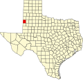
Bledsoe
Location within the state of Texas
Usa edcp location map.svg
Red pog.svg
Bledsoe
Bledsoe (the United States)
Coordinates: 33°37′09″N103°01′17″W / 33.61917°N 103.02139°W / 33.61917; -103.02139
Country United States
State Texas
County Cochran
Population
 (1990 est.)
  Total125
Time zone UTC-6 (Central (CST))
  Summer (DST) UTC-5 (CDT)
ZIP codes
79314
Area code 806
FIPS code 48-08644

Bledsoe is an unincorporated community in western Cochran County, Texas, United States, located near the New Mexico border. It is approximately 68 miles west of Lubbock. As of the 1990 US Census, the town had a population of 125.

Contents

History

Bledsoe was founded in 1925 as the terminus of the Panhandle and Santa Fe Railway, and named for Samuel T. Bledsoe, the line's president. [1] [2] The town gained its original prosperity through its function as a cattle-shipping station, and reached its greatest population of 400 in 1930. The Great Depression had dire effect on the community and throughout the remainder of the 20th century the population continued to dwindle; the last recorded figure put the 1990 population at 125.

Education

It is within the Whiteface Consolidated Independent School District. The former Bledsoe Independent School District merged into Whiteface CISD on July 1, 1996. [3]

See also

Related Research Articles

<span class="mw-page-title-main">Cochran County, Texas</span> County in Texas, United States

Cochran County is a county located in the U.S. state of Texas. As of the 2020 census, its population was 2,547. The county seat is Morton. The county was created in 1876 and later organized in 1924. It is named for Robert E. Cochran, a defender of the Alamo.

<span class="mw-page-title-main">Megargel, Texas</span> Town in Texas, United States

Megargel is a town in Archer County, Texas, United States. It is part of the Wichita Falls, Texas metropolitan statistical area. Its population was 203 at the 2010 census. The town is named for Roy C. Megargel, the president of the railroad that developed the town.

<span class="mw-page-title-main">Gallatin, Texas</span> City in Texas, United States

Gallatin is a city in Cherokee County, Texas, in the United States, with a 2020 U.S. census-tabulated population of 321.

<span class="mw-page-title-main">Whiteface, Texas</span> Community in Texas, United States

Whiteface is a town in Cochran County, Texas, United States. The population was 449 at the 2010 census.

<span class="mw-page-title-main">Lancaster, Texas</span> City in Texas, United States

Lancaster is a city in Dallas County, Texas, United States. Its population was 41,275 according to the 2020 census. Founded in 1852 as a frontier post, Lancaster is one of Dallas County's earliest settlements. Today, it is a suburban community located in the Dallas–Fort Worth metroplex, about 15 mi (24 km) south of downtown Dallas.

<span class="mw-page-title-main">Kendleton, Texas</span> City in Texas, United States

Kendleton is a city in western Fort Bend County, Texas southwest of Sugar Land, Texas. It was established by emancipated slaves after the American Civil War. The population was 380 at the 2010 census, down from 466 at the 2000 census. As of 2011, Darryl Humphrey was the mayor of the city.

<span class="mw-page-title-main">Lakeview, Texas</span> Town in Texas, United States

Lakeview is a town in Hall County, Texas, United States. The population was 107 at the 2010 census, down from 152 at the 2000 census.

<span class="mw-page-title-main">Highlands, Texas</span> Census-designated place in Texas, United States

Highlands is a census-designated place (CDP) located along the Union Pacific Railroad, north of Interstate 10 and west of Farm to Market Road 2100, in an industrialized area of unincorporated Harris County, Texas, United States. The population was 8,612 at the 2020 census.

<span class="mw-page-title-main">Linn, Texas</span> Census-designated place in Texas

Linn, formerly San Manuel-Linn, is an unincorporated area and census-designated place (CDP) in Hidalgo County, Texas, United States. The population was 801 at the 2010 census, down from 958 at the 2000 census. It is part of the McAllen–Edinburg–Mission Metropolitan Statistical Area.

<span class="mw-page-title-main">Winfield, Texas</span> City in Texas, United States

Winfield is a small city in Titus County, Texas, United States. The population was 524 at the 2010 census.

Whiteface Consolidated Independent School District is a public school district based in Whiteface, Texas (USA).Located in Cochran County, the district extends into small portions of Hockley and Lamb counties. It also serves Bledsoe.

Talpa is an unincorporated community in Coleman County, Texas, United States. According to the Handbook of Texas, the community had an estimated population of 127 in 2000.

<span class="mw-page-title-main">Texas State Highway 125</span>

State Highway 125 (SH 125) is a state highway in the U.S. state of Texas maintained by the Texas Department of Transportation (TxDOT). The 28-mile (45 km) highway begins at the New Mexico state line southwest of Bledsoe, and passes through Bledsoe where it turns east intersecting SH 214 before terminating at SH 114. The highway is located entirely within Cochran County, and is numerically continuous with New Mexico State Road 125 which it meets at the state line and connects the highway to Tatum, NM. The highway has brief concurrencies with SH 214 in Lehman and Farm to Market Road 1780 in Whiteface.

Pipe Creek is an unincorporated community in Bandera County, Texas, United States. According to the Handbook of Texas, it had a population of approximately 66 in 1990. It is part of the San Antonio Metropolitan Statistical Area.

<span class="mw-page-title-main">Crabb, Texas</span> Unincorporated community in Texas, United States

Crabb is a small unincorporated community in Fort Bend County, Texas, United States. Crabb is located along Farm to Market Road 762 and the BNSF Railroad southeast of Richmond, Texas. The Crabb road sign is located west of the intersection of Crabb River Road and Farm to Market Road 2759 and FM 762. The Zion Hill Baptist Church, a Fort Bend County Road and Bridge facility, the Brazos Village and Brazos Gardens subdivisions, several businesses and an abandoned grain elevator are in the area.

Pottsville is an unincorporated community located in western Hamilton County in Central Texas.

Old Glory is an unincorporated community in Stonewall County, Texas, United States. The community has an estimated population of 100.

<span class="mw-page-title-main">Pep, Texas</span> Unincorporated community in Texas, United States

Pep is an unincorporated community in northwestern Hockley County, Texas, United States, situated along Farm to Market Road 303. It is located on the high plains of the Llano Estacado just to the west of the historic Yellow House Ranch. Pep has a post office with the ZIP code 79353.

<span class="mw-page-title-main">Needmore, Bailey County, Texas</span> Unincorporated community in Texas, United States

Needmore is an unincorporated community in Bailey County, Texas, United States.

<span class="mw-page-title-main">Becton, Texas</span> Unincorporated community in Texas, United States

Becton is an unincorporated community in northeast Lubbock County, about 18 mi (29 km) northeast of Lubbock, Texas. This small rural community lies on the high plains of the Llano Estacado in West Texas.

References

  1. Bledsoe, Texas from the Handbook of Texas Online Retrieved 2008-05-19.
  2. "Bledsoe, Texas". TexasEscapes.com. August 31, 2006. Retrieved May 19, 2008.
  3. "CONSOLIDATIONS, ANNEXATIONS AND NAME CHANGES FOR TEXAS PUBLIC SCHOOLS" (PDF). Texas Education Agency. September 10, 2018. Retrieved October 30, 2019.