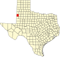
Griffith, Cochran County, Texas | |
|---|---|
 Griffith  Griffith | |
| Coordinates: 33°45′29″N103°1′11″W / 33.75806°N 103.01972°W | |
| Country | United States |
| State | Texas |
| County | Cochran |
| Elevation | 3,944 ft (1,202 m) |
| Time zone | UTC-6 (Central (CST)) |
| • Summer (DST) | UTC-5 (CDT) |
| Area code | 806 |
| GNIS feature ID | 1379863 [1] |
Griffith is an unincorporated community in Cochran County, Texas, United States. [1] According to the Handbook of Texas, the community had a population of 12 in 2000.