Samnorwood, Texas

Last updated

Samnorwood, Texas
TXMap-doton-Samnorwood.PNG
Location of Samnorwood, Texas
Collingsworth County Samnorwood.svg
Coordinates: 35°03′00″N100°16′53″W / 35.05000°N 100.28139°W / 35.05000; -100.28139
Country United States
State Texas
County Collingsworth
Area
  Total1.6 sq mi (4.2 km2)
  Land1.6 sq mi (4.2 km2)
  Water0.0 sq mi (0.0 km2)
Elevation
[1]
2,195 ft (669 m)
Population
 (2010)
  Total51
  Density31/sq mi (12.0/km2)
Time zone UTC-6 (Central (CST))
  Summer (DST) UTC-5 (CDT)
ZIP code
79077
Area code 806
FIPS code 48-64448 [2]
GNIS feature ID2409245 [1]

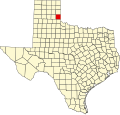
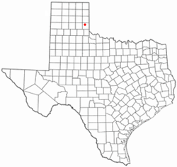
Samnorwood is a census-designated place (CDP) in Collingsworth County, Texas, United States. It was designated in or after 1980. The population was 51 at the 2010 census, [3] up from 39 at the 2000 census. The hamlet of Samnorwood, for which the CDP was named, is located within the CDP.

Contents

Geography

Samnorwood is located in north-central Collingsworth County and is 16 miles (26 km) north of Wellington, the county seat, and 14 miles (23 km) south of Shamrock.

According to the United States Census Bureau, the Samnorwood CDP has a total area of 1.6 square miles (4.2 km2), all land. [3]

Demographics

As of the census [2] of 2000, there were 39 people, 16 households, and 12 families residing in the CDP. The population density was 24.0 people per square mile (9.2/km2). There were 20 housing units at an average density of 12.3/sq mi (4.7/km2). The racial makeup of the CDP was 87.18% White, 5.13% African American, 7.69% from other races. Hispanic or Latino of any race were 25.64% of the population.

There were 16 households, out of which 31.3% had children under the age of 18 living with them, 56.3% were married couples living together, 18.8% had a female householder with no husband present, and 25.0% were non-families. 25.0% of all households were made up of individuals, and 12.5% had someone living alone who was 65 years of age or older. The average household size was 2.44 and the average family size was 2.92.

In the CDP, the population was spread out, with 20.5% under the age of 18, 15.4% from 18 to 24, 15.4% from 25 to 44, 25.6% from 45 to 64, and 23.1% who were 65 years of age or older. The median age was 45 years. For every 100 females, there were 105.3 males. For every 100 females age 18 and over, there were 106.7 males.

The median income for a household in the CDP was $38,750, and the median income for a family was $38,750. Males had a median income of $58,125 versus $40,417 for females. The per capita income for the CDP was $30,690. There were no families and 2.4% of the population living below the poverty line, including no under eighteens and none of those over 64.
Education

Samnorwood is served by the Wellington Independent School District as of July 1, 2012. Prior to that date it was served by the Samnorwood Independent School District. [4]

Related Research Articles

<span class="mw-page-title-main">Collingsworth County, Texas</span> County in Texas, United States

Collingsworth County is a county in the U.S. state of Texas. As of the 2020 census, its population was 2,652. Its county seat is Wellington. The county was created in 1876 and later organized in 1890. It is named for James Collinsworth, a signer of the Texas Declaration of Independence and first chief justice of the Republic of Texas. Collingsworth County was one of 30 prohibition, or entirely dry, counties in Texas, but a vote in 2017 changed this law.

<span class="mw-page-title-main">Ferry, Alaska</span> Census-designated place in Alaska, United States

Ferry is a census-designated place (CDP) in Denali Borough, Alaska, United States. The population was 17 at the 2020 census, down from 33 in 2010.

<span class="mw-page-title-main">Northway Junction, Alaska</span> CDP in Alaska, United States

Northway Junction was a census-designated place (CDP) in Southeast Fairbanks Census Area, Alaska, United States. It was merged with Northway CDP prior to the 2020 Census. The population was 54 at the 2010 census, down from 72 in 2000.

<span class="mw-page-title-main">Kicking Horse, Montana</span> Census-designated place in Montana, United States

Kicking Horse is a census-designated place (CDP) in Lake County, Montana, United States. The population was 286 at the 2010 census, up from 80 in 2000.

Plain View is a census-designated place (CDP) in Sampson County, North Carolina, United States. The population was 1,923 at the 2020 U.S. census.

<span class="mw-page-title-main">Dodge, Oklahoma</span> Census-designated place in Oklahoma, United States

Dodge is an unincorporated community and census-designated place (CDP) in Delaware County, Oklahoma, United States. The population was 115 at the 2010 census, up from the figure of 96 recorded in 2000.

Sour John is a census-designated place (CDP) in Muskogee County, Oklahoma, United States. The population was 61 at the 2000 census.

Timber Hills is an unincorporated community and census-designated place (CDP) in Lebanon County, Pennsylvania, United States. The population was 360 at the 2010 census.

Oswego is a census-designated place (CDP) in Sumter County, South Carolina, United States. The population was 95 at the 2000 census. It is included in the Sumter, South Carolina Metropolitan Statistical Area.

<span class="mw-page-title-main">Encino, Texas</span> Census-designated place in Texas, United States

Encino is a census-designated place (CDP) in Brooks County, Texas, United States. It is 18 miles (29 km) south of the county seat of Falfurrias. The population was 143 at the 2010 census. It is the site of a United States Border Patrol interior checkpoint.

<span class="mw-page-title-main">Dodson, Texas</span> Town in Texas, United States

Dodson is a town in Collingsworth County, Texas, United States. The population was 109 at the 2010 census.

<span class="mw-page-title-main">Quail, Texas</span> Census-designated place in Texas, United States

Quail is a rural small town and census-designated place in Collingsworth County, Texas, United States. The population was 19 at the 2010 census, down from 33 at the 2000 census. The town has a general store, a small hotel and an income tax service.

<span class="mw-page-title-main">Lipscomb, Texas</span> Census-designated place in Texas, United States

Lipscomb is an unincorporated community and census-designated place (CDP) in Lipscomb County, Texas, United States. It is the Lipscomb county seat. The population was 37 at the 2010 census.

<span class="mw-page-title-main">Box Canyon-Amistad, Texas</span> Former CDP in Texas, United States

Box Canyon-Amistad was a census-designated place (CDP) in Val Verde County, Texas, United States. The population was 76 at the 2000 census. For the 2010 census, the area was delineated as two separate CDPs, Amistad and Box Canyon.

<span class="mw-page-title-main">Garden, Utah</span> CDP in Utah, United States

Garden is a census-designated place (CDP) in Rich County, Utah, United States. It includes the southernmost subdivision of Garden City at its northeast and the hamlet of Meadowville at its southeast; otherwise it is farmland. The population was 181 at the 2010 census.

<span class="mw-page-title-main">Blyn, Washington</span> Census-designated place in Washington, United States

Blyn is a census-designated place (CDP) in Clallam County, Washington, United States. The population was 101 at the 2010 census, down from 162 at the 2000 census. It is located near the city of Sequim on the shores of Sequim Bay. The area includes the Jamestown S'Klallam Indian Reservation, established in 1874 by the Jamestown S'Klallam Tribe, who named their community Jamestown after their leader; Lord James Balch.

<span class="mw-page-title-main">Banks Lake South, Washington</span> Census-designated place in Washington, United States

Banks Lake South is a census-designated place (CDP) in Grant County, Washington, United States. The population was 174 at the 2010 census.

<span class="mw-page-title-main">Centerville, Washington</span> Census-designated place in Washington, United States

Centerville is an unincorporated community and census-designated place (CDP) in Klickitat County, Washington, United States. Settled in 1877 by Albert J. Brown, the population was 112 at the 2010 census.

<span class="mw-page-title-main">Garrett, Washington</span> CDP in Washington, United States

Garrett is a census-designated place (CDP) in Walla Walla County, Washington, United States. The population was 1,419 at the 2010 census.

<span class="mw-page-title-main">Owl Creek, Wyoming</span> CDP in Wyoming, United States

Owl Creek is a (CDP) in Hot Springs County, Wyoming, United States. The population was five at the 2010 Census.

References

  1. 1 2 U.S. Geological Survey Geographic Names Information System: Samnorwood, Texas
  2. 1 2 "U.S. Census website". United States Census Bureau . Retrieved January 31, 2008.
  3. 1 2 "Geographic Identifiers: 2010 Census Summary File 1 (G001): Samnorwood CDP, Texas". U.S. Census Bureau, American Factfinder. Archived from the original on February 13, 2020. Retrieved August 4, 2015.
  4. "CONSOLIDATIONS, ANNEXATIONS AND NAME CHANGES FOR TEXAS PUBLIC SCHOOLS." Texas Education Agency. Updated August 1, 2016. Retrieved on February 23, 2017.