Dodson, Texas

Last updated

Dodson, Texas
TXMap-doton-Dodson.PNG
Location of Dodson, Texas
Collingsworth County Dodson.svg
Coordinates: 34°45′55″N100°01′14″W / 34.76528°N 100.02056°W / 34.76528; -100.02056
CountryUnited States
State Texas
County Collingsworth
Government
  Type Mayor-council government
  MayorSteve Kane [1]
Area
[2]
  Total0.61 sq mi (1.58 km2)
  Land0.61 sq mi (1.58 km2)
  Water0.00 sq mi (0.00 km2)
Elevation
[3]
1,791 ft (546 m)
Population
 (2010)
  Total109
  Estimate 
(2019) [4]
107
  Density175.41/sq mi (67.74/km2)
Time zone UTC-6 (Central (CST))
  Summer (DST) UTC-5 (CDT)
ZIP code
79230
Area code 806
FIPS code 48-20716 [5]
GNIS feature ID2412437 [3]

Dodson is a town in Collingsworth County, Texas, United States. The population was 109 at the 2010 census. [6]

Contents

Geography

Dodson is located near the southeastern corner of Collingsworth County. Dodson is 1.25 miles (2.01 km) west of the 100th meridian west (the Texas-Oklahoma border), one mile (1.6 km) north of the Childress County line, 13 miles (21 km) southeast of Wellington and 12 miles (19 km) northwest of Hollis, Oklahoma.

According to the U.S. Census Bureau, Dodson has a total area of 0.62 square miles (1.6 km2), all land. [6]

Demographics

Historical population
CensusPop.Note
1930 426
1940 357−16.2%
1950 336−5.9%
1960 308−8.3%
1970 239−22.4%
1980 185−22.6%
1990 113−38.9%
2000 1151.8%
2010 109−5.2%
2019 (est.)107 [4] −1.8%
U.S. Decennial Census [7]

As of the census [5] of 2000, there were 115 people, 53 households, and 34 families residing in the town. The population density was 189.8 inhabitants per square mile (73.3/km2). There were 65 housing units at an average density of 107.3 per square mile (41.4/km2). The racial makeup of the town was 84.35% White, 2.61% Native American, 0.87% Asian, 9.57% from other races, and 2.61% from two or more races. Hispanic or Latino of any race were 13.04% of the population.

There were 53 households, out of which 24.5% had children under the age of 18 living with them, 56.6% were married couples living together, 3.8% had a female householder with no husband present, and 34.0% were non-families. 32.1% of all households were made up of individuals, and 13.2% had someone living alone who was 65 years of age or older. The average household size was 2.17 and the average family size was 2.69.

In the town, the age distribution of the population shows 19.1% under the age of 18, 8.7% from 18 to 24, 18.3% from 25 to 44, 38.3% from 45 to 64, and 15.7% who were 65 years of age or older. The median age was 46 years. For every 100 females, there were 121.2 males. For every 100 females age 18 and over, there were 121.4 males.

The median income for a household in the town was $15,625, and the median income for a family was $21,250. Males had a median income of $19,063 versus $16,250 for females. The per capita income for the town was $11,213. There were 31.0% of families and 32.5% of the population living below the poverty line, including 18.2% of under eighteens and 48.3% of those over 64.

History

The city of Dodsonville was founded on July 1, 1910, by Frank Kell of Wichita Falls. The wealthy entrepreneur Kell was an important figure in promotion of the Wichita Falls and Northwestern Railway, and the city was established as a stop on the Wellington Branch of the railroad. Elmore Dodson, a local pioneer and rancher, donated the 200-acre (0.81 km2) town site to ensure the railroad's passing through the southeastern part of the county. Other town sites had been proposed, including the community of Arlie located 5 miles (8 km) southwest of Dodson, but the grant given by Mr. Dodson sealed the railroad's passage through southeastern Collingsworth County. In return, the new city was named for Dodson. A celebration was held on August 29, 1910, to commemorate the town's establishment. The gala celebration, complete with a picnic, marked the town's formal opening, and was attended by a trainload of people from Oklahoma.

N. L. Jones built the first residence and opened a cotton gin. The first store was operated by William T. McDowell, who was also the first postmaster. R. H. Miller established a hotel, and the town added a bank, a telephone exchange, and two churches. Three newspapers, all called the Dodsonville News, were published intermittently by three different men between January 1911 and December 1915. A fourth paper, the Dodsonville Messenger, was printed from 1928 until 1930. School was sometimes held in the churches until a permanent schoolhouse was completed in the fall of 1912; the previous school was located 3 miles (5 km) northwest of town.

Dodson was incorporated in the 1920s and by 1930 had 25 businesses and a population of 426. Public Works Administration appropriations enabled the town to install a $52,000 water system during the 1930s, and a volunteer fire department was organized. In 1947 a new consolidated high school served neighboring communities in Oklahoma as well as Dodson. The population dropped to 357 in 1940; this decline, attributed to decreased agricultural activity and a renewed interest in cattle raising, continued into the 1990s. In 1984 Dodson remained the county's second largest town, with a population of 185, one business, and four churches. In 1990 the population was 113, and in 2000 it was 115.

The city's name was officially changed from "Dodsonville" to "Dodson" on July 1, 1937.

Dodson's first permanent school building was completed in 1912. This school was used until 1947 when a new school was constructed. Dodson High School continued to educated students until 1969 when the school board voted to consolidate the Dodson School District with that of Wellington. The elementary and junior high schools continued to operate until 1972. The Dodson School was destroyed in the late 1980s or early 1990s.

Economy

Dodson serves as an agricultural center for southeastern Collingsworth County, northeastern Childress County, Texas, and western Harmon County, Oklahoma.

Cotton, wheat, sorghum, and peanuts are the primary crops of the region. There are also a large number of small ranching operations in the surrounding area.

Tri-County Co-Op operates a cotton gin located in Dodson that serves the surrounding tri-county area. It is one of the town's few businesses.

Education

Public education in Dodson is provided by the Wellington Independent School District.

Related Research Articles

<span class="mw-page-title-main">Hardeman County, Texas</span> County in Texas, United States

Hardeman County is a county located in the U.S. state of Texas. As of the 2020 census, its population was 3,549. The county seat and largest city is Quanah. The county was created in 1858 and later organized in 1884. It is named for two brothers, Bailey Hardeman and Thomas Jones Hardeman, early Texas politicians and legislators. Hardeman County was one of 46 prohibition or entirely dry counties in the state of Texas until November 2006, when voters approved referendums to permit the legal sale of alcoholic beverages for on- and off-premises consumption.

<span class="mw-page-title-main">Hall County, Texas</span> County in Texas, United States

Hall County is a county located in the U.S. state of Texas. As of the 2020 census, the population is 2,825. Its county seat is Memphis. The county was created in 1876 and later organized in 1890. It is named for Warren D. C. Hall, a secretary of war for the Republic of Texas.

<span class="mw-page-title-main">Collingsworth County, Texas</span> County in Texas, United States

Collingsworth County is a county in the U.S. state of Texas. As of the 2020 census, its population was 2,652. Its county seat is Wellington. The county was created in 1876 and later organized in 1890. It is named for James Collinsworth, a signer of the Texas Declaration of Independence and first chief justice of the Republic of Texas. Collingsworth County was one of 30 prohibition, or entirely dry, counties in Texas, but a vote in 2017 changed this law.

<span class="mw-page-title-main">Childress County, Texas</span> County in Texas, United States

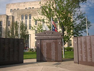
Childress County is a county located in the U.S. state of Texas. As of the 2020 census, its population was 6,664. The county seat is Childress. The county was created in 1876 and later organized in 1887. It is named for George Campbell Childress, the author of the Texas Declaration of Independence.

<span class="mw-page-title-main">Harmon County, Oklahoma</span> County in Oklahoma, United States

Harmon County is a county in the southwest corner of the U.S. state of Oklahoma. As of the 2020 Census, the population was 2,488, making it the second-least populous county in Oklahoma, behind only Cimarron County. It has lost population in every census since 1930. The county seat is Hollis.

<span class="mw-page-title-main">Covington, Oklahoma</span> Town in Oklahoma, United States

Covington is a town in Garfield County, Oklahoma, United States. The population was 477 at the 2020 census.

<span class="mw-page-title-main">Douglas, Oklahoma</span> Town in Oklahoma, United States

Douglas is a town in Garfield County, Oklahoma, United States. The population was 32 at the 2010 census.

<span class="mw-page-title-main">Wynnewood, Oklahoma</span> City in Oklahoma, United States

Wynnewood is a city in Garvin County, Oklahoma, United States. It is 67 miles (108 km) south of Oklahoma City. The population was 2,212 at the 2010 U.S. census, compared to 2,367 in 2000. Located in what was then the Chickasaw Nation of Indian Territory, it began as a village called "Walner" in 1886, on the proposed route of the Gulf, Colorado and Santa Fe Railway. Railroad workers from Pennsylvania named the community for Wynnewood, a community outside of Philadelphia. The name became official on April 6, 1887.

<span class="mw-page-title-main">Stuart, Oklahoma</span> Town in Oklahoma, United States

Stuart is a town in southeastern Hughes County, Oklahoma, United States. The population was 180 at the 2010 census, down from 220 in 2000.

<span class="mw-page-title-main">Waurika, Oklahoma</span> City in Oklahoma, United States

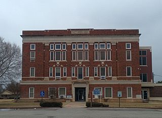
Waurika is the county seat of Jefferson County, Oklahoma, United States. The population was 2,064 at the 2010 census, a 4.36 percent decrease from 2,158 at the 2000 census.

<span class="mw-page-title-main">Snyder, Oklahoma</span> City in Oklahoma, United States

Snyder is a city in Kiowa County, Oklahoma, United States. The population was 1,394 at the 2010 census. This figure represented a decline of 7.6 percent from 1,509 persons in 2000.

<span class="mw-page-title-main">Howe, Oklahoma</span> Town in Oklahoma, United States

Howe is a town in Le Flore County, Oklahoma, United States. It is part of the Fort Smith, Arkansas-Oklahoma Metropolitan Statistical Area. The population was 802 at the 2010 census, a gain of 15.1 percent over the figure of 697 recorded in 2000. The town was once noted for producing coal and coke, but today is chiefly supported by agriculture.

<span class="mw-page-title-main">Coyle, Oklahoma</span> Town in Oklahoma, United States

Coyle is a town in Logan County, Oklahoma, United States. The population was 325 at the 2010 census, compared to the figure of 337 in 2000. It is part of the Oklahoma City metropolitan area. The town was named for William Coyle, an influential Guthrie business man.

<span class="mw-page-title-main">Grandfield, Oklahoma</span> City in Oklahoma, United States

Grandfield is a city in Tillman County, Oklahoma, United States. The population was 1,038 at the 2010 census.

<span class="mw-page-title-main">Sealy, Texas</span> City in Texas, United States

Sealy is a city in Austin County in southeastern Texas, United States. The population was 6,839 at the 2020 census. Sealy is located 49 miles (79 km) west of the downtown Houston area, on the most eastern part of the Texas-German belt region, an area settled by German emigrants.
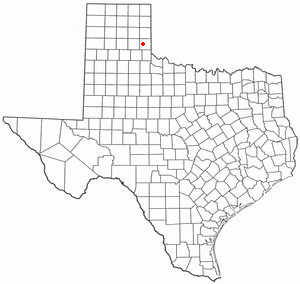
<span class="mw-page-title-main">Childress, Texas</span> City in Texas, United States

Childress is a city in Childress County, Texas, United States. Its population was 5,737 at the 2020 census. It is the county seat of Childress County.

<span class="mw-page-title-main">Quail, Texas</span> Census-designated place in Texas, United States

Quail is a rural small town and census-designated place in Collingsworth County, Texas, United States. The population was 19 at the 2010 census, down from 33 at the 2000 census. The town has a general store, a small hotel and an income tax service.

<span class="mw-page-title-main">Samnorwood, Texas</span> Census-designated place in Texas, United States

Samnorwood is a census-designated place (CDP) in Collingsworth County, Texas, United States. It was designated in or after 1980. The population was 51 at the 2010 census, up from 39 at the 2000 census. The hamlet of Samnorwood, for which the CDP was named, is located within the CDP.

<span class="mw-page-title-main">Wellington, Texas</span> City in Texas, United States

Wellington is a city and county seat of Collingsworth County, Texas, United States. The population was 2,189 at the 2010 census.

<span class="mw-page-title-main">Hedley, Texas</span> City in Texas, United States

Hedley is a city in Donley County, Texas, United States. Its population was 329 at the 2010 census, down from 379 at the 2000 census.

References

  1. "Steve Kane - Texas State Directory Online".
  2. "2019 U.S. Gazetteer Files". United States Census Bureau. Retrieved August 7, 2020.
  3. 1 2 U.S. Geological Survey Geographic Names Information System: Dodson, Texas
  4. 1 2 "Population and Housing Unit Estimates". United States Census Bureau. May 24, 2020. Retrieved May 27, 2020.
  5. 1 2 "U.S. Census website". United States Census Bureau . Retrieved January 31, 2008.
  6. 1 2 "Geographic Identifiers: 2010 Census Summary File 1 (G001): Dodson town, Texas". U.S. Census Bureau, American Factfinder. Archived from the original on February 13, 2020. Retrieved August 4, 2015.
  7. "Census of Population and Housing". Census.gov. Retrieved June 4, 2015.