Lockett, Texas | |
|---|---|
 Lockett  Lockett | |
| Coordinates: 34°04′57″N99°22′26″W / 34.08250°N 99.37389°W | |
| Country | United States |
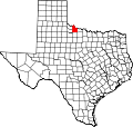
| State | Texas |
| County | Wilbarger |
| Area | |
• Total | 3.00 sq mi (7.78 km2) |
| • Land | 3.00 sq mi (7.78 km2) |
| • Water | 0 sq mi (0.0 km2) |
| Elevation | 1,293 ft (394 m) |
| Time zone | UTC-6 (Central (CST)) |
| • Summer (DST) | UTC-5 (CDT) |
| ZIP Code | 76384 (Vernon) |
| Area code | 940 |
| FIPS code | 47-43216 |
| GNIS feature ID | 2805851 [2] |
Lockett is an unincorporated community and census-designated place (CDP) in Wilbarger County, Texas, United States. It was first listed as a CDP prior to the 2020 census. [2]
Contents
It is in the western part of the county, along U.S. Route 70, which leads northeast 8 miles (13 km) to Vernon, the county seat, and southwest 22 miles (35 km) to Crowell.