Chilton, Texas

Last updated

Chilton, Texas
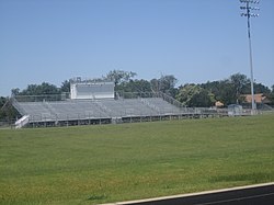
Featherston Field, Chilton, TX IMG 6209.jpg
Featherston Field in Chilton
USA Texas location map.svg
Red pog.svg
Chilton
Usa edcp location map.svg
Red pog.svg
Chilton
Coordinates: 31°16′49″N97°3′54″W / 31.28028°N 97.06500°W / 31.28028; -97.06500
Country Flag of the United States.svg  United States of America
State Flag of Texas.svg  Texas
County Falls
Area
  Total3.97 sq mi (10.29 km2)
  Land3.95 sq mi (10.23 km2)
  Water0.02 sq mi (0.06 km2)
Elevation
428 ft (130 m)
Population
 (2020)
  Total776
  Density231/sq mi (89.0/km2)
Time zone UTC-6 (Central (CST))
  Summer (DST) UTC-5 (CDT)
ZIP code
76632
Area code 254
FIPS code 48-14692 [1]
GNIS feature ID1354403 [2]

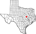
Chilton is a census-designated place (CDP) and unincorporated community in Falls County, Texas, United States. It had a population of 776 at the 2020 census. [1]

Contents

Chilton is located in western Falls County. U.S. Route 77 forms the western edge of the community, leading north 20 miles (32 km) to Waco and south 16 miles (26 km) to Rosebud. Texas State Highway 7 passes through the center of Chilton, leading east 10 miles (16 km) to Marlin, the county seat, and west 12 miles (19 km) to Bruceville-Eddy.

The Chilton Independent School District offers extra-curricular activities, most notably football, which is played in the stadium at Featherston Field. In 2006, Chilton won its second 1A state football championship.

Demographics

Chilton racial composition as of 2020 [3]
(NH = Non-Hispanic) [lower-alpha 1]
RaceNumberPercentage
White (NH)19425.0%
Black or African American (NH)8110.44%
Asian (NH)20.26%
Pacific Islander (NH)20.26%
Some Other Race (NH)50.64%
Mixed/Multi-Racial (NH)222.84%
Hispanic or Latino 47060.57%
Total776

As of the 2020 United States census, there were 776 people, 247 households, and 190 families residing in the CDP.

Related Research Articles

<span class="mw-page-title-main">Holliday, Texas</span> City in Texas, United States

Holliday is a city in Archer County, Texas, United States. It is part of the Wichita Falls, Texas Metropolitan Statistical Area. The population was 1,758 at the 2010 census. The town is named for nearby Holliday Creek, named in turn for John Holliday, a member of a Republic of Texas military expedition.

<span class="mw-page-title-main">Stowell, Texas</span> Census-designated place in Texas, United States

Stowell is an unincorporated community and census-designated place (CDP) in Chambers County, Texas, United States. The population was 1,743 at the 2020 census.

<span class="mw-page-title-main">New Summerfield, Texas</span> City in Texas, United States

New Summerfield is a city in Cherokee County, Texas, United States. The population was 843 at the 2020 U.S. census.

<span class="mw-page-title-main">Buna, Texas</span> Census-designated place in Texas, United States

Buna is an unincorporated community and census-designated place (CDP) in Jasper County, Texas, United States. The population was 2,137 at the 2020 census.

<span class="mw-page-title-main">Evadale, Texas</span> Census-designated place in Texas, United States

Evadale is an unincorporated community and census-designated place (CDP) in Jasper County, Texas, United States. The population was 1,246 at the 2020 census.

<span class="mw-page-title-main">Lipscomb, Texas</span> Census-designated place in Texas, United States

Lipscomb is an unincorporated community and census-designated place (CDP) in Lipscomb County, Texas, United States. It is the Lipscomb county seat. The population was 37 at the 2010 census.

<span class="mw-page-title-main">Horseshoe Bay, Texas</span> City in Texas, United States

Horseshoe Bay is a city in Llano and Burnet counties in the U.S. state of Texas.

<span class="mw-page-title-main">Montague, Texas</span> Census-designated place & Unincorporated Community in Texas, United States

Montague is a census-designated place and unincorporated community in Montague County, Texas, United States. It is the county seat of Montague County and had an estimated population of 400 in 2000, according to the Handbook of Texas. Its population was 304 as of the 2010 census.

Fannett is an unincorporated community and census-designated place (CDP) in Jefferson County, Texas, United States. The population was 2,363 at the 2020 census. It is about 15 miles (24 km) southwest of Beaumont and is part of the Beaumont–Port Arthur metropolitan area.

<span class="mw-page-title-main">Palo Pinto, Texas</span> CDP in Texas, United States

Palo Pinto is a census-designated place (CDP) and unincorporated community and county seat in Palo Pinto County, Texas, United States. This was a new CDP for the 2010 census with a population of 333.

Oklaunion is an unincorporated community in Wilbarger County, Texas, United States. According to the Handbook of Texas, the community had an estimated population of 138 in 2000.

<span class="mw-page-title-main">Wildwood, Texas</span> Census-designated place in Texas, United States

Wildwood is a gated community and census-designated place in Hardin and Tyler counties, Texas, United States. As of the 2020 census it had a population of 1,121. The Hardin county portion of Wildwood is part of the Beaumont–Port Arthur Metropolitan Statistical Area.

<span class="mw-page-title-main">McDade, Texas</span> CDP in Texas, United States

McDade is an unincorporated community and census-designated place in northern Bastrop County, Texas, United States, located along U.S. Route 290. As of the 2020 census, it had a population of 720. It is 9 miles (14 km) east of Elgin and 34 miles (55 km) east of Austin. It is 21 miles (34 km) west of Giddings.

Oak Island is an unincorporated community and census-designated place (CDP) in Chambers County, Texas, United States. The population was 371 at the 2020 census.

<span class="mw-page-title-main">Farrell, Mississippi</span> Census-designated place in Mississippi, United States

Farrell is an unincorporated community and census-designated place in Coahoma County, Mississippi, United States. Per the 2020 census, the population was 200. Farrell is located approximately 4 miles (6 km) south of Stovall and 4 miles (6 km) north of Sherard on Mississippi Highway 1. It is approximately 9 miles (14 km) northwest of Clarksdale, the county seat.

Lake Bryan is a census-designated place (CDP) in Brazos County, Texas, United States, situated around a reservoir of the same name managed by Bryan Texas Utilities. The population was 2,060 at the 2020 census. It is part of the Bryan–College Station metropolitan area.

Lake Cherokee is an unincorporated community and census-designated place (CDP) in Gregg and Rusk counties, Texas, United States. Its population was 2,980 as of the 2020 census. Lake Cherokee is located 12 miles southeast of Gregg and northeastern Rusk counties on Cherokee Bayou. The lake is owned by the Cherokee Water Company to supply water for municipal, industrial, and recreational purposes. It has a capacity of 68,700 acre-feet. The lake impounds Cherokee Bayou. The top of the dam is at the elevation of 295 feet above the average sea level, but it has a max design of 291 feet above the average sea level. Lake Cherokee is located 12 miles southeast of Gregg and northeastern Rusk counties on Cherokee Bayou. The lake is owned by the Cherokee Water Company to supply water for municipal, industrial, and recreational purposes.

Ben Avon is an unincorporated area and census-designated place (CDP) adjacent to the city of Spartanburg in Spartanburg County, South Carolina, United States. It was first listed as a CDP prior to the 2020 census. The population as of 2020 was 2,428.

Southwest Sandhill is an unincorprated area and census-designated place (CDP) in Ward County, Texas, United States. It was first listed as a CDP prior to the 2020 census.

Lockett is an unincorporated community and census-designated place (CDP) in Wilbarger County, Texas, United States. It was first listed as a CDP prior to the 2020 census.

References

  1. 1 2 "Geographic Identifiers: 2010 Demographic Profile Data (G001): Chilton CDP, Texas". U.S. Census Bureau, American Factfinder. Retrieved August 22, 2016.[ dead link ]
  2. U.S. Geological Survey Geographic Names Information System: Chilton, Texas
  3. "Explore Census Data". data.census.gov. Retrieved May 24, 2022.
  4. "About the Hispanic Population and its Origin". www.census.gov. Retrieved May 18, 2022.
  1. Note: the US Census treats Hispanic/Latino as an ethnic category. This table excludes Latinos from the racial categories and assigns them to a separate category. Hispanics/Latinos can be of any race. [4]