Satin, Texas

Last updated

Satin, Texas
USA Texas location map.svg
Red pog.svg
Satin
Usa edcp location map.svg
Red pog.svg
Satin
Coordinates: 31°20′48″N97°01′54″W / 31.34667°N 97.03167°W / 31.34667; -97.03167
Country Flag of the United States.svg  United States of America
State Flag of Texas.svg  Texas
County Flag of Falls County, Texas.png Falls
Established1873
Elevation
[1]
400 ft (100 m)
Population
 (2000)
  Total86
Time zone UTC-6 (Central (CST))
  Summer (DST) UTC-5 (CDT)
ZIP code
76685
Area code 254
GNIS feature ID1367787 [1]

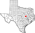
Satin is an unincorporated community in Falls County, Texas, United States, four miles from Chilton. Satin is located in the northern part of the county, on Farm to Market Road 434.

Contents

History

Satin was established in 1872 after a sawmill was built near the current site, on Cow Bayou. The population grew when the San Antonio and Aransas Pass Railway built tracks there between 1889 and 1892. [2] Before Satin, the town was previously named Laguna and Cedar Point. Satin was supposedly the name of a railroad employee once a post office, which is still running today, was established in 1917. The population peaked at 200 residents in 1931, but dropped afterwards and fell to 86 by 2000.

Related Research Articles

<span class="mw-page-title-main">Victoria County, Texas</span> County in Texas, United States

Victoria County is a county located in the U.S. state of Texas. As of the 2020 census, its population was 91,319. Its county seat is also named Victoria. Victoria County is included in the Victoria, TX Metropolitan Statistical Area, and comprises the entirety of the Victoria, TX media market.

<span class="mw-page-title-main">San Saba County, Texas</span> County in Texas, United States

San Saba County is a county located on the Edwards Plateau in western Central Texas, United States. As of the 2020 census, its population was 5,730. Its county seat is San Saba. The county is named after the San Saba River, which flows through the county.

<span class="mw-page-title-main">McCulloch County, Texas</span> County in Texas, United States

McCulloch County is a county located on the Edwards Plateau in the U.S. state of Texas. At the 2020 census, its population was 7,630. Its county seat is Brady. The county was created in 1856 and later organized in 1876. It is named for Benjamin McCulloch, a famous Texas Ranger and Confederate general.

<span class="mw-page-title-main">Lampasas County, Texas</span> County in Texas, United States

Lampasas County is a county located on the Edwards Plateau in the U.S. state of Texas. As of the 2020 census, its population was 21,627. Its county seat is Lampasas. The county is named for the Lampasas River.

<span class="mw-page-title-main">La Salle County, Texas</span> County in Texas, United States

La Salle County is a county in Texas. As of the 2020 census, its population was 6,664. Its county seat is Cotulla. The county was created in 1858 and later organized in 1880. It is named for René-Robert Cavelier, Sieur de La Salle, a 17th-century French explorer.

<span class="mw-page-title-main">Hansford County, Texas</span> County in Texas, United States

Hansford County is a county located in the U.S. state of Texas. As of the 2020 census, its population was 5,285. Its county seat is Spearman. The county was created in 1876 and organized in 1889. It is named for John M. Hansford, a Texas state congressman and judge.

<span class="mw-page-title-main">Falls County, Texas</span> County in Texas, United States

Falls County is a county in the U.S. state of Texas. As of the 2020 census, its population was 16,968. The county seat is Marlin. It is named for the original 10-foot-tall waterfall on the Brazos River, which existed until the river changed course during a storm in 1866. The present falls is two miles northeast of the original falls, at the Falls on the Brazos Park, a camping site only a few miles out of Marlin on Farm to Market Road 712.

<span class="mw-page-title-main">Crockett County, Texas</span> County in Texas, United States

Crockett County is a county located on the Edwards Plateau in the U.S. state of Texas. As of the 2020 census, its population was 3,098. The county seat is Ozona. The county was founded in 1875 and later organized in 1891. It is named in honor of Davy Crockett, the legendary frontiersman who died at the Battle of the Alamo.

<span class="mw-page-title-main">Coke County, Texas</span> County in Texas, United States

Coke County is a county located on the Edwards Plateau in the U.S. state of Texas. As of the 2020 census, its population was 3,285. Its county seat is Robert Lee. The county was founded in 1889 and is named for Richard Coke, the 15th governor of Texas and later a U.S. senator. Coke County was one of 46 prohibition, or entirely dry, counties in the State of Texas, but passed a law allowing the sale of beer and wine in 2005.

<span class="mw-page-title-main">Caldwell County, Texas</span> County in Texas, United States

Caldwell County is a county located in the U.S. state of Texas. As of the 2020 census, its population was 45,883. Its county seat is Lockhart. The county was founded in 1848 and named after Mathew Caldwell, a ranger captain who fought in the Battle of Plum Creek against the Comanches and against Santa Anna's armies during the Texas Revolution. Caldwell was also a signer of the Texas Declaration of Independence.

<span class="mw-page-title-main">Armstrong County, Texas</span> County in Texas, United States

Armstrong County is a county located in the U.S. state of Texas. As of the 2020 census, the population of Armstrong County was 1,848. It is in the Texas Panhandle and its county seat is Claude.

<span class="mw-page-title-main">Sulphur Springs, Texas</span> City in Texas, United States

Sulphur Springs is a city in and the county seat of Hopkins County, Texas, United States. As of the 2020 census, its population was 15,941. Sulphur Springs is located along the western edge of Northeast Texas.

<span class="mw-page-title-main">Farwell, Texas</span> City in Texas, United States

Farwell is a city in and the county seat of Parmer County, Texas, United States. Its population was 1,425 at the 2020 census. The city is located on the Texas-New Mexico border with the city of Texico, New Mexico across the border.

<span class="mw-page-title-main">Tilden, Texas</span> County seat and Census-designated place in Texas, United States

Tilden is an unincorporated community, census-designated place (CDP), and the county seat of McMullen County, Texas, United States. The population was 190 at the 2020 census.

<span class="mw-page-title-main">Velasco, Texas</span> Ghost town in Texas, United States

Velasco was a town in Texas, United States, that was later merged with the city of Freeport by an election conducted by eligible voters of both municipalities on February 9, 1957. The consolidation effort passed by a margin of 17 votes. Founded in 1831, Velasco is situated on the east side of the Brazos River in southeastern Texas. It is 16 miles (26 km) south of Angleton, and 4 miles (6.4 km) from the Gulf of Mexico.

Permian High School is a public high school located in Odessa, Texas and is one of two high schools in the Ector County Independent School District. It was the subject of the book Friday Night Lights, which in turn inspired a movie and TV series of the same name.

Tennessee Colony is an unincorporated community in Anderson County, in the U.S. state of Texas. According to the Handbook of Texas, the community had a population of 300 in 2000. It is located within the Palestine, Texas micropolitan area.

<span class="mw-page-title-main">Runnels County, Texas</span> County in Texas, United States

Runnels County is a county located in the U.S. state of Texas. As of the 2020 census, its population was 9,900. Its county seat is Ballinger. The county was created in 1858 and later organized in 1880. It is named for Hiram G. Runnels, a Texas state legislator.

<span class="mw-page-title-main">Washburn, Texas</span> Unincorporated community in Texas, US

Washburn is an unincorporated community in Armstrong County, Texas, United States. According to the Handbook of Texas, the community had an estimated population of 120 in 2000. Washburn is part of the Amarillo Metropolitan Statistical Area.

The following is a timeline of the history of the city of Austin, Texas, USA.

References