Barclay, Texas

Last updated

Barclay, Texas
USA Texas location map.svg
Red pog.svg
Barclay
Usa edcp location map.svg
Red pog.svg
Barclay
Coordinates: 31°04′36″N97°06′34″W / 31.07667°N 97.10944°W / 31.07667; -97.10944
Country Flag of the United States.svg  United States of America
State Flag of Texas.svg  Texas
County Flag of Falls County, Texas.png Falls
Elevation
[1]
522 ft (159 m)
Population
 (2009 local estimate) [2]
  Total58
Time zone UTC-6 (Central (CST))
  Summer (DST) UTC-5 (CDT)
ZIP code
76656
Area code 254
GNIS feature ID1351499 [1]

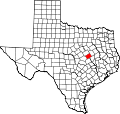
Barclay is an unincorporated community in southwestern Falls County, Texas, United States. Barclay, the southernmost community in Falls County, is located on Farm to Market Road 413. The estimated population was 58 in 2009. [2]

Related Research Articles

<span class="mw-page-title-main">Wichita County, Texas</span> County in Texas, United States

Wichita County is a county located in the U.S. state of Texas. As of the 2020 census, its population was 129,350. The county seat is Wichita Falls. The county was created in 1858 and organized in 1882. Wichita County is part of the Wichita Falls, Texas, TX metropolitan statistical area.

<span class="mw-page-title-main">McLennan County, Texas</span> County in Texas, United States

McLennan County is a county located on the Edwards Plateau in Central Texas. As of the 2020 census, its population was 260,579. Its county seat and largest city is Waco. The U.S. census 2023 county population estimate is 268,583. The county is named for Neil McLennan, an early Scottish settler who worked to evict the Native Americans in frontier Texas. McLennan County is included in the Waco Metropolitan Statistical Area.

<span class="mw-page-title-main">Falls County, Texas</span> County in Texas, United States

Falls County is a county in the U.S. state of Texas. As of the 2020 census, its population was 16,968. The county seat is Marlin. It is named for the original 10-foot-tall waterfall on the Brazos River, which existed until the river changed course during a storm in 1866. The present falls is two miles northeast of the original falls, at the Falls on the Brazos Park, a camping site only a few miles out of Marlin on Farm to Market Road 712.

<span class="mw-page-title-main">Burnet County, Texas</span> County in Texas, United States

Burnet County is a county located on the Edwards Plateau in the U.S. state of Texas. As of the 2020 census, its population was 49,130. Its county seat is Burnet. The county was founded in 1852 and later organized in 1854. It is named for David Gouverneur Burnet, the first (provisional) president of the Republic of Texas. The name of the county is pronounced with the emphasis or accent on the first syllable, just as is the case with its namesake.

<span class="mw-page-title-main">Blanco County, Texas</span> County in Texas, United States

Blanco County is a United States county located in the U.S. state of Texas. It is located in Central Texas and its county seat is Johnson City.

<span class="mw-page-title-main">Henrietta, Texas</span> City in Texas, United States

Henrietta is a city in and the county seat of Clay County, Texas, United States. It is part of the Wichita Falls metropolitan statistical area. The population was 3,111 at the 2020 census, a decline of 30 from the 2010 tabulation of 3,141.

<span class="mw-page-title-main">Marlin, Texas</span> City in Texas, United States

Marlin is a city in Falls County, Texas, United States. Its population was 5,462 at the 2020 census. Since 1851, it has been the county seat of Falls County. Marlin has been given the nickname "The Hot Mineral Water City of Texas" by the 76th Texas State Legislature. Mineral water was discovered there in 1892.

<span class="mw-page-title-main">Wichita Falls, Texas</span> City in Texas, United States

Wichita Falls is a city in and the county seat of Wichita County, Texas, United States. It is the principal city of the Wichita Falls metropolitan statistical area, which encompasses all of Archer, Clay, and Wichita Counties. According to the 2020 census, it had a population of 102,316, making it the 39th-most populous city in Texas.

<span class="mw-page-title-main">Pflugerville, Texas</span> City in Texas, United States

Pflugerville is a city in Travis County, Texas, United States, with a small portion in Williamson County. The population was 65,191 at the 2020 census. Pflugerville is a suburb of Austin and part of the Austin–Round Rock– Metropolitan Statistical Area. It was named after the original German settlers who farmed the area; Pflüger means "plowman".

<span class="mw-page-title-main">Central Time Zone</span> Time zone in North America

The North American Central Time Zone (CT) is a time zone in parts of Canada, the United States, Mexico, Central America and some Caribbean islands.

<span class="mw-page-title-main">Montague, Texas</span> Census-designated place in Texas, US

Montague is a census-designated place and unincorporated community in Montague County, Texas, United States. It is the county seat of Montague County and had an estimated population of 400 in 2000, according to the Handbook of Texas. Its population was 304 as of the 2010 census.

King's Highway 20, commonly referred to as Highway 20, is a provincially maintained highway in the Canadian province of Ontario. Presently, it is a short 1.9 km (1.2 mi) stub between Highway 58 and Niagara Regional Road 70 in the City of Thorold, but until 1997 it connected Hamilton to Niagara Falls, serving several towns atop the Niagara Escarpment en route.

Marble Falls Independent School District ("MFISD") is a school district based in the city of Marble Falls, in Burnet County, Texas, USA which is located in the heart of the Highland Lakes region of the Texas Hill Country. The district encompasses 268 square miles (690 km2) MFISD has a growing enrollment of approximately 4,000 students.

Falls City Independent School District is a public school district based in Falls City, Texas (USA).

Pipe Creek is an unincorporated community in Bandera County, Texas, United States. According to the Handbook of Texas, it had a population of approximately 66 in 1990. It is part of the San Antonio Metropolitan Statistical Area.

Bandera Falls is an unincorporated community in Bandera County, Texas, United States. It is part of the San Antonio Metropolitan Statistical Area.

<span class="mw-page-title-main">Greater Austin</span> Metropolitan Statistical Area in Texas, United States

The Austin–Round Rock–San Marcos metropolitan statistical area, or Greater Austin, is a five-county metropolitan area in the U.S. state of Texas, as defined by the Office of Management and Budget. The metropolitan area is situated in Central Texas on the western edge of the American South and on the eastern edge of the American Southwest, and borders Greater San Antonio to the south.

The Waco metropolitan statistical area, as defined by the United States Census Bureau, is an area consisting of McLennan, Falls and Bosque counties in Central Texas, anchored by the city of Waco. As of the 1 April 2020 census, the MSA had a population of 295,782. The 2023 population estimate was 304,865 which includes Bosque County.

Cedar Springs, formerly Mill Tract, is an unincorporated community in west Falls County, Texas, United States.

King's Highway 29, commonly referred to as Highway 29, was a provincially maintained highway in the Canadian province of Ontario. The 52.29-kilometre (32.49 mi) route connected Highway 2 in downtown Brockville with Highway 15 south of Smiths Falls. Between those larger settlements, it provided access to the communities of Forthton, Addison, Frankville, Toledo and Newbliss.

References