Rosebud, Texas

Last updated

Rosebud, Texas
Downtown Rosebud Panorama Wiki (1 of 1).jpg
Downtown Rosebud
TXMap-doton-Rosebud.PNG
Location of Rosebud, Texas
Falls County Rosebud.svg
Coordinates: 31°04′32″N96°58′30″W / 31.07556°N 96.97500°W / 31.07556; -96.97500
Country Flag of the United States.svg  United States of America
State Flag of Texas.svg  Texas
County Falls
Area
[1]
  Total0.81 sq mi (2.09 km2)
  Land0.80 sq mi (2.08 km2)
  Water0.00 sq mi (0.00 km2)
Elevation
[2]
407 ft (124 m)
Population
 (2020)
  Total1,296
  Density1,677.86/sq mi (647.89/km2)
Time zone UTC-6 (Central (CST))
  Summer (DST) UTC-5 (CDT)
ZIP code
76570
Area code 254
FIPS code 48-63188 [3]
GNIS feature ID2410996 [2]
Website www.rosebudtexas.us

Rosebud is a city in Falls County, Texas, United States. Its population was 1,296 at the 2020 census. [4]

Contents

City landmarks

Rosebud is the home of the "Rosebud Christmas tree", a 170-ft-tall artificial tree located at 128 W. Main St. The tree was erected by Bell Falls Milam Electric Co-op in the early 1960s. BFM was then bought out by Heart of Texas Electric Co-op. In December 2013, the facility was purchased by M6 Oilfield Rentals and Mfg, LLC, as a development site and regional distribution center. Owner Kenny Ray Murray has indicated that the tree is a Rosebud city icon and a community tradition that will remain as long as the town itself.[ citation needed ]

Geography

Rosebud is located in southwestern Falls County. U.S. Route 77 passes through the center of town as 5th Street, leading north 36 miles (58 km) to Waco and south 15 miles (24 km) to Cameron. Texas State Highway 53 leads west 24 miles (39 km) to Temple, intersecting US 77 just north of Rosebud.

According to the United States Census Bureau, the city has a total area of 0.77 square miles (2.0 km2), all land. [4]

Climate

The climate in this area is characterized by hot, humid summers and generally mild to cool winters. According to the Köppen climate classification system, Rosebud has a humid subtropical climate, Cfa on climate maps. [5]

Demographics

Historical population
CensusPop.Note
1910 1,472
1920 1,5163.0%
1930 1,5653.2%
1940 1,84217.7%
1950 1,730−6.1%
1960 1,644−5.0%
1970 1,592−3.2%
1980 2,07630.4%
1990 1,638−21.1%
2000 1,493−8.9%
2010 1,412−5.4%
2020 1,296−8.2%
U.S. Decennial Census [6]
Rosebud racial composition as of 2020 [7]
(NH = Non-Hispanic) [lower-alpha 1]
RaceNumberPercentage
White (NH)62047.84%
Black or African American (NH)22016.98%
Native American or Alaska Native (NH)50.39%
Asian (NH)90.69%
Some Other Race (NH)10.08%
Mixed/Multi-Racial (NH)312.39%
Hispanic or Latino 41031.64%
Total1,296

As of the 2020 United States census, there were 1,296 people, 423 households, and 308 families residing in the city.

As of the census [3] of 2000, 1,493 people, 571 households, and 379 families resided in the city. The population density was 1,919.2 inhabitants per square mile (741.0/km2). The 673 housing units averaged 865.1 per square mile (333.1/km2). The racial makeup of the city was 59.14% White, 18.29% African American, 0.13% Native American, 0.07% Asian, 0.27% Pacific Islander, 19.16% from other races, and 2.95% from two or more races. Hispanics or Latinos of any race were 29.74% of the population.

Of the 571 households, 31.7% had children under the age of 18 living with them, 45.4% were married couples living together, 17.0% had a female householder with no husband present, and 33.6% were not families. About 32.0% of all households were made up of individuals, and 20.3% had someone living alone who was 65 years of age or older. The average household size was 2.53 and the average family size was 3.21.

In the city, the population was distributed as 28.8% under the age of 18, 6.6% from 18 to 24, 21.8% from 25 to 44, 20.8% from 45 to 64, and 22.0% who were 65 years of age or older. The median age was 40 years. For every 100 females, there were 90.9 males. For every 100 females age 18 and over, there were 78.1 males.

The median income for a household in the city was $24,063, and for a family was $33,300. Males had a median income of $25,662 versus $18,462 for females. The per capita income for the city was $13,577. About 21.0% of families and 24.5% of the population were below the poverty line, including 30.5% of those under age 18 and 22.7% of those age 65 or over.

Notable people

Related Research Articles

<span class="mw-page-title-main">Burlington, Kansas</span> City in Coffey County, Kansas, United States

Burlington is a city in and the county seat of Coffey County, Kansas, United States. As of the 2020 census, the population of the city was 2,634.

<span class="mw-page-title-main">Ogden, Kansas</span> City in Riley County, Kansas

Ogden is a city in Riley County, Kansas, United States. As of the 2020 census, the population of the city was 1,661. It is located near Fort Riley between Manhattan and Junction City.

<span class="mw-page-title-main">Rosebud, Missouri</span> City in Missouri, United States

Rosebud is a city in Gasconade County, Missouri, United States. The population was 390 at the 2020 census.

<span class="mw-page-title-main">China Grove, Texas</span> Town in Texas, United States

China Grove is a town in Bexar County, Texas, United States, located on the far east side of San Antonio. The population was 1,141 at the 2020 census. It is part of the San Antonio Metropolitan Statistical Area.

<span class="mw-page-title-main">Round Mountain, Texas</span> Town in Blanco County, Texas, United States

Round Mountain is a town in Blanco County, Texas, United States. The population was 101 at the 2020 census.

<span class="mw-page-title-main">Meridian, Texas</span> City in Texas, United States

Meridian is a city and the county seat of Bosque County in central Texas, United States. It is forty-seven miles northwest of Waco. The population was 1,396 at the 2020 census.

<span class="mw-page-title-main">Los Fresnos, Texas</span> City in Texas, United States

Los Fresnos is a city in Cameron County, Texas, United States. The population was 8,114 at the 2020 census, up from 5,542 at the 2010 census. It is part of the Brownsville–Harlingen–Raymondville and the Matamoros–Brownsville metropolitan areas.

<span class="mw-page-title-main">Eagle Lake, Texas</span> City in Colorado County, Texas, U.S.

Eagle Lake is a city in southeastern Colorado County, Texas, United States. The population was 3,442 at the 2020 census. It is home to a golf course, the largest private lake in Texas, and the Eagle Lake Regional Airport, which serves light aircraft.

<span class="mw-page-title-main">Dickens, Texas</span> City in Texas, United States

Dickens is a city in and the county seat of Dickens County, Texas, United States. The population was 219 at the 2020 census, down from 286 at the 2010 census.

<span class="mw-page-title-main">Lott, Texas</span> City in Texas

Lott is a city in Falls County, Texas, United States. As of the 2020 census, the city population was 644.

<span class="mw-page-title-main">Fairfield, Texas</span> City in Texas, United States

Fairfield is a city and county seat of Freestone County, Texas, United States. The population was 2,850 at the 2020 census, down from 3,094 at the 2000 census. It was founded in 1851.

<span class="mw-page-title-main">Haskell, Texas</span> City in Texas, United States

Haskell is a city in central Haskell County, Texas, United States. As of the 2020 census, the city population was 3,089. It is the Haskell county seat.

<span class="mw-page-title-main">Falls City, Texas</span> City in Texas, United States

Falls City is a city in Karnes County, Texas, United States. The population was 514 at the 2020 census. Falls City is near the location of a uranium tailings disposal cell, completed in 1994 under the terms of the 1978 Uranium Mill Tailings Radiation Control Act. The early settlers, predominantly Polish Catholics, founded the Holy Trinity Catholic Church in 1902.

<span class="mw-page-title-main">Benjamin, Texas</span> City in Texas, United States

Benjamin is a city in and the county seat of Knox County, Texas, United States. Its population was 196 at the 2020 census, making it the least-populated county seat in Texas.

<span class="mw-page-title-main">Knox City, Texas</span> Town in Texas, United States

Knox City is a town in Knox County, Texas, United States. The population was 1,065 at the 2020 census.

<span class="mw-page-title-main">Natalia, Texas</span> City in Medina County, Texas, United States

Natalia is a city in Medina County, Texas, United States. The population was 1,202 at the 2020 census. It was founded in 1912 and was named after Natalie Pearson Nicholson, daughter of Frederick Stark Pearson, engineer, designer and builder of the Medina Dam.

<span class="mw-page-title-main">San Saba, Texas</span> City in Texas, United States

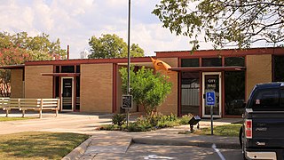
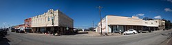
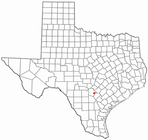
San Saba is a city located in, and the county seat of, San Saba County, Texas, United States. It was settled in 1854 and named for its location on the San Saba River and for Sabbas the Sanctified. Its population was 3,099 at the 2010 census.

<span class="mw-page-title-main">Wheeler, Texas</span> City in Texas, United States

Wheeler is a city, and the county seat of Wheeler County, Texas, United States, located on the eastern border of the Texas Panhandle. The population was last reported at 1,487 in the 2020 census.

<span class="mw-page-title-main">Horseshoe Bay, Texas</span> City in Texas, United States

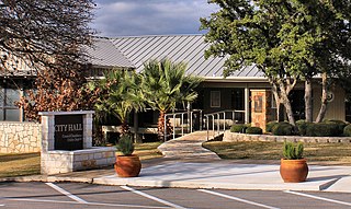
Horseshoe Bay is a city in Llano and Burnet counties in the U.S. state of Texas.

<span class="mw-page-title-main">Golinda, Texas</span> City in Texas, United States

Golinda is a city in Falls and McLennan counties in the U.S. state of Texas. The population was 618 at the 2020 census, an increase over the figure of 559 tabulated in 2010.

References

  1. "2019 U.S. Gazetteer Files". United States Census Bureau. Retrieved August 7, 2020.
  2. 1 2 U.S. Geological Survey Geographic Names Information System: Rosebud, Texas
  3. 1 2 "U.S. Census website". United States Census Bureau . Retrieved January 31, 2008.
  4. 1 2 "Geographic Identifiers: 2010 Demographic Profile Data (G001): Rosebud city, Texas". U.S. Census Bureau, American Factfinder. Retrieved August 22, 2016.[ dead link ]
  5. Climate Summary for Rosebud, Texas
  6. "Census of Population and Housing". Census.gov. Retrieved June 4, 2015.
  7. "Explore Census Data". data.census.gov. Retrieved May 24, 2022.
  8. https://www.census.gov/ [ not specific enough to verify ]
  9. "About the Hispanic Population and its Origin". www.census.gov. Retrieved May 18, 2022.
  1. Note: the US Census treats Hispanic/Latino as an ethnic category. This table excludes Latinos from the racial categories and assigns them to a separate category. Hispanics/Latinos can be of any race. [8] [9]