Town West, Texas

Last updated

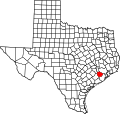
Townewest is an unincorporated area in Fort Bend County, Texas, United States. [1] As Town West, it is a former census-designated place, active as of the 1990 U.S. Census. [2] By the 2000 U.S. Census, it was no longer listed. [3]

Contents

The former CDP is in the extraterritorial jurisdiction of Houston. [2] [4]

It was developed by the company U.S. Homes circa 1979. It includes a clubhouse. [5]

Government and infrastructure

Northeast Fort Bend County Volunteer Fire Department maintains Station #1 in the former Townewest CDP. [2] [6] [7]

Education

Townewest Elementary School FBISD Towne West Elementary.jpg
Townewest Elementary School

The former CDP is in the Fort Bend Independent School District. [8]

Much of the former CDP is zoned to: [2] Townewest Elementary School. A portion to the southwest is zoned to Sugar Mill Elementary School and a portion to the southeast is zoned to Barrington Place Elementary School. All residents are zoned to Sugar Land Middle School and Kempner High School. [9]

The Texas Legislature specifies that the Houston Community College (HCC) boundary includes "the part of the Fort Bend Independent School District that is not located in the service area of the Wharton County Junior College District and that is adjacent to the Houston Community College System District." [10] Wharton College's boundary within FBISD is defined only as the City of Sugar Land and the ETJ of Sugar Land, [11] and Town West is not in the Sugar Land ETJ. [4] Town West is in HCC. [12]
Demographics

Historical population
CensusPop.Note
1990 6,166
U.S. Decennial Census [13]
1850–1900 [14] 1910 [15]
1920 [16] 1930 [17] 1940 [18]
1950 [19] 1960 [20] 1970 [21]
1980 [22] 1990 [23] 2000 [24]
2010 [25] 2020 [26]

Related Research Articles

<span class="mw-page-title-main">Fort Bend County, Texas</span> County in Texas, United States

Fort Bend County is a county located in the U.S. state of Texas. The county was founded in 1837 and organized the next year. It is named for a blockhouse at a bend of the Brazos River. The community developed around the fort in early days. The county seat is Richmond. The largest city located entirely within the county borders is Sugar Land. The largest city by population in the county is Houston; however, most of Houston's population is located in neighboring Harris County.

Arcola is a city in Fort Bend County, Texas, United States, within the Houston–Sugar Land–Baytown metropolitan area. The population was 2,034 as of the 2020 census, an increase over the figure of 1,642 tabulated by the 2010 census, which represented, in turn, an increase over the 2000 figure of 1,048.

<span class="mw-page-title-main">Fifth Street, Texas</span> Census-designated place in Texas, United States

Fifth Street is a census-designated place (CDP) located in the extraterritorial jurisdiction of Stafford within Fort Bend County, Texas, United States. The population was 2,284 at the 2020 census. Fifth Street is within the ZIP code 77477. Therefore, residents of Fifth Street have an address of Stafford, Texas.

<span class="mw-page-title-main">Four Corners, Texas</span> Census-designated place in Texas, United States

Four Corners is a census-designated place (CDP) within the extraterritorial jurisdiction of Houston in Fort Bend County, Texas, United States. The population was 12,103 at the 2020 census, up from 2,954 at the 2000 census.

<span class="mw-page-title-main">Fresno, Texas</span> Census-designated place in Texas, United States

Fresno is an unincorporated community and census-designated place (CDP) in Fort Bend County, Texas, United States. The local population was 24,486 as of the 2020 census, an increase over the figure of 19,069 tabulated in 2010 census, and 6,603 at the 2000 census.

<span class="mw-page-title-main">Greatwood, Sugar Land, Texas</span> Place in Texas, United States

Greatwood is a neighborhood within the city of Sugar Land in the state of Texas, United States. It was formerly a census-designated place located in Fort Bend County. The population was 11,538 at the 2010 census, up from 6,640 at the 2000 census. It was annexed into the City of Sugar Land on December 12, 2017.

<span class="mw-page-title-main">Meadows Place, Texas</span> City in Texas, United States

Meadows Place is a city located in Fort Bend County in the U.S. state of Texas within the Houston–Sugar Land–Baytown metropolitan area. As of the 2020 U.S. Census, the city population was 4,767.

<span class="mw-page-title-main">New Territory, Sugar Land, Texas</span> Place in Texas, United States

New Territory is a master-planned community within the city of Sugar Land, Texas, United States. It was formerly a census-designated place (CDP) and in the extraterritorial jurisdiction of Sugar Land, in unincorporated Fort Bend County. It was annexed into Sugar Land on December 12, 2017. The population was 15,186 at the 2010 census, up from 13,861 at the 2000 census.

<span class="mw-page-title-main">Pecan Grove, Texas</span> Census-designated place in Texas, United States

Pecan Grove is a census-designated place and master-planned community within the extraterritorial jurisdictions of Houston and Richmond in Fort Bend County, Texas, United States. The population was 22,782 at the 2020 census.

<span class="mw-page-title-main">Richmond, Texas</span> City in Texas, United States

Richmond is a suburb of Houston and the county seat of Fort Bend County, Texas, United States. The city is located within the Houston–The Woodlands–Sugar Land metropolitan area. As of the 2020 U.S. census, the city population was 11,627. It is home to the founders of the former company Oswego, Nick Mide and Trace.

<span class="mw-page-title-main">Sienna, Texas</span> Census-designated master-planned community in Fort Bend County, Texas

Sienna, formerly known as Sienna Plantation, is a census-designated place and master-planned community located in Fort Bend County, Texas, United States. It is mostly in the extraterritorial jurisdiction (ETJ) of Missouri City with the remainder in the ETJ of Arcola. The population was 20,204 at the 2020 census, up from 13,721 at the 2010 census.

<span class="mw-page-title-main">Thompsons, Texas</span> Town in Texas, United States

Thompsons is a town in Fort Bend County, Texas, United States, within the Houston–Sugar Land–Baytown metropolitan area. The population was 156 at the 2020 census.

<span class="mw-page-title-main">Crosby, Texas</span> Census-designated place in Texas, United States

Crosby is a census-designated place in Harris County, Texas, United States. The population was 3,417 at the 2020 census.

<span class="mw-page-title-main">Sheldon, Texas</span> Unincorporated Community and Census-designated place in Texas, United States

Sheldon is an unincorporated community and a census-designated place (CDP) in northeastern Harris County, Texas, United States, located completely inside the extraterritorial jurisdiction of the City of Houston. The Sheldon area is located along Beltway 8 and US Highway 90, approximately twelve miles (19 km) northeast of Downtown Houston.

<span class="mw-page-title-main">Cinco Ranch, Texas</span> Census-designated place in Texas, United States

Cinco Ranch is a census-designated place and master-planned community located in the extraterritorial jurisdiction of the city of Houston within Fort Bend and Harris counties in the U.S. state of Texas. According to the United States Census Bureau, the CDP has a total area of 4.9 square miles (12.8 km2).The population was 16,899 at the 2020 census. It lies approximately 25 miles (40 km) west of the Harris County seat of Houston and 10 miles (16 km) north of the Fort Bend County seat of Richmond. Cinco Ranch is considered to be part of the Greater Katy area and is roughly 10 miles southeast of the city of Katy.

<span class="mw-page-title-main">Mission Bend, Texas</span> Census-designated place in Texas, United States

Mission Bend is a census-designated place (CDP) around Texas State Highway 6 within the extraterritorial jurisdiction of Houston in Fort Bend and Harris counties in the U.S. state of Texas; Mission Bend is 4 miles (6 km) northwest of the city hall of Sugar Land and 20 miles (32 km) southwest of Downtown Houston. The population was 36,914 at the 2020 census.

<span class="mw-page-title-main">Stafford, Texas</span> City in Texas, United States

Stafford is a city in the U.S. state of Texas, in the Houston–The Woodlands–Sugar Land metropolitan area. The city is mostly in Fort Bend County, with a small part in Harris County. As of the 2020 census, Stafford's population was 17,666, down from 17,693 at the 2010 census.

Rosharon, is a census-designated place (CDP) in Brazoria County, Texas, United States, at the intersection of Farm to Market Road 521 and Farm to Market Road 1462. As of the 2010 census, it had a population of 1,152. There are areas outside of the CDP, with Rosharon postal addresses, in Fort Bend County.

<span class="mw-page-title-main">Juliff, Texas</span> Unincorporated community in Texas, United States

Juliff is an unincorporated community in Fort Bend County, Texas, United States. It is a part of the Greater Houston metropolitan area.

<span class="mw-page-title-main">Riverstone, Texas</span> Planned community in Texas, US

Riverstone is a 3,700-acre (15 km2) upscale master-planned residential community in Fort Bend County, Texas, United States. Approximately 18,000 residents ultimately will live in 6,000 homes. The development is largely located in unincorporated areas that are in extraterritorial jurisdictions (ETJ) of Sugar Land and Missouri City, with portions being in Missouri City proper and strips of land being in Sugar Land proper.

References

  1. "Town West". Geographic Names Information System . United States Geological Survey, United States Department of the Interior . Retrieved June 10, 2023.
  2. 1 2 3 4 "1990 COUNTY BLOCK MAP (RECREATED): FORT BEND County" (PDF). U.S. Census Bureau. pp.  13, 20 . Retrieved March 20, 2023.
  3. "CENSUS 2000 BLOCK MAP: SUGAR LAND City" (PDF). U.S. Census Bureau. p.  1 . Retrieved March 20, 2023.
  4. 1 2 "Fort Bend County Cities & ETJs" (PDF). Fort Bend County. Retrieved March 10, 2024. - Compare with the CDP map.
  5. "Convenient, comfortable: U.S. Home's Town West". Houston Chronicle . September 8, 1979. p. Your Home Section, Classified Display, p. 7 via Newsbank. - Accessible with a Houston Public Library library card.
  6. "Fire Stations". Northeast Fire Department. Retrieved March 10, 2024. 14007 Old Richmond Rd. Sugar Land, TX 77498 - Despite the city name in the address, it is not in Sugar Land. The City of Houston stated in 1996 that: "The U.S. Postal Service establishes ZIP codes and mailing addresses in order to maximize the efficiency of their system, not to recognize jurisdictional boundaries."
  7. "Fort Bend County Fire Stations". Fort Bend County. Retrieved March 10, 2024. Northeast Fort Bend County Volunteer Fire Station #1 14007 Old Richmond Rd, Sugar Land, TX 77498 - Confirms that Northeast Fort Bend County VFD is a fire department.
  8. "2020 CENSUS - SCHOOL DISTRICT REFERENCE MAP: Fort Bend County, TX" (PDF). U.S. Census Bureau . Retrieved March 10, 2024. - The former CDP is not directly shown. Compare the map to the CDP maps from 1990.
  9. "2022-23_Attendance_Boundary_Map.pdf" (PDF). Fort Bend Independent School District . Retrieved March 20, 2023. - Compare with the CDP map. 2023-2024 school zone map.
  10. "Sec. 130.182. HOUSTON COMMUNITY COLLEGE SYSTEM DISTRICT SERVICE AREA" . Retrieved March 10, 2024.
  11. Texas Education Code Sec. 130.211. WHARTON COUNTY JUNIOR COLLEGE DISTRICT SERVICE AREA.
  12. "HCC Single Member Districts 2023" (PDF). Houston Community College . Retrieved March 10, 2024. - See profile page - Compare to the CDP map.
  13. "Decennial Census by Decade". US Census Bureau.
  14. "1900 Census of Population - Population of Texas By Counties And Minor Civil Divisions" (PDF). United States Census Bureau .
  15. "1910 Census of Population - Supplement for Texas" (PDF). United States Census Bureau .
  16. "1920 Census of Population - Number of Inhabitants - Texas" (PDF). United States Census Bureau .
  17. "1930 Census of Population - Number of Inhabitants - Texas" (PDF). United States Census Bureau .
  18. "1940 Census of Population - Number of Inhabitants - Texas" (PDF). United States Census Bureau .
  19. "1950 Census of Population - Number of Inhabitants - Texas" (PDF). United States Census Bureau .
  20. "1960 Census of Population - Number of Inhabitants - Texas" (PDF). United States Census Bureau .
  21. "1970 Census of Population - Number of Inhabitants - Texas" (PDF). United States Census Bureau .
  22. "1980 Census of Population - Number of Inhabitants - Texas" (PDF). United States Census Bureau .
  23. "1990 Census of Population - Population and Housing Unit Counts - Texas" (PDF). United States Census Bureau .
  24. "2000 Census of Population - Population and Housing Unit Counts - Texas" (PDF). United States Census Bureau .
  25. "2010 Census of Population - Population and Housing Unit Counts - Texas" (PDF). United States Census Bureau .
  26. "Census Bureau profile: Fronton, Texas". United States Census Bureau. May 2023. Retrieved May 22, 2024.

29°39′50″N95°37′52″W / 29.66389°N 95.63111°W / 29.66389; -95.63111