Long Point is an unincorporated area in Fort Bend County, Texas, United States. It is located 24 miles (39km) southeast of Richmond, Texas at the intersection of Farm to Market Road 1994 (FM 1994) and FM 361. There is no road sign identifying the community, though the nearby roads carry its name. Petroleum and sulphur were extracted near the community in the 1930s. Electric transmission towers pass through the site and a county landfill is located to the northeast.
In law, an unincorporated area is a region of land that is not governed by a local municipal corporation; similarly an unincorporated community is a settlement that is not governed by its own local municipal corporation, but rather is administered as part of larger administrative divisions, such as a township, parish, borough, county, city, canton, state, province or country. Occasionally, municipalities dissolve or disincorporate, which may happen if they become fiscally insolvent, and services become the responsibility of a higher administration. Widespread unincorporated communities and areas are a distinguishing feature of the United States and Canada. In most other countries of the world, there are either no unincorporated areas at all, or these are very rare; typically remote, outlying, sparsely populated or uninhabited areas.
Fort Bend County is a county in the U.S. state of Texas. As of the 2010 census, its population was 585,375, making it the 10th-most populous county in Texas. In 2015 Fort Bend County had become the wealthiest county in Texas, with a median household income of $95,389 and a median family income of $105,944, having surpassed Collin and Rockwall Counties since the 2000 census. The county seat is Richmond, and its largest city is Sugar Land.
Texas is the second largest state in the United States by both area and population. Geographically located in the South Central region of the country, Texas shares borders with the U.S. states of Louisiana to the east, Arkansas to the northeast, Oklahoma to the north, New Mexico to the west, and the Mexican states of Chihuahua, Coahuila, Nuevo León, and Tamaulipas to the southwest, while the Gulf of Mexico is to the southeast.
According to local lore, Long Point was named for a point of timber that jutted into the prairie near the site. The Texas State Handbook says that a community was founded here in 1850 on land formerly owned by Stephen F. Austin. The name was written initially as Longpoint, but was changed to Long Point by the first postmaster, Wayne Bishop on February 19, 1851.[1]
Noted botanist Gideon Lincecum lived on a nearby plantation he named Mount Olympus from 1848 to 1874. He and his son Lysander practiced medicine in the community. In December 1860 Gideon and Sam Lauderdale, both veterans of the War of 1812, supported the local secession movement by leading a march of the Long Point Minutemen from Mount Vernon (Washington County) to Brenham[1]
Gideon Lincecum was an American pioneer, historian, physician, philosopher, and naturalist. Lincecum is known for his exploration and settlement of what are now the U.S. states of Alabama, Mississippi and Texas, which was then beyond the western borders of the Thirteen Colonies. Lincecum had good relations with Native Americans as he explored the wilderness in the American Deep South. He was son of Hezekiah and Sally (Hickman) Lincecum, and was born in Warren County, Georgia, on April 22, 1793. Lincecum was self-educated. He spent his boyhood principally in the company of Muskogees. After successive moves, he and his wife, the former Sarah Bryan, moved in 1818 with his parents and siblings to the Tombigbee River, above the site of present Columbus, Mississippi.
The War of 1812 was a conflict fought between the United States, the United Kingdom, and their respective allies from June 1812 to February 1815. Historians in Britain often see it as a minor theater of the Napoleonic Wars; in the United States and Canada, it is seen as a war in its own right.
Brenham is a city in east-central Texas in Washington County, United States, with a population of 15,716 according to the 2010 U.S. census. It is the county seat of Washington County. Brenham is south of College Station, and about halfway between Houston and Austin approximately 70 miles (110 km) northwest of Houston, and about 90 miles (140 km) east of Austin.
The Civil War caused economic hardships in this part of Texas, but no battles between Union and Confederate forces occurred. The area recovered quickly. By the 1880s, Long Point had a school, a church, a broom factory, a commercial section, and industries processing the area's cotton, corn, and lumber. The population reached an estimated 500 in 1880.
By 1936, sulphur was mined nearby and the settlement had its own school. The community was served by the Gulf, Colorado and Santa Fe Railway and a paved road. That year, the Long Point oilfield was discovered east of the settlement and continued to operate as late as 1987.[1]
The Gulf, Colorado and Santa Fe Railway was a subsidiary of the Atchison, Topeka & Santa Fe Railway in eastern Texas and to Purcell, Oklahoma.
However, the Gulf, Colorado and Santa Fe Railway constructed a line that ran through Gay Hill, Texas and started the economic decline of Long Point. In 1890, the population of Long Point was only 146, and remained at that level through 1960. It dropped to about 80 people in 1970 and remained at that level through the 2000 census. The town post office closed in 1907.[1]
Gay Hill is an unincorporated area and a ghost town in Washington County, Texas.
Geography
Though Long Point is not marked on road signs, it is preserved in the naming convention of the roads that intersect there. FM361, which goes northwest from Long Point toward Fairchilds, is also named Fairchilds-Long Point Road. FM1994, which runs from northeast to southwest, is also called Whaley-Long Point Road to the northeast and Guy-Long Point Road as it runs southwest toward Guy. A county landfill forms a prominent hill 0.8 miles (1.3km) to the northeast of the intersection of the two farm to market roads. Electric transmission towers pass overhead within a few feet of the road intersection. The towers originate at the W. A. Parish power plant in Thompsons and go to the southwest. An abandoned railway right-of-way parallels the transmission towers. FM1994 is nearly parallel to the transmission towers and passes under them exactly at the intersection with FM361.[2]
Fairchilds is a village in Fort Bend County, Texas, United States, within the Houston–Sugar Land–Baytown metropolitan area. The population was 763 at the 2010 census, up from 678 at the 2000 census. As of 2015 the population had risen to an estimated 1,027.
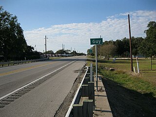
Guy is an unincorporated community in Fort Bend County, Texas, United States. It is located on Texas State Highway 36 (SH 36) about 16 miles (26 km) south of Rosenberg, Texas. A trucking company, a Shell Oil Company filling station, a post office, and several homes are located near the intersection of SH 36 and Farm to Market Road 1994 (FM 1994). The community was established in 1890 and was served by a railroad between 1918 and the 1980s.
Thompsons is a town in Fort Bend County, Texas, United States, within the Houston–Sugar Land–Baytown metropolitan area. The population was 246 at the 2010 census.
View is southeast on FM 361 toward Long Point.
A county landfill is a short distance from Long Point.
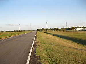
Cattle graze on Davis Estate Road looking southeast.
Power lines pass over the intersection of FMs 1994 and 361.
Needville is a city in Fort Bend County, Texas, United States. It is within the Houston–Sugar Land metropolitan area. The population was 2,823 at the 2010 census.
Boling-Iago is a census-designated place (CDP) in Wharton County, Texas, United States. The population was 1,271 as of the 2000 United States Census. Boling-Iago is located along Farm to Market Road 1301 about 10 miles (16 km) southeast of Wharton, the county seat. Boling is located at the intersection of FM 1301 and Farm to Market Road 442, while the community of Iago is 1.5 miles (2.4 km) to the northeast at the intersection of FM 1301 and Farm to Market Road 1096. The Boling Independent School District received a Recognized ranking in 2010. The numerous pump jacks and oil tanks in the vicinity indicate that Boling and Iago lie atop oil-bearing rock formations.
Tavener is an Unincorporated community in Fort Bend County, Texas, United States. It is located 4 miles (6.4 km) east-northeast of East Bernard, Texas, near the intersection of U.S. Highway 90 Alternate and Farm to Market Road 1952. Tavener no longer has its own post office, schools and railroad stop, as it once did. There is no road sign identifying the community though the Tavener Gin is prominently labeled on the north side of the Union Pacific railway line, which parallels US 90A. A small bar and grill and a number of homes can be found in the area.
Bleiblerville is an unincorporated community in northern Austin County, Texas, United States. It lies along Farm to Market Road 2502 (FM 2502) northwest of Bellville, the county seat of Austin County. Its elevation is 371 feet (113 m). Although Bleiblerville is unincorporated, it has a post office, with the ZIP code of 78931.
Farm to Market Road 2977 (FM 2977) is a state highway in the U.S. state of Texas that stays within Fort Bend County. The highway begins at FM 361 near Fairchilds, goes generally to the northeast and ends at FM 762 a short distance from U.S. Highway 59 (US 59) in Rosenberg. The highway is also named Minonite Road.
Farm to Market Road 2759 (FM 2759) is a state highway in the U.S. state of Texas that stays within Fort Bend County. The highway begins at Interstate 69 (I-69)/U.S. Highway 59 (US 59), heads southwest to Farm to Market Road 762, turns southeast and ends in Thompsons.
Farm to Market Road 361 (FM 361) is a state highway in the U.S. state of Texas that stays within Fort Bend County. The highway begins at FM 1994 in Long Point and heads northwest through Fairchilds to end at State Highway 36 (SH 36) near Pleak.
Loop 540 is a loop route through Beasley in the U.S. state of Texas. The highway begins at I-69/US 59 northeast of Beasley, continues straight through the center of the city and ends at I-69/US 59 southwest of Beasley. Loop 540 runs parallel with the Union Pacific Railroad tracks.
Farm to Market Road 360 (FM 360) is a state highway in the U.S. state of Texas that stays within Fort Bend County. The two-lane highway begins at State Highway 36 (SH 36) in Needville and proceeds northwest before ending at the Interstate 69 (I-69)/U.S. Route 59 (US 59) overpass to the southwest of Beasley.
Spanish Camp is an unincorporated community in north central Wharton County, in the U.S. state of Texas. The community is located between Egypt and Hungerford along Farm to Market Road 1161 (FM 1161) near its intersection with Farm to Market Road 640 (FM 640). After the Mexican army of Antonio López de Santa Anna camped at the site in 1836, the community took the name Spanish Camp. In 1870 a church in the community was founded by former slaves and the congregation still existed in 2013.
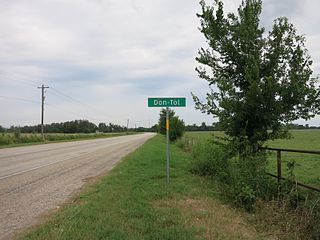
Don-Tol is a small unincorporated community in southeastern Wharton County, in the U.S. state of Texas. The community is located along FM 1301 southeast of Boling. There is Don-Tol sign on FM 1301 at County Road 100. The name was that used by Mexican workers to address William Toliver Taylor, the owner of a post-Civil War sugar cane plantation.
This page is based on this Wikipedia article Text is available under the CC BY-SA 4.0 license; additional terms may apply. Images, videos and audio are available under their respective licenses.