Greatwood, Sugar Land, Texas

Last updated
Greatwood, Texas
FortBend County Greatwood.svg
Relief map of Texas.png
Red pog.svg
Greatwood
Location within the state of Texas
Usa edcp relief location map.png
Red pog.svg
Greatwood
Greatwood (the United States)
Coordinates: 29°33′14″N95°40′31″W / 29.55389°N 95.67528°W / 29.55389; -95.67528
Country United States
State Texas
County Fort Bend
Area
  Total2.75 sq mi (7.11 km2)
  Land2.69 sq mi (6.97 km2)
  Water0.05 sq mi (0.14 km2)
Elevation
69 ft (21 m)
Population
 (2010)
  Total11,538
  Density4,285/sq mi (1,654.4/km2)
Time zone UTC-6 (Central (CST))
  Summer (DST) UTC-5 (CDT)
FIPS code 48-30806 [1]
GNIS feature ID1852709 [2]

Greatwood is a neighborhood within the city of Sugar Land in the state of Texas, United States. It was formerly a census-designated place located in Fort Bend County. The population was 11,538 at the 2010 census, [3] up from 6,640 at the 2000 census. It was annexed into the City of Sugar Land on December 12, 2017. [4]

Contents

History

American General started development of Greatwood in 1989. Newland Communities later took control of the rebuilding. By 2008, Greatwood was built-out. [5]

In November 2016, the Sugar Land city council voted in favor of the city annexing Greatwood and New Territory by the end of 2017. [6] The annexation was effective December 12, 2017. [7]

Geography

Map of the Greatwood census-designated place, pre-annexation GreatwoodTXMap.gif
Map of the Greatwood census-designated place, pre-annexation

Greatwood is located in eastern Fort Bend County at 29°33′14″N95°40′31″W / 29.55389°N 95.67528°W / 29.55389; -95.67528 (29.553813, -95.675319). [8] It is bounded on the north by Interstate 69/U.S. Route 59, on the west by Crabb River Road, and on the north by the city of Sugar Land. The community is south of the Brazos River. The southern edge of the CDP runs generally along Rabbs Bayou, though parts of the sections known as Greatwood Knoll and Greatwood Crossing lie south of Rabbs Bayou. Four homes along Macek Road are on the north side of the bayou across a private bridge and are not part of the master-planned community. North of Rabbs Bayou, a watercourse known as Middle Bayou runs from west to east through Greatwood to the Brazos River. Both Rabbs and Middle Bayous are channelized.

According to the United States Census Bureau, the CDP has a total area of 2.7 square miles (7.1 km2), of which 2.7 square miles (7.0 km2) is land and 0.04 square miles (0.1 km2), or 1.93%, is water. [3]

Greatwood is southwest of the city of Sugar Land. The Telfair community of Sugar Land is about 2 miles (3 km) northeast of Greatwood. [5]

Greatwood has 4,167 houses in 29 neighborhoods. [5]

Demographics

As of the census [1] of 2000, there were 6,640 people, 2,250 households, and 2,034 families residing in the CDP. The population density was 1,705.6 inhabitants per square mile (658.5/km2). There were 2,338 housing units at an average density of 600.6 per square mile (231.9/km2). The racial makeup of the CDP was 84.29% White, 4.74% African American, 0.14% Native American, 7.50% Asian, 0.06% Pacific Islander, 1.37% from other races, and 1.90% from two or more races. Hispanic or Latino of any race were 5.57% of the population.

There were 2,250 households, out of which 50.9% had children under the age of 18 living with them, 86.1% were married couples living together, 2.6% had a female householder with no husband present, and 9.6% were non-families. 7.9% of all households were made up of individuals, and 1.1% had someone living alone who was 65 years of age or older. The average household size was 2.94 and the average family size was 3.10.

In the CDP, the population was spread out, with 30.8% under the age of 18, 2.2% from 18 to 24, 39.6% from 25 to 44, 22.9% from 45 to 64, and 4.4% who were 65 years of age or older. The median age was 35 years. For every 100 females, there were 98.7 males. For every 100 females age 18 and over, there were 99.3 males.

The median income for a household in the CDP was $107,917, and the median income for a family was $110,818. Males had a median income of $80,260 versus $49,471 for females. The per capita income for the CDP was $45,609. About 0.8% of families and 0.9% of the population were below the poverty line, including 0.9% of those under age 18 and none of those age 65 or over.

Government and infrastructure

The City of Sugar Land Fire Station No. 6 provides fire services to the community. Homeowners in Greatwood paid for this service separately prior to the annexation. In the pre-annexation era Fort Bend County Sheriff's Office and the county constables provided police services to Greatwood. [5]

Fort Bend County does not have a hospital district. OakBend Medical Center serves as the county's charity hospital which the county contracts with. [9]

Education

Bess Campbell Elementary School in Greatwood LCISD Bess Campbell Elem.jpg
Bess Campbell Elementary School in Greatwood
Susanna Dickinson Elementary School in Greatwood Lamar CISD Dickinson Elem.jpg
Susanna Dickinson Elementary School in Greatwood

Residents are zoned to the Lamar Consolidated Independent School District.

Zoned schools within Greatwood include: [5]

The LCISD established a middle school and a high school south of Greatwood as part of a bond program designed to serve the community. [5] They are Reading Junior High School and George Ranch High School. Reading JHS, [10] and George Ranch HS are the respective zoned schools. [11] Polly Ryon Middle School, a sixth grade-only school next to George Ranch, opened in 2013. [12]

Prior to the opening of the George Ranch schools, Greatwood was zoned to Lamar Consolidated High School. [13]

In 2009, LCISD proposed rezoning houses containing 366 students from Campbell Elementary students to Dickinson Elementary in order to relieve Campbell Elementary. This plan also called for rezoning some areas in the Canyon Gate at Brazos neighborhood, adjacent to Greatwood, from Dickinson to Williams Elementary School. Several residents of Canyon Gate protested the rezoning. Joshua Winata of the Houston Chronicle wrote that it resulted in a "reluctant rivalry" between Canyon Gate and Greatwood. [14]

The Texas Legislature designated Wharton County Junior College as the college for the city and extraterritorial jurisdiction of Sugar Land as well as for LCISD. [15]

Parks and recreation

There are 12 community parks in Greatwood. The community has playgrounds, ballfields, swimming pools, and clubhouses. There is also an assisted living facility and a privately operated public golf course. [5]

Related Research Articles

<span class="mw-page-title-main">Arcola, Texas</span> City in Texas, United States

Arcola is a city in Fort Bend County, Texas, United States, within the Houston–Sugar Land–Baytown metropolitan area. The population was 2,034 as of the 2020 census, an increase over the figure of 1,642 tabulated by the 2010 census, which represented, in turn, an increase over the 2000 figure of 1,048.

<span class="mw-page-title-main">Beasley, Texas</span> City in Texas, United States

Beasley is a city in Fort Bend County, Texas, United States, within the Houston–Sugar Land metropolitan area. The city's population was 641 at the 2010 census, up from 590 at the 2000 census. State Highway Loop 540 goes straight through the city from the northeast to the southwest while U.S. Route 59, the Southwest Freeway, passes to the south of Beasley. The Union Pacific Railroad tracks run parallel with Loop 540.

<span class="mw-page-title-main">Cumings, Texas</span> Census-designated place in Texas, United States

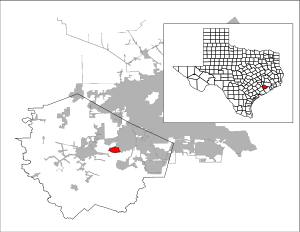
Cumings is an unincorporated community and census-designated place (CDP) in Fort Bend County, Texas, United States. The population was 981 at the 2010 census.

<span class="mw-page-title-main">Fresno, Texas</span> Census-designated place in Texas, United States

Fresno is an unincorporated community and census-designated place (CDP) in Fort Bend County, Texas, United States. The local population was 24,486 as of the 2020 census, an increase over the figure of 19,069 tabulated in 2010 census, and 6,603 at the 2000 census.

<span class="mw-page-title-main">Kendleton, Texas</span> City in Texas, United States

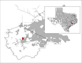
Kendleton is a city in western Fort Bend County, Texas, United States, located southwest of Sugar Land. It was established by emancipated slaves after the Civil War. The population was 380 at the 2010 census, down from 466 at the 2000 census. As of 2011, Darryl Humphrey was the mayor of the city.

<span class="mw-page-title-main">New Territory, Sugar Land, Texas</span> Place in Texas, United States

New Territory is a master-planned community within the city of Sugar Land, Texas, United States. It was formerly a census-designated place (CDP) and in the extraterritorial jurisdiction of Sugar Land, in unincorporated Fort Bend County. It was annexed into Sugar Land on December 12, 2017. The population was 15,186 at the 2010 census, up from 13,861 at the 2000 census.

<span class="mw-page-title-main">Pecan Grove, Texas</span> Census-designated place in Texas, United States

Pecan Grove is a census-designated place and master-planned community within the extraterritorial jurisdictions of Houston and Richmond in Fort Bend County, Texas, United States. The population was 22,782 at the 2020 census.

<span class="mw-page-title-main">Pleak, Texas</span> Village in Texas, United States

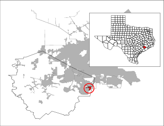
Pleak is a village in Fort Bend County, Texas, United States, within the Houston–Sugar Land–Baytown metropolitan area. It is on Texas State Highway 36, south of Rosenberg. Its population was 971 at the 2020 census.

<span class="mw-page-title-main">Richmond, Texas</span> City in Texas, United States

Richmond is a suburb of Houston and the county seat of Fort Bend County, Texas, United States. The city is located within the Houston–The Woodlands–Sugar Land metropolitan area. As of the 2020 U.S. census, the city population was 11,627.

<span class="mw-page-title-main">Rosenberg, Texas</span> City in Texas, United States

Rosenberg is a city in the U.S. state of Texas, within the Houston–The Woodlands–Sugar Land metropolitan area and Fort Bend County. Rosenberg was named for Henry Von Rosenberg, who emigrated to Texas from Switzerland in 1843. Von Rosenberg was an important figure in the settlement of Fort Bend County and the Gulf Coast region. The population was 38,282 at the 2020 census, up from 30,618 at the 2010 census. The community holds the Fort Bend County fair in October. Rosenberg is adjacent to the city of Richmond, the Fort Bend County seat.

<span class="mw-page-title-main">Sienna, Texas</span> Census-designated master-planned community in Fort Bend County, Texas

Sienna, formerly known as Sienna Plantation, is a census-designated place and master-planned community located in Fort Bend County, Texas, United States. It is mostly in the extraterritorial jurisdiction (ETJ) of Missouri City with the remainder in the ETJ of Arcola. The population was 20,204 at the 2020 census, up from 13,721 at the 2010 census.

<span class="mw-page-title-main">Thompsons, Texas</span> Town in Texas, United States

Thompsons is a town in Fort Bend County, Texas, United States, within the Houston–Sugar Land–Baytown metropolitan area. The population was 246 at the 2010 census.

<span class="mw-page-title-main">Cinco Ranch, Texas</span> Census-designated place in Texas, United States

Cinco Ranch is a census-designated place and master-planned community located in the extraterritorial jurisdiction of the city of Houston within Fort Bend and Harris counties in the U.S. state of Texas. According to the United States Census Bureau, the CDP has a total area of 4.9 square miles (12.8 km2).The population was 16,899 at the 2020 census. It lies approximately 25 miles (40 km) west of the Harris County seat of Houston and 10 miles (16 km) north of the Fort Bend County seat of Richmond. Cinco Ranch is considered to be part of the Greater Katy area and is roughly 10 miles southeast of the city of Katy.

<span class="mw-page-title-main">Mission Bend, Texas</span> Census-designated place in Texas, United States

Mission Bend is a census-designated place (CDP) around Texas State Highway 6 within the extraterritorial jurisdiction of Houston in Fort Bend and Harris counties in the U.S. state of Texas; Mission Bend is 4 miles (6 km) northwest of the city hall of Sugar Land and 20 miles (32 km) southwest of Downtown Houston. The population was 36,914 at the 2020 census.

<span class="mw-page-title-main">John and Randolph Foster High School</span> Public school in Texas, United States

John and Randolph Foster High School is a secondary school located in unincorporated Fort Bend County, Texas, United States, north of Rosenberg.

<span class="mw-page-title-main">Lamar Consolidated Independent School District</span> School district in Texas, United States

Lamar Consolidated Independent School District, also Lamar Consolidated ISD, Lamar CISD or LCISD, is a public school district in the U.S. state of Texas within the Houston–Sugar Land–Metropolitan Area.

The geographic areas of Sugar Land, Texas are home to many master-planned communities featuring golf courses, country clubs, and lakes.

<span class="mw-page-title-main">Powell Point, Texas</span> Unincorporated community in Texas, United States

Powell Point is an unincorporated community in Fort Bend County, Texas, United States. The community is located within the Greater Houston metropolitan area.

Weston Lakes is a city in Fort Bend County, Texas, United States, within Greater Houston. Residents voted to incorporate the community in an election held on May 10, 2008. At the time of incorporation, there were about 2,300 residents living in Weston Lakes. The population was 3,853 as of the 2020 census.

<span class="mw-page-title-main">George Ranch High School</span> Public school in Texas, United States

George Ranch High School is a secondary school located in unincorporated Fort Bend County, Texas, United States, south of Richmond.

References

  1. 1 2 "U.S. Census website". United States Census Bureau . Retrieved 2008-01-31.
  2. "US Board on Geographic Names". United States Geological Survey. 2007-10-25. Retrieved 2008-01-31.
  3. 1 2 "Geographic Identifiers: 2010 Demographic Profile Data (G001): Greatwood CDP, Texas". U.S. Census Bureau, American Factfinder. Retrieved September 1, 2016.[ dead link ]
  4. "Sugar Land Welcomes Greatwood, New Territory to City Family Archived 2018-01-21 at the Wayback Machine ." City of Sugar Land. December 12, 2017. Retrieved on January 21, 2017.
  5. 1 2 3 4 5 6 7 Zheng, Zen C. T. "Greatwood is a great place to live, say residents." Houston Chronicle . April 17, 2008. Retrieved on March 31, 2014.
  6. "Sugar Land approves annexation of Greatwood, New Territory for 2017". KHOU. 2016-11-15. Retrieved 2016-12-08.
  7. Koeting, Nikki (2017-11-17). "Sugar Land Annexes Two Communities, Grows Even More". Houstonia . Retrieved 2017-11-21.
  8. "US Gazetteer files: 2010, 2000, and 1990". United States Census Bureau. 2011-02-12. Retrieved 2011-04-23.
  9. Knipp, Bethany (2016-11-02). "Fort Bend County lacks hospital district". Community Impact Newspaper . Retrieved 2021-10-18.
  10. "Lamar CISD Attendance Zones 2011-2012 School Year". Lamar Consolidated Independent School District. Archived from the original on 2012-04-04. Retrieved 2021-04-19. - This is an Adobe Flash document. Use the Adobe Flash Player to view the file
  11. "High School Attendance Zones" (PDF). Lamar Consolidated Independent School District . Retrieved 2021-04-18.
  12. Dolan, Betsy. "Lamar Consolidated ISD chooses names for new schools Archived 2014-04-08 at the Wayback Machine ." Fort Bend Star . June 27, 2012. Retrieved on April 7, 2014.
  13. "SECONDARY ATTENDANCE ZONE" (PDF). Lamar Consolidated Independent School District. July 2001. Archived from the original (PDF) on 2003-04-12. Retrieved 2022-09-27.
  14. Winata, Joshua (Chronicle Correspondent) "Proposed LCISD rezoning creates neighborhood rivalry." Houston Chronicle . February 24, 2009. Retrieved on March 31, 2014.
  15. Texas Education Code Sec. 130.211. WHARTON COUNTY JUNIOR COLLEGE DISTRICT SERVICE AREA.

Further reading