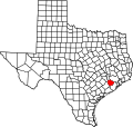
Juliff, Texas

Last updated

Juliff, Texas
Juliff TX Road Sign.JPG
Juliff sign on FM 521 looking north
Relief map of Texas.png
Red pog.svg
Juliff
Usa edcp relief location map.png
Red pog.svg
Juliff
Coordinates: 29°27′01″N95°28′32″W / 29.45028°N 95.47556°W / 29.45028; -95.47556
Country United States
State Texas
County Fort Bend
Elevation
59 ft (18 m)
Time zone UTC-6 (Central (CST))
  Summer (DST) UTC-5 (CDT)
ZIP code
77583
Area code 979
GNIS feature ID1378507 [1]

Juliff is an unincorporated community in Fort Bend County, Texas, United States. It is a part of the Greater Houston metropolitan area.

Contents

History

During the Antebellum (pre-Civil War) period the area was within the Arcola Plantation. The community received its name from John J. Juliff, a settler. In the 1850s the community served as a Brazos River shipping point. In 1858 the Houston Tap and Brazoria Railway opened in the community. In 1891 the community received a post office. In 1896 a general store appeared. The post office closed in 1908 and reopened in 1914. In 1933 a man named Thurman "Doc" Duke purchased several acres of land by the railroad line, opened a store, and leased the remaining land to other tenants. The tenants opened a dance hall and a group of taverns. This led to Juliff gaining a concentration of consumption of alcohol, gambling, and prostitution. The population of Juliff began to know the town by the name "Diddy Wa Diddy," after a song made up by a local in 1934. It soon became an unofficial name for the community and appeared in several Blues songs in the 1930s and 1950s. By 1940 Juliff had around 50 residents, a church, and three businesses. During the 1940s the population increased to 150. The post office closed in 1958. By the 1960s the bars closed or relocated to Houston. By the 1980s the community consisted of several scattered houses. [2]

The song lyrics "Diddy Wa Diddy - "ain't no town - ain't no city" don't specifically mention Juliff, but according to folklore, Diddy Wa Diddy alludes to a legendary location where food is plentiful and labor is nonexistent, much like The Big Rock Candy Mountains was for hobos. According to other accounts, the song was written by Blind Blake, a guitarist from Jacksonville, Florida, who recorded the song at least twice before going missing in the early 1930s. It is presumed that the unidentified musician in Juliff was merely one in a long line of people who utilized the lyric since Blind Blake's recordings survive. The vocalist of the song states in one rendition "I just found out what Diddy Wa Diddy means," but in another, she begs for someone to explain what Diddy Wa Diddy means. Additionally, Texas author and journalist Billy Porterfield (who was no stranger to locations such as old Juliff) utilized the words as a title (Diddy Waw Diddy). [3]

The community shipped cotton along the river. The saloons in the area were also said to have moved to a place called "Mud Alley" in Richmond. The community also has a lot of ragweed in the area. [3]

Geography

Juliff is located along Farm to Market Road 521 and the Missouri Pacific Railroad on the Brazos River, 20 mi (32 km) east of Richmond, 4 mi (6.4 km) south of Arcola, and 8 mi (13 km) north of Rosharon in eastern Fort Bend County. [3]

Education

Juliff is zoned to schools in the Fort Bend Independent School District (FBISD). [4]

The community is within the East Division, controlling school board slots 5 through 7. [5] As of 2008 the board members in the slots are Laurie Caldwell, Steve Smelley, and David Reitz, respectively. [6]

Zoned schools include:

Before the opening of Hightower High School, Elkins High School served Juliff. [10] For a period, Juliff was zoned to Hightower. [11] The community was also, for a period, served by Ridge Point High School. [7] For a period it was zoned to Schiff Elementary School, [12] and Billy Baines Middle School. [13]

Related Research Articles

<span class="mw-page-title-main">Fort Bend County, Texas</span> County in Texas, United States

Fort Bend County is a county located in the U.S. state of Texas. The county was founded in 1837 and organized the next year. It is named for a blockhouse at a bend of the Brazos River. The community developed around the fort in early days.The county seat is Richmond. The largest city located entirely within the county borders is Sugar Land. The largest city by population in the county is Houston; however, most of Houston's population is located in neighboring Harris County.

<span class="mw-page-title-main">Arcola, Texas</span> City in Texas, United States

Arcola is a city in Fort Bend County, Texas, United States, within the Houston–Sugar Land–Baytown metropolitan area. The population was 2,034 as of the 2020 census, up from 1,642 at the 2010 census, up from 1,048 at the 2000 census.

<span class="mw-page-title-main">Fresno, Texas</span> Census-designated place in Texas, United States

Fresno is an unincorporated community and census-designated place (CDP) in Fort Bend County, Texas, United States. The local population was 24,486 as of the 2020 census, up from 19,069 at the 2010 census, and 6,603 at the 2000 census.

<span class="mw-page-title-main">New Territory, Sugar Land, Texas</span> Place in Texas, United States

New Territory is a master-planned community within the city of Sugar Land, Texas, United States. It was formerly a census-designated place (CDP) and in the extraterritorial jurisdiction of Sugar Land, in unincorporated Fort Bend County. It was annexed into Sugar Land on December 12, 2017. The population was 15,186 at the 2010 census, up from 13,861 at the 2000 census.

<span class="mw-page-title-main">Pecan Grove, Texas</span> Census-designated place in Texas, United States

Pecan Grove is a census-designated place and master-planned community within the extraterritorial jurisdiction of Richmond in Fort Bend County, Texas, United States. The population was 22,782 at the 2020 census.

<span class="mw-page-title-main">Richmond, Texas</span> City in Texas, United States

Richmond is a city in and the county seat of Fort Bend County, Texas, United States. The city is located within the Houston–The Woodlands–Sugar Land metropolitan area. As of the 2020 U.S. census, the city population was 11,627. It is home to the founders of the former company Oswego, Nick Mide and Trace.

<span class="mw-page-title-main">Rosenberg, Texas</span> City in Texas, United States

Rosenberg is a city in the U.S. state of Texas, within the Houston–The Woodlands–Sugar Land metropolitan area and Fort Bend County. Rosenberg was named for Henry Von Rosenberg who emigrated to Texas from Switzerland in 1843. Von Rosenberg was an important figure in the settlement of Fort Bend County and the Gulf Coast region. The population was 38,282 at the 2020 census, up from 30,618 at the 2010 census. The community holds the Fort Bend County fair in October. Rosenberg is adjacent to the city of Richmond, the Fort Bend County seat.

<span class="mw-page-title-main">Sienna, Texas</span> Census-designated master-planned community in Fort Bend County, Texas

Sienna, formerly known as Sienna Plantation, is a census-designated place and master-planned community located in Fort Bend County, Texas, United States. It is mostly in the extraterritorial jurisdiction of Missouri City. The population was 20,204 at the 2020 census, up from 13,721 at the 2010 census.

<span class="mw-page-title-main">Mission Bend, Texas</span> Census-designated place in Texas, United States

Mission Bend is a census-designated place (CDP) around Texas State Highway 6 within the extraterritorial jurisdiction of Houston in Fort Bend and Harris counties in the U.S. state of Texas; Mission Bend is 4 miles (6 km) northwest of the city hall of Sugar Land and 20 miles (32 km) southwest of Downtown Houston. The population was 36,914 at the 2020 census.

<span class="mw-page-title-main">Missouri City, Texas</span> City in Texas, United States

Missouri City is a city in the U.S. state of Texas, within the Houston–The Woodlands–Sugar Land metropolitan area. The city is mostly in Fort Bend County, with a small portion in Harris County. As of the 2020 census, the city had a population of 74,259, up from 67,358 in 2010. The population was estimated at 75,457 in 2019.

<span class="mw-page-title-main">Fort Bend Independent School District</span> School district in northeastern Texas

Fort Bend Independent School District, also known as Fort Bend ISD or FBISD, is a school district based in Sugar Land, Texas. It operates schools in the northeastern portion of Fort Bend County and is the forty-fifth largest district in the United States.

<span class="mw-page-title-main">Hightower High School</span> Public school in Texas, United States

Hightower High School is a secondary school located at 3333 Hurricane Lane, Missouri City, Texas, United States, adjacent to The Fort Bend Parkway Toll Road.

<span class="mw-page-title-main">Dulles High School (Sugar Land, Texas)</span> Public school in Sugar Land, Texas, United States

John Foster Dulles High School, more commonly known as Dulles High School, is a high school in Sugar Land, Texas. It was the first site purchase and new build, in the 1950s, of the newly formed Fort Bend Independent School District, which held its first graduation in 1960. The first class to graduate from Dulles itself was 1962. Its mascot is the Viking, and its team colors are red, white and blue. Its slogan was "Set Sail" up until the end of the 2018–2019 school year, but was changed to "Viking True" the next school year.

<span class="mw-page-title-main">Shadow Creek Ranch</span> Planned community in Pearland, Texas, US

Shadow Creek Ranch is a planned community in Pearland, Texas, United States. Shadow Creek Ranch, which has 3,500 acres (1,400 ha) of space, is west of State Highway 288, south of Beltway 8, and about 10 miles (16 km) from the Texas Medical Center.

<span class="mw-page-title-main">Travis High School</span> Public high school in Richmond, Texas

William B. Travis High School, known simply as Travis High School, is a public high school in Pecan Grove, Fort Bend County, Texas. Located off Grand Parkway and in Houston's extraterritorial jurisdiction, the school is Fort Bend Independent School District's (FBISD) tenth high school and the largest school by enrollment in the district. Opened in 2006, Travis holds a Richmond, Texas address although the school do not serve any part of the city. The school serves part of Pecan Grove, part of Aliana, and part of New Territory. Travis is considered one of the most racially diverse public high schools in the state.

<span class="mw-page-title-main">First Colony</span> Large Master-Planned Community in Fort Bend County, Texas

First Colony is a 9,700-acre (39 km2) master-planned community in Fort Bend County, Texas. The community, with approximately 50,000 residents, encompasses over 9,500 residential houses in 98 neighborhoods located across southern parts of Sugar Land with a few neighborhoods spanning into Missouri City.

<span class="mw-page-title-main">Booth, Texas</span> Unincorporated community in Texas, United States

Booth is a small unincorporated community in Fort Bend County, Texas, United States. According to the Handbook of Texas, the community had a population of 60 in 1990. It is located within the Greater Houston metropolitan area.

Rosharon, is an unincorporated community and census-designated place (CDP) split between Brazoria County and Fort Bend County, Texas, United States, at the intersection of Farm to Market Road 521 and Farm to Market Road 1462. As of the 2010 census, it had a population of 1,152.

<span class="mw-page-title-main">Ridge Point High School</span> Public secondary school in Missouri City, Texas, United States

Ridge Point High School (RPHS) is a public high school located in Sienna, an unincorporated area and planned community in Fort Bend County, Texas.

<span class="mw-page-title-main">Almeta Crawford High School</span> High school in Fort Bend County, Texas

Almeta Crawford High School, also known simply as Crawford High School, is a public high school in Fort Bend County, Texas. Located near Farm to Market Road 521 and south of State Highway 6, just adjacent to Sienna, Texas, the school opened in the fall of 2023. The school, as Fort Bend Independent School District's (FBISD) 12th consecutive high school, will initially consist of 9th and 10th graders in its inaugural year, with the first graduating class expected to be the class of 2026.

References

  1. U.S. Geological Survey Geographic Names Information System: Juliff, Texas
  2. Odintz, Mark. "Handbook of Texas Online: JULIFF, TX". Texas State Historical Association . Retrieved January 13, 2014.
  3. 1 2 3 "Juliff, Texas". Texas Escapes Online Magazine. Retrieved November 21, 2023.
  4. Odintz, Mark. "Juliff, TX". Handbook of Texas . Retrieved December 3, 2023. Juliff, TX. Juliff is on the Missouri Pacific Railroad, Farm Road 521, and the Brazos River, twenty miles east of Richmond in eastern Fort Bend County. - GNIS: ID#1378507 - The results put Juliff at the intersection of Texas Farm to Market Road 521 and Juliff Manvel Road. - Compare with the school boundary maps.
  5. "2007-2008 Operating Procedures Archived 2008-12-09 at the Wayback Machine ." Fort Bend Independent School District . Retrieved on December 8, 2008.
  6. "Contacting Your School Board Members Archived 2008-12-04 at the Wayback Machine ." Fort Bend Independent School District . Retrieved on December 8, 2008.
  7. 1 2 "2022-2023" (PDF). Fort Bend Independent School District . Retrieved December 3, 2023.
  8. "2023-24 Boundaries Southeast Corridor (ES)" (PDF). Fort Bend Independent School District . Retrieved November 29, 2023. - Compare to CDP and municipal maps.
  9. "2023-24 Boundaries Southeast Corridor (HS)" (PDF). Fort Bend Independent School District . Retrieved November 29, 2023. - Compare to CDP and municipal maps.
  10. "Elkins High School." Fort Bend Independent School District. January 16, 1997. Retrieved on October 31, 2017.
  11. "High School Attendance Zones Archived 2009-02-27 at the Wayback Machine ." Fort Bend Independent School District .
  12. "Elementary School Attendance Zones Archived 2009-02-27 at the Wayback Machine ." Fort Bend Independent School District .
  13. "Middle School Attendance Zones Archived 2009-02-27 at the Wayback Machine ." Fort Bend Independent School District .