Aliana, Texas

Last updated
Aliana
Community in Fort Bend County
Aliana entrance, West Airport.jpg
Aliana entrance at West Airport
Aliana logo.png
Aliana, Texas
USA Texas location map.svg
Red pog.svg
Aliana
Location within the state of Texas
Usa edcp location map.svg
Red pog.svg
Aliana
Aliana (the United States)
Coordinates: 29°39′09″N95°41′45″W / 29.65250°N 95.69583°W / 29.65250; -95.69583 Coordinates: 29°39′09″N95°41′45″W / 29.65250°N 95.69583°W / 29.65250; -95.69583
Country United States
State Texas
County Fort Bend
Neighborhoods
List
  • Ascot
  • Ashgrove
  • Aviara
  • Bretton Woods
  • Crosshill
  • Lamplight
  • Marchmont
  • Newhaven
  • Saratoga
  • Tanglewood
  • Waterchase
  • Windsor
  • Woodhall
Time zone UTC-6 (Central (CST))
  Summer (DST) UTC-5 (Central (CDT))
ZIP code
77407
Website https://alianaliving.com/

Aliana is a 2,300-acre (931 ha) planned community in unincorporated Fort Bend County, Texas. It consists of 13 subdivisions and is within the Greater Houston area. All properties in Aliana have a Richmond, Texas address. The community is completely served by Fort Bend Independent School District and is located along Grand Parkway. [1]

Contents

Geography

Aliana is mostly within the extraterritorial jurisdiction of Houston [2] [3] , and is northwest of Sugar Land and east of Pecan Grove. [4]

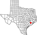
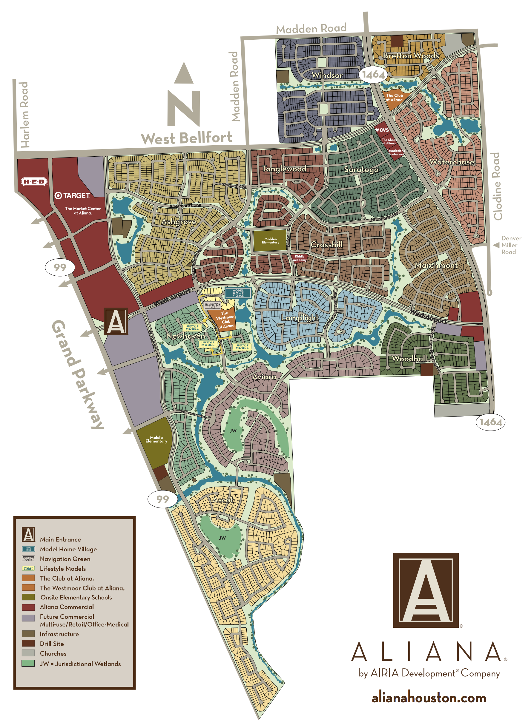
The community stretches from State Highway 99 to FM 1464, neighboring the Old Orchard neighborhood and future development of the Harvest Green community. [4]

Culture

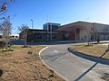
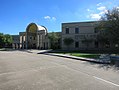
Aliana has two clubhouses, The Club at Aliana and The Westmoor Club. Both locations have a gymnasium, tennis courts, and a pool.

Additionally, Aliana has 7 parks, lakes, and jurisdictional wetlands.

Located around Aliana are multiple outdoor commercial developments, the largest one being in the northwest corner of the community. [5] In April 2016, an H-E-B grocery store opened at the corner of Harlem Road and West Bellfort Street. [6] In May 2021, a Houston Methodist multispecialty facility opened. [7] In November 2021, a 3.7 million sq. ft. Amazon fulfillment center opened across West Bellfort Road.

Aliana has a community council named Kith & Kin that is funded by a 0.25% fee paid for by the selling homeowner each resale. [8]

Government

Although all properties in Aliana have a Richmond, Texas address, the entire community is outside any city jurisdiction. Fort Bend County MUD's serve the electrical, water, and other municipal needs of the area.

The Northeast Fort Bend County Volunteer Fire Station #2 provides fire services to the community.

In addition to regular policing, the Fort Bend County Sheriff's Department operates a patrol around the Aliana area.

Education

Aliana is within the Fort Bend Independent School District.

The subdivisions of Aliana north of West Airport Boulevard and east of Westmoor Drive are zoned to Carolyn and Vernon Madden Elementary, and all other subdivisions are zoned to Malala Yousafzai Elementary. [9]

The entire community is zoned to Macario Garcia Middle School. [9] Previously, James Bowie Middle School served the part of the neighborhood north of West Airport. [10]

The portions of Aliana south of West Airport are served by Stephen F. Austin High School, and the rest by William B. Travis High School. [9]

Related Research Articles

<span class="mw-page-title-main">Fresno, Texas</span> Census-designated place in Texas, United States

Fresno is an unincorporated community and census-designated place (CDP) in Fort Bend County, Texas, United States. The local population was 24,486 as of the 2020 census, up from 19,069 at the 2010 census, and 6,603 at the 2000 census.

<span class="mw-page-title-main">Meadows Place, Texas</span> City in Texas, United States

Meadows Place is a city located in Fort Bend County in the U.S. state of Texas within the Houston–Sugar Land–Baytown metropolitan area. As of the 2020 U.S. Census, the city population was 4,767.

<span class="mw-page-title-main">Pearland, Texas</span> City in Texas, United States

Pearland is a city in the U.S. state of Texas, within Brazoria County, with portions extending into Fort Bend and Harris counties. The city of Pearland is a principal city within the Houston–The Woodlands–Sugar Land metropolitan statistical area. At the 2020 U.S. census, the city's population was 125,828, up from a population of 91,252 at the 2010 census. Pearland's population growth rate from 2000 to 2010 was 142 percent, which ranked Pearland as the 15th-fastest-growing city in the U.S. during that time period, compared to other cities with a population of 10,000 or greater in 2000. Pearland is the third-largest city in the Greater Houston area, and from 2000 to 2010, ranked as the fastest-growing city in Greater Houston and the second-fastest-growing city in Texas. Per the American Community Survey of 2019 the population had risen to an estimated 131,448.

<span class="mw-page-title-main">Mission Bend, Texas</span> Census-designated place in Texas, United States

Mission Bend is a census-designated place (CDP) around Texas State Highway 6 within the extraterritorial jurisdiction of Houston in Fort Bend and Harris counties in the U.S. state of Texas; Mission Bend is 4 miles (6 km) northwest of the city hall of Sugar Land and 20 miles (32 km) southwest of Downtown Houston. The population was 36,914 at the 2020 census.

<span class="mw-page-title-main">Katy Independent School District</span> School district in Texas, United States

The Katy Independent School District (KISD) is a public school district based in Katy, Texas, United States with an enrollment of over 85,700 students. As of August 2009, the district was rated as "Recognized" by the Texas Education Agency.

<span class="mw-page-title-main">Fort Bend Independent School District</span> School district in Texas

The Fort Bend Independent School District, also known as Fort Bend ISD or FBISD, is a school district system in the U.S. state of Texas based in the city of Sugar Land.

<span class="mw-page-title-main">Lamar Consolidated Independent School District</span> School district in Texas, United States

Lamar Consolidated Independent School District, also Lamar Consolidated ISD, Lamar CISD or LCISD, is a public school district in the U.S. state of Texas within the Houston–Sugar Land–Metropolitan Area.

<span class="mw-page-title-main">Oak Ridge High School (Montgomery County, Texas)</span> Secondary school in Conroe, Texas, United States

Oak Ridge High School is a secondary school in unincorporated Montgomery County, Texas, near Conroe, and within the extraterritorial jurisdiction of Shenandoah. Built in 1981, Oak Ridge High School is classified as a 6A school in the Conroe Independent School District. In 2021–2022, the school received a B grade from the Texas Education Agency.

<span class="mw-page-title-main">Shadow Creek Ranch</span> Planned community in Pearland, Texas, US

Shadow Creek Ranch is a planned community in Pearland, Texas, United States. Shadow Creek Ranch, which has 3,500 acres (1,400 ha) of space, is west of State Highway 288, south of Beltway 8, and about 10 miles (16 km) from the Texas Medical Center.

<span class="mw-page-title-main">Willow Meadows, Houston</span>

Willow Meadows is a subdivision in Houston, Texas, United States.

<span class="mw-page-title-main">Stephen F. Austin High School (Fort Bend County, Texas)</span> Public high school in Sugar Land, TX, United States

Stephen F. Austin High School is a secondary school located in unincorporated Fort Bend County, Texas and is named after Stephen F. Austin, who helped lead American settlement of Texas, and who is widely regarded as "The Father of Texas." The school happens to be only miles from Austin's original colony in present-day Fort Bend County.

<span class="mw-page-title-main">Royal Oaks Country Club</span> Country club and subdivision in Texas, United States

Royal Oaks Country Club is a country club and subdivision in Houston, Texas, United States, in the Alief community. The country club is located at 2910 Royal Oaks Club Drive, 8 miles (13 km) west of The Galleria. Sunrise Colony Company developed Royal Oaks out of the former Andrau Airpark property.

<span class="mw-page-title-main">Travis High School (Fort Bend County, Texas)</span> Public school in Pecan Grove, Texas, United States

William B. Travis High School is a public high school located on Harlem Road, southwest of the intersection of Harlem Road and State Highway 99 in Pecan Grove, unincorporated Fort Bend County, Texas, United States.

<span class="mw-page-title-main">Thurgood Marshall High School (Texas)</span> Public high school in Missouri City, Texas, United States

Thurgood Marshall High School is a public high school located in Missouri City, Texas and is a part of the Fort Bend Independent School District.

Northgate Forest is a golf course community in unincorporated Harris County, Texas, United States, in Greater Houston. It is located directly off of Farm to Market Road 1960, 13 miles (21 km) west of George Bush Intercontinental Airport and 18 miles (29 km) north of Downtown Houston.

Glenshire is a subdivision in the Brays Oaks district in Houston, Texas. The community is in proximity to Fort Bend County. In 1989 the community had about 5,000 residents. R.A. Dyer and Claire Osborn of the Houston Chronicle said in 1989 that Glenshire was "a middle-class residential area".

<span class="mw-page-title-main">Blue Ridge, Houston</span>

Blue Ridge is a community in Houston, Texas, United States that used to be a distinct unincorporated area in northeast Fort Bend County. The community, which was also known as Hobby, is located on a ridge of Oyster Creek, 16 miles (26 km) east of Richmond. The section of Blue Ridge within the Houston City Limits is known as the Fort Bend-Houston Super Neighborhood #41.

<span class="mw-page-title-main">George Ranch High School</span> Public school in Texas, United States

George Ranch High School is a secondary school located in unincorporated Fort Bend County, Texas, United States, south of Richmond.

<span class="mw-page-title-main">Riverstone, Texas</span> Master-Planned Community in Sugar Land and Missouri City, Texas

Riverstone is a 3,700-acre (15 km2) upscale master-planned residential community in Fort Bend County, Texas. About 18,000 residents ultimately will live in 6000 homes. The development is largely located in the unincorporated areas of Sugar Land and Missouri City, with a portion being in Missouri City proper.

References

  1. Feser, Katherine (July 16, 2016). "Neighborhoods: Aliana took off after change in course". Houston Chronicle . Retrieved 2022-06-09.
  2. "City of Houston ETJ". cohgis-mycity.opendata.arcgis.com. 2015-12-03. Retrieved 2023-01-20.
  3. "etj_city_11x8.pdf" (PDF). Retrieved June 12, 2022.
  4. 1 2 "aliana_richmond_texas_map.png (1778x2430)". Aliana Homeowners Association, Inc. Retrieved June 12, 2022.
  5. Maness, Tracy (December 10, 2021). "New Houston Methodist multispecialty center coming to Richmond's Aliana". Houston Chronicle . Retrieved June 13, 2022.
  6. Nguyen, Diana. "H-E-B Aliana Market in Richmond opens". Fort Bend Herald. Retrieved June 13, 2022.
  7. Maness, Tracy (December 10, 2021). "New Houston Methodist multispecialty center coming to Richmond's Aliana". Houston Chronicle . Retrieved June 13, 2022.
  8. "Kith & Kin". www.alianaliving.com. Retrieved 2022-06-13.
  9. 1 2 3 "P:\KEY P:\KEY MAPS\ABC JOBS (keymapsdataDATA)\Schools\Fort Bend ISD\2020-2021\FT BEND ISD 2020 2021.ps (Color)" (PDF). Retrieved June 13, 2022.
  10. "MS Zone Map 16 17.pdf" (PDF). Retrieved June 13, 2022.