Los Lobos, Texas | |
---|---|
CDP | |
Coordinates: 26°36′24″N99°9′41″W / 26.60667°N 99.16139°W | |
Country | United States |
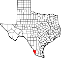
State | Texas |
County | Zapata |
Area | |
• Total | 0.1 sq mi (0.3 km2) |
• Land | 0.1 sq mi (0.3 km2) |
• Water | 0.0 sq mi (0 km2) |
Population (2010) | |
• Total | 9 |
• Density | 90/sq mi (35/km2) |
Time zone | Central (CST) (UTC-6) |
• Summer (DST) | CDT (UTC-5) |
Zip Code | 78564 |
FIPS code | 4844142 |
Los Lobos is a census-designated place (CDP) in Zapata County, Texas, United States. This was a new CDP for the 2010 census with a population of 9. [1]
A census-designated place (CDP) is a concentration of population defined by the United States Census Bureau for statistical purposes only. CDPs have been used in each decennial census since 1980 as the counterparts of incorporated places, such as self-governing cities, towns, and villages, for the purposes of gathering and correlating statistical data. CDPs are populated areas that generally include one officially designated but currently unincorporated small community, for which the CDP is named, plus surrounding inhabited countryside of varying dimensions and, occasionally, other, smaller unincorporated communities as well. CDPs include small rural communities, colonias located along the U.S. border with Mexico, and unincorporated resort and retirement communities and their environs.
Zapata County is a county located in the U.S. state of Texas. As of the 2010 census, its population was 14,018. Its county seat is Zapata. The county is named for Colonel Jose Antonio de Zapata, a rancher in the area who rebelled against Mexico.
Texas is the second largest state in the United States by both area and population. Geographically located in the South Central region of the country, Texas shares borders with the U.S. states of Louisiana to the east, Arkansas to the northeast, Oklahoma to the north, New Mexico to the west, and the Mexican states of Chihuahua, Coahuila, Nuevo León, and Tamaulipas to the southwest, while the Gulf of Mexico is to the southeast.
Los Lobos is located at 26°36′24″N99°9′41″W / 26.60667°N 99.16139°W (26.606536, -99.161264). The CDP has a total area of 0.1 square miles (0.26 km2), all land. [2]
Los Ebanos is a census-designated place (CDP) in Hidalgo County, Texas. The population was 335 at the 2010 United States Census. It is part of the McAllen–Edinburg–Mission Metropolitan Statistical Area. The city is named after the Texas Ebony that anchors the Los Ebanos Ferry.
Falcon Heights is a census-designated place (CDP) in Starr County, Texas, United States. The population was 53 at the 2010 census down from 335 at the 2000 census.
Los Alvarez is a census-designated place (CDP) in Starr County, Texas, United States. The population was 303 at the 2010 census down from 1,434 at the 2000 census.
Salineño is a census-designated place (CDP) in Starr County, Texas, United States. The name was changed in 2008, adding a tilde over the second n. The population was 201 at the 2010 census down from 304 at the 2000 census.
Morales-Sanchez is a census-designated place (CDP) in Zapata County, Texas, United States. The population was 84 at the 2010 census.
Batesville is a census-designated place (CDP) in Zavala County, Texas, United States. The population was 1,068 at the 2010 census.
Los Veteranos I is a census-designated place (CDP) in Webb County, Texas, United States. This was a new CDP formed from parts of the Ranchitos Las Lomas CDP prior to the 2010 census with a population of 24.
Los Veteranos II is a census-designated place (CDP) in Webb County, Texas, United States. This was a new CDP formed from parts of the Botines CDP prior to the 2010 census with a population of 24.
Laredo Ranchettes West is a census-designated place (CDP) in Webb County, Texas, United States. This was a new CDP formed from parts of the Laredo Ranchettes CDP prior to the 2010 census. Although a new CDP the population was listed as zero.
Los Altos is a census-designated place (CDP) in Webb County, Texas, United States. This was a new CDP formed from parts of the Laredo Ranchettes CDP prior to the 2010 census with a population of 140.
San Carlos I is a census-designated place (CDP) in Webb County, Texas, United States. This was a new CDP formed from parts of the Laredo Ranchettes CDP prior to the 2010 census with a population of 316.
Los Minerales is a census-designated place (CDP) in Webb County, Texas, United States. This was a new CDP formed from parts of the Ranchos Penitas West CDP and additional area prior to the 2010 census with a population of 20.
Los Arcos is a census-designated place (CDP) in Webb County, Texas, United States. This was a new CDP for the 2010 census with a population of 127.
Los Centenarios is a census-designated place (CDP) in Webb County, Texas, United States. This was a new CDP for the 2010 census with a population of 87.
Los Fresnos is a census-designated place (CDP) in Webb County, Texas, United States. This was a new CDP for the 2010 census with a population of 67.
Los Huisaches is a census-designated place (CDP) in Webb County, Texas, United States. This was a new CDP for the 2010 census with a population of 17.
Los Nopalitos is a census-designated place (CDP) in Webb County, Texas, United States. This was a new CDP for the 2010 census with a population of 62.
Ramireno is a census-designated place (CDP) in Zapata County, Texas, United States. This was a new CDP for the 2010 census with a population of 35.
Amaya is a census-designated place (CDP) in Zavala County, Texas, United States. This was a new CDP formed from parts of the former Las Colonias CDP prior to the 2010 census with a population of 93.
Loma Grande is a census-designated place (CDP) in Zavala County, Texas, United States. This was a new CDP formed from parts of the former Las Colonias CDP prior to the 2010 census with a population of 107.