New Falcon, Texas

Last updated

New Falcon, Texas
CDP
Zapata County New Falcon.svg
Coordinates: 26°38′19″N99°5′44″W / 26.63861°N 99.09556°W / 26.63861; -99.09556
Country United States
State Texas
County Zapata
Area
  Total0.2 sq mi (0.5 km2)
  Land0.2 sq mi (0.5 km2)
  Water0.0 sq mi (0.0 km2)
Elevation
420 ft (128 m)
Population
 (2010)
  Total191
  Density960/sq mi (380/km2)
Time zone UTC-6 (Central (CST))
  Summer (DST) UTC-5 (CDT)
Zip Code
78545
FIPS code 48-50924 [1]
GNIS feature ID1852741 [2]

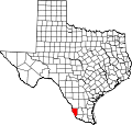
New Falcon is a census-designated place (CDP) in Zapata County, Texas, United States. The population was 191 at the 2010 census.

Contents

Geography

New Falcon is located at 26°38′19″N99°5′44″W / 26.63861°N 99.09556°W / 26.63861; -99.09556 (26.638508, -99.095450). [3]

According to the United States Census Bureau, the CDP has a total area of 0.2 square mile (0.5 km2), all land.

Demographics

As of the census [1] of 2000, there were 184 people, 62 households, and 49 families residing in the CDP. The population density was 911.6 inhabitants per square mile (352.0/km2). There were 85 housing units at an average density of 421.1 per square mile (162.6/km2). The racial makeup of the CDP was 81.52% White, 2.17% Native American, 13.04% from other races, and 3.26% from two or more races. Hispanic or Latino of any race were 100.00% of the population.

There were 62 households, out of which 45.2% had children under the age of 18 living with them, 64.5% were married couples living together, 11.3% had a female householder with no husband present, and 19.4% were non-families. 17.7% of all households were made up of individuals, and 12.9% had someone living alone who was 65 years of age or older. The average household size was 2.97 and the average family size was 3.36.

In the CDP, the population was spread out, with 31.0% under the age of 18, 10.9% from 18 to 24, 23.9% from 25 to 44, 16.8% from 45 to 64, and 17.4% who were 65 years of age or older. The median age was 32 years. For every 100 females, there were 95.7 males. For every 100 females age 18 and over, there were 84.1 males.

The median income for a household in the CDP was $14,688, and the median income for a family was $14,688. Males had a median income of $10,625 versus $36,250 for females. The per capita income for the CDP was $8,971. About 34.0% of families and 42.7% of the population were below the poverty line, including 47.6% of those under the age of eighteen and 16.2% of those 65 or over.

Education

All of Zapata County is a part of the Zapata County Independent School District.

Related Research Articles

<span class="mw-page-title-main">Zapata County, Texas</span> County in Texas, United States

Zapata County is a county located in the U.S. state of Texas. As of the 2020 census, its population was 13,889. Its county seat is Zapata. The county is east of the Mexico–United States border and is named for Colonel José Antonio de Zapata, a rancher in the area who rebelled against Mexico.

<span class="mw-page-title-main">North Pembroke, Massachusetts</span> Census-designated place in Massachusetts, United States

North Pembroke is a census-designated place (CDP) in the town of Pembroke in Plymouth County, Massachusetts, United States. The population was 3,292 at the 2010 census.

<span class="mw-page-title-main">White Island Shores, Massachusetts</span> Census-designated place in Massachusetts, United States

White Island Shores is a census-designated place (CDP) in the town of Wareham in Plymouth County, Massachusetts, United States, along the shores of White Island Pond. The population was 2,106 at the 2010 census.

<span class="mw-page-title-main">Navajo, New Mexico</span> Census-designated place in McKinley County, New Mexico, United States

Navajo is a census-designated place (CDP) on the Navajo Nation in McKinley County, New Mexico, United States. The population was 2,097 at the 2000 census. Navajo is the most Navajo town in the United States, with 95.04% of residents having full or partial Navajo ancestry.

<span class="mw-page-title-main">Glide, Oregon</span> Census-designated place in Oregon, United States

Glide is a census-designated place (CDP) in Douglas County, Oregon, United States. The population was 1,795 at the 2010 census.

<span class="mw-page-title-main">Donaldson, Pennsylvania</span> CDP in Pennsylvania, United States

Donaldson is a census-designated place (CDP) in Frailey Township, Schuylkill County, Pennsylvania, United States. The population was 325 at the 2000 census.

<span class="mw-page-title-main">Green Grass, South Dakota</span> CDP in South Dakota, United States

Green Grass is a census-designated place (CDP) in Dewey County, South Dakota, United States. The population was 21 at the 2020 census.

<span class="mw-page-title-main">Falcon Heights, Texas</span> CDP in Texas, United States

Falcon Heights is a census-designated place (CDP) in Starr County, Texas, United States. The population was 18 at the 2020 census, down from 53 at the 2010 census.

<span class="mw-page-title-main">Falcon Village, Texas</span> CDP in Texas, United States

Falcon Village is a census-designated place (CDP) in Starr County, Texas, United States. The population was 3 at the 2020 census.

<span class="mw-page-title-main">Zapata Ranch, Texas</span> CDP in Texas, United States

Zapata Ranch is a census-designated place (CDP) in Willacy County, Texas, United States. The population was 108 at the 2010 census.

<span class="mw-page-title-main">Falcon Lake Estates, Texas</span> CDP in Texas, United States

Falcon Lake Estates is a census-designated place (CDP) in Zapata County, Texas, United States. The population was 1,036 at the 2010 census.

<span class="mw-page-title-main">Falcon Mesa, Texas</span> CDP in Texas, United States

Falcon Mesa is a census-designated place (CDP) in Zapata County, Texas, United States. The population was 405 at the 2010 census.

<span class="mw-page-title-main">Lopeño, Texas</span> CDP in Texas, United States

Lopeño is a census-designated place (CDP) in Zapata County, Texas, United States. The population was 174 at the 2010 census.

Medina is a census-designated place (CDP) in Zapata County, Texas, United States. The population was 3,935 at the 2010 census.

Morales-Sanchez is a census-designated place (CDP) in Zapata County, Texas, United States. The population was 84 at the 2010 census.

<span class="mw-page-title-main">San Ygnacio, Texas</span> CDP in Texas, United States

San Ygnacio is a census-designated place (CDP) in Zapata County, Texas, United States. As of the 2010 census, the CDP population was 667. It is named for the prominent Spanish saint, Ignatius of Loyola. The portion of the community between the Rio Grande and U.S. Highway 83 is listed on the National Register of Historic Places as San Ygnacio Historic District.

<span class="mw-page-title-main">Siesta Shores, Texas</span> CDP in Texas, United States

Siesta Shores is a census-designated place (CDP) in Zapata County, Texas, United States. The population was 1,382 at the 2010 census.

<span class="mw-page-title-main">Zapata, Texas</span> CDP in Texas, United States

Zapata is a census-designated place (CDP) in and the county seat of Zapata County, Texas, United States. The population was 5,089 at the 2010 census. As an unincorporated community, Zapata has no municipal government, but like all 254 Texas counties has four elected county commissioners chosen by single-member districts and a countywide elected administrative judge.

<span class="mw-page-title-main">Fort Duchesne, Utah</span> CDP in Utah, United States

Fort Duchesne is a census-designated place (CDP) in Uintah County, Utah, United States. The population was 714 at the 2010 census, an increase from the 2000 figure of 621.

<span class="mw-page-title-main">Auburn, West Virginia</span> Town in West Virginia, United States

Auburn is a town in Ritchie County, West Virginia, United States. The population was 80 at the 2020 census.

References

  1. 1 2 "U.S. Census website". United States Census Bureau . Retrieved January 31, 2008.
  2. "US Board on Geographic Names". United States Geological Survey. October 25, 2007. Retrieved January 31, 2008.
  3. "US Gazetteer files: 2010, 2000, and 1990". United States Census Bureau. February 12, 2011. Retrieved April 23, 2011.