Oilton, Texas

Last updated

Oilton, Texas
CDP
TXMap-doton-Oilton.PNG
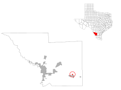
Location of Oilton, Texas
Webb County Oilton.svg
Coordinates: 27°28′8″N98°58′33″W / 27.46889°N 98.97583°W / 27.46889; -98.97583
Country United States
State Texas
County Webb
Established1922
Area
  Total1.4 sq mi (4 km2)
  Land1.4 sq mi (4 km2)
  Water0.0 sq mi (0 km2)
Elevation
[1]
860 ft (260 m)
Population
 (2010)
  Total152
  Density110/sq mi (42/km2)
Time zone UTC-6 (CST)
  Summer (DST) UTC-5 (CST)
Zip Code
78371
Area code +1-361
FIPS code 48-53556 [2]
GNIS feature ID1343096 [1]
Nearest Airports: Laredo: Laredo International Airport KLRD LRD Nuevo Laredo: Quetzalcoatl International Airport MMNL NLD

Oilton is a census-designated place (CDP) in Webb County, Texas, United States. The population was 152 at the 2010 census. The community is within the boundary of Webb Consolidated Independent School District and is home to the Oilton Elementary School.

Contents

History

Oilton is located 32 miles east of Laredo, Texas. It was originally called Torrecillas Towers, for two limestone formations nearby. In 1922 the name was changed because that year, oil was discovered near the town, which also caused it to grow. [3]

Geography

Oilton is located at 27°28′8″N98°58′33″W / 27.46889°N 98.97583°W / 27.46889; -98.97583 (27.468979, -98.975739). [4]

According to the United States Census Bureau in 2000, the CDP has a total area of 0.8 square miles (2.2 km2), all of it land. This CDP gained area in the changes in Webb County prior to the 2010 census. [5] Its total area was increased to 1.4 square miles (3.6 km2), all land. [6]

Demographics

2020 census

Oilton racial composition [7]
(NH = Non-Hispanic) [lower-alpha 1]
RaceNumberPercentage
White (NH)82.96%
Black or African American (NH)10.37%
Asian (NH)10.37%
Hispanic or Latino 26096.3%
Total270

As of the 2020 United States census, there were 270 people, 75 households, and 44 families residing in the CDP.

2000 census

As of the census [2] of 2000, there were 310 people, 89 households, and 71 families residing in the CDP. The population density was 371.1 inhabitants per square mile (143.3/km2). There were 124 housing units at an average density of 148.4 per square mile (57.3/km2). The racial makeup of the CDP was 72.58% White, 1.61% African American, 20.65% from other races, and 5.16% from two or more races. Hispanic or Latino people of any race were 93.55% of the population.

There were 89 households, out of which 50.6% had children under the age of 18 living with them, 56.2% were married couples living together, 20.2% had a female householder with no husband present, and 20.2% were non-families. 19.1% of all households were made up of individuals, and 13.5% had someone living alone who was 65 years of age or older. The average household size was 3.48 and the average family size was 4.06.

In the CDP, the population was spread out, with 39.7% under the age of 18, 8.1% from 18 to 24, 23.9% from 25 to 44, 17.1% from 45 to 64, and 11.3% who were 65 years of age or older. The median age was 28 years. For every 100 females, there were 81.3 males. For every 100 females age 18 and over, there were 78.1 males.

The median income for a household in the CDP was $20,625, and the median income for a family was $21,964. Males had a median income of $24,375 versus $18,750 for females. The per capita income for the CDP was $7,890. About 29.2% of families and 32.1% of the population were below the poverty line, including 37.2% of those under age 18 and 16.1% of those age 65 or over.

Education

Oilton is served by the Webb Consolidated Independent School District.

Oilton residents attend:

The designated community college for Webb County is Laredo Community College. [10]

Related Research Articles

<span class="mw-page-title-main">Webb County, Texas</span> County in Texas, United States

Webb County is a county located in the U.S. state of Texas. As of the 2020 census, its population was 267,114. Its county seat is Laredo. The county was named after James Webb (1792–1856), who served as secretary of the treasury, secretary of state, and attorney general of the Republic of Texas, and later judge of the United States District Court following the admission of Texas to statehood. By area, Webb County is the largest county in South Texas and the sixth-largest in the state. Webb County comprises the Laredo metropolitan area. Webb County is the only county in the United States to border three foreign states or provinces, sharing borders with Coahuila, Nuevo Leon, and Tamaulipas.

<span class="mw-page-title-main">Jim Hogg County, Texas</span> County in Texas, United States

Jim Hogg County is a county located in the U.S. state of Texas. As of the 2020 census, the population was 4,838. Its county seat is Hebbronville. The county is named for James Stephen Hogg, the governor of Texas from 1891 to 1895.

<span class="mw-page-title-main">Perry Heights, Ohio</span> CDP in Ohio, United States

Perry Heights is a census-designated place (CDP) in Stark County, Ohio, United States. The population was 8,900 at the 2000 census. It is part of the Canton-Massillon, OH Metropolitan Statistical Area. It was originally known as Genoa.

<span class="mw-page-title-main">Canyon Lake, Texas</span> CDP in Texas, United States

Canyon Lake is a census-designated place (CDP) in Comal County, Texas, United States. The population was 31,124 at the 2020 census. It is part of the San Antonio Metropolitan Statistical Area.

<span class="mw-page-title-main">Linn, Texas</span> Census-designated place in Texas

Linn, formerly San Manuel-Linn, is an unincorporated area and census-designated place (CDP) in Hidalgo County, Texas, United States. The population was 801 at the 2010 census, down from 958 at the 2000 census. It is part of the McAllen–Edinburg–Mission Metropolitan Statistical Area.

<span class="mw-page-title-main">Hebbronville, Texas</span> County seat and Census-designated place in Texas, United States

Hebbronville is a census-designated place (CDP) in and the county seat of Jim Hogg County, Texas, United States. The population was 4,558 at the 2010 census. In 1918, Helen Sewel Harbison became the first woman in Texas to cast a ballot, two years before the implementation of the Nineteenth Amendment to the United States Constitution.

<span class="mw-page-title-main">Eidson Road, Texas</span> CDP in Texas, United States

Eidson Road is a census-designated place (CDP) in Maverick County, Texas, United States. The population was 8,960 at the 2010 census.

<span class="mw-page-title-main">San Isidro, Texas</span> CDP in Texas, United States

San Isidro is a census-designated place (CDP) in Starr County, Texas, United States. The population was 240 at the 2010 census. The town is named for St. Isidore the Laborer, the patron saint of farmers. A large Southwestern Barrel Cactus growing just east of town is said to be the largest in Texas.

<span class="mw-page-title-main">Sabinal, Texas</span> City in Texas, United States

Sabinal is a city in Uvalde County, Texas, United States. The population was 1,695 at the 2010 census.

<span class="mw-page-title-main">Botines, Texas</span> CDP in Texas, United States

Botines is a census-designated place (CDP) in Webb County, Texas, United States. The population was 117 at the 2010 census. Botines is located 5 miles (8.0 km) north of Laredo. The town's name originates from the Spanish term botín, which means buskin, boot, or legging.

<span class="mw-page-title-main">Bruni, Texas</span> CDP in Texas, United States

Bruni is a census-designated place (CDP) in Webb County, Texas, United States. The population was 379 at the 2010 census.

<span class="mw-page-title-main">El Cenizo, Texas</span> City in Texas, United States

El Cenizo is a city in Webb County, Texas, United States. The population was 3,273 at the 2010 census. El Cenizo is the third-largest city in Webb County. It is located about 20 miles south of the county seat of Laredo.

<span class="mw-page-title-main">La Presa, Texas</span> CDP in Texas, United States

La Presa is a census-designated place (CDP) in Webb County, Texas, United States. The population was 319 at the 2010 census.

Laredo Ranchettes is a census-designated place (CDP) in Webb County, Texas, United States. The population was 22 at the 2010 census.

Larga Vista is a former census-designated place (CDP) in Webb County, Texas, United States. The population was 742 at the 2000 census. Larga Vista lost its census-designated place status in 2010 because it became surrounded by Laredo, Texas. A CDP may not be located, either partially or entirely, within an incorporated place or another CDP. Today, Larga Vista is considered a Laredo neighborhood.

<span class="mw-page-title-main">Mirando City, Texas</span> CDP in Texas, United States

Mirando City is a census-designated place (CDP) in Webb County, Texas, United States. It is three hundred eighty-four miles southwest of Houston. The population was 166 at the 2010 census. The town gets its name from Nicolás Mirando, a Spanish land grantee. The population of Mirando City was highest in 1929, at an estimated 1500.

Ranchitos Las Lomas is a census-designated place (CDP) in Webb County, Texas, United States. The population was 266 at the 2010 census. Las Lomas means "the hills" in Spanish. The town prides itself as "the place where nothing ever happened."

<span class="mw-page-title-main">Ranchos Penitas West, Texas</span> CDP in Texas, United States

Ranchos Penitas West is a census-designated place (CDP) in Webb County, Texas, United States. The population was 573 at the 2010 census.

<span class="mw-page-title-main">Rio Bravo, Texas</span> City in Texas, United States

Rio Bravo is a colonia in Webb County, in the American state of Texas. It lies sixteen miles south of Laredo on Highway 83, and sits on the left bank of the Rio Grande. Founded in 1982 by the property developer Cecil McDonald, Rio Bravo was incorporated as a city in 1989. It had a population of 4,794 at the 2010 census.

<span class="mw-page-title-main">Horseshoe Bay, Texas</span> City in Texas, United States

Horseshoe Bay is a city in Llano and Burnet counties in the U.S. state of Texas.

References

  1. 1 2 U.S. Geological Survey Geographic Names Information System: Oilton, Texas
  2. 1 2 "U.S. Census website". United States Census Bureau . Retrieved January 31, 2008.
  3. Texas Handbook; History of Oilton
  4. "US Gazetteer files: 2010, 2000, and 1990". United States Census Bureau. February 12, 2011. Retrieved April 23, 2011.
  5. "Population and Housing Unit Counts, 2010 Census of Population and Housing" (PDF). Texas: 2010. Retrieved January 4, 2017.
  6. "Boundary Map of Oilton, Texas". MapTechnica. Retrieved January 4, 2017.
  7. "Explore Census Data". data.census.gov. Retrieved May 19, 2022.
  8. https://www.census.gov/ [ not specific enough to verify ]
  9. "About the Hispanic Population and its Origin". www.census.gov. Retrieved May 18, 2022.
  10. Texas Education Code Sec. 130.185. LAREDO COMMUNITY COLLEGE DISTRICT SERVICE AREA.
  1. Note: the US Census treats Hispanic/Latino as an ethnic category. This table excludes Latinos from the racial categories and assigns them to a separate category. Hispanics/Latinos can be of any race. [8] [9]