Related Research Articles

Scofield is a town in Carbon County, Utah, United States. The population was 23 at the 2010 census. Scofield's name is frequently applied to the 1900 mine disaster in the Pleasant Valley Coal Company's Winter Quarters mine. The community was named for General Charles W. Scofield, a timber contractor and local mine official. It is the smallest incorporated area in Utah by population.
Boquillas del Carmen, frequently known simply as Boquillas, is a village in northern Mexico on the banks of the Rio Grande. It is the northernmost populated place in the municipality of Ocampo, which lies within the Mexican state of Coahuila.

The Nueces River is a river in the U.S. state of Texas, about 315 miles (507 km) long. It drains a region in central and southern Texas southeastward into the Gulf of Mexico. It is the southernmost major river in Texas northeast of the Rio Grande. Nueces is Spanish for nuts; early settlers named the river after the numerous pecan trees along its banks.
Terlingua is a mining district and census-designated place (CDP) in southwestern Brewster County, Texas, United States. It is located near the Rio Grande and the villages of Lajitas and Study Butte, Texas, as well as the Mexican state of Chihuahua. The discovery of cinnabar, from which the metal mercury is extracted, in the mid-1880s brought miners to the area, creating a city of 2,000 people. The only remnants of the mining days are a ghost town of the Howard Perry-owned Chisos Mining Company and several nearby capped and abandoned mines: the California Hill, the Rainbow, the 248, and the Study Butte mines. The mineral terlinguaite was first found in the vicinity of California Hill.
Jiménez is a town and seat of the municipality of Jiménez in the Mexican state of Coahuila, at an altitude of 250 meters above sea level. It is located on the confluence of the Río San Diego and the Rio Grande bordering with the U.S. state of Texas. It had a population of 1,160 inhabitants in the 2010 census, and is, unusually for a Mexican municipal seat, the second-largest locality in the municipality, after the town of San Carlos.

The Big South Fork Scenic Railway is a heritage railroad in Stearns, Kentucky.
The Rio Grande Southern Railroad was a 3 ft (914 mm) narrow-gauge railroad which ran in the southwestern region of the US state of Colorado, from the towns of Durango to Ridgway, routed via Lizard Head Pass. Built by Russian immigrant and Colorado toll road builder Otto Mears, the RGS operated from 1891 through 1951 and was built with the intent to transport immense amounts of silver mineral traffic that were being produced by the mining communities of Rico and Telluride. On both ends of the railroad, there were interchanges with The Denver and Rio Grande Railroad, which would ship the traffic the RGS hauled elsewhere like the San Juan Smelter in Durango.

The geography of Texas is diverse and large. Occupying about 7% of the total water and land area of the U.S., it is the second largest state after Alaska, and is the southernmost part of the Great Plains, which end in the south against the folded Sierra Madre Oriental of Mexico. Texas is in the South Central United States of America, and is considered to form part of the U.S. South and also part of the U.S. Southwest.
Camargo is a municipality in the Mexican state of Tamaulipas. It is located on the US border, across from Rio Grande City, Texas. It has an official population of 14,933 inhabitants. The municipal seat is Ciudad Camargo, with a population of 7,984. The municipality is connected to Rio Grande City, Texas, via the Rio Grande City-Camargo International Bridge.

Castle Gate is a ghost town in the western United States, located in Carbon County in eastern Utah. A mining town approximately ninety miles (140 km) southeast of Salt Lake City, its name was derived from a rock formation near the mouth of Price Canyon. This formation features two sheer sandstone walls on either side of the Price River, which appear to open like a giant gate as travelers approach this narrow section of the canyon.
Islitas is a ghost town in southwestern Webb County, Texas, United States. It was established as a railroad stop and coal shipping center on the Rio Grande and Pecos Valley Railroad in 1882. In 1914, Islitas experienced its peak population of 300. After that year, the local mines declined in production. As of 1920, the last census report for the community showed 100 people.
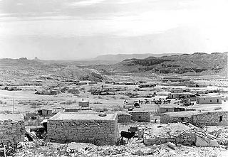
Santo Tomás was a coal-mining town near Laredo in west central Webb County, Texas, United States. The town was founded in 1801 by Antonio Gonzales and was named in honor of Saint Thomas. During the colonial era, the land was used primarily for ranching. Pure quality cannel coal was found and extracted in 1873. In June 1882, the narrow-gauge Rio Grande and Pecos Railroad was built to transport the coal. By 1900, the town grew and had a population of approximately 1,000. By 1920, all the mines had closed and the population of Santo Tomás decreased to 18. Today, Santo Tomás is a ghost town near the Colombia-Solidarity International Bridge.
Dolores is a community near the Rio Grande in western Webb County, Texas, United States, near Laredo.

Lajitas is an unincorporated community in Brewster County, Texas, United States, near the Big Bend National Park. According to the Handbook of Texas, the community had a population of 75 in 2010.

Sego is a ghost town in Grand County, Utah, United States. It lies in the narrow, winding Sego Canyon, in the Book Cliffs some 5 miles (8.0 km) north of Thompson Springs. Formerly an important eastern Utah coal mining town, Sego was inhabited about 1910–1955. The town is accessed via the grade of the Ballard & Thompson Railroad, a spur from the Denver and Rio Grande Western built by the founders of the town to transport the coal.

Clear Creek is a census-designated place on the western edge of Carbon County, Utah, United States. It is located at the south end of State Route 96 and the Pleasant Valley Branch of the Union Pacific Railroad.

Standardville is a ghost town in Carbon County, Utah, United States. Standardville was established after coal was discovered in the area in 1912. The layout of the town was so well-planned, it became the "standard" for all mining towns to follow, which resulted in the town name of Standardville. In 1922, a group of striking miners killed a mine guard and wounded two miners before escaping. In 1930, 20 miners were killed in a mine explosion caused by carbon monoxide gas. In 1950, the mine shut down and people began to relocate elsewhere. A couple families remained until the 1970s, after which Standardville was abandoned.
Peerless is a ghost town in Carbon County, Utah, United States. It is located just 3 miles (4.8 km) west of Helper.
La Junta Indians is a collective name for the various Indians living in the area known as La Junta de los Rios on the borders of present-day West Texas and Mexico. In 1535 Alvar Nunez Cabeza de Vaca recorded visiting these peoples while making his way to a Spanish settlement. They cultivated crops in the river floodplains, as well as gathering indigenous plants and catching fish from the rivers. They were part of an extensive trading network in the region. As a crossroads, the area attracted people of different tribes.

Pikeview is a neighborhood of Colorado Springs, annexed to the city as the "Pike View Addition" on August 1, 1962. In 1896 there was a Denver and Rio Grande Western Railroad station in Pikeview, and miners had begun digging a shaft for the Pikeview Coal Mine. Pikeview also had a quarry beginning 1905 for the mining of limestone for concrete. Coal mining ended in 1957, but the Pikeview Quarry continues to operate. Quarry operations, though, have created a gash or scar in the landscape and efforts have been made since the late 1980s to reclaim the hillside landscape. The Greg Francis Bighorn Sheep Habitat in what had been Queens Canyon Quarry was founded in 2003 in recognition of the individuals and organizations that have worked to create a nature hillside habitat.
References

 | This article about a location in Webb County, Texas is a stub. You can help Wikipedia by expanding it. |