Steiner Ranch, Texas

Last updated

Steiner Ranch, Texas
Steiner Ranch, Texas.jpg
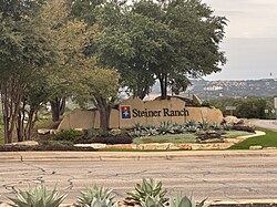
A sign marking the entrance to Steiner Ranch
USA Texas location map.svg
Red pog.svg
Steiner Ranch
Usa edcp location map.svg
Red pog.svg
Steiner Ranch
Coordinates: 30°21′44″N97°53′59″W / 30.36222°N 97.89972°W / 30.36222; -97.89972
CountryUnited States
State Texas
County Travis
Area
[1]
  Total6.6 sq mi (17.2 km2)
  Land6.6 sq mi (17.2 km2)
  Water0.0 sq mi (0.0 km2)
Elevation
834 ft (254 m)
Population
 (2020)
16,713
Time zone UTC-6 (Central (CST))
  Summer (DST) UTC-5 (CDT)
ZIP Code
78732 (Austin)
Area code(s) 512, 737
FIPS code 48-70154
GNIS feature ID2805844 [2]

Steiner Ranch is a planned community and census-designated place (CDP) in Travis County, Texas, United States. It was first listed as a CDP in the 2020 census. [2]

Contents

It is in the west-central part of the county, occupying 4,600 acres (1,900 ha) on a ridge running within a large bend on the north side of the Colorado River between Lake Travis and Lake Austin. [3] The community is surrounded by the city limits of Austin, the state capital, and is 18 miles (29 km) by road northwest of downtown.

Real estate developer Al Hughes initially purchased the land for development in the late 1980s from the Steiner family. [4] The neighborhood grew throughout the 1990s and, as of 2017, had a population of around 15,000. [5] It currently contains three elementary schools, one middle school and a variety of community parks, recreation centers and trails. [5]

Demographics

Steiner Ranch's total population, as of 2021, is 17,780, with 8,748 males and 9,032 females. The median age is 40.7. The total number of households in 5,867 with an average of 3 people per household. Families account for 4,334 of those households, and non-families, 1,533. Of those households, 3,148 have children. 1,626 Steiner residents are self-employed, while 5,650 work for private companies. Governmental workers number 877 and those working for non-profit companies, 432. [6]

Education

Steiner Ranch Elementary School
Laura Welch Bush Elementary School
River Ridge Elementary School
Vandegrift High School Steiner Ranch Elementary School Nov 2023.jpg
Steiner Ranch Elementary School
Laura Welch Bush Elementary School Laura Welch Bush Elementary School Front Entrance.jpg
Laura Welch Bush Elementary School
River Ridge Elementary School River Ridge Elementary Nov 2023.jpg
River Ridge Elementary School
Vandegrift High School Vandegrift HS from the Side Oct 2023.jpg
Vandegrift High School

Steiner Ranch is located in Leander Independent School District. It contains three elementary schools:

The community also contains one middle school: Canyon Ridge Middle School. High School students attend Vandegrift High School located at 9500 McNeil Drive, Austin, TX 78750. [7]

Related Research Articles

<span class="mw-page-title-main">Highlands Ranch, Colorado</span> Census Designated Place in Colorado, United States

Highlands Ranch is an unincorporated community and a census-designated place (CDP) located in and governed by Douglas County, Colorado, United States. The CDP is a part of the Denver–Aurora–Lakewood, CO Metropolitan Statistical Area. The population of the Highlands Ranch CDP was 105,631 at the 2020 census, making it the most populous unincorporated community in the State of Colorado. The Highlands Ranch Metropolitan District provides services to the community, which lies in ZIP Codes 80126, 80129, 80130, and 80163.

<span class="mw-page-title-main">Fish Hawk, Florida</span> Census-designated place in Florida, United States

Fish Hawk is an unincorporated area and census-designated place (CDP) in Hillsborough County, Florida, United States. It is a suburb of Tampa, and includes a portion of the community of Lithia. As of the 2020 census, the CDP had a population of 24,625. The place name is derived from Little Fishhawk Creek, a tributary of the Alafia River that joins the Alafia just west of Lithia Springs.

<span class="mw-page-title-main">Timberwood Park, Texas</span> Census-designated place in Texas, United States

Timberwood Park is a census-designated place (CDP) in far northern unincorporated Bexar County, Texas, United States and located within the southern edge of the Texas Hill Country. The district has roughly 42 miles of roads and encompasses over 2,000 acres. The overall plan shows 3,263 platted lots. The population was 35,217 at the 2020 census, up from 13,447 at the 2010 census. It is part of the San Antonio Metropolitan Statistical Area.

<span class="mw-page-title-main">Four Corners, Texas</span> Census-designated place in Texas, United States

Four Corners is a census-designated place (CDP) within the extraterritorial jurisdiction of Houston in Fort Bend County, Texas, United States. The population was 12,103 at the 2020 census, up from 2,954 at the 2000 census.

<span class="mw-page-title-main">Fresno, Texas</span> Census-designated place in Texas, United States

Fresno is an unincorporated community and census-designated place (CDP) in Fort Bend County, Texas, United States. The local population was 24,486 as of the 2020 census, an increase over the figure of 19,069 tabulated in 2010 census, and 6,603 at the 2000 census.

<span class="mw-page-title-main">Greatwood, Sugar Land, Texas</span> Place in Texas, United States

Greatwood is a neighborhood within the city of Sugar Land in the state of Texas, United States. It was formerly a census-designated place located in Fort Bend County. The population was 11,538 at the 2010 census, up from 6,640 at the 2000 census. It was annexed into the City of Sugar Land on December 12, 2017.

<span class="mw-page-title-main">New Territory, Sugar Land, Texas</span> Place in Texas, United States

New Territory is a master-planned community within the city of Sugar Land, Texas, United States. It was formerly a census-designated place (CDP) and in the extraterritorial jurisdiction of Sugar Land, in unincorporated Fort Bend County. It was annexed into Sugar Land on December 12, 2017. The population was 15,186 at the 2010 census, up from 13,861 at the 2000 census.

<span class="mw-page-title-main">Pecan Grove, Texas</span> Census-designated place in Texas, United States

Pecan Grove is a census-designated place and master-planned community within the extraterritorial jurisdictions of Houston and Richmond in Fort Bend County, Texas, United States. The population was 22,782 at the 2020 census.

<span class="mw-page-title-main">Barton Creek, Texas</span> CDP in Texas, United States

Barton Creek is a census-designated place (CDP) in Travis County, Texas, United States. As of the 2020 census, the CDP population was 3,356.

<span class="mw-page-title-main">Bee Cave, Texas</span> City in Texas, United States

Bee Cave is a city located in Travis County, Texas, United States. Its population was 9,144 as of the 2020 census.

<span class="mw-page-title-main">Garfield, Texas</span> CDP in Texas, United States

Garfield is a census-designated place (CDP) in Travis County, Texas, United States. As of the 2020 census, the CDP population was 1,825.

<span class="mw-page-title-main">Hudson Bend, Texas</span> CDP in Texas, United States

Hudson Bend is a census-designated place (CDP) in Travis County, Texas, United States. The population was 4,005 at the 2020 census.

<span class="mw-page-title-main">Lakeway, Texas</span> City in Texas, United States

Lakeway is a city in Travis County, Texas, United States. The population was 19,189 at the 2020 census, an increase over the figure of 11,391 tabulated in 2010. The city is located next to Lake Travis. It is an exurb in Greater Austin.

<span class="mw-page-title-main">Lost Creek, Texas</span> CDP in Texas, United States

Lost Creek is an affluent upper-middle-class neighborhood and census-designated place (CDP) of approximately 4,500 people in Travis County, Texas, United States. The census tract is bordered by Capital of Texas Highway to the east, Barton Creek to the south, Barton Creek Boulevard to the west, and Bee Caves Road to the north. The Lost Creek CDP encompasses several small neighborhoods—Parkstone, Woods of Westlake, Camelot, and Knollwood—as well as the largest and most populous Lost Creek neighborhood.

<span class="mw-page-title-main">Shady Hollow, Texas</span> CDP in Texas, United States

Shady Hollow is a census-designated place (CDP) in southwestern Travis County, Texas, United States, and is partially in the City of Austin. It is located ten miles (16 km) southwest of Downtown Austin, near the Travis/Hays county line. The population was 4,822 at the 2020 census.

Wells Branch is a census-designated place (CDP) in Travis County, Texas, United States. The population was 14,000 at the 2020 census.

<span class="mw-page-title-main">Cinco Ranch, Texas</span> Census-designated place in Texas, United States

Cinco Ranch is a census-designated place and master-planned community located in the extraterritorial jurisdiction of the city of Houston within Fort Bend and Harris counties in the U.S. state of Texas. According to the United States Census Bureau, the CDP has a total area of 4.9 square miles (12.8 km2).The population was 16,899 at the 2020 census. It lies approximately 25 miles (40 km) west of the Harris County seat of Houston and 10 miles (16 km) north of the Fort Bend County seat of Richmond. Cinco Ranch is considered to be part of the Greater Katy area and is roughly 10 miles southeast of the city of Katy.

Anderson Mill is a neighborhood of Austin and a former census-designated place (CDP) in Travis and Williamson counties in the U.S. state of Texas. The population was 7,199 at the 2010 census.

<span class="mw-page-title-main">Jollyville, Texas</span> Place in Texas, United States

Jollyville is a neighborhood in the northern part of Austin, Texas, United States. In 2010 it was a census-designated place (CDP) in Travis and Williamson counties, but has since been annexed by Austin. The population of the CDP was 16,151 at the 2010 census.

Santa Rita is a planned community and census-designated place (CDP) in Williamson County, Texas, United States. It was first listed as a CDP during the 2020 census. It sits on 3,100-acres It is in the western part of the county, 11 miles (18 km) west of Georgetown, the county seat, and 6 miles (10 km) northeast of Liberty Hill. Ronald Reagan Boulevard, a western bypass of the Georgetown area, is the main road through the CDP.

References

  1. "2020 U.S. Gazetteer Files – Texas". United States Census Bureau. Retrieved September 30, 2021.
  2. 1 2 "Steiner Ranch Census Designated Place". Geographic Names Information System . United States Geological Survey, United States Department of the Interior.
  3. "Steiner Ranch". WestAustin.com. Retrieved February 9, 2021.
  4. "Lake Travis Area History: Steiner Ranch". Lake Travis Lifestyle. May 29, 2014. Retrieved February 9, 2021.
  5. 1 2 "Profile of the Steiner Ranch Neighborhood in Austin". Tripsavvy.com. June 26, 2019. Retrieved February 9, 2021.
  6. "Steiner Ranch Demographics". point@homes. Retrieved February 9, 2021.
  7. "Steiner Ranch Schools". Steiner Ranch HOA. Retrieved March 26, 2020.