Census designated places in Louisiana
| CDP [1] | Parish | Parish location | Population (2020) | Population (2010) [2] | Population (2000) [3] | Population (1990) [4] | Population (1980) [5] | Notes [6] [7] [8] |
|---|---|---|---|---|---|---|---|---|
| Ama | St. Charles |  | 1,290 | 1,316 | 1,285 | x | x | |
| Amelia | St. Mary |  | 2,132 | 2,459 | 2,423 | 2,447 | 3,617 | Listed as an unincorporated community in the 1970 U.S. census (pop. 2,292) [6] |
| Arabi | St. Bernard |  | 4,533 | 3,635 | 8,093 | 8,787 | 10,248 | |
| Avondale | Jefferson |  | 4,582 | 4,954 | 5,441 | 5,813 | 6,699 | |
| Banks Springs | Caldwell |  | 1,136 | 1,192 | x | x | x | |
| Barataria | Jefferson | | 1,057 | 1,109 | 1,333 | 1,160 | 1,123 | |
| Bawcomville | Ouachita |  | 3,472 | 3,588 | x | x | x | Formed out of the deleted Brownsville-Bawcomville CDP after the 2000 U.S. census |
| Bayou Blue | Lafourche and Terrebonne |   | 13,352 | 12,352 | x | x | x | |
| Bayou Cane | Terrebonne | | 19,770 | 19,335 | 17,046 | 15,876 | 15,723 | Listed as an unincorporated community in the 1970 U.S. census (pop. 9,077), [6] 1960 U.S. census (pop. 3,173), [7] and 1950 U.S. census (pop. 2,212) [8] |
| Bayou Corne | Assumption | | 32 | x | x | x | x | |
| Bayou Country Club | Lafourche | | 1,304 | 1,396 | x | x | x | |
| Bayou Gauche | St. Charles | | 2,161 | 2,071 | 1,770 | x | x | |
| Bayou Goula | Iberville |  | 514 | 612 | x | x | x | |
| Bayou L'Ourse | Assumption | | 1,806 | 1,978 | x | x | x | |
| Bayou Vista | St. Mary | | 4,213 | 4,652 | 4,351 | 4,733 | 5,805 | Listed as an unincorporated community in the 1970 U.S. census (pop. 5,121) [6] |
| Belle Chasse | Plaquemines |  | 10,579 | 12,679 | 9,848 | 8,512 | 5,412 | |
| Belle Rose | Assumption | | 1,698 | 1,902 | 1,944 | x | x | |
| Belmont | Sabine |  | 305 | 361 | x | x | x | |
| Boothville | Plaquemines | | 718 | 854 | x | x | x | Formed out of the Boothville-Venice CDP after the 2000 U.S. census |
| Bordelonville | Avoyelles |  | 458 | 525 | x | x | x | |
| Bourg | Terrebonne | | 2,375 | 2,579 | x | x | x | |
| Boutte | St. Charles | | 3,054 | 3,075 | 2,181 | 2,702 | x | |
| Branch | Acadia |  | 431 | 388 | x | x | x | |
| Bridge City | Jefferson | | 7,219 | 7,706 | 8,323 | 8,327 | x | |
| Brownfields | East Baton Rouge |  | 5,145 | 5,401 | 5,222 | 5,229 | x | |
| Brownsville | Ouachita | | 4,353 | 4,317 | x | x | x | Formed out of the deleted Brownsville-Bawcomville CDP after the 2000 U.S. census |
| Buras | Plaquemines | | 1,109 | 945 | x | x | x | Formed out of the Buras-Triumph CDP after the 2000 U.S. census |
| Cade | St. Martin |  | 1,874 | 1,723 | x | x | x | |
| Calhoun | Ouachita | | 670 | 679 | x | x | x | |
| Cameron | Cameron |  | 315 | 406 | 1,965 | 2,041 | 1,736 | |
| Carlyss | Calcasieu | | 5,101 | 4,670 | 4,049 | 3,305 | 1,806 | |
| Catahoula | St. Martin | | 988 | 1094 | x | x | x | |
| Cecilia | St. Martin | | 1,807 | 1,980 | 1,505 | 1,374 | x | |
| Center Point | Avoyelles | | 520 | 492 | x | x | x | |
| Centerville | St. Mary | | 499 | x | x | x | x | |
| Chackbay | Lafourche | | 5,370 | 5,177 | 4,018 | 2,276 | x | |
| Chalmette | St. Bernard | | 21,562 | 16,751 | 32,069 | 31,860 | 33,847 | |
| Charenton | St. Mary | | 1,699 | 1,903 | 1,944 | 1,584 | x | |
| Chauvin | Terrebonne | | 2,575 | 2,912 | 3,229 | 3,375 | 3,338 | |
| Choctaw | Lafourche | | 775 | 879 | x | x | x | |
| Claiborne | Ouachita | | 12,631 | 11,507 | 9,830 | 8,300 | 6,278 | |
| Convent | St. James |  | 483 | 711 | x | x | x | |
| Crescent | Iberville | | 811 | 959 | x | x | x | |
| Cut Off | Lafourche | | 5,533 | 5,976 | 5,635 | 5,325 | 5,049 | |
| Darrow | Ascension |  | 200 | x | x | x | x | |
| Delacroix | St. Bernard | | 48 | x | x | x | x | |
| Des Allemands | Lafourche and St. Charles | | 2,179 | 2,505 | 2,500 | 2,504 | 2,920 | |
| Destrehan | St. Charles | | 11,340 | 11,535 | 11,260 | 8,031 | 2,382 | |
| Deville | Rapides |  | 1,761 | 1,764 | 1,007 | 1,113 | x | |
| Dorseyville | Iberville | | 159 | x | x | x | x | |
| Dulac | Terrebonne | | 1,241 | 1,463 | 2,458 | 3,273 | x | |
| Eastwood | Bossier |  | 4,390 | 4,093 | 3,374 | 2,987 | x | |
| Echo | Rapides | | 352 | x | x | x | x | |
| Eden Isle | St. Tammany | 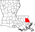 | 7,782 | 7,041 | 6,261 | 3,768 | x | |
| Edgard | St. John the Baptist |  | 1,948 | 2,441 | 2,637 | 2,753 | x | |
| Egan | Acadia | | 618 | 631 | x | x | x | |
| Elmwood | Jefferson | | 5,649 | 4,635 | 4,270 | x | x | |
| Empire | Plaquemines | | 905 | 993 | 2,211 | 2,654 | x | |
| Erwinville | West Baton Rouge |  | 2,275 | 2,192 | x | x | x | |
| Estelle | Jefferson | | 17,952 | 16,377 | 15,880 | 14,091 | x | |
| Fifth Ward | Avoyelles | | 921 | 800 | x | x | x | |
| Fort Jesup | Sabine | | 494 | 509 | x | x | x | |
| Fort Johnson North | Vernon |  | 2,179 | 2,864 | 3,279 | 3,819 | 1,644 | |
| Fort Johnson South | Vernon | | 7,950 | 9,038 | 11,000 | 10,911 | 12,498 | |
| Frierson | DeSoto |  | 132 | 143 | x | x | x | |
| Galliano | Lafourche | | 7,100 | 7,676 | 7,356 | 4,294 | 5,159 | |
| Gardere | East Baton Rouge | | 13,203 | 10,580 | 8,992 | 7,209 | x | |
| Garyville | St. John the Baptist | | 2,123 | 2,811 | 2,775 | 3,181 | 2,856 | Listed as an unincorporated community in the 1970 U.S. census (pop. 2,474), [6] 1960 U.S. census (pop. 2,839), [7] and 1950 U.S. census (pop. 1,850). [8] |
| Gillis | Calcasieu | | 800 | 657 | x | x | x | |
| Glencoe | St. Mary | | 132 | 211 | x | x | x | |
| Gloster | DeSoto | | 53 | 94 | x | x | x | |
| Good Pine | LaSalle |  | 259 | x | x | x | x | |
| Grand Point | St. James | | 2,241 | 2,473 | x | x | x | |
| Gray | Terrebonne | | 5,518 | 5,584 | 4,958 | 4,260 | x | |
| Hackberry | Cameron | | 926 | 1,261 | 1,699 | 1,664 | 1,601 | |
| Hahnville | St. Charles | | 2,959 | 3,344 | 2,792 | 2,599 | 2,947 | Listed as an unincorporated community in the 1970 U.S. census (pop. 2,483) and 1960 U.S. census (pop. 1,297). [6] |
| Harvey | Jefferson | | 22,236 | 20,348 | 22,226 | 21,222 | 22,709 | First appeared as an unincorporated community in the 1970 U.S. census (pop. 6,347). [6] |
| Hayes | Calcasieu | | 676 | 780 | x | x | x | |
| Hester | St. James | | 483 | 498 | x | x | x | |
| Jefferson | Jefferson | | 10,633 | 11,193 | 11,843 | 14,521 | 15,550 | Listed as an unincorporated place in the 1970 U.S. census (pop. 16, 489) [6] and the 1960 U.S. census (pop. 19,353). [7] |
| Jordan Hill | Winn | | 196 | 211 | x | x | x | |
| Joyce | Winn | | 328 | 384 | x | x | x | |
| Killona | St. Charles | | 724 | 793 | 797 | x | x | |
| Kraemer | Lafourche | | 877 | 934 | x | x | x | |
| Labadieville | Assumption | | 1,715 | 1,854 | 1,811 | 1,821 | 2,138 | |
| Lacassine | Jefferson Davis | 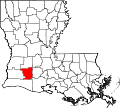 | 490 | 480 | x | x | x | |
| Lacombe | St. Tammany | | 8,657 | 8,679 | 7,518 | 6,523 | x | |
| Lafitte | Jefferson | | 1,014 | 972 | 1,576 | 1,507 | 1,312 | First appeared as an unincorporated place in the 1970 U.S. census (pop. 1,223). [6] |
| Lafourche Crossing | Lafourche | | 2,427 | 2,002 | x | x | x | |
| Lakeshore | Ouachita | | 1,988 | 1,930 | x | x | x | |
| Lakeview | Caddo |  | 818 | 948 | x | x | x | |
| Laplace | St. John the Baptist | | 28,841 | 29,872 | 27,684 | 24,194 | 16,112 | Listed as an unincorporated community in the 1970 U.S. census (pop. 5,953), [6] 1960 U.S. census (pop. 3,541), [7] and 1950 U.S. census (pop. 5,953). [8] |
| Larose | Lafourche | | 6,763 | 7,400 | 7,306 | 5,772 | 5,234 | Listed as an unincorporated community in the 1970 U.S. census (pop. 4,267), [6] 1960 U.S. census (pop. 2,796), [7] and 1950 U.S. census (pop. 1,286). [8] |
| Lawtell | St. Landry |  | 1,066 | 1,198 | x | x | x | |
| Lemannville | Ascension and St. James | | 695 | 860 | x | x | x | |
| Lewisburg | St. Tammany | | 420 | x | x | x | x | |
| Lockport Heights | Lafourche | | 1,171 | 1,286 | x | x | x | |
| Longville | Beauregard |  | 545 | 635 | x | x | x | |
| Luling | St. Charles | | 13,716 | 12,119 | 11,512 | 2,803 | 4,006 | Listed as an unincorporated community in the 1970 U.S. census (pop. 3,255) and 1960 U.S. census (pop. 2,122). [6] |
| Lydia | Iberia |  | 892 | 952 | 1,079 | 1,136 | x | |
| Marrero | Jefferson | | 32,382 | 33,141 | 36,165 | 36,671 | 36,548 | First appeared as an unincorporated community in the 1970 U.S. census (pop. 29,015). [6] |
| Marthaville | Natchitoches |  | 90 | x | x | x | x | |
| Mathews | Lafourche | | 2,273 | 2,209 | 2,003 | 3,009 | x | |
| Meraux | St. Bernard | | 6,804 | 5,816 | 10,192 | 8,849 | x | |
| Merrydale | East Baton Rouge | | 9,227 | 9,772 | 10,427 | 9,227 | x | |
| Metairie | Jefferson | | 143,507 | 138,481 | 146,136 | 149,428 | 164,160 | First appeared as an unincorporated community in the 1970 U.S. census (pop. 135,816). [6] |
| Midland | Acadia | | 249 | x | x | x | x | |
| Midway | LaSalle | | 1,157 | 1,586 | 1,505 | 1,586 | x | |
| Milton | Lafayette |  | 2,590 | 3,030 | x | x | x | |
| Minorca | Concordia | 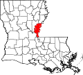 | 2,156 | 2,317 | x | x | x | |
| Montegut | Terrebonne | | 1,465 | 1,540 | 1,803 | 1,784 | x | |
| Monterey | Concordia | | 474 | 439 | x | x | x | |
| Monticello | East Baton Rouge | | 5,431 | 5,172 | 4,763 | 4,710 | x | |
| Montz | St. Charles | | 2,106 | 1,918 | 1,120 | x | x | |
| Moonshine | St. James | | 168 | 194 | x | x | x | |
| Morrow | St. Landry | | 149 | x | x | x | x | |
| Moss Bluff | Calcasieu | | 12,522 | 11,557 | 10,535 | 8,039 | 7,004 | |
| Natalbany | Tangipahoa |  | 2,510 | 2,984 | 1,739 | 1,289 | x | |
| New Orleans Station | Plaquemines | | 2,508 | x | x | x | x | |
| New Sarpy | St. Charles | | 1,169 | 1,464 | 1,568 | 2,946 | 1,643 | Listed as an unincorporated community in the 1970 U.S. census (pop. 1,643) and 1960 U.S. census (pop. 1,259). [6] |
| Norco | St. Charles | | 2,984 | 3,074 | 3,579 | 3,385 | 4,416 | Listed as an unincorporated community in the 1970 U.S. census (pop. 4,773) and 1960 U.S. census (pop. 4,682). [6] |
| North Vacherie | St. James | | 2,093 | 2,346 | 2,411 | 2,354 | x | |
| Oretta | Beauregard | | 371 | 418 | x | x | x | |
| Ossun | Lafayette | | 2,145 | 2,144 | x | x | x | |
| Paincourtville | Assumption | | 857 | 911 | 884 | 1,550 | 2,004 | |
| Paradis | St. Charles | | 1,242 | 1,298 | 1,252 | x | x | |
| Paulina | St. James | | 1,778 | 1,178 | x | x | x | |
| Perry | Vermilion | 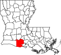 | 1,171 | x | x | x | x | |
| Pierre Part | Assumption | | 3,024 | 3,169 | 3,239 | 3,053 | 3,153 | |
| Pitkin | Vernon | | 455 | 576 | x | x | x | |
| Pleasure Bend | St. John the Baptist | | 212 | 250 | x | x | x | |
| Pointe a la Hache | Plaquemines | | 183 | 187 | x | x | x | |
| Point Place | Natchitoches | | 382 | 400 | x | x | x | |
| Port Sulphur | Plaquemines | | 1,677 | 1,760 | 3,115 | 3,523 | 3,318 | |
| Poydras | St. Bernard | | 2,536 | 2,351 | 3,886 | 4,029 | 5,722 | |
| Prairieville | Ascension | | 33,197 | 26,895 | x | x | x | |
| Presquille | Terrebonne | | 1,703 | 1,807 | x | x | x | |
| Prien | Calcasieu | | 7,745 | 7,810 | 7,215 | 6,448 | 6,224 | |
| Prospect | Grant |  | 380 | 476 | x | x | x | |
| Raceland | Lafourche | | 9,768 | 10,193 | 10,224 | 5,564 | 6,302 | Listed as an unincorporated community in the 1970 U.S. census (pop. 4,880), [6] 1960 U.S. census (pop. 3,666), [7] and 1950 U.S. census (pop. 2,025) [8] |
| Red Chute | Bossier | | 7,065 | 6,261 | 5,984 | 5,431 | x | |
| Reddell | Evangeline |  | 904 | 733 | x | x | x | |
| Reserve | St. John the Baptist | | 8,541 | 9,766 | 9,111 | 8,847 | 7,288 | Listed as an unincorporated community in the 1970 U.S. census (pop. 6,381), [6] 1960 U.S. census (pop. 5,297), [7] and 1950 U.S. census (pop. 4,465). [8] |
| Rio | Washington |  | 137 | x | x | x | x | |
| River Ridge | Jefferson | | 13,591 | 13,494 | 14,588 | 14,800 | 17,146 | |
| Roanoke | Jefferson Davis | | 491 | 546 | x | x | x | |
| Rock Hill | Grant | | 260 | 274 | x | x | x | |
| Romeville | St. James | | 99 | 130 | x | x | x | |
| St. James | St. James | | 592 | 828 | x | x | x | |
| St. Maurice | Winn | | 266 | 323 | x | x | x | |
| St. Rose | St. Charles | | 7,504 | 8,122 | 6,450 | 6,259 | x | Listed as an unincorporated community in the 1970 U.S. census (pop. 2,106) and 1960 U.S. census (pop. 1,099). [6] The census did not survey the CDP in the 1980 U.S. Census. [5] |
| Schriever | Terrebonne | | 6,711 | 6,853 | 5,880 | 4,958 | x | |
| Singer | Beauregard | | 303 | 287 | x | x | x | |
| Siracusaville | St. Mary | | 297 | 422 | x | x | x | |
| Sorrel | St. Mary | | 711 | 766 | x | x | x | |
| South Vacherie | St. James | | 3,388 | 3,642 | 3,543 | 3,462 | x | |
| Spokane | Concordia | | 378 | 442 | x | x | x | |
| Starks | Calcasieu | | 659 | 664 | x | x | x | |
| Start | Richland |  | 982 | 905 | x | x | x | |
| Sugartown | Beauregard | | 33 | 54 | x | x | x | |
| Supreme | Assumption | | 839 | 1,052 | 1,119 | 1,020 | x | |
| Swartz | Ouachita | | 4,354 | 4,536 | 4,247 | 3,698 | x | |
| Taft | St. Charles | | 61 | 63 | 0 | x | x | |
| Terrytown | Jefferson | | 25,278 | 23,319 | 25,430 | 23,787 | 23,548 | First appeared as an unincorporated community in the 1970 U.S. census (pop. 13,832). [6] |
| Timberlane | Jefferson | | 10,364 | 10,243 | 11,405 | 12,614 | 11,579 | |
| Triumph | Plaquemines | | 268 | 216 | x | x | x | Formed out of the Buras-Triumph CDP after the 2000 U.S. census |
| Trout | LaSalle | | 104 | x | x | x | x | |
| Union | St. James | | 735 | 892 | x | x | x | |
| Venice | Plaquemines | | 162 | 202 | x | x | x | Formed out of the Boothville-Venice CDP after the 2000 U.S. census |
| Ventress | Pointe Coupee |  | 800 | 890 | x | x | x | |
| Vienna Bend | Natchitoches | | 1,314 | 1,251 | x | x | x | |
| Violet | St. Bernard | | 5,758 | 4,973 | 8,555 | 8,574 | 11,678 | |
| Waggaman | Jefferson | | 9,835 | 10,015 | 9,435 | 9,405 | 9,004 | |
| Wallace | St. John the Baptist | | 755 | 671 | 570 | x | x | |
| Wallace Ridge | Catahoula |  | 572 | 710 | x | x | x | |
| Watson | Livingston |  | 956 | 1,047 | x | x | x | |
| Welcome | St. James | | 672 | 800 | x | x | x | |
| Woodmere | Jefferson | | 11,238 | 12,080 | 13,058 | x | x |