Swartz, Louisiana

Last updated • 2 min readFrom Wikipedia, The Free Encyclopedia

Swartz
Swartz, Louisiana Post Office.jpg
Swartz, Louisiana U.S. Post Office
Swartz Louisiana Outliine 02.png
Swartz, Louisiana
USA Louisiana relief location map.svg
Red pog.svg
Swartz
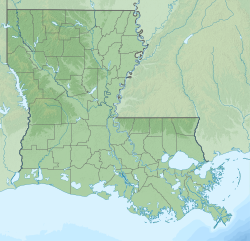
Location of Swartz in Louisiana
Coordinates: 32°33′58″N91°59′30″W / 32.56611°N 91.99167°W / 32.56611; -91.99167
CountryUnited States
StateLouisiana
Parish Ouachita
Area
[1]
  Total8.13 sq mi (21.07 km2)
  Land8.13 sq mi (21.07 km2)
  Water0.00 sq mi (0.00 km2)
Elevation
95 ft (29 m)
Population
 (2020)
  Total4,354
  Density535.22/sq mi (206.65/km2)
Time zone UTC-6 (CST)
  Summer (DST) UTC-5 (CDT)
ZIP code
71203 [2]
Area code 318
FIPS code 22-74340
Historical population
CensusPop.Note
2020 4,354
U.S. Decennial Census [3]
Louise Williams Library, Swartz, Louisiana, 2023 Louise Williams Library, Monroe, Louisiana 2023.jpg
Louise Williams Library, Swartz, Louisiana, 2023

Swartz is a census-designated place (CDP) in Ouachita Parish in northeastern Louisiana, United States. The population was 4,536 in the 2010 census, an increase of 289 or 6.8 percent over the 2000 population. [4] It is part of the Monroe Metropolitan Statistical Area.

Contents

Swartz was part of the 2011 Tornado Super Outbreak, with an EF-0 touching-down and moving across Swartz Fairbanks Road and Louisiana Highway 139 on April 27, 2011.

Tornado path in Swartz during the 2011 Tornado Super Outbreak Swartz in the Tornadoes of 2011 Super Outbreak (cropped).png
Tornado path in Swartz during the 2011 Tornado Super Outbreak

Geography

Swartz is located at 32°33′58″N91°59′30″W / 32.56611°N 91.99167°W / 32.56611; -91.99167 (32.566128, -91.991557). [5]

According to the United States Census Bureau, the CDP has a total area of 13.5 square miles (35 km2), all land.

Demographics

2020 census

Swartz racial composition [6]
RaceNumberPercentage
White (non-Hispanic)2,91366.9%
Black or African American (non-Hispanic)1,11725.65%
Native American 110.25%
Asian 310.71%
Pacific Islander 20.05%
Other/Mixed 1744.0%
Hispanic or Latino 1062.43%

As of the 2020 United States census, there were 4,354 people, 1,523 households, and 1,073 families residing in the CDP.

2000 census

As of the census [7] of 2000, there were 4,247 people, 1,557 households, and 1,250 families residing in the CDP. The population density was 314.7 inhabitants per square mile (121.5/km2). There were 1,642 housing units at an average density of 121.7 per square mile (47.0/km2). The racial makeup of the CDP was 91.10% White, 6.80% African American, 0.40% Native American, 0.47% Asian, 0.78% from other races, and 0.45% from two or more races. Hispanic or Latino of any race were 1.62% of the population.

There were 1,557 households, out of which 41.6% had children under the age of 18 living with them, 66.5% were married couples living together, 10.6% had a female householder with no husband present, and 19.7% were non-families. 16.5% of all households were made up of individuals, and 5.0% had someone living alone who was 65 years of age or older. The average household size was 2.73 and the average family size was 3.06.

In the CDP, the population was spread out, with 28.1% under the age of 18, 10.8% from 18 to 24, 30.9% from 25 to 44, 21.9% from 45 to 64, and 8.4% who were 65 years of age or older. The median age was 32 years. For every 100 females, there were 93.9 males. For every 100 females age 18 and over, there were 89.9 males.

The median income for a household in the CDP was $42,645, and the median income for a family was $50,682. Males had a median income of $32,006 versus $25,305 for females. The per capita income for the CDP was $17,058. About 5.9% of families and 8.3% of the population were below the poverty line, including 9.8% of those under age 18 and 10.5% of those age 65 or over.

Notable People

Fmr. U.S. Rep. Vance McAllister, 2013 Vance McAllister, Official Portrait, 113th Congress.jpg
Fmr. U.S. Rep. Vance McAllister, 2013

Swartz is the residence of Vance McAllister, the former Republican U.S. Representative from Louisiana's 5th congressional district and a Monroe-area businessman.

Swartz, Louisiana is the former residence of Rodney H Stoffer, musician, sketch artist, guitarist for Dallas, Texas based psychedelic rock band, The Mammal Virus.

Related Research Articles

Rheems is an unincorporated community and census-designated place (CDP) in Lancaster County, Pennsylvania, United States, between the boroughs of Elizabethtown and Mount Joy. The population was 1,598 during the 2010 census.

<span class="mw-page-title-main">Pirtleville, Arizona</span> CDP in Cochise County, Arizona

Pirtleville is a census-designated place (CDP) in Cochise County, Arizona, United States. The population was 1,744 at the 2010 census.

<span class="mw-page-title-main">Valencia West, Arizona</span> CDP in Pima County, Arizona

Valencia West is a census-designated place (CDP) in Pima County, Arizona, United States. The population was 9,355 at the 2010 census, a 293% increase over the population of 2,380 in 2000.

<span class="mw-page-title-main">East Whittier, California</span> Place in California, United States

East Whittier is an unincorporated community in Los Angeles County, California, United States. The population was 9,757 at the 2010 census, up from 9,538 at the 2000 census. For statistical purposes, the United States Census Bureau has defined this community as a census-designated place (CDP). The name was changed from East La Mirada in 2012, likely due to its precise location in relation to the city of Whittier. The previous delineation of East Whittier CDP occurred during the 1960 census, when the area recorded a population of 19,884.

<span class="mw-page-title-main">Sunnyside–Tahoe City, California</span> Census-designated place in California, United States

Sunnyside–Tahoe City is a census-designated place (CDP) in Placer County, California, located on the northwest shore of Lake Tahoe. The population was 1,557 at the 2010 census, down from 1,761 at the 2000 census, and a total area of 3.4 sq mi (8.8 km2), all of it land. It comprises two communities, Sunnyside, and Tahoe City.

Carver Ranches was a census-designated place (CDP) in Broward County, Florida, United States. The population was 4,299 at the 2000 census.

Eastwood is a census-designated place (CDP) in Bossier Parish, Louisiana, United States. The population was 4,093 at the 2010 census. It is part of the Shreveport–Bossier City Metropolitan Statistical Area.

West Ferriday is an Unincorporated Community in Concordia Parish, Louisiana, United States. The population was 1,541 at the 2000 census. The area was not delineated as a CDP for the 2010 census.

<span class="mw-page-title-main">Inniswold, Louisiana</span> Census-designated place in Louisiana, United States

Inniswold is an unincorporated area and census-designated place (CDP) in East Baton Rouge Parish, Louisiana, United States. The population was 6,180 at the 2010 census, up from 4,944 in 2000. In 2020, its population was 5,987. It is part of the Baton Rouge metropolitan statistical area.

<span class="mw-page-title-main">Monticello, Louisiana</span> Census-designated place in Louisiana, United States

Monticello is a census-designated place (CDP) in East Baton Rouge Parish, Louisiana, United States. The population was 5,172 at the 2010 census, up from 4,763 in 2000. It is part of the Baton Rouge Metropolitan Statistical Area.

<span class="mw-page-title-main">Village St. George, Louisiana</span> Census-designated place in Louisiana, United States

Village St. George is a census-designated place (CDP) in East Baton Rouge Parish, Louisiana, United States. The population was 7,104 at the 2010 census. It is part of the Baton Rouge Metropolitan Statistical Area.

Lydia is an unincorporated community and census-designated place (CDP) in Iberia Parish, Louisiana, United States. The population was 952 at the 2010 census, down from 1,079 at the 2000 census. It is part of the New Iberia Micropolitan Statistical Area.

Amelia is a census-designated place (CDP) in St. Mary Parish, Louisiana, United States. The population was 2,459 at the 2010 census. It is part of the Morgan City Micropolitan Statistical Area.

Bayou Vista is a census-designated place (CDP) in St. Mary Parish, Louisiana, United States. The population was 4,652 at the 2010 census. It is part of the Morgan City Micropolitan Statistical Area.

<span class="mw-page-title-main">Parole, Maryland</span> Census-designated place in Maryland, United States

Parole, a suburb of Annapolis, is a census-designated place (CDP) in Anne Arundel County, Maryland, United States. The population was 15,922 at the 2010 census. It has several major roads intersect at the western edge of the state capital, Annapolis, and it contains the Annapolis Mall, a number of other large shopping centers, and the Anne Arundel Medical Center. It is generally considered to be part of Annapolis, rather than a separate town. The neighborhood was named because it was a parole camp, where Union and Confederate prisoners of war were brought for mutual exchange and eventual return to their respective homes.

<span class="mw-page-title-main">Camp Three, Montana</span> CDP in Montana, United States

Camp Three is a census-designated place (CDP) in Musselshell County, Montana, United States. The population was 138 at the 2000 census.

<span class="mw-page-title-main">Fairview, Dutchess County, New York</span> Census-designated place in New York, United States

Fairview is a hamlet and census-designated place (CDP) in Dutchess County, New York, United States. The population was 5,515 at the 2010 census. It is part of the Poughkeepsie–Newburgh–Middletown, NY Metropolitan Statistical Area as well as the larger New York–Newark–Bridgeport, NY-NJ-CT-PA Combined Statistical Area.

<span class="mw-page-title-main">East Bethlehem Township, Washington County, Pennsylvania</span> Township in Pennsylvania, United States

East Bethlehem Township is a township in Washington County, Pennsylvania, United States. The population was 2,309 at the 2020 census. The township contains the Frederickstown-Millsboro census-designated place.

<span class="mw-page-title-main">Chief Lake, Wisconsin</span> CDP in Wisconsin, United States

Chief Lake is a census-designated place (CDP) in the town of Hayward, Sawyer County, Wisconsin, United States. The population was 583 at the 2010 census.

Norridgewock is a census-designated place (CDP) in the town of Norridgewock in Somerset County, Maine, United States. The population was 1,351 at the 2020 census.

References

  1. "2020 U.S. Gazetteer Files". United States Census Bureau. Retrieved March 20, 2022.
  2. "Swartz LA ZIP Code". zipdatamaps.com. 2023. Retrieved June 16, 2023.
  3. "Census of Population and Housing". Census.gov. Retrieved June 4, 2016.
  4. "Swartz, Louisiana". city-data.com. Retrieved October 22, 2013.
  5. "US Gazetteer files: 2010, 2000, and 1990". United States Census Bureau. February 12, 2011. Retrieved April 23, 2011.
  6. "Explore Census Data". data.census.gov. Retrieved December 29, 2021.
  7. "U.S. Census website". United States Census Bureau . Retrieved January 31, 2008.