Lacassine, Louisiana | |
|---|---|
 Lacassine  Lacassine | |
| Coordinates: 30°14′6″N92°55′19.2″W / 30.23500°N 92.922000°W | |
| Country | United States |
| State | Louisiana |
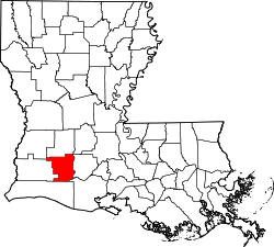
| Parish | Jefferson Davis |
| Area | |
• Total | 1.75 sq mi (4.53 km2) |
| • Land | 1.75 sq mi (4.53 km2) |
| • Water | 0 sq mi (0.00 km2) |
| Elevation | 21 ft (6.4 m) |
| Population (2020) | |
• Total | 490 |
| • Density | 280.0/sq mi (108.11/km2) |
| Time zone | UTC-6 (CST) |
| • Summer (DST) | UTC-5 (CDT) |
| ZIP Code | 70650 |
| Area code | 337 |
| FIPS code | 22-40595 |
| GNIS feature ID | 554960 |
Lacassine (French: La Cassine) is an unincorporated community and census-designated place (CDP) in Jefferson Davis Parish in the U.S. state of Louisiana. As of the 2010 census the population was 480. [2]