Acadia Parish, Louisiana

Last updated

Acadia Parish
Crowley, Louisiana - Parish Courthouse Feb 2019.jpg
Acadia Parish Courthouse
Map of Louisiana highlighting Acadia Parish.svg
Location within the U.S. state of Louisiana
Louisiana in United States.svg
Louisiana's location within the U.S.
Coordinates: 30°16′N92°24′W / 30.267°N 92.400°W / 30.267; -92.400
CountryFlag of the United States.svg United States
StateFlag of Louisiana.svg  Louisiana
FoundedJune, 30, 1886
Named for The Acadians
Seat Crowley
Largest cityCrowley
Area
  Total657 sq mi (1,700 km2)
  Land655 sq mi (1,700 km2)
  Water2.3 sq mi (6 km2)  0.4%
Population
 (2020)
  Total57,576
  Density88/sq mi (34/km2)
Time zone UTC−6 (Central)
  Summer (DST) UTC−5 (CDT)
Congressional district 3rd
Website www.appj.org/index.html

Acadia Parish (French: Paroisse de l'Acadie) is a parish located in the U.S. state of Louisiana. At the 2020 U.S. census, the population was 57,576. [1] The parish seat is Crowley. [2] The parish was founded from parts of St. Landry Parish in 1886, and later an election was held to determine the parish seat, ending when Crowley beat Rayne and Prairie Hayes. [3] Acadia Parish is included in the Lafayette metropolitan statistical area.

Contents

History

The name of the parish is derived from the former French colony of Acadia in Canada (which consisted of the modern provinces of Nova Scotia, Prince Edward Island, New Brunswick, and much of Maine), many of whose French-speaking inhabitants were deported to France and then migrated to Louisiana in the Great Upheaval (see Cajuns).

The parish itself was formed from the southwestern portion of St. Landry Parish. On Wednesday May 19, 1886, a bill was introduced in the house entitled "An act to create the parish of Nicholls, and to provide for the organization thereof." [4] The title was later changed to read: "An act to create the parish of Acadia." Father Joseph Anthonioz, the first pastor of the Catholic Church at Rayne, is credited with having suggested the name, Acadia Parish. The bill passed the house on June 11, the senate on June 28, and was approved by Governor Samuel D. McEnery on June 30. [5] On October 6, an election was held to affirm the creation of the parish, with 2,516 votes for and 1,521 votes against the creation. The population of the new parish was from 10,000 to 12,000. Acadia Parish population in 1890 was 13,231. [6]

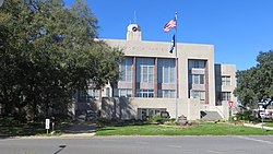
After a close election held on March 1, 1887, Crowley was chosen as the parish seat, gathering 698 votes to Rayne's and Prairie Hayes' 560 and 519, respectively. The election also determined the first officers in the parish: Elridge W. Lyons, first sheriff of Acadia, and R. T. Clark, first clerk of court. The first courthouse was therefore constructed in Crowley and completed on June 30, 1888, and continued to be used until May 1, 1902, when it was destroyed to make way for the second building. [7]

Geography

According to the U.S. Census Bureau, the parish has a total area of 657 square miles (1,700 km2), of which 655 sq mi (1,700 km2) are land and 2.3 sq mi (6.0 km2) (0.4%) are covered by water. [8]

Major highways

Adjacent parishes

Communities

Map of Acadia Parish, with municipal labels Map of Acadia Parish Louisiana With Municipal Labels.PNG
Map of Acadia Parish, with municipal labels

Cities

Towns

Villages

Unincorporated areas

Census-designated places

Other unincorporated communities

Demographics

Historical population
CensusPop.Note
1890 13,231
1900 23,48377.5%
1910 31,84735.6%
1920 34,8209.3%
1930 39,32612.9%
1940 46,26017.6%
1950 47,0501.7%
1960 49,9316.1%
1970 52,1094.4%
1980 56,4278.3%
1990 55,882−1.0%
2000 58,8615.3%
2010 61,7734.9%
2020 57,576−6.8%
U.S. Decennial Census [9]
1790–1960 [10] 1900–1990 [11]
1990–2000 [12] 2010–2013 [13]
Acadia Parish racial composition as of 2020 [14]
RaceNumberPercentage
White (non-Hispanic)44,11576.62%
Black or African American (non-Hispanic)9,94617.27%
Native American 1450.25%
Asian 1630.28%
Pacific Islander 20.0%
Other/Mixed 1,5642.72%
Hispanic or Latino 1,6412.85%

As of the 2020 United States census, there were 57,576 people, 22,236 households, and 15,519 families residing in the parish. At the 2010 United States census, 61,773 people were residing in the parish, and 58,861 people at the 2000 United States census. [15] In 2019, the American Community Survey estimated 62,045 people lived in the parish. [16]

According to the 2019 American Community Survey, the racial and ethnic makeup of the parish was 77.4% non-Hispanic white, 17.4% Black and African American, 0.1% American Indian and Alaska Native, 0.1% Asian alone, 0.3% some other race, 2.8% two or more races, and 2.6% Hispanic and Latin American of any race. In 2010, 79.5% were White American, 18.1% Black and African American, 0.3% American Indian and Alaska Native, 0.6% some other race, and 1.3% of two or more races; 1.7% were Hispanic or Latin American of any race.

Among the population in 2019, 73.8% were aged 18 and older, and 14.9% aged 65 and older; 7.0% were aged 5 and under. [16] The median age was 36.7, and 27.4% were of French heritage; 9.3% were German, 4.2% English, 4.1% Irish, 0.5% sub-Saharan African, 0.4% Scottish, 0.1% Norwegian, and 0.1% Polish in ancestry. Among the population in 2010, 43.7% were of French, French Canadian or Cajun, 10.8% American, and 8.0% German ancestry. Approximately 10% of the parish spoke a language other than English at home.

There were 22,236 households spread among 26,435 housing units. There was a home-ownership rate of 71.1% with an average of 3.31 people per household; an estimated 32% of the population living in the parish were never married, and 26.2% of households had children under the age of 18 living in them. The median gross rent was $662, and the median household value was $118,000. [16] The median monthly cost with a mortgage was $1,083, and $312 without a mortgage.

An estimated 1,120 businesses operated in the parish, and the median household income was $43,396; the mean income was $61,465. [17] The parish had a 52.6% employment rate, and 24.2% of the total population lived at or below the poverty line in 2019.

Arts and culture

Many festivals and cultural celebrations are held annually in Acadia Parish, including the International Rice Festival in Crowley, Frog Festival in Rayne, and Buggy Festival in Church Point. Cajun food and music, both specialties of the local population, feature prominently in these festivals.

Several communities in Acadia Parish celebrate the tradition of Courir de Mardi Gras . Disguised with masks and costumes, Cajuns travel through their rural neighborhoods, making merry while begging for gumbo ingredients. The gumbo is the centerpiece of a communal supper and dance.

Education

Acadia Parish is served by Acadia Parish Schools.

Acadia Parish is also served by the Roman Catholic Diocese of Lafayette with five schools:

Additionally, Acadia Parish is served by one unaffiliated private school:

Acadia Parish is served by two institutions of higher education:

Acadia Parish Library operates branches in the parish.

National Guard

C Company 3-156TH Infantry Battalion resides in Crowley, Louisiana. As part of the 256th IBCT, this unit deployed to Iraq twice, 2004-5 and 2010.

Politics

Historically, along with the rest of Louisiana, Acadia Parish strongly supported the Democratic Party, with support waning throughout the latter half of the 20th century. Following Bill Clinton's 1996 re-election bid, Acadia Parish has voted exclusively for Republican candidates at the presidential level.

United States presidential election results for Acadia Parish, Louisiana [18]
Year Republican Democratic Third party
No.%No.%No.%
2020 22,59679.49%5,44319.15%3861.36%
2016 21,16277.26%5,63820.58%5892.15%
2012 19,93174.27%6,56024.45%3441.28%
2008 19,22971.99%7,02826.31%4541.70%
2004 16,08363.75%8,93735.42%2100.83%
2000 13,81459.45%8,89238.26%5322.29%
1996 9,24638.64%12,30051.41%2,3819.95%
1992 9,01736.70%12,27649.97%3,27513.33%
1988 11,31948.98%11,51049.81%2811.22%
1984 14,90660.59%9,26237.65%4341.76%
1980 11,53352.19%9,94845.01%6192.80%
1976 6,29635.68%10,81461.28%5383.05%
1972 9,69863.83%4,40629.00%1,0907.17%
1968 3,17818.70%4,09824.12%9,71557.18%
1964 6,70641.47%9,46358.53%00.00%
1960 2,61617.34%11,44075.84%1,0286.82%
1956 4,20439.97%6,12258.21%1911.82%
1952 4,16741.55%5,86358.45%00.00%
1948 78411.74%2,38235.67%3,51252.59%
1944 1,02318.73%4,43981.27%00.00%
1940 71912.44%5,05887.52%20.03%
1936 4418.92%4,50491.08%00.00%
1932 3518.92%3,58391.08%00.00%
1928 1,07122.77%3,63377.23%00.00%
1924 69130.20%1,48164.73%1165.07%
1920 1,14151.75%1,05847.98%60.27%
1916 20214.54%1,16583.87%221.58%
1912 513.34%1,14775.07%33021.60%

Notable people

See also

Related Research Articles

<span class="mw-page-title-main">Vermilion Parish, Louisiana</span> Parish in Louisiana, United States

Vermilion Parish is a parish located in the U.S. state of Louisiana, created in 1844. The parish seat is Abbeville. Vermilion Parish is part of the Lafayette metropolitan statistical area, and located in southern Acadiana. At the 2020 U.S. census, the population was 57,359.

<span class="mw-page-title-main">St. Martin Parish, Louisiana</span> Parish in Louisiana, United States

St. Martin Parish is a parish located in the U.S. state of Louisiana, founded in 1811. Its parish seat is St. Martinville, and the largest city is Breaux Bridge. At the 2020 census, the population was 51,767. St. Martin Parish is part of the Lafayette metropolitan area in the region of Acadiana, along the Gulf Coast.

<span class="mw-page-title-main">St. Landry Parish, Louisiana</span> Parish in Louisiana, United States

St. Landry Parish is a parish located in the U.S. state of Louisiana. As of the 2020 Census, the population was 82,540. The parish seat is Opelousas. The parish was established in 1807.

<span class="mw-page-title-main">Jefferson Davis Parish, Louisiana</span> Parish in Louisiana, United States

Jefferson Davis Parish is a parish located in the U.S. state of Louisiana. As of the 2020 census, the population was 32,250. The parish seat is Jennings. Jefferson Davis Parish is named after the president of the Confederacy during the American Civil War, Jefferson Davis. It is located in southwestern Louisiana and forms a part of the Acadiana region.

<span class="mw-page-title-main">Evangeline Parish, Louisiana</span> Parish in Louisiana, United States

Evangeline Parish is a parish located in the U.S. state of Louisiana. As of the 2020 census, the population was 32,350. The parish seat is Ville Platte.

<span class="mw-page-title-main">Church Point, Louisiana</span> Town in Louisiana, United States

Church Point is a town in Acadia Parish, Louisiana, United States. The population was 4,560 at the 2010 census. It is part of the Crowley Micropolitan Statistical Area. Church Point is known as the Buggy Capital of the World as it used to be host to the annual Buggy Festival which has since gone defunct.

<span class="mw-page-title-main">Crowley, Louisiana</span> City in Louisiana, United States

Crowley is a city in, and the parish seat of, Acadia Parish in the U.S. state of Louisiana. At the 2020 United States census, Crowley had a population of 11,710. Crowley is the principal city of the Crowley micropolitan statistical area, which includes all of Acadia Parish. It is also part of the larger Lafayette–Acadiana combined statistical area.

<span class="mw-page-title-main">Estherwood, Louisiana</span> Village in Louisiana, United States

Estherwood is a village in Acadia Parish, Louisiana, United States. The population was 889 at the 2010 census. It is part of the Crowley Micropolitan Statistical Area.

<span class="mw-page-title-main">Mermentau, Louisiana</span> Village in Louisiana, United States

Mermentau is a village in Acadia Parish, Louisiana, United States. The population was 661 at the 2010 census. It is part of the Crowley Micropolitan Statistical Area.

<span class="mw-page-title-main">Rayne, Louisiana</span> City in Louisiana, United States

Rayne is a city in the U.S. state of Louisiana, in Acadia Parish. With a population of 7,326 at the 2020 United States census, it is nicknamed the "Frog Capital of the World", as well as the "Louisiana City of Murals". Rayne is part of the Crowley micropolitan statistical area, and within the Lafayette metropolitan statistical area in Acadiana.

<span class="mw-page-title-main">Mamou, Louisiana</span> Town in Louisiana, United States

Mamou is a town in Evangeline Parish, Louisiana, United States. The population was 3,242 at the 2010 census, down from 3,566 in 2000.

<span class="mw-page-title-main">Ville Platte, Louisiana</span> City in Louisiana, United States

Ville Platte is the largest city in, and the parish seat of, Evangeline Parish, Louisiana, United States. The population was 6,303 at the 2020 census, down from 8,145 in 2000. The city's name is of French origin, roughly translating to "flat town", in reference to its relatively flat topography in contrast to the more hilly terrain north of the area.

<span class="mw-page-title-main">Basile, Louisiana</span> Town in Louisiana, United States

Basile is a town in Acadia and Evangeline parishes in the U.S. state of Louisiana. The population was 1,214 in 2020.

<span class="mw-page-title-main">Eunice, Louisiana</span> City in Louisiana, United States

Eunice is a city in Acadia and St. Landry parishes in the U.S. state of Louisiana. The 2010 census placed the population at 10,398, a decrease of 1,101, or 9.5 percent, from the 2000 tabulation of 11,499.

<span class="mw-page-title-main">Louisiana Highway 13</span>

Louisiana Highway 13 (LA 13) is a state highway located in southern Louisiana. It runs 64.02 miles (103.03 km) in a north–south direction from LA 14 west of Kaplan to US 167 in Turkey Creek.

<span class="mw-page-title-main">Lafayette–Opelousas–Morgan City combined statistical area</span>

The Lafayette–Opelousas–Morgan City combined statistical area is made up of seven parishes in the Acadiana region of southern Louisiana. The statistical area consists of the Lafayette Metropolitan Statistical Area (MSA) and two micropolitical statistical areas (μSAs) – Opelousas, Louisiana Micropolitical Statistical Area and Morgan City, Louisiana Micropolitical Statistical Area. The region consists of seven parishes: Acadia, Iberia, Lafayette, St. Landry, St. Martin, St. Mary, and Vermilion Parishes. As of the 2010 census, the CSA had a population of 604,784.

<span class="mw-page-title-main">Acadia Parish School Board</span>

Acadia Parish School Board is a school district headquartered in Crowley, Louisiana, United States. The district serves all of Acadia Parish.

<span class="mw-page-title-main">Egan, Louisiana</span> Census-designated place in Louisiana, United States

Egan is an unincorporated community and census-designated place in Acadia Parish, Louisiana, United States, located between Crowley and Jennings along Louisiana Highway 100, approximately two and one-half miles north of Midland near Bayou Jonas. The community is a part of the Crowley Micropolitan Statistical Area. As of the 2010 census, it had a population of 631.

<span class="mw-page-title-main">Louisiana Highway 97</span>

Louisiana Highway 97 (LA 97) is a state highway located in southwestern Louisiana. It runs 21.55 miles (34.68 km) in a north–south direction from the junction of U.S. Highway 90 (US 90) and LA 102 in Jennings to U.S. Highway 190 (US 190) east of Basile.

<span class="mw-page-title-main">Louisiana Highway 100</span>

Louisiana Highway 100 (LA 100) is a state highway located in Acadia Parish, Louisiana. It runs 14.83 miles (23.87 km) in an east–west direction from LA 97 in Evangeline to LA 13 in Crowley.

References

  1. "QuickFacts: Acadia Parish, Louisiana". U.S. Census Bureau. Retrieved August 14, 2021.
  2. "Find a County". National Association of Counties. Archived from the original on May 31, 2011. Retrieved June 7, 2011.
  3. "Acadia Parish History". Acadia Parish Library. Archived from the original on July 7, 2010. Retrieved September 3, 2014.
  4. "Official Journal of the Proceedings of the House of Representatives of the State of Louisiana". 1886.
  5. Fontenot, Mary.Acadia Parish, Louisiana. The Center for Louisiana Studies, 1976, p. 244.
  6. Fontenot, Mary.Acadia Parish, Louisiana. The Center for Louisiana Studies, 1976, p. 254.
  7. Fontenot, Mary.Acadia Parish, Louisiana. The Center for Louisiana Studies, 1976, p. 298.
  8. "2010 Census Gazetteer Files". United States Census Bureau. August 22, 2012. Archived from the original on September 28, 2013. Retrieved August 20, 2014.
  9. "U.S. Decennial Census". United States Census Bureau. Retrieved August 20, 2014.
  10. "Historical Census Browser". University of Virginia Library. Retrieved August 20, 2014.
  11. "Population of Counties by Decennial Census: 1900 to 1990". United States Census Bureau. Retrieved August 20, 2014.
  12. "Census 2000 PHC-T-4. Ranking Tables for Counties: 1990 and 2000" (PDF). United States Census Bureau. Archived (PDF) from the original on March 27, 2010. Retrieved August 20, 2014.
  13. "State & County QuickFacts". United States Census Bureau. Archived from the original on June 6, 2011. Retrieved August 20, 2013.
  14. "Explore Census Data". data.census.gov. Retrieved December 29, 2021.
  15. "U.S. Census website". United States Census Bureau . Retrieved January 31, 2008.
  16. 1 2 3 "Geography Profile: Acadia Parish, Louisiana". data.census.gov. Archived from the original on August 12, 2021. Retrieved August 12, 2021.
  17. "2019 Income Statistics". data.census.gov. Archived from the original on August 12, 2021. Retrieved August 12, 2021.
  18. Leip, David. "Dave Leip's Atlas of U.S. Presidential Elections". uselectionatlas.org. Retrieved April 14, 2018.

Geology

{{ |titlestyle = background:#ccccff; |title = Presidential elections results }}