Elton, Louisiana

Last updated

Elton, Louisiana
Town
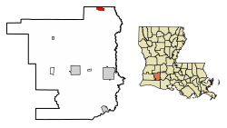
Jefferson Davis Parish Louisiana Incorporated and Unincorporated areas Elton Highlighted.svg
Location of Elton in Jefferson Davis Parish, Louisiana
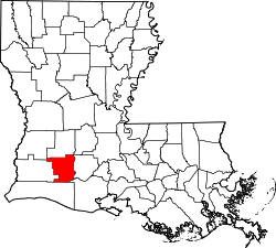
Louisiana in United States (US48).svg
Location of Louisiana in the United States
Coordinates: 30°28′51″N92°41′47″W / 30.48083°N 92.69639°W / 30.48083; -92.69639
CountryUnited States
StateLouisiana
Parish Jefferson Davis
Government
  MayorKesia Lemoine [1]
Area
[2]
  Total1.66 sq mi (4.30 km2)
  Land1.66 sq mi (4.30 km2)
  Water0.00 sq mi (0.00 km2)
Elevation
49 ft (15 m)
Population
 (2020)
  Total992
  Density597.23/sq mi (230.60/km2)
Time zone UTC-6 (CST)
  Summer (DST) UTC-5 (CDT)
ZIP code
70532 [3]
Area code 337
FIPS code 22-23620
Website townofelton.municipalimpact.com

Elton is a town in Jefferson Davis Parish, Louisiana, United States. The population was 992 at the 2020 census, [4] down from 1,128 at the 2010 census. [5] It is part of the Jennings Micropolitan Statistical Area.
Contents

History

The wife of pioneer settler J. M. Henderson is said to have chosen the name "Elton" for her home town from a book in which she read of an English town named Elton. That was probably the town on the northwest coast of England in County Durham near Middlesbrough. Elton, Louisiana, was incorporated as a village in 1911. [6]

Geography

Elton is in northeast Jefferson Davis Parish and is bordered to the north by Allen Parish. U.S. Route 190 passes through the town, leading east 16 miles (26 km) to Eunice and west 9 miles (14 km) to Kinder. Jennings, the Jefferson Davis Parish seat, is 26 miles (42 km) to the south of Elton via Louisiana Highway 26.

According to the United States Census Bureau, the town of Elton has a total area of 1.7 square miles (4.3 km2), all land. [5]

Demographics

Historical population
CensusPop.Note
1920 995
1930 742−25.4%
1940 90121.4%
1950 1,43459.2%
1960 1,59511.2%
1970 1,5980.2%
1980 1,450−9.3%
1990 1,277−11.9%
2000 1,261−1.3%
2010 1,128−10.5%
2020 992−12.1%
U.S. Decennial Census [7]
Elton racial composition as of 2020 [8]
RaceNumberPercentage
White (non-Hispanic)49349.7%
Black or African American (non-Hispanic)36937.2%
Native American 323.23%
Asian 60.6%
Other/Mixed 666.65%
Hispanic or Latino 262.62%

As of the 2020 United States census, there were 992 people, 504 households, and 291 families residing in the town.

Education

Jefferson Davis Parish Public Schools operates public schools in Elton. Schools serving Elton, within Elton, include Elton Elementary School (PK-5) and Elton High School (6-12). [9]

Jefferson Davis Parish Library operates the Elton Branch at 813 Main Street.

Notable people

Related Research Articles

<span class="mw-page-title-main">Jefferson Davis Parish, Louisiana</span> Parish in Louisiana, United States

Jefferson Davis Parish is a parish located in the U.S. state of Louisiana. As of the 2020 census, the population was 32,250. The parish seat is Jennings. Jefferson Davis Parish is named after the president of the Confederacy during the American Civil War, Jefferson Davis. It is located in southwestern Louisiana and forms a part of the Acadiana region.

<span class="mw-page-title-main">Allen Parish, Louisiana</span> Parish in Louisiana, United States

Allen Parish is a parish located in the U.S. state of Louisiana. As of the 2020 census, the population was 22,750. The parish seat is Oberlin and the largest city is Oakdale. Allen Parish is in southwestern Louisiana, southwest of Alexandria.

<span class="mw-page-title-main">Iowa, Louisiana</span> Town in Louisiana, United States

Iowa is a town in Calcasieu Parish, Louisiana, United States. The population was 3,436 in 2020. It is part of the Lake Charles metropolitan statistical area.

<span class="mw-page-title-main">Inniswold, Louisiana</span> Census-designated place in Louisiana, United States

Inniswold is an unincorporated area and census-designated place (CDP) in East Baton Rouge Parish, Louisiana, United States. The population was 6,180 at the 2010 census, up from 4,944 in 2000. In 2020, its population was 5,987. It is part of the Baton Rouge metropolitan statistical area.

<span class="mw-page-title-main">Ville Platte, Louisiana</span> City in Louisiana, United States

Ville Platte is the largest city in, and the parish seat of, Evangeline Parish, Louisiana, United States. The population was 6,303 at the 2020 census, down from 8,145 in 2000. The city's name is of French origin, roughly translating to "flat town", in reference to its relatively flat topography in contrast to the more hilly terrain north of the area.

<span class="mw-page-title-main">Fenton, Louisiana</span> Village in Louisiana, United States

Fenton is a village in Jefferson Davis Parish, Louisiana, United States. The population was 226 at the 2020 census. It is notable for being a speed trap along U.S. Route 165.

<span class="mw-page-title-main">Jennings, Louisiana</span> City in Louisiana, United States

Jennings is a city in, and the parish seat of, Jefferson Davis Parish, Louisiana, United States, near Lake Charles. The population was 10,383 at the 2010 census, a small decline from the 2000 tabulation.

<span class="mw-page-title-main">Lake Arthur, Louisiana</span> Town in Louisiana, United States

Lake Arthur is a town in Jefferson Davis Parish, Louisiana, United States. The population was 2,738 at the 2010 census, down from 3,007 at the 2000 census. It is part of the Jennings Micropolitan Statistical Area. The current mayor is Sampson “poncho” Lejeune.

<span class="mw-page-title-main">Welsh, Louisiana</span> Town in Louisiana, United States

Welsh is a town in Jefferson Davis Parish, Louisiana. The population was 3,226 at the time of the 2010 census. It is part of the Jennings Micropolitan Statistical Area.

<span class="mw-page-title-main">Barataria, Louisiana</span> Census-designated place in Louisiana, United States

Barataria is a census-designated place (CDP) in Jefferson Parish, Louisiana, United States. The population was 1,057 in 2020. It is part of the New Orleans–Metairie–Kenner metropolitan statistical area.

<span class="mw-page-title-main">Jean Lafitte, Louisiana</span> Town in Louisiana, United States

Jean Lafitte is a town on Bayou Barataria in the U.S. state of Louisiana. Located in Jefferson Parish, it is named after the privateer Jean Lafitte. The population was 1,809 at the 2020 census. It is part of the New Orleans–Metairie–Kenner metropolitan statistical area.

Waggaman is a census-designated place and unincorporated community in Jefferson Parish, Louisiana, United States. Waggaman is on the West Bank of the Mississippi River, within the New Orleans–Metairie–Kenner metropolitan statistical area. The population was 9,835 at the 2020 census. The area was named for U.S. Senator George Augustus Waggaman (1782–1843).

Woodmere is an unincorporated community and census-designated place (CDP) in Jefferson Parish, Louisiana, United States. The population was 12,080 at the 2010 census, and 11,238 at the 2020 census. It is part of the New Orleans–Metairie–Kenner metropolitan statistical area.

<span class="mw-page-title-main">Scott, Louisiana</span> City in Louisiana, United States

Scott is the fourth largest municipality in Lafayette Parish, Louisiana, United States. The population was 8,614 as of the 2010 U.S. census, and 8,119 at the 2020 census, up from 7,870 at the 2000 census. Scott is a suburban community of Lafayette and is part of the Lafayette metropolitan statistical area in Acadiana.

<span class="mw-page-title-main">Basile, Louisiana</span> Town in Louisiana, United States

Basile is a town in Acadia and Evangeline parishes in the U.S. state of Louisiana. The population was 1,214 in 2020.

<span class="mw-page-title-main">Louisiana Highway 26</span> State highway in Louisiana, United States

Louisiana Highway 26 (LA 26) is a state highway located in southwestern Louisiana. It runs 75.86 miles (122.08 km) in a northwest to southeast direction from a junction with the concurrent U.S. Highways 171 and 190 southeast of DeRidder to LA 14 in Lake Arthur.

<span class="mw-page-title-main">Lake Charles–DeRidder CSA</span> Combined Statistical Area in Louisiana, United States

The Lake Charles–DeRidder combined statistical area is made up of four parishes in southwestern Louisiana. The statistical area consists of the Lake Charles Metropolitan Statistical Area and the DeRidder Micropolitan Statistical Area. The largest principal city is Lake Charles, and the smaller principal city is Jennings. As of the 2010 census, the CSA had a population of 231,201. A July 1, 2019 estimate placed the population at 241,777.

Jefferson Davis Parish Public Schools or Jefferson Davis Parish School Board (JDPSB) is a school district headquartered in Jennings, Louisiana, United States.

Lacassine is an unincorporated community and census-designated place (CDP) in Jefferson Davis Parish in the U.S. state of Louisiana. As of the 2010 census the population was 480.

<span class="mw-page-title-main">Louisiana Highway 102</span> Highway in Jefferson Davis Parish, Louisiana

Louisiana Highway 102 is a state highway located in Jefferson Davis Parish. It runs 35.4 miles (57.0 km) in a northwest to southeast direction from U.S. Highway 165 in Fenton to LA 26 north of Lake Arthur. The route is bannered west–east from Fenton to a point just east of the first junction with LA 26 at Hathaway. From this point to its terminus north of Lake Arthur, LA 102 travels in a north–south direction and is bannered accordingly. A largely rural route following section line roads, LA 102 passes through the city of Jennings in the southern portion of its route.

References

  1. "Lemoine is Elton's newest mayor". December 11, 2022.
  2. "2020 U.S. Gazetteer Files". United States Census Bureau. Retrieved March 20, 2022.
  3. "Elton LA ZIP Code". zipdatamaps.com. 2023. Retrieved June 16, 2023.
  4. "Explore Census Data".
  5. 1 2 "Geographic Identifiers: 2010 Census Summary File 1 (G001): Elton town, Louisiana". American Factfinder. U.S. Census Bureau. Archived from the original on February 13, 2020. Retrieved June 28, 2018.
  6. "www.carencrohighschool.org "Elton named for town in Middlesbrough, England"". Archived from the original on August 1, 2012. Retrieved July 6, 2008.
  7. "Census of Population and Housing". Census.gov. Retrieved June 4, 2015.
  8. "Explore Census Data". data.census.gov. Retrieved December 29, 2021.
  9. "Schools". Jefferson Davis Parish Schools. Retrieved March 26, 2017.