Roanoke, Louisiana | |
|---|---|
 Roanoke  Roanoke | |
| Coordinates: 30°14′13″N92°44′50″W / 30.23694°N 92.74722°W | |
| Country | United States |
| State | Louisiana |
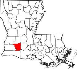
| Parish | Jefferson Davis |
| Area | |
• Total | 0.43 sq mi (1.11 km2) |
| • Land | 0.43 sq mi (1.11 km2) |
| • Water | 0 sq mi (0.00 km2) |
| Elevation | 26 ft (7.9 m) |
| Population (2020) | |
• Total | 491 |
| • Density | 1,148.5/sq mi (443.42/km2) |
| Time zone | UTC-6 (Central (CST)) |
| • Summer (DST) | UTC-5 (CDT) |
| Area code | 337 |
| GNIS feature ID | 555810 [2] |
Roanoke is an unincorporated community and census-designated place in Jefferson Davis Parish, Louisiana, United States. Its population was 546 as of the 2010 census. [3]
Contents
The Roanoke post office was established in 1895. [4]