Lockport Heights, Louisiana | |
|---|---|
 Lockport Heights  Lockport Heights | |
| Coordinates: 29°39′02″N90°32′47″W / 29.65056°N 90.54639°W | |
| Country | United States |
| State | Louisiana |
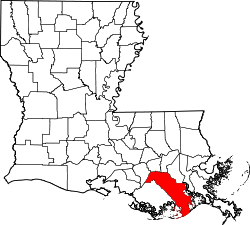
| Parish | Lafourche |
| Area | |
• Total | 1.32 sq mi (3.42 km2) |
| • Land | 1.31 sq mi (3.38 km2) |
| • Water | 0.015 sq mi (0.04 km2) |
| Elevation | 3 ft (0.91 m) |
| Population (2020) | |
• Total | 1,171 |
| • Density | 896.0/sq mi (345.96/km2) |
| Time zone | UTC-6 (Central (CST)) |
| • Summer (DST) | UTC-5 (CDT) |
| Area code | 985 |
| GNIS feature ID | 543408 [2] |
Lockport Heights is an unincorporated community and census-designated place in Lafourche Parish, Louisiana, United States. Its population was 1,286 as of the 2010 census. [3] Louisiana Highway 1 passes through the community.