Nevada is a state located in the Western United States. Nevada has several census-designated places (CDPs) which are unincorporated communities lacking elected municipal officers and boundaries with legal status. [1] [2]
Nevada is a state located in the Western United States. Nevada has several census-designated places (CDPs) which are unincorporated communities lacking elected municipal officers and boundaries with legal status. [1] [2]

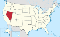
Nevada is a landlocked state in the Western region of the United States. It borders Oregon to the northwest, Idaho to the northeast, California to the west, Arizona to the southeast, and Utah to the east. Nevada is the seventh-most extensive, the 32nd-most populous, and the ninth-least densely populated U.S. state. Nearly three-quarters of Nevada's population live in Clark County, which contains the Las Vegas–Paradise metropolitan area, including three of the state's four largest incorporated cities. Nevada's capital is Carson City. Las Vegas is the largest city in the state.
Whitney is an unincorporated town and census-designated place in Clark County, Nevada, United States. The population was 38,585 at the 2010 census.

Littlefield is an unincorporated community and census-designated place in Mohave County, Arizona, United States, that is located in the Arizona Strip region. As of the 2020 census, its population was 256, a decline from the figure of 308 tabulated in 2010. It lies just south of Interstate 15, next to the Virgin River, approximately 10 miles (16 km) northeast of Mesquite, Nevada. Littlefield is located in the 86432 ZIP Code.

Hiko is a small, agrarian community in the Tonopah Basin on State Route 318 in Lincoln County, Nevada, United States. It is a census-designated place, with a population of 119 at the 2010 census.

Crystal Bay is a census-designated place (CDP) located on the north shore of Lake Tahoe in Washoe County, Nevada, United States. The population was 305 at the 2010 census. It is part of the Reno−Sparks Metropolitan Statistical Area. Prior to 2010, it was listed by the U.S. Census Bureau within the Incline Village–Crystal Bay CDP.

Lund is a small town and census-designated place in White Pine County, Nevada, United States. The population of Lund as of 2020 was 211.

Kingston is an unincorporated town and census-designated place in Lander County, Nevada, United States. The population of the census-designated place of Kingston was 113 at the 2010 census.
Ursine is an unincorporated community and census-designated place in Lincoln County, Nevada, United States. It is located in the foothills of the White Rock Mountains on Eagle Valley about two miles downstream from the Eagle Valley Reservoir and Spring Valley State Park. The population was 91 at the 2010 census.

Preston is a census-designated place in White Pine County, Nevada, United States.
Carter Springs is a census-designated place (CDP) in Douglas County, Nevada, United States. The population was 553 at the 2010 census.
Fish Springs is a census-designated place (CDP) in Douglas County, Nevada, United States. The population was 648 at the 2010 census.
Lakeridge is a census-designated place (CDP) in Douglas County, Nevada, United States. The population was 371 at the 2010 census.

Round Hill Village is a census-designated place (CDP) in northwestern Douglas County, Nevada, United States. The population was 759 at the 2010 census. Prior to 2010, the community was part of the Zephyr Cove–Round Hill Village CDP.
Ruhenstroth is a census-designated place (CDP) in Douglas County, Nevada, United States. The population was 1,293 at the 2010 census.
Skyland is a census-designated place (CDP) in Douglas County, Nevada, United States. The population was 376 at the 2010 census.
Topaz Ranch Estates is a census-designated place (CDP) in Douglas County, Nevada, United States. The population was 1,501 at the 2010 census.
Dry Valley is a census-designated place in Lincoln County, Nevada, United States. As of the 2020 census it had a population of 49.
Grass Valley is a census-designated place (CDP) in northeastern Pershing County, Nevada, United States. As of the 2010 census the population was 1,161.
Humboldt River Ranch is a census-designated place (CDP) in Pershing County, Nevada, United States. As of the 2010 census the population was 119.