Preston, Nevada | |
|---|---|
Census-designated place | |
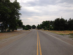 Nevada State Route 895 in Preston, July 2014 | |
 Preston Location within the state of Nevada  Preston Location within the United States | |
| Coordinates: 38°54′54″N115°03′49″W / 38.91500°N 115.06361°W | |
| Country | United States |
| State | Nevada |
| County | White Pine |
| Established | 1876 |
| Area | |
• Total | 1.29 sq mi (3.35 km2) |
| • Land | 1.29 sq mi (3.35 km2) |
| • Water | 0 sq mi (0.00 km2) |
| Elevation | 5,643 ft (1,720 m) |
| Population (2020) | |
• Total | 76 |
| • Density | 58.8/sq mi (22.71/km2) |
| Time zone | UTC-8 (Pacific (PST)) |
| • Summer (DST) | UTC-7 (PDT) |
| ZIP code | 89317 [3] |
| Area code | 775 |
| FIPS code | 32-58000 |
| GNIS feature ID | 2583952 [2] |
Preston is a census-designated place in White Pine County, Nevada, United States.
